07 June 1997 - Diagnosis For 07 June 12.00 UTC
|
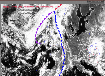
07 June 1997/12.00 UTC - Meteosat VIS image; weather events (blue: WW code, red: SFLOCS)
|
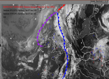
07 June 1997/12.00 UTC - Meteosat IR image; weather events (blue: WW code, red: SFLOCS)
|
The Cold Front still shows a wavy pattern. Just in front of the Cold Front over western Belgium and the south-west of the Netherlands, a cloud cluster is to be seen with high, cold tops. This convective cluster had meso beta dimensions at the time of the analysis (12.00 UTC). Heavy thunderstorm activity was reported with hail and gusts up to 70 kts.
ABSTOP1000 + WA1000-500 + CA 500-300 + IR + Vertical Cross Section
|
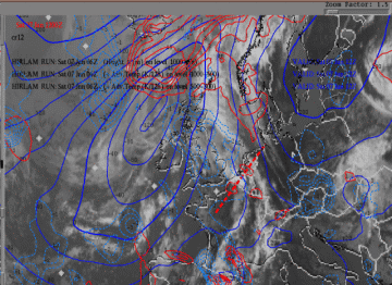
07 June 1997/12.00 UTC - Meteosat IR image; cyan: height contours 1000 hPa, red: temperature advection - WA 1000 hPa, blue:temperature
advection - CA 500hPa; position of vertical cross section indicated
|
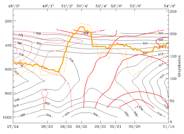
07 June 1997/12.00 UTC - Vertical cross section; black: isentropes (ThetaE), red thin: temperature advection - CA, red thick:
temperature advection - WA, orange thin: IR pixel values, orange thick: WV pixel values
|
Warm advection in the lower levels and cold advection in the higher level are now clearly to be seen in the area of investigation (west Belgium - south-west Netherlands), although most of the cold advection in the higher levels is more in the western part of the area, as can be seen in the cross section.
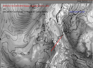
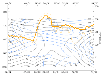
ThetaW 850 hPa + WV + Vertical Cross Section with relative humidity
|
07 June 1997/12.00 UTC - Meteosat WV image; black: wet bulb temperature 850 hPa; position of vertical cross section indicated
|
07 June 1997/12.00 UTC - Vertical cross section; black: isentropes (ThetaE), blue: relative humidity, orange thin: IR pixel values,
orange thick: WV pixel values
|
The investigated cloud cluster is clearly within the ThetaW 850 hPa ridge with very high pixel values in the WV image (moist in the middle and/or higher levels). Behind the cluster low pixel values are to be seen indicating the presence of dry air in the higher levels.
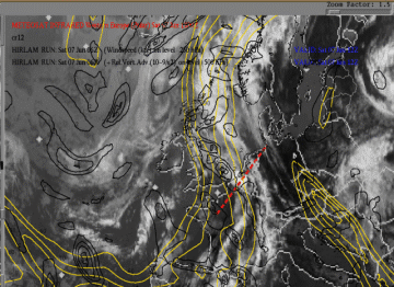
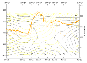
Isotachs 250 hPa >= 60kt + PVA500 >= 2 + IR + Vertical Cross Section
|
07 June 1997/12.00 UTC - Meteosat IR image; black: positive vorticity advection (PVA) 500 hPa, yellow: isotachs 250 hPa; position of
vertical cross section indicated
|
07 June 1997/12.00 UTC - Vertical cross section; black: isentropes (ThetaE), yellow: isotachs, orange thin: IR pixel values, orange
thick: WV pixel values
|
|
|
|
|
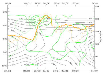
07 June 1997/12.00 UTC - Vertical cross section; black: isentropes (ThetaE), green thick: vorticity advection - PVA, green thin:
vorticity advection - NVA, orange thin: IR pixel values, orange thick: WV pixel values
|
|
The cloud cluster over Belgium and the Netherlands is within or very close to a maximum of PVA 500 at the warm side of a jet stream in the vicinity of the right entrance of a jet streak over Scotland. The cross sections show very distinct features in the area of the cluster; the maximum of the PVA is at the 300 hPa level. In the cross section of the isotachs a strong positive vertical windshear is visible.
Divergence and vertical motion
|
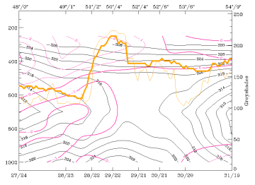
07 June 1997/12.00 UTC - Vertical cross section; black: isentropes (ThetaE), magenta thin: divergence, magenta thick: convergence,
orange thin: IR pixel values, orange thick: WV pixel values
|
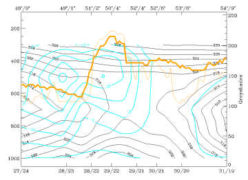
07 June 1997/12.00 UTC - Vertical cross section; black: isentropes (ThetaE), cyan thick: vertical motion (omega) - upward motion, cyan
thin: vertical motion (omega) - downward motion, orange thin: IR pixel values, orange thick: WV pixel values
|
The high positive and negative values of the divergence, and (as a consequence) the high values of negative omega in between, give a striking image of the ideal dynamic situation for an MCS.
Summary of diagnosis 12.00 UTC
The convective cluster over the southern Netherlands is now clearly under the influence of dynamic forcing. The temperature advection distribution, with warm advection in the lower layers and cold advection above, unstabilises the atmosphere. Strong convection is possible in such a situation.
Strong positive vorticity advection causes strong upward motion which intensifies the activity of the MCS.
