30th July 2005: 06UTC
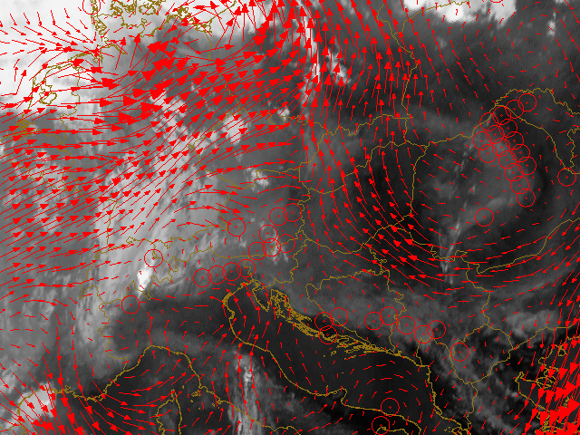
A different part of the satellite image is studied because of the use of the LAM model. By using the modelfields of Aladin the windfields in the boundary layer at 925 hPa are studied. The direction of the wind is marked by the arrows. At this timestep (some 8 hours before the convection starts!) the prefrontal convection line is already recognised with converging motions over Northern Italy, Austria (red circles) and further north in the Czech Republic and Poland.
Further west one can recognise already some early morning convection over Lucarno in Switzerland. Not only in satellite but also the model depicts converging motions near the surface in that area.
30th July 2005: 12UTC
At this timestep the convection is about to start. In the model fields a wide line of converging windvectors is seen stretching from Northern Italy over Austria, the Czech Republic and Poland.
30th July 2005: 18UTC
A prefontal convergence line formed over the past 6 hours. Except for the two cells up north all of them are marked by convergence near the surface. Judging the length of the vectors beside thunderstorms and rain also severe windspeeds have to be reckoned with.
31st July 2005: 00UTC
The cells of the prefrontal convergence lines have merged with convection embedded to the cold front. Especially south of the Alps still some convergence is spotted which might result in more rising motions and convection. The strength of the winds observed in the thunderstorms is still high.
31st July 2005: 06UTC
The convection hast mostly died over night. Up north still an MCS is observed which is marked by strong winds and some convergence. South of the Alps some remnant CBs are still observed. The associated windvectors reveal convergence.