The Training Bulletin

Joint newsletter related to new activities and resources
in European meteorological training

// issue XIX - July 2020

Activities & events
//image missing//

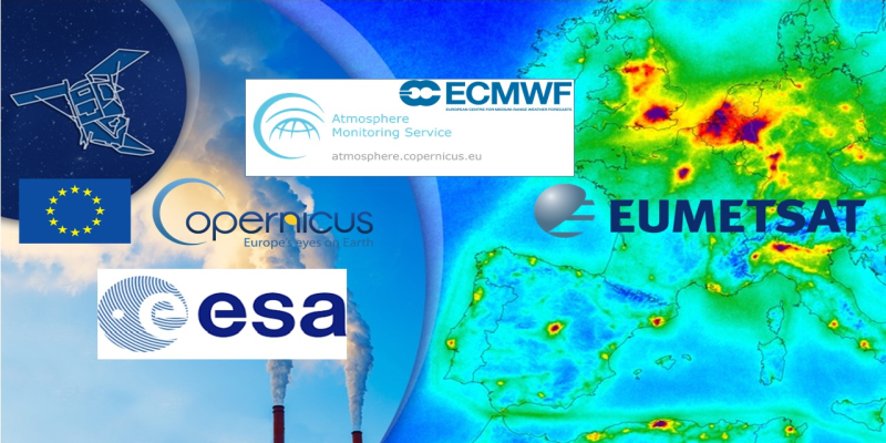
New series of EUMETSAT short online courses on satellite applications starting September

September 2020 / Online

A series of short online courses on weather, oceanography, air quality, and climate applications will be offered by EUMETSAT and partners starting September 2020. Courses will be open to all and for a wide audience, including service providers, scientists and weather forecasters. The planned duration for each course is from two hours to a full day.

Each short course will showcase EUMETSAT and/or Copernicus satellite data, and include tutorials and hands-on exercises on how to handle the data using a variety of digital tools.

Registration will soon be available on the EUMETSAT training platform.

//image missing//

EUMeTrain Event Week on IASI L2 profiles

Autumn 2020 / Online

In Autumn 2020, EUMeTrain will run an event week on IASI L2 profiles. The IASI L2 product contains temperature and humidity profiles, available 30 minutes after sensing through the EARS-IASI service from EUMETSAT. The event week aims to raise awareness of the EARS-IASI L2 product, with the understanding that product usage is still in the early stages. During the event week we will show how these profiles are made, along with some possible applications.

Participation is freely available to all. Due to the fact that this event week is run online, prior registration is needed. Self-registration is simple and you can register for one or more sessions.

Registration links soon available at eumetrain.org.

//image missing//

Expert Forum for Preparing MTG Meteorological Applications and Training

May - December 2020 / Online, Germany

In two years the first MTG satellite will be launched and now is the perfect time to prepare for ingesting the next generation of Meteosat data into operational application environments. Successful user preparation relies heavily on trainers, training material, and training infrastructure.

To aid the provision of training resources, a dialogue platform was opened for expert discussion – the Expert Forum for Preparing MTG Meteorological Applications and Training, with two scheduled phases:

  • An online phase starting May 2020 for an initial period of six months, where experts who can contribute to the forum will be identified and invited to explore the MTG data.
  • The MTG 3T Workshop, 23-27 Nov 2020, a week-long workshop where selected experts and trainers will be sharing their MTG-related work.

The development of training material and training courses requires input from subject matter experts, such as on the enhancements expected from MTG FCI compared to MSG SEVIRI, or on the information content of geostationary lightning imagery. Guidance from application experts and practitioners is needed to understand what added value to expect from MTG data.

// issue XIX - July 2020
Resources & Tools
//image missing//

New quick guides for MTG

EUMeTrain

Three new quick guides have been added to the EUMeTrain section - two new single channel guides and a Cloud Type RGB quick guide. All new quick guides refer to applications that will be ready once the new spectral channels of the upcoming MTG satellite are available.

The single channel quick guides refer to channels in the near infrared: 1.38 µm and 2.25 µm. Both quick guides explain the main characteristics of these spectral channels and point out their future applications. Images on the quick guide originate from GOES-R ABI sensor and the Himawari imager, that are used as proxies.

The Cloud Type RGB makes use of the NIR1.38 µm channel that has good capabilities to detect high-level thin cirrus clouds. This RGB is particularly appealing because of its vivid colours. It differentiates between cloud height, cloud phase and cloud optical thickness.

More quick guides on new RGB types will be published in the coming months, such as the True Colour RGB and the Fire RGB. All of them will be available with MTG.

//image missing//

EUMeTrain satellite webcams website

EUMeTrain

EUMeTrain has recently finalised the first phase of a project combining satellite imagery and webcam images from specific locations around Europe.

The project was of interest to the members for practical reasons: using the data in weather briefings or having a quick view of the situation over different regions and countries, etc. Currently, the webcams show the sky over two cities (Vienna and Hamburg). They present a useful learning tool and are a good means for understanding and comparing the type of clouds seen from the ground with the corresponding RGB colours in satellite imagery.

The project is currently in its infancy and it is still developing. The plan for the future is to add more webcams from cities around Europe, to get a better picture of the weather, and to add more times during the day, currently there is only one image at 12:00 UTC.

Check out the website.

//image missing//

Hurricane Ophelia – Case study

Online

Ophelia was the 10th and the final hurricane of the 2017 hurricane season. It formed and moved over the Atlantic, reached its maximum strength of Category 3 near the Azores, and made landfall over Ireland as an extra-tropical storm.

The storm was well tracked and the Met Éireann issued timely warnings, so the casualty numbers were low (three reported deaths). However, there was still significant damage.

There is some indication that the number of hurricanes reaching so far north could increase with the changing climate, therefore, it is important to get acquainted and prepared for such a possibility.

In this case study you can follow Hurricane Ophelia's life cycle, from tropical cyclone to Cat 3 hurricane, and then the transformation to an extra-tropical cyclone; using satellite images, meteorological parameters, and vertical cross sections.

Following the case study, the user can interact with a simulator. You can try out a forecaster shift and forecast the impact of Ophelia on Ireland.

Who are the case and the simulator for? The case study and the simulator are primarily made for forecasters, but other meteorologists and students can benefit from them.

Check out the case study.

//image missing//

Simulator Ophelia

Online

In 2017 Ophelia was the first hurricane that reached so far north and east. Her genesis was not typical nor her life or path. With the climate change and the temperature increase this kind of scenarios might become more numerous in the future and increase the hurricane threat for western/northwestern Europe, therefore it is crucial to work on acquiring new prognostic skills that could come in handy in the upcoming years. The simulator covers only the day before landfall to Ireland since the landfall has the biggest social and economic impact. Additionaly, since the area affected will be big, the warnings need to be issued early enough to organise the community and government officials as to decrease any kind of loss. In the simulator you can practise your forecasting skills and sending out relevant and timely warnings.

Check out the simulator.

//image missing//

Polarstern Satellite Logbook

Online

A typical weather station on land is fixed and always in the same climate zone. The advantage of the station on the Research vessel Polarstern is its mobility. The vessel's course runs from the Arctic to the Antarctic through many climate zones and you have a chance to read about it and train your forecasting skills and the interpretation of satellite images in some of the zones.

For this training module, we will single out some interesting weather events around the Polarstern from the last few years. These logbook entries will mark the Northeast Trade Winds, the Inter Tropical Convergence Zone (ITCZ) and the Southeast Trade Winds. You can train the interpretation of cloud types with the different RGB images from the METEOSAT satellite. There is the possibility to compare these RGB images with the Webcam, the Radio Sounding and the Weather Reports on the vessel.

Check out the logbook.

//image missing//

Alpine Meteorology Simulator

Online

When do you have the chance to be a forecaster in an unfamiliar office, maybe even in a different country? Probably not very often and, if so, you shouldn't touch anything. Simulators can put you into a unique position of being a forecaster and give you the opportunity to challenge yourself with various - maybe new and extreme - weather situations.

This simulator focuses on Alpine Meteorology. During the virtual night shift the forecaster is led from task to task, while observing and evaluating the development of relevant weather parameters.

It offers the combination of interesting data and images, lots of interactivity, independent decision-making, and a final summary page. All of this can be "played" and watched in less than an hour and is accessable online via the EUMeTrain website.

// issue XIX - July 2020
Stories & Achievements
//image missing//

EUMETSAT / Copernicus short courses in the frame of #shareEGU2020

May 2020 / Online

The EUMETSAT training team recently delivered a series of three short online courses, in the frame of #shareEGU2020.

They were:

  • Using the Copernicus Marine Data Stream for Marine Applications
  • Using the Copernicus Atmosphere Data Stream for Atmosphere Applications
  • Using EUMETSAT's Climate Data Records: Satellite data for climate applications

More than 200 scientists from around the world registered for the three events. Each event consisted of a webinar and hands-on exercises to explore the data. All courses were hosted on Moodle, made use of video conferencing tools, and used Sli.do for questions and polls. The hands-on session were conducted using Jupyter Notebooks and the CM SAF R Toolbox, hosted on the European Weather Cloud. At the end of the sessions, participants were able to share and discuss the outcome of their project work.

EUMETSAT is currently preparing another series of short courses on different subjects related to EUMETSAT and Copernicus data and services. The series will start in Autumn 2020. Keep an eye on trainingevents.eumetsat.int and don't miss the opportunity!

//image missing//

Joint Satellite Applications Course for multilingual audience

04 May 2020 - 26 Jun 2020 / Online

During May/June 2020, EUMETSAT, in collaboration with WMO/VLab Centres of Excellence, ran an eight-week online course for the African meteorological community. For the first time, the course was conducted in both English and French languages simultaneously, using the same Moodle course page. The two language versions had similar content and made use of bilingual ASMET training material. More than 60 learners across Africa participated.

On enrolling, participants opted for their preferred language and were added to the corresponding Moodle group, which presented only material in their chosen language.

The highlights of the course were the live webinars hosted in Zoom - interactive weather briefings on topics such as Convection, Fog and Dust. Some of the sessions were open for a global audience, while others were restricted to course participants. Participants were free to join any live sessions of choice.

Other platforms used were Slack, for informal chatting, and Padlet for sharing of satellite imagery and questions.

Dedicated instructors were assigned to both language groups.

Instructor Vesa Nietosvaara (EUMETSAT) said: "It was great to have all teams running the course in parallel. Weekly instructor meetings helped us support each other. We hope to offer more such multilingual courses in the future."

//image missing//

The online training events for Met Eireann from KNMI in COVID19 lockdown

March and April 2020 / Online

KNMI recently provided forecaster training for a group of new forecasters at Met Eireann in Dublin.

From January to March the training was provided on-site in the classroom. However, in the second week of March, the COVID-19 lockdown started, so the trainers had to introduce online lessons. This was done with much appreciated help from Heleen ter Pelkwijk and Tomislav Marekovic from Eumetcal.

In the series of online lectures forecasters were trained in aviation meteorology, convective weather, and winter weather. PowerPoint presentations were predominantly used, with websites being used on occasion, all via Webex.

Assessments were made in the modules, e.g by asking the participant questions. In one lecture about climate, trainer Gerard vd Schrier (KNMI) turned his laptop webcam to a houseroom experiment to show the butterfly effect (see screenshot). This was a clearly visible and instructive point in this lecture. Because the instructors were with a small group, the chat function proved to be very popular!

//image missing//

User Workshop and Training on Fire Monitoring

11-18 May 2020 / Online

The User Workshop and Training on Fire Monitoring, engaged more than 100 participants in the online sessions from 11 to 18 May 2020.

Webinars with experts on the dataset took place every day, followed by hands-on sessions on the JupyterHub. Datasets included principal compounds from CAMS, Sentinel 5P, Metop GOME-2, Metop IASI, the LSA-SAF and EFFIS. The presentations and the recordings of each webinar are available online on the EUMETSAT training platform.

The training was jointly organised by EUMETSAT, CAMS-ECMWF, the AC SAF and the LSA SAF, with the support from Copernicus.

//image missing//

User Workshop on Satellite Atmospheric Composition: raising awareness and expert consultation

23-25 June 2020 / Online

The User Workshop on Satellite Atmospheric Composition, organised by EUMETSAT, in collaboration with the Copernicus Atmosphere Monitoring Service (CAMS), was held online from 23 to 25 June. This event brought together European service and data providers and experts from weather offices and environmental agencies, to discuss atmospheric data.

The event was split into six sessions, consisting of informative live presentations by EUMETSAT and European experts, followed by a moderated open discussion. The presentations addressed upcoming EUMETSAT and Copernicus data, existing services, examples of applications and available data products provided by EUMETSAT and CAMS, perspectives, and any related user needs.

The outcome of this event will prepare the ground for a user survey.

All presentations and the recordings of the sessions can be accessed on the EUMETSAT training platform.

//image missing//

Using Copernicus Atmospheric Composition data: Satellite Data for Atmospheric Applications

26 May 2020 / Online

This short online course on 26 May, convened by Federico Fierli (EUMETSAT), Mark Parrington (CAMS-ECMWF), Christian Retscher (ESA) and Julia Wagemann (MEEO), was part of the 2020 EGU General Assembly. It offered the opportunity to learn about Copernicus data for Atmospheric Composition and get examples of how to develop workflows, based on sample applications. The slide deck of the webinar and its recording are available on the EUMETSAT training platform.

//image missing//

Using the Copernicus Marine Data Stream for Ocean Applications

May and June 2020 / Online

What was planned as a blended training, composed of a two-week online plus a one-week classroom course, had to be moved completely online due to measures related to COVID-19. Twenty-three participants from around the world participated.

The two weeks preparatory phase was composed of self-study material, covering background knowledge about Sentinel-3, the Copernicus programme in general and the software tools used during the hands-on session. In the final week, participants worked on their own mini projects for five days, supervised and supported by the instructors Lauren Biermann and Oliver Clements (EUMETSAT / Plymouth Marine Laboratory). Jupyter Notebooks and SNAP were used in this practical phase. The supervision worked well using video conferencing tools, where small groups of two to five participants met with a supervisor.

The group managed to develop a great team spirit, which helped the collaboration among students, who did a great job in supporting each other.

At the end of the course all participants were able to apply Copernicus Marine data retrieved from Sentinel-3 in their mini projects. The participants presented impressive results.

//image missing//

Training during the corona crisis

Spring 2020 / Online

In March, the life of trainers in MeteoSwiss changed suddenly. We were no longer allowed to enter our offices, but it was taboo to cancel planned courses and training. Within a few weeks we had to convert two classroom courses and the initial training of new forecasters into a virtual format. A lot of work and no time, would we succeed?

Without the support from different people and resources, the demands would certainly not have been manageable. Fortunately, we could fall back on a wide range of existing learning modules and courses, a motivated community, and a well-functioning infrastructure. From the beginning Eumetcal supported us all with good tips and technical support in using web conferencing tools, the Eumetcal Moodle and others.

Not only for us, but also for the users of the world of virtual learning this has been a change. The use of new platforms and tools was not easy for all participants. Countless tests, personal coaching and more than one spontaneous rescue action were necessary to get all users used to the new systems. We were all the more pleased about the active participation, the good results and feedback during the courses.

The coronavirus outbreak has meant a lot of work, but also reduced scepticism towards virtual forms of learning. Only the shared beer cannot be replaced by a well-designed online learning course. Cheers!