The Training Bulletin

Joint newsletter related to new activities and resources
in European meteorological training

// Issue XII - Apr 2018

Activities & events
//image missing//

Eumetcal Workshop 2018

Tentatively 28 – 30 August 2018 / Riga, Latvia

The Eumetcal Workshop 2018 will be held during the last week of August in Riga, Latvia. This year’s workshop will focus on sharing and exploring how NHMSs organise the training for their operational forecasters, it will also address latest practices in training development and delivery. The workshop is aimed at trainers and training managers at NMHSs and will provide an opportunity to meet and discuss the latest training issues within this community. A more concrete outline of the workshop programme will be available at the end of April, when the registration and abstract submissions will be open at: https://eumetcal.eu/. The workshop will include a lot of group work and discussions, and also presentations and other type of activities.

//image missing//

CALMet Online 2018: Submit your training project ideas and start collaborating!

June 2018 / Online

CALMet Online Workshops are online collaboration sessions for trainers in the field of meteorology. Trainers are invited to submit their current training projects and share and discuss them with colleague trainers and instructional designers in the context of one-hour online workshops. The main aim of the workshop is to generate ideas on how to actively engage the learners and propose ideas for training exercises.

The next series of workshops will start in June 2018. If you are working on a training project for which you would like more ideas, you are now invited to submit your project ideas using this form before 31 May.

//image missing//

Satellite Skills Course 2018

May 2 - June 17, 2018 / Online, Moodle

This course is mainly intended for forecasters on shifts, but will also be useful for other meteorologists and geoscientists. It is competency-based and aims to help the participants in their everyday work.

During the course, basic principles of satellite meteorology will be covered. Participants will obtain general knowledge about meteorological satellites, identifying land features and analysing them and identifying fronts, different types of clouds, atmospheric phenomena, etc.

The course is mainly asynchronous, with three online playground sessions where participants will be able to interact with the presenter and each other. It will be delivered through the Eumetcal Moodle website over seven weeks, from 2 May to 17 June.

The course consists of three main blocks, each in the duration of two weeks and a ‘Refresher’ block at the beginning of the course, which aims to refresh your knowledge and get you acquainted with the environment you will be working in, and with your colleagues.

Register via the Met Learning website. The deadline for registrations is 8 April.

//image missing//

ESSL Testbed

11 – 15 June, 18 – 22 June, 2 – 6 July and 9 – 13 July 2018 / Wiener Neustadt, Austria

A growing range of tools is steadily becoming available for weather forecasters as a basis for their forecasts and warnings.

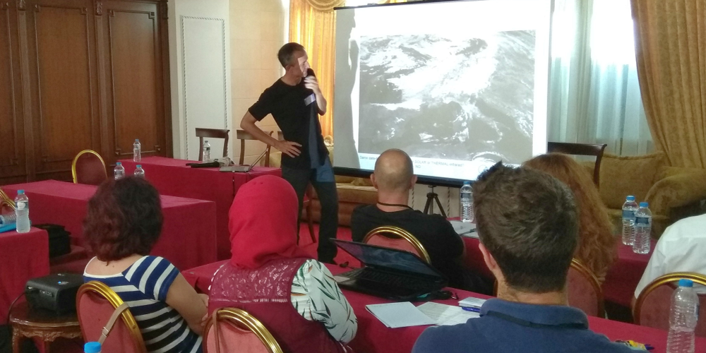
At the ESSL Testbed, such tools are evaluated by its participants. At the same time, participants are trained in forecasting severe weather by working together with ESSL team and experts from around the world.

The Testbed includes both nowcasting and forecasting exercises using the real-time weather, product evaluation sessions, and presentations by researchers and developers, as well as expert severe storm forecasters.

Register via the ESSL website.

//image missing//

Autumn School on Use of Satellite Data on Nowcasting High Impact Weather

24-28 September, 2018 / Thessaloniki, Greece

The sixth edition of the Autumn School in Thessaloniki will consolidate it as a fixture in the EUMETSAT training calendar, offering Eastern Mediterranean countries from three continents the opportunity to compare and debate their nowcasting methods.

The organisation of the event is the responsibility of Prof. Haralambos Feidas from the Department of Meteorology and Climatology at Aristotle University. He kindly provides his team's best efforts for a pleasant and fruitful event.

Invitations to attend the course are sent to PR representatives of interested countries in the region.

The venue is usually very close to the seashore and allows for a balance of mental and physical effort.

//image missing//

ESSL Seminar: Forecasting Severe Convection I

1 – 5 Oct 2018 / Wiener Neustadt, Austria

This seminar given by Dr. Tomáš Púčik consists of lectures and hand-on forecasting exercises. Basic concepts of (severe) convection forecasting are introduced with an emphasis on the ingredients-based methodology.

For each ingredient the importance for convection will be presented, along with its diagnosis and prognosis. After the basic ingredients, to the seminar looks at vertical wind shear, especially on its influence on the different organisational forms of convection (single cells, multi-cells, supercells etc.).

The seminar will also look at a basic conceptual model of storm types and relate it to the potential for severe weather. Then it concentrates on the synoptic and mesoscale patterns that are supportive of severe convection and negative factors that may degrade the severe convection risk.

The afternoon exercises will involve forecasting convection either in real-time, or using the past cases, for different parts of Europe. After the forecast, there will be a discussion with an emphasis on the subject that was studied during the morning.

At the end of the week, participants may choose to take part in an exam. Participants that pass this exam receive a Testimonial.

Register via the ESSL website.

//image missing//

Seminar on Forecasting Convective Precipitation and Flash Floods

10 - 14 September 2018 / Wiener Neustadt, Austria

Heavy precipitation is a particular challenge to forecast, given the small spatial and temporal scales on which it occurs, and the limited predictability of deep convection. The hazards associated with flash flooding are an even greater challenge, as detailed information about hydrology and antecedent conditions is also required. In this seminar, Prof. Russ Schumacher from Colorado State University, USA, will address the current state of knowledge about heavy rainfall and flash flooding, plus current research aimed at improving forecasts through increased understanding and sophisticated numerical modelling techniques.

The seminar includes hand-on forecasting exercises during the afternoon. At the end of the week, participants may choose to take part in an exam. Participants that pass this exam receive a Testimonial.

Register via the ESSL website.

//image missing//

XV Ibero American Course

27 August – 7 September 2018 / Cartagena, Colombia

This year is the 15th anniversary of the successful course on meteorological applications of satellites on tropical latitudes, held in Cartagena, Colombia. In those 15 years more than 300 meteorologists in Central and South America have been instructed on the use of imagery from space. The scheme switches the focus between mid-latitude meteorology and tropical meteorology. The focus this year will be on GOES new generation, with GOES-16 already operational and GOES-S in the commissioning phase. The main problem for most countries in RA III and IV will be the data reception, either through GEONETCast-Americas or through GRB dissemination, the continuation of GVAR stations.

AEMET in Spain leads the course and sends instructors who focus on nowcasting, environmental applications, maritime and atmospheric dynamics.

AECID, the Spanish agency for development, provides accommodation and catering, plus excellent training venues for the course.

The participants in this course are appointed by their WMO PRs.

(Image by Pedro Szekely on Flickr, CC BY-NC-SA 2.0).

// Issue XII - Apr 2018
Resources & Tools
//image missing//

Quick Guides on standard SEVIRI RGB types

Online, EUMeTrain

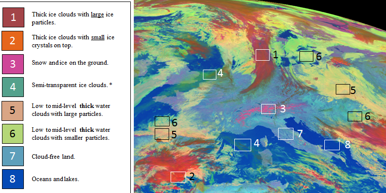
Eleven Quick Guides on EUMETSAT-recommended standard SEVIRI RGB types, such as the Dust RGB, the Airmass RGB and the Day Microphysical RGB, have recently been published.

For each standard SEVIRI RGB, a clearly arranged two-page guide has been created, including the most important information about the purpose of the RGB type, area and time for its main application, and the physical background of the used channel combinations, together with many examples helping to interpret the typical colours.

The aim of the Quick Guides is to help the users (weather forecasters and/or other experts) to understand the physical principles behind each RGB and to show the use of these RGB types by giving typical examples and interpretations.

The RGB Quick Guides can be downloaded from the EUMeTrain website. They can be printed (A4 size) or just be viewed online.

//image missing//

New video on YouTube – Jochen Kerkmann on Using the Convection RGB

Online, Youtube

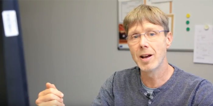
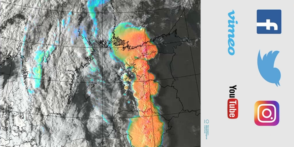
As part of EUMETSAT's YouTube series on RGB applications, a new video on using the Convection RGB, the main RGB used to detect severe thunderstorms, featuring Training Officer Jochen Kerkmann - has recently been published. The RGBs are available in real-time on EUMETView, including animations; and on ePort, every six hours (no animations).

Watch the video

The YouTube series aims to complement the EUMeTrain RGB quick guides.

//image missing//

Winter Weather in Central Europe - Simulator

Online, EUMeTrain

Since 2016 EUMeTrain has been developing online simulators that can be used as an exercise in forecasting, and for understanding the work of a forecaster on shift. Our first 'pioneer' simulator was published in Summer 2017 and now a second simulator on Winter Weather in Central Europe has been published on the EUMeTrain website.

If you have any comments or suggestions about the simulator, please send feedback to the team via the emails provided on the simulator index page.

More simulators are in the process of being developed and will be made available on our website during the year.

//image missing//

New cloud microphysics products in ePort PRO

Online, EUMeTrain

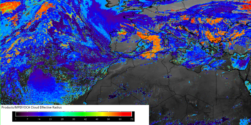
Cloud microphysical products are now available on ePort PRO. The products, from the NowCasting SAF and the EUMETSAT ground segment are:

  • the cloud effective radius (NWC-SAF and MPEF)
  • the cloud ice water path (NWC-SAF)
  • the cloud liquid water path (NWC-SAF)
  • the cloud optical thickness (NWC-SAF and MPEF)
  • the cloud top phase (NWC-SAF and MPEF)

The Optimal Cloud Analysis from EUMETSAT (OCA) and the Cloud MICrophysics product (CMIC) from the NWC-SAF differ in their geographical availability. While the OCA product is available for the full disk, the NWC-SAF CMIC products are calculated for Central Europe only. The EUMETSAT OCA product also contains a cloud top pressure product which is available in ePort PRO.

As for all data in ePort, these new products are available every six hours.

Anyone who is interested in using ePort PRO, send an email to info@eumetrain.org to obtain the username and password.

//image missing//

New lesson available on MetEd: Basic Satellite Imagery Interpretation

Online, MetEd

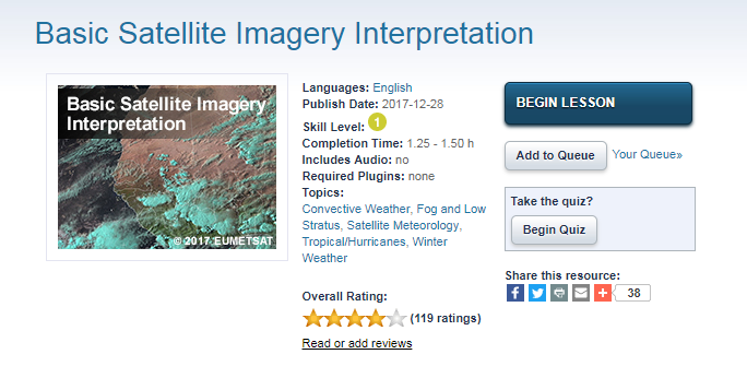
The Basic Satellite Imagery Interpretation lesson teaches the basics of satellite image interpretation to forecasters, meteorology students, and other interested learners, with an emphasis on the African region. It begins by briefly describing visible, infrared, and water vapour channels, as well as RGBs and derived products. From there, it teaches learners how to interpret clouds and surface features using various channels and products. This sets the stage for the final section, where learners practice identifying features using assorted imagery and products. The lesson uses Meteosat Second Generation imagery over Africa and, to a lesser extent, Europe. Given the similarities in channels between satellites, the lesson should also appeal to a broader, international audience.

Developed in the context of the ASMET project (African Satellite Meteorology Education and Training) in collaboration with COMET and EUMETSAT, the lesson was designed to support EUMETSAT training courses, such as the online Satellite Application Courses run yearly by EUMETSAT and the African training centres.

Find more information about training opportunities and resources on the EUMETSAT Training page.

//image missing//

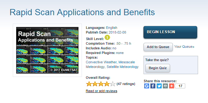
Rapid Scan Applications and Benefits lesson now on MetEd

Online, MetEd

The Rapid Scan lesson is now available on MetEd. The outcome of a successful collaboration between COMET and EUMETSAT, the lesson introduces the capabilities and benefits of rapid scan imaging from geostationary meteorological satellites, with a special focus on the current Meteosat Second Generation satellites.

The lesson begins with an overview of current rapid scan imaging strategies and the products made from those observations. It then addresses nowcasting applications that benefit from these products with a focus on convection and its evolution. Other application areas that benefit from rapid scan observations are mentioned, including the monitoring of fog and low stratus, wildfires, tropical cyclones, and atmospheric motion vector data. The final section describes the new and next generation rapid scan datasets from international satellite operators around the world, and improvements for advancing weather analysis and prediction.

Find more information about training opportunities and resources on the EUMETSAT Training page.

// Issue XII - Apr 2018
Stories & Achievements
//image missing//

Integrated Modelling Workshop (supported by COST Action EOS)

5 February – 9 February, 2018 / Hamburg, Germany

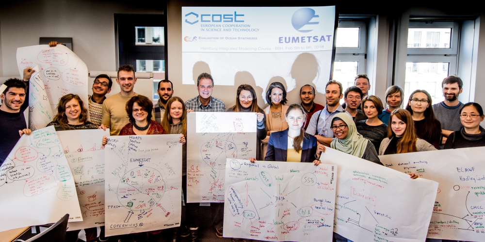
This Integrated Modelling Course brought together expertise from the operational satellite processing and the numerical modelling communities, enabling attendees to learn about a broad range of approaches to processing and exploiting earth observation data and numerical model output.

After two weeks of preparatory online lessons, participants from across Europe, Georgia and Kazakhstan, were met by trainers from PML, CLS, Brockmann Consult, EUMETSAT, the University of Liege, ICM, KNMI, and NIB at BSH in Hamburg.

The course focused on EUMETSAT CMDS products, plus data from CMEMS and OSI-SAF. It included sessions on processing L1/L2 data from each of the three Sentinel-3 sensor platforms, approaching satellite derived wind and sea-ice data, designing and implementing processing chains, assimilating data into numerical models, statistical gap filling of satellite data, and numerical model validation. The course also introduced attendees to a multitude of data manipulation and pre-processing tools. This highly interactive week featured practical, hand-on sessions throughout.

After an intensive, but rewarding week, candidates reported that they had a highly positive experience, especially being encouraged to interact extensively with both the trainers and each other, and that they left with a firm grasp of new data sources and the techniques used to exploit them.

//image missing//

The EuMeTrain online 'Warning Week' 2017

11 - 15 December 2017 / Online training week

EuMeTrain organises an online Event Week twice a year. In December 2017 the event focused on warnings and was called 'Warning Week'.

When we talk about weather warnings, forecasters in different countries struggle with the same kind of challenges. In the first part of the event week the presentations addressed warning methods and tools, for example EFI products. The second part covered communication. The target audience was forecasters who issue warnings and staff who develop warning tools and methods.

The aim was to raise the awareness about different warning methods and tools, enabling forecasters to effectively evaluate the suitable method for a specific weather event. The presentations encouraged good conversations about warning methods and provided a good insight for all the attendees how warnings are managed in other countries.

Another aim was to raise the awareness of effective communication, which proved to be an important topic as there are now many different ways to communicate to our customers, such as social media.

The Event Week was held online, using the web conferencing system Webex. Webex enabled the lectures to be interactive and it was an effective way of bringing together people from different countries to discuss an important topic.

//image missing

The Use of Gridded Satellite Data for Climate Services in Africa

23 Nov – 4 Dec 2017 Online / 20 Nov – 24 Nov 2017 Classroom

From more than 80 applicants from all over Africa, 19 participants from 13 African countries attended the Training Workshop on 'The Use of Gridded Satellite Data for Climate Services in Africa'.

This course was run in close collaboration with the CM SAF, and hosted by SAWS. For the first time EUMETSAT collaborated with Stats4SD, who provides the free and open software R-Instat. R-Instat follows Instat, a software that manages climate data and is well known in Africa. R-Instat allows users to combine in-situ observations with any satellite-based climate data provided, e.g. by the CM SAF.

As in previous years, the course comprised of an online phase and classroom phase. During the online phase participants engaged with the principles of satellite-based climate monitoring, and were provided with a first overview on the software tools R (CM SAF R Toolbox, and the CM SAF R package) and R-Instat. The major part of the classroom phase was reserved for work on individual mini projects. Participants worked on real-life questions using CM SAF data, with support from the course instructors. At the end of the week all participants presented their results.

//image missing//

Marine Forecasters Workshop in Casablanca, Morocco

4 - 8 December 2017 / Casablanca, Morrocco

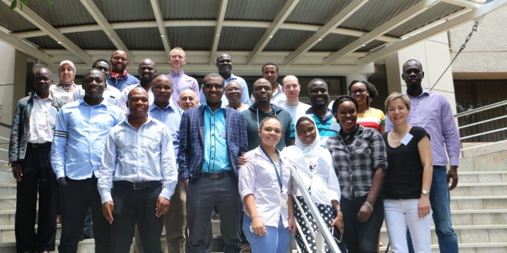
A new type of marine meteorology training event took place in Morocco from 4-8 December 2017. It was the first time that trainers from DMN and MétéoFrance, supported by EUMETSAT, joined forces to train a community of participants from western Africa. The event was attended by 16 participants.

The focus of the training course were altimeter and scatterometer measurements of the sea surface, as those collected by ASCAT on wind direction and speed. Sea surface temperature and ocean colour are key variable where satellites play an essential role in producing.

The language of the course was French, as training in languages other than the native or second native are usually inefficient, as the sharing of knowledge can be limited and satisfaction rates are often poor.