Table of Contents
Cloud Structure In Satellite Images
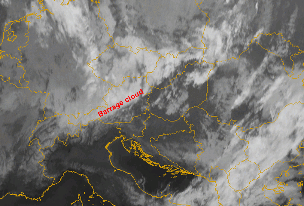
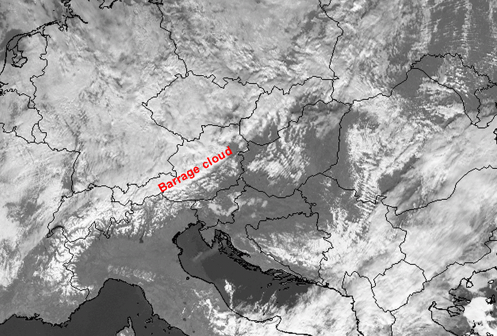
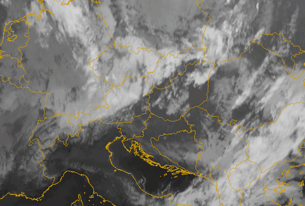
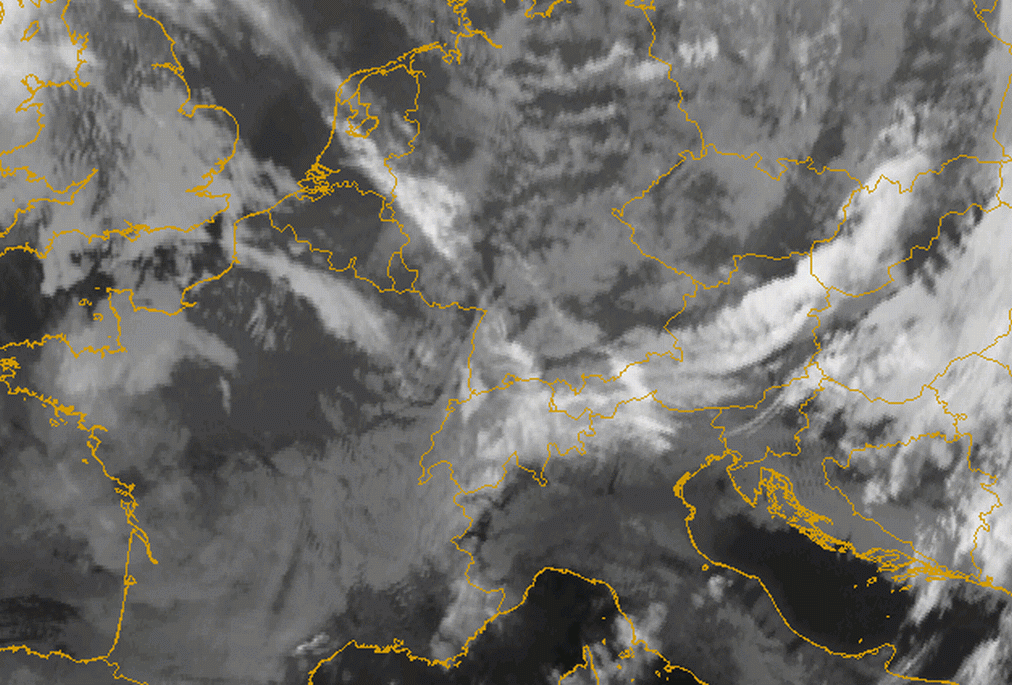
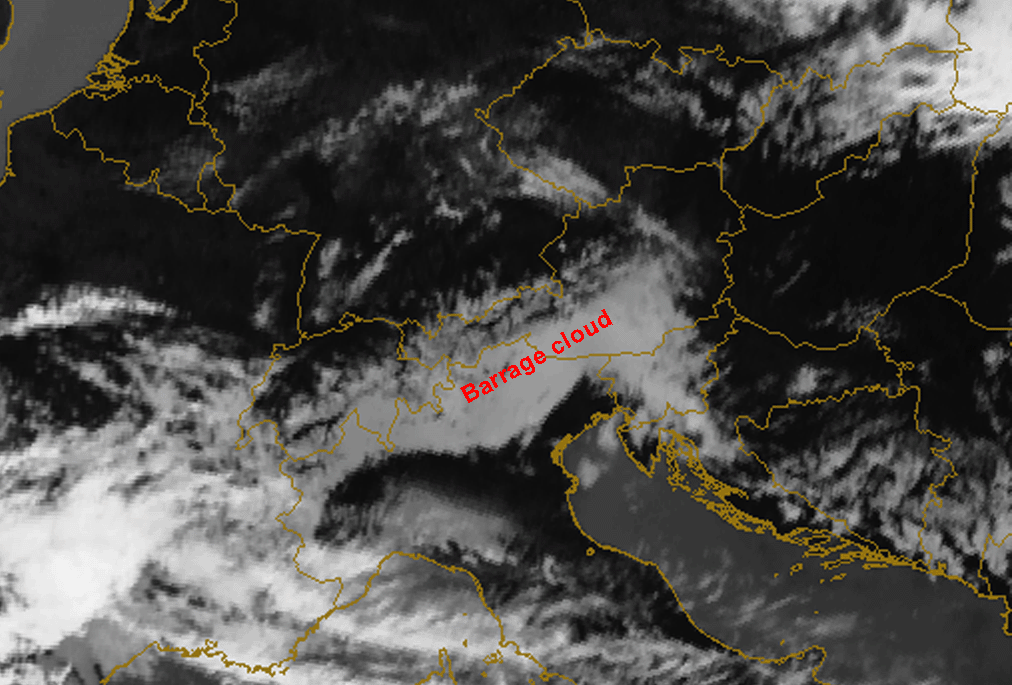
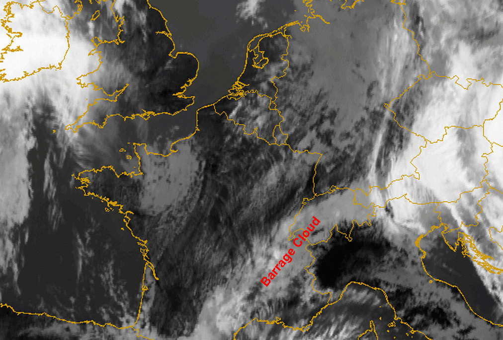
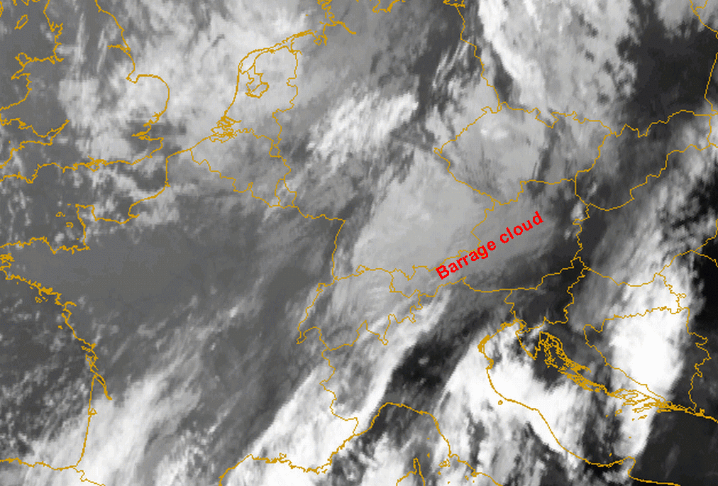
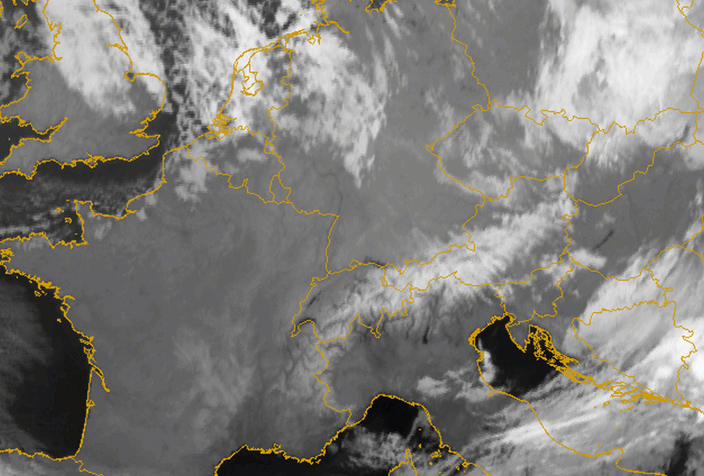
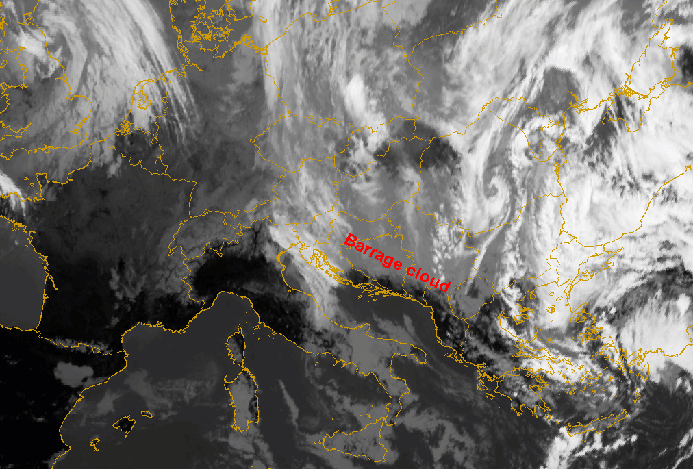
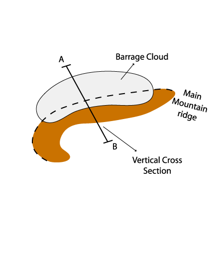
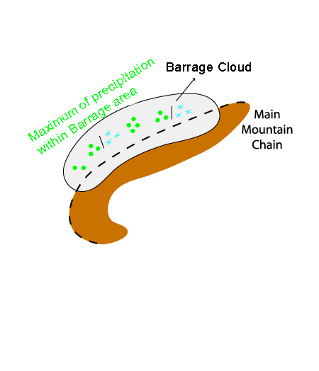
If a flow is crossing over a mountain chain and therefore forced to rise, Barrage cloudiness will develop if sufficient humidity is available within the flow. The Barrage cloudiness mostly consists of low and middle clouds, depending on the height of the mountain range and the angle between the streamlines and the orographic obstacle. It exists as long as the necessary configuration between mountains and wind field exists.
Appearance in METEOSAT Second Generation imagery
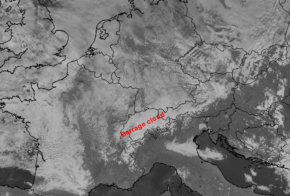
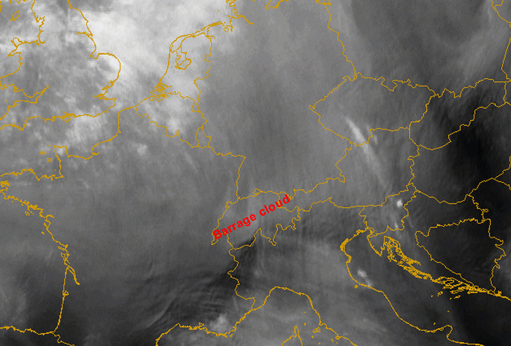
A belt or a bulge of relatively low but thick cloud forms along the windward side of a mountain barrier. Regularly there is an enhancement of
preliminarily existing cloudiness in association with orography. In general, low grey cloudiness exhibiting a certain form and appearance can
be seen as Barrage cloud along a mountain barrier.
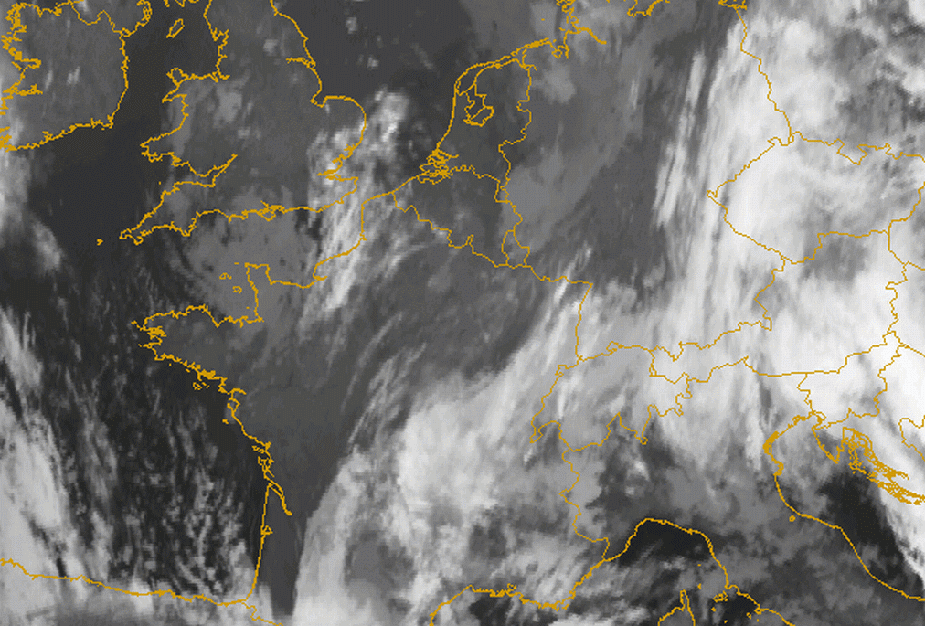
Sometimes Stratus and/or Fog Sheets which are slowly advected onto the mountain barrier have the same appearance as Barrage cloudiness, but
they are usually associated with synoptic situations with a low pressure gradient and weak winds at all levels. However Barrage cloudiness is
associated with a strong flow and forms after a frontal passage over mountains or redevelops within a baroclinic zone.
- IR imagery
- Mostly a dark grey to grey cloud bulge indicating low cloud with a relatively warm cloud top
- Light grey to white clouds form during cloud enhancement
- Light grey to white clouds form during cloud enhancement over the main mountain ridge
- The downwind edge of the mountain crest is sharply defined
- Because of the strong upper level stream also lee or high fibre clouds can often be formed to the lee of the mountain chain, appearing as bright grey to white (see Lee Cloudiness ).
- WV imagery
- Low level Barrage cloudiness is usually not seen in WV images, but the enhancement of frontal cloud during its passage over the mountain chain can be well seen in WV imagery
- Bright lee or high fibre cloudiness is also well seen in the WV image
- VIS imagery
- The sharp edge along the downwind side of the mountain barrier is best seen in the VIS image
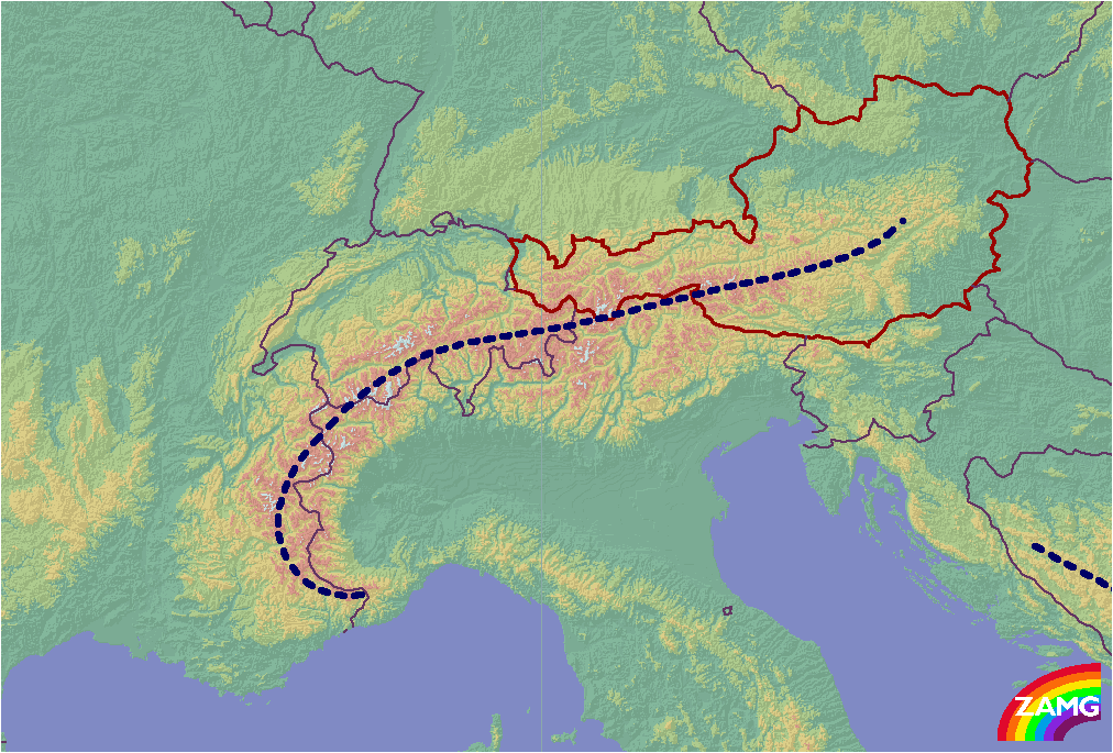
Barrage cloudiness in Europe is often observed over the Scandinavian Mountains, the Pyrenees, the Carpathian Mountains, the Dinarian Mountains and the Alps.
Alpine Barrage cloudiness
Alpine Barrage clouds take different forms depending upon:
- The angle and direction of the flow against the main ridge of the mountain barrier, causing a characteristic appearance of the Barrage cloudiness bulge and extension towards the windward side.
- Whether it is a Barrage cloud within a frontal cloud band or separate Barrage cloudiness.
About 60 cases have been investigated in detail; 36 cases show frontal Barrage (8 cases Detached Warm Front) and 24 cases show separate Barrage cloudiness (13 cases with Barrage north of the Alps, 8 with Barrage south of the Alps and 4 cases with Barrage at the west Alps).
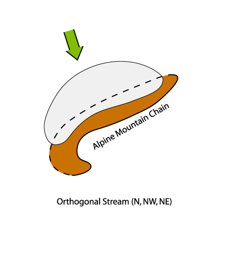
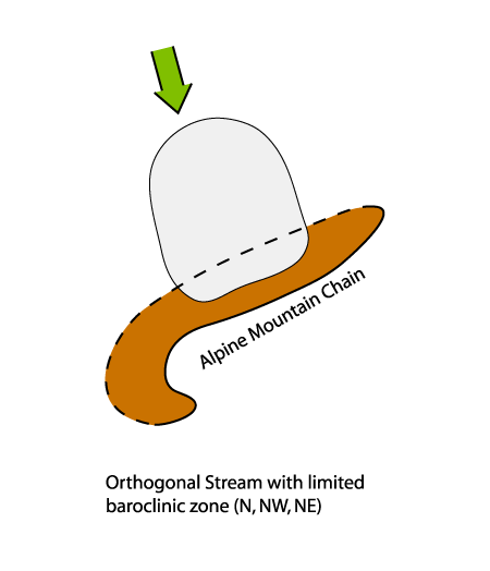
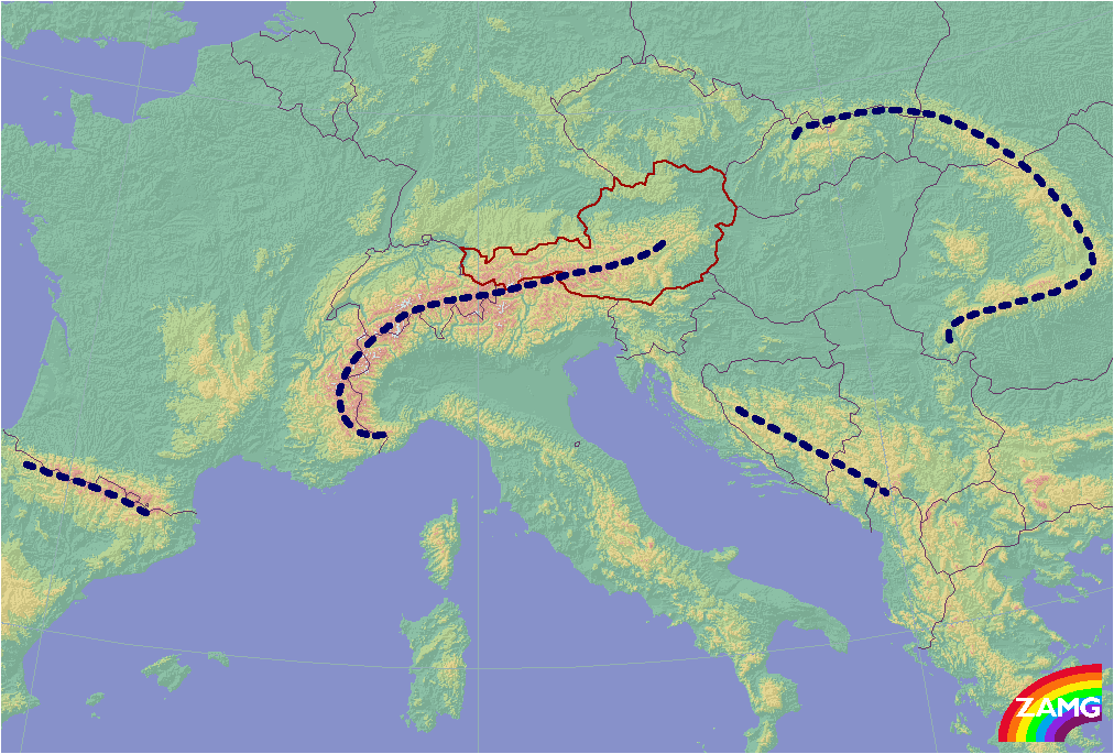
The schematic above shows the topographical distribution of the Alps with the main alpine ridge indicated (dashed blue).
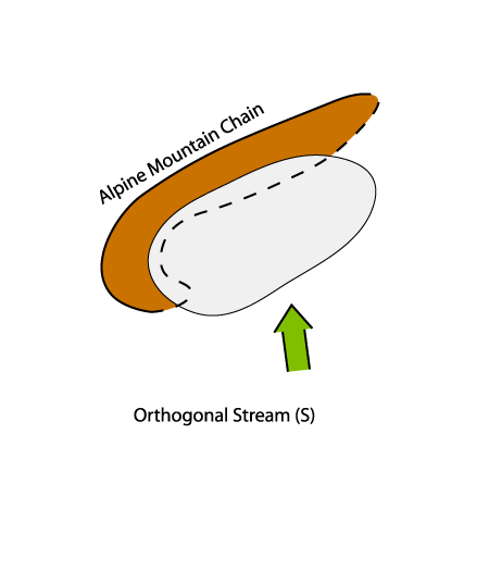
1. Orthogonal (right angle) stream to the main Alpine ridge
- The orthogonal stream has a dominating northerly component throughout all levels
- Barrage cloudiness frequently forms after a frontal passage, when remaining cloudiness is enhanced along the windward side of the mountains.
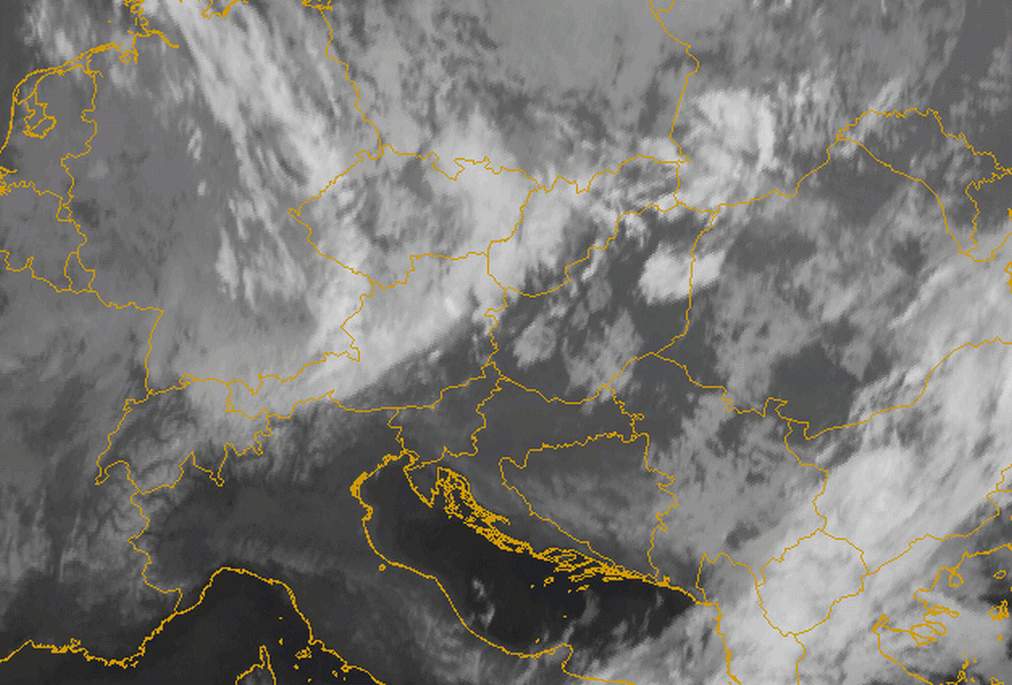
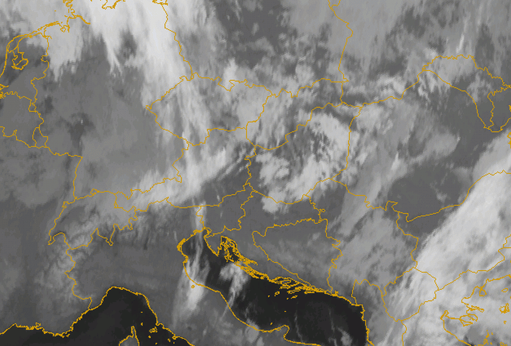
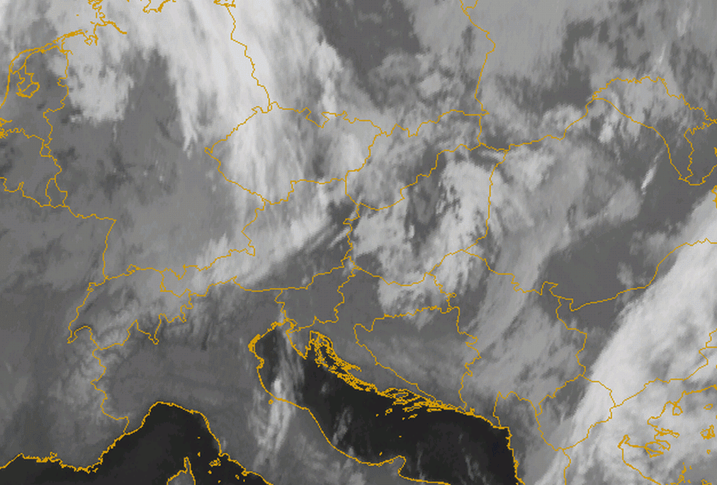
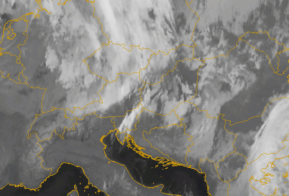
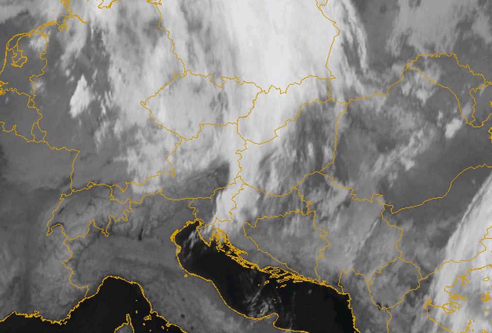
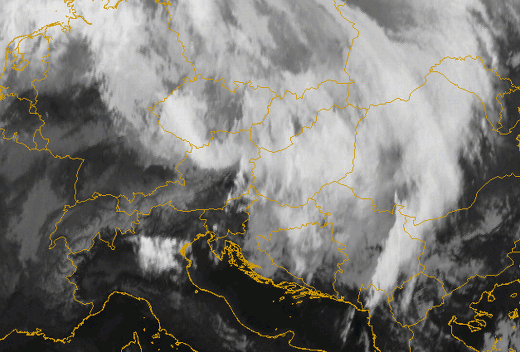
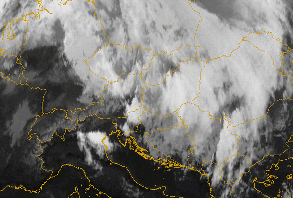
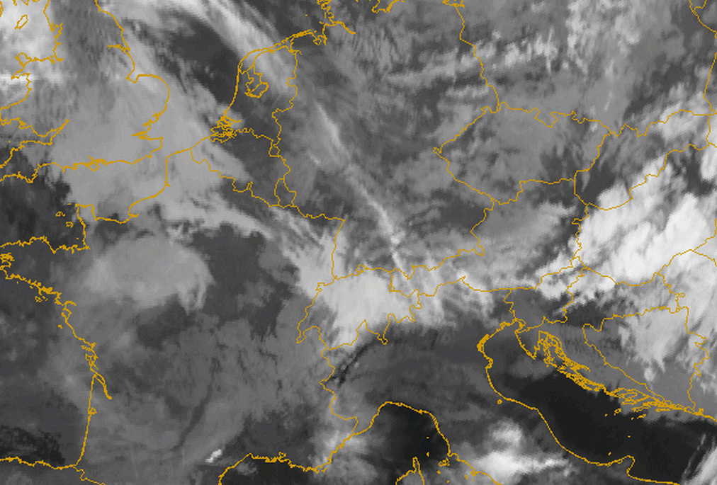
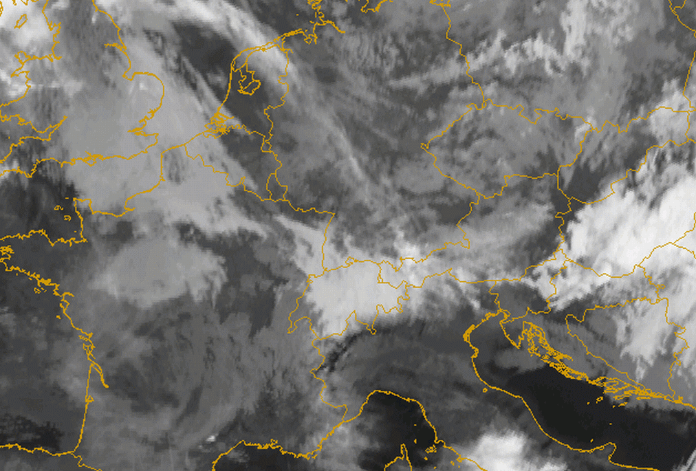
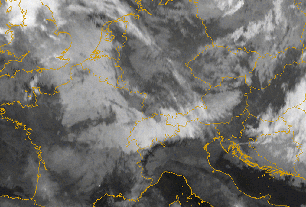
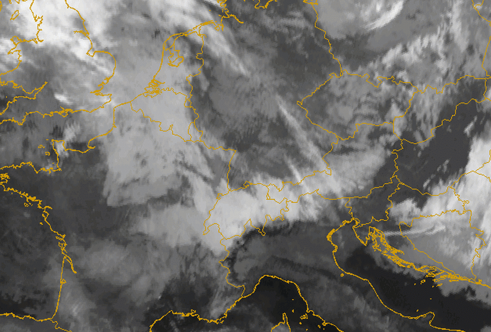
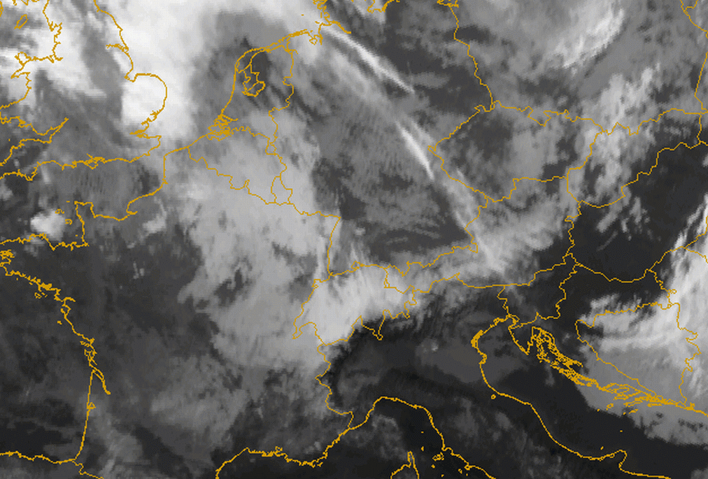
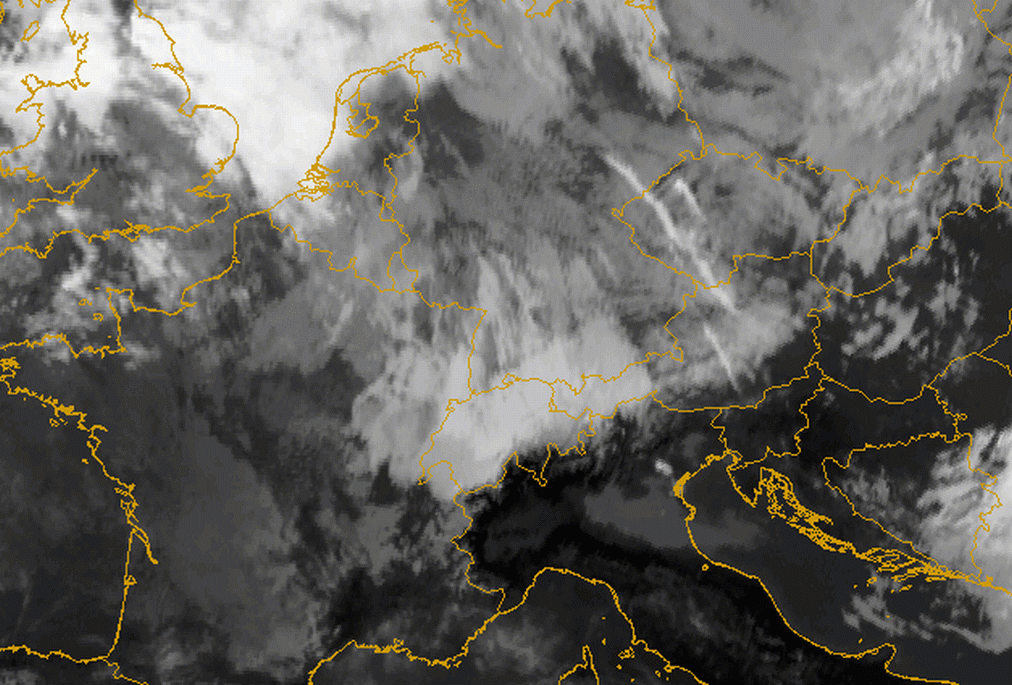
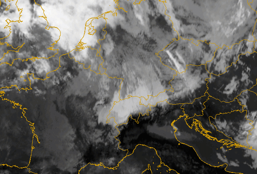
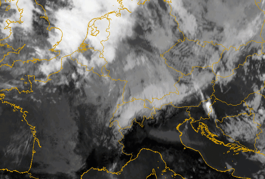
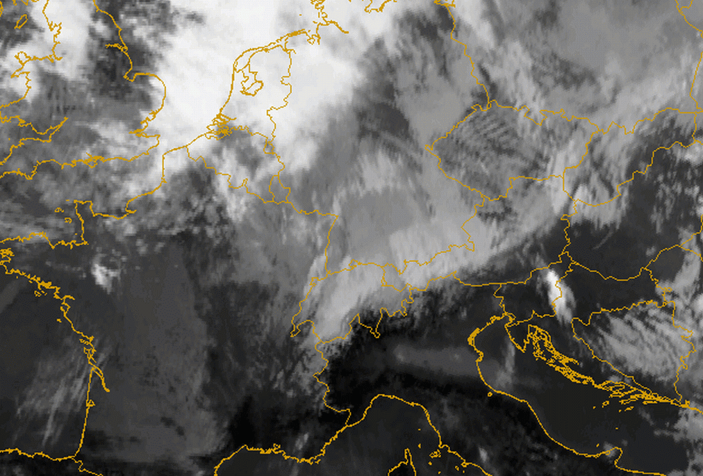
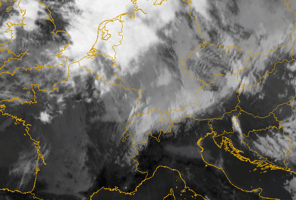
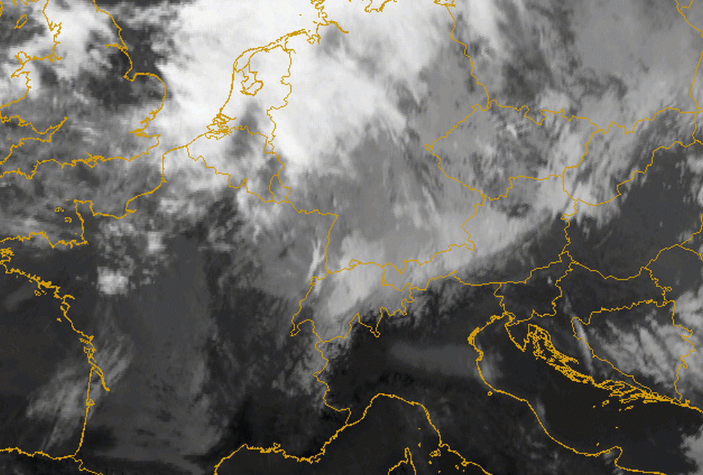
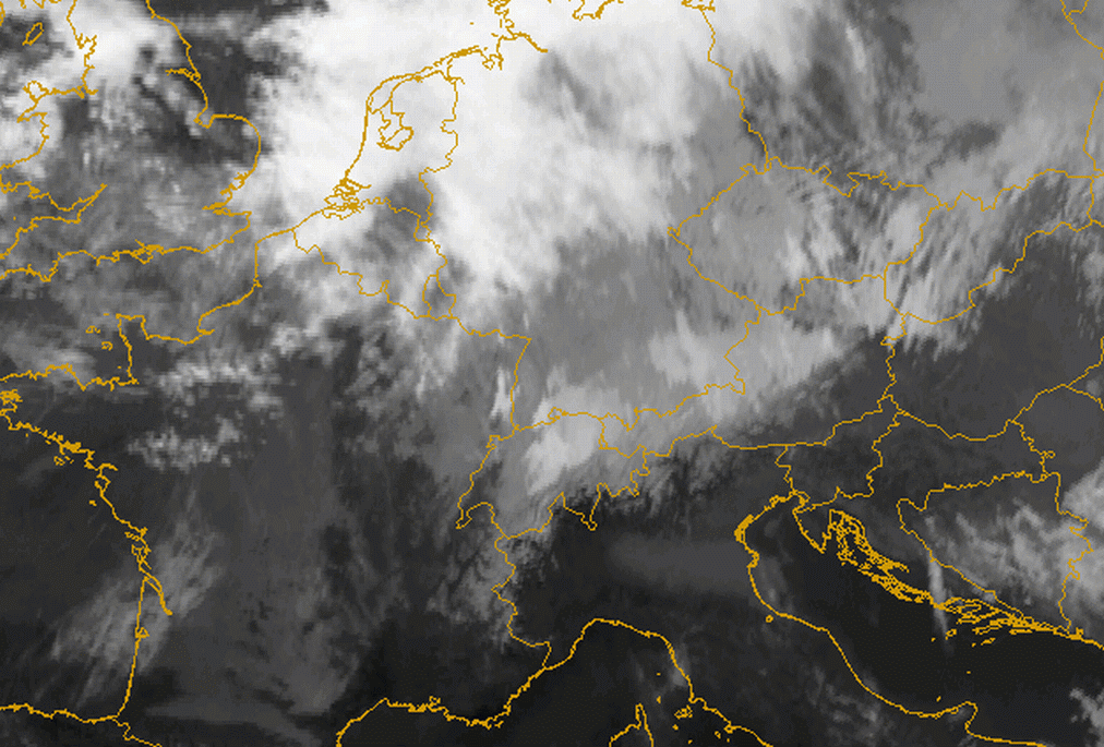
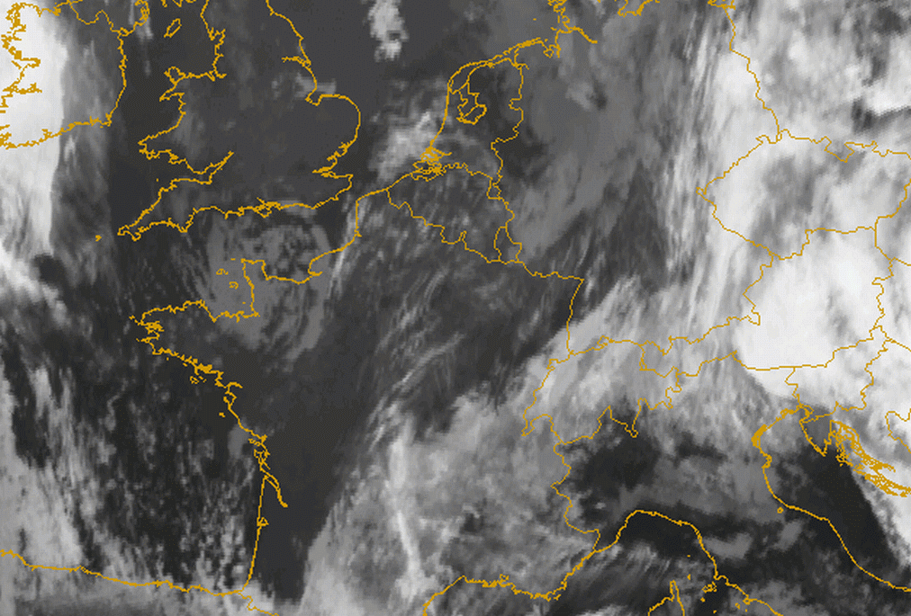
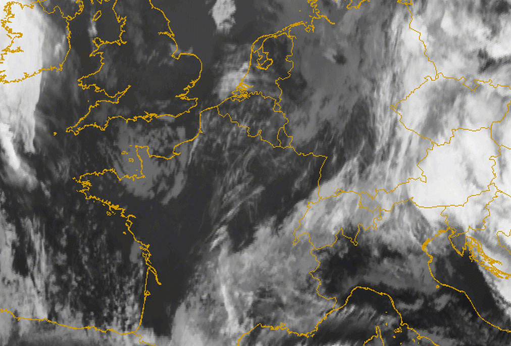
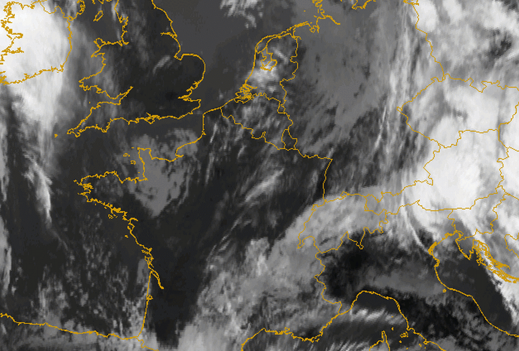
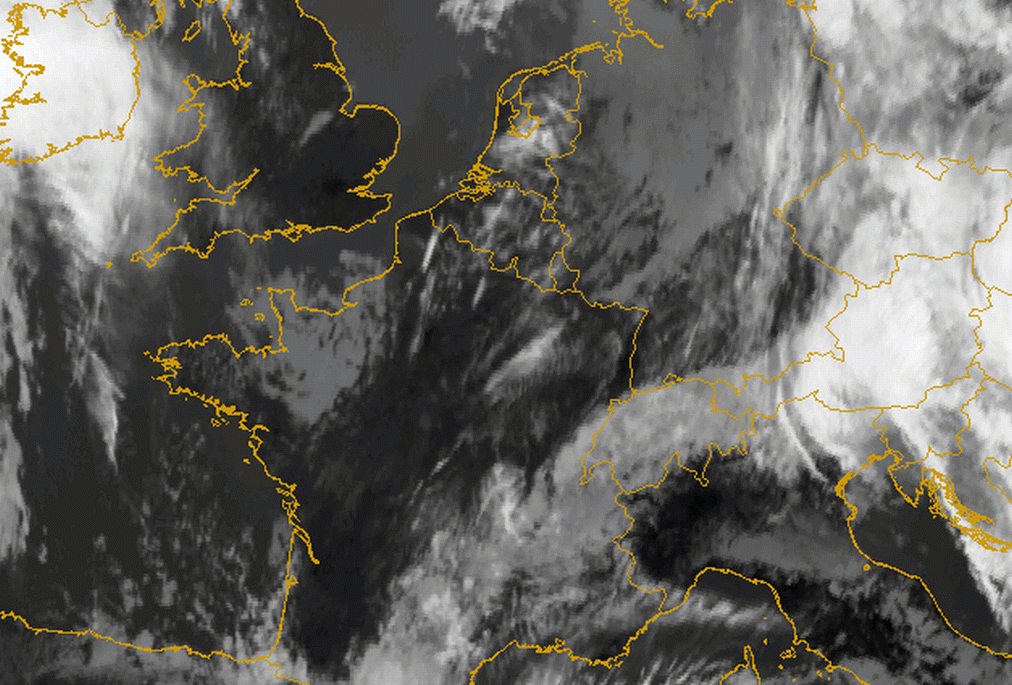
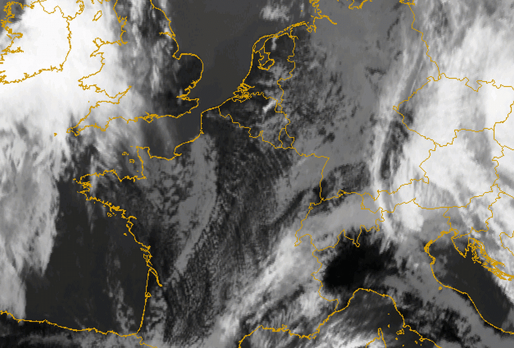
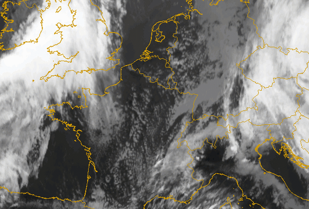
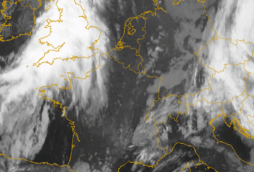
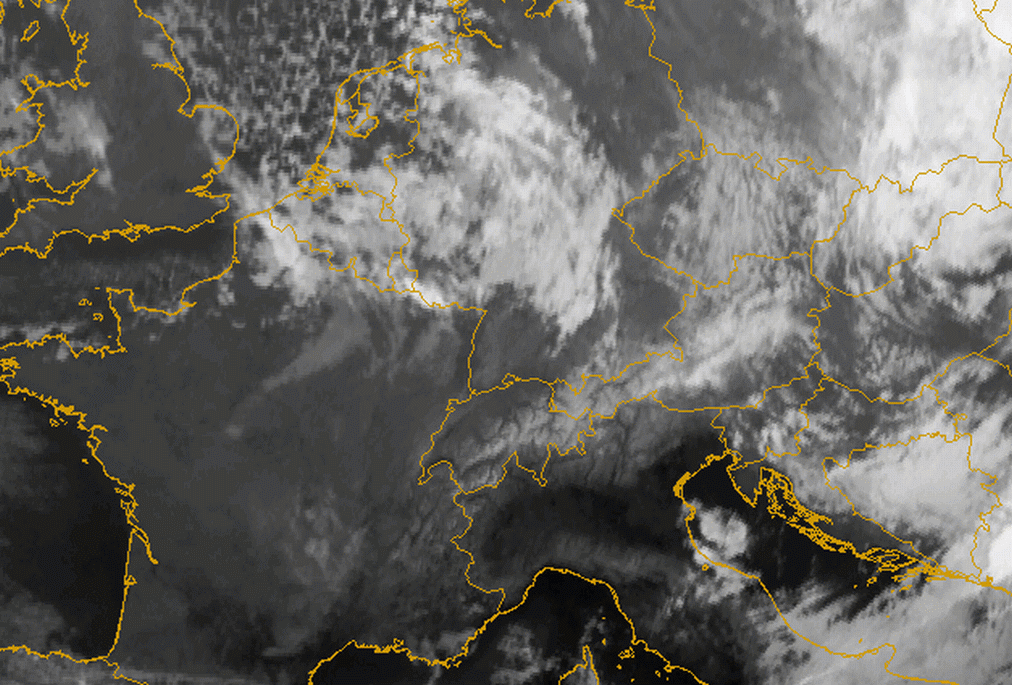
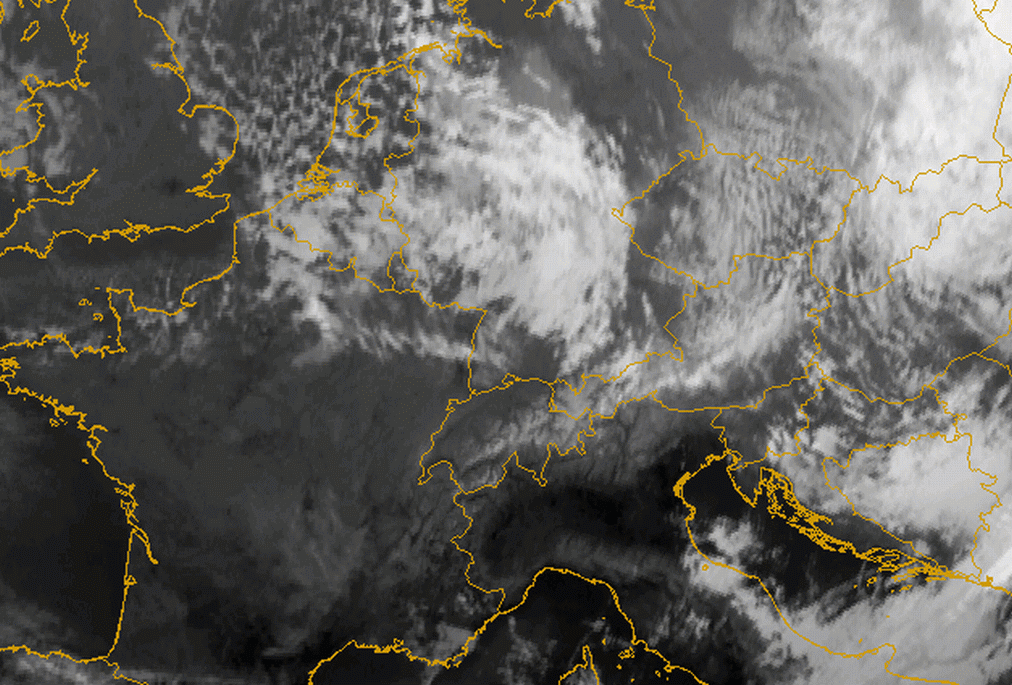
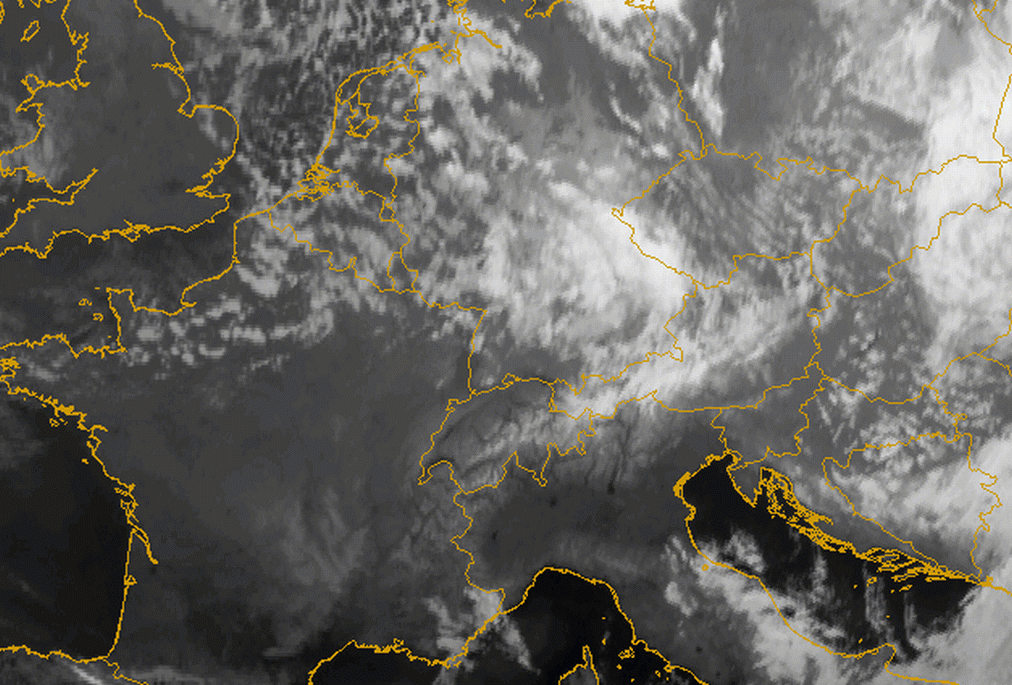
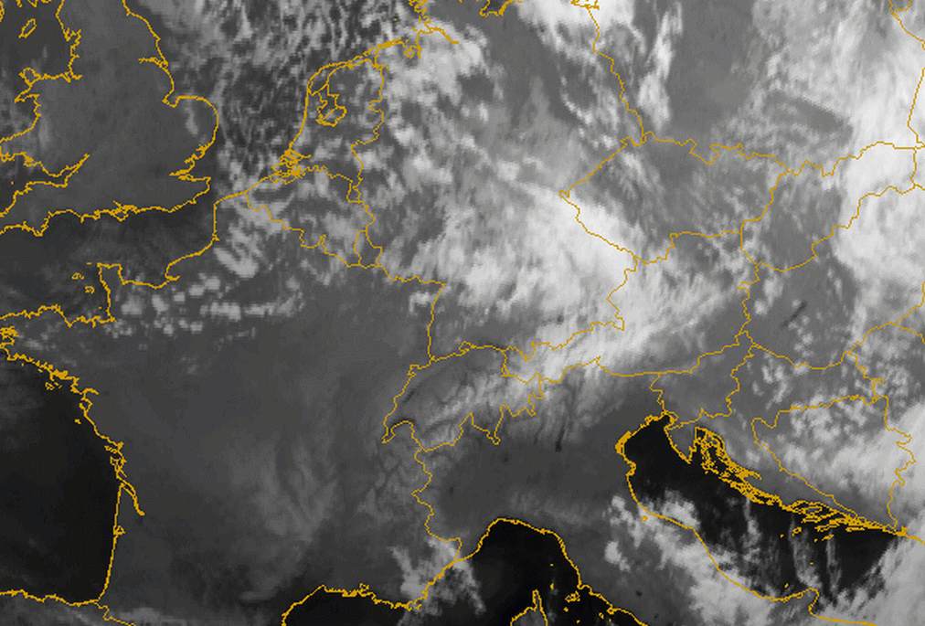
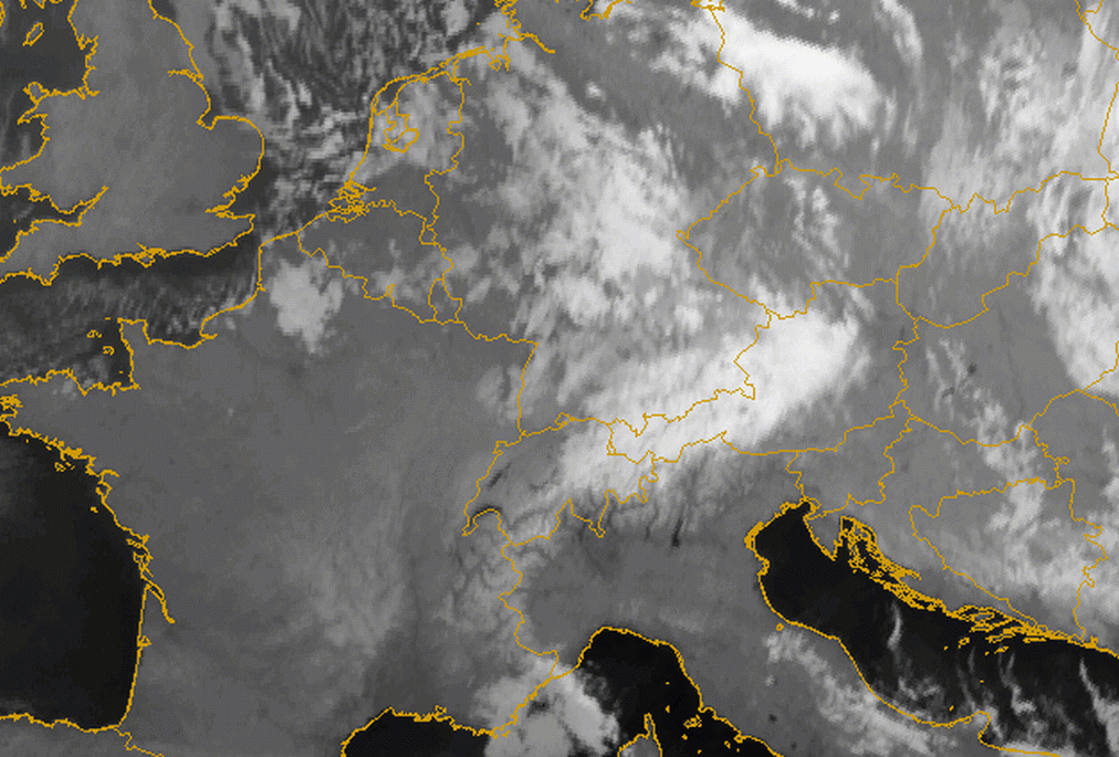
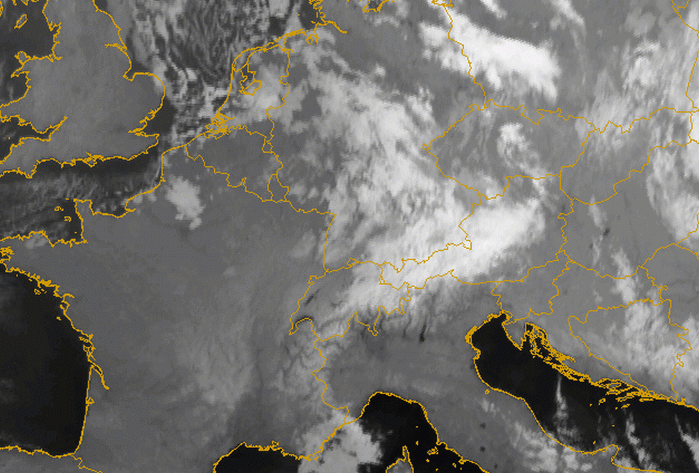
The case of the 3 January 2005 shows Barrage cloudiness over Austria from an orthogonal stream. In the IR10.8 image the Barrage cloudiness can be observed as a separate feature after frontal passage (below left). The sharp edge towards the lee side of the mountains can be seen in the HRVIS image. The bright white cloud feature implies higher multilayered cloudiness (below right).
|
04 January 2005/12.00 UTC - Meteosat 8 IR10.8 image; SatRep overlay: names of conceptual models
|
04 January 2005/12.00 UTC - Meteosat 8 HRVIS image; SatRep overlay: names of conceptual models
|
|
|
|
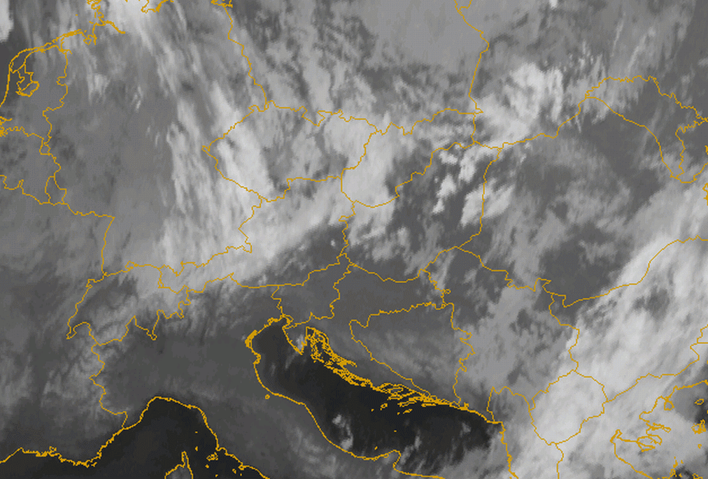
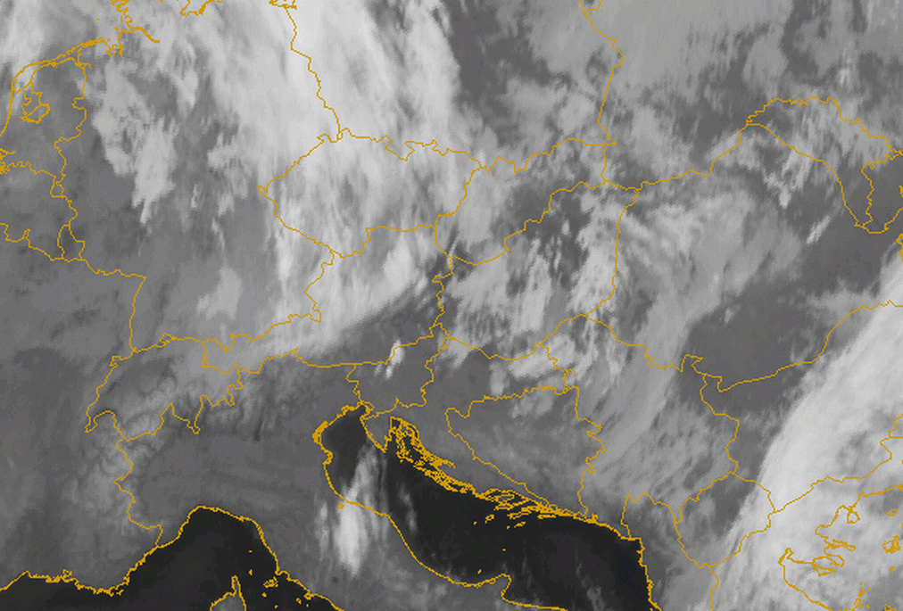
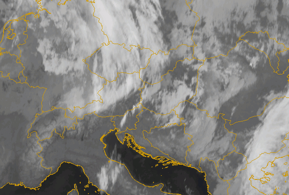
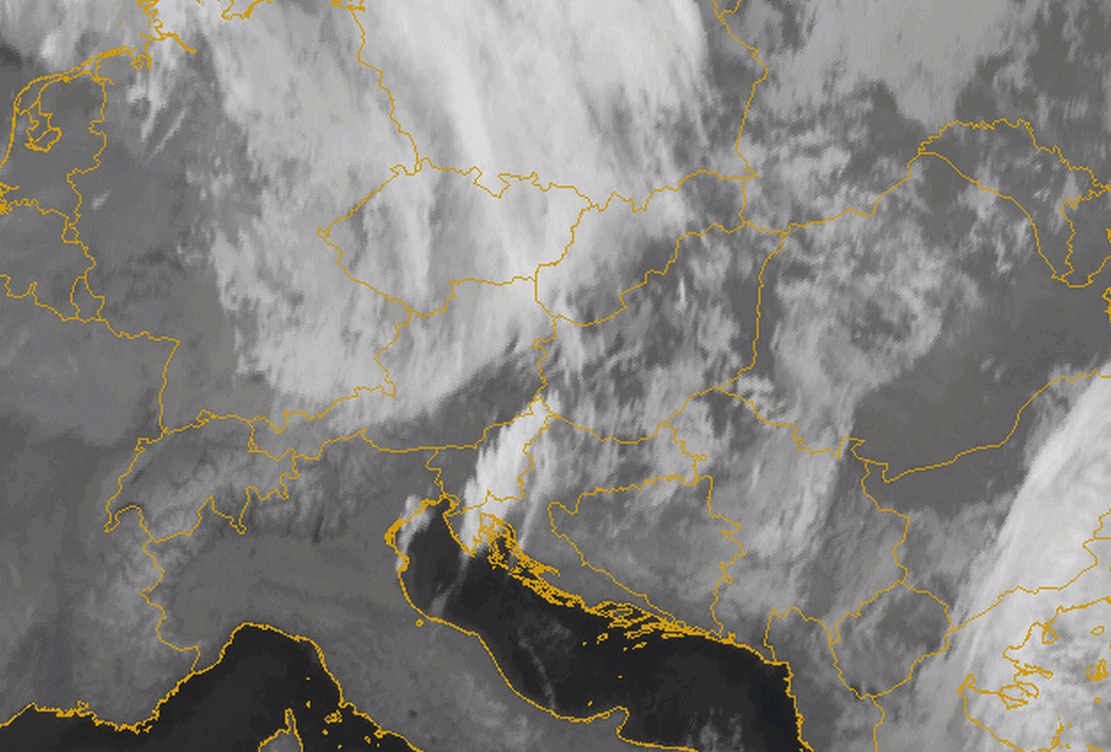
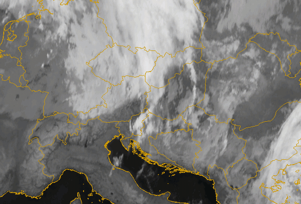
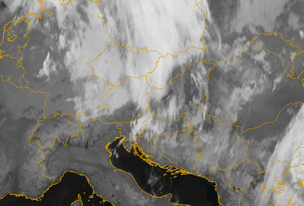
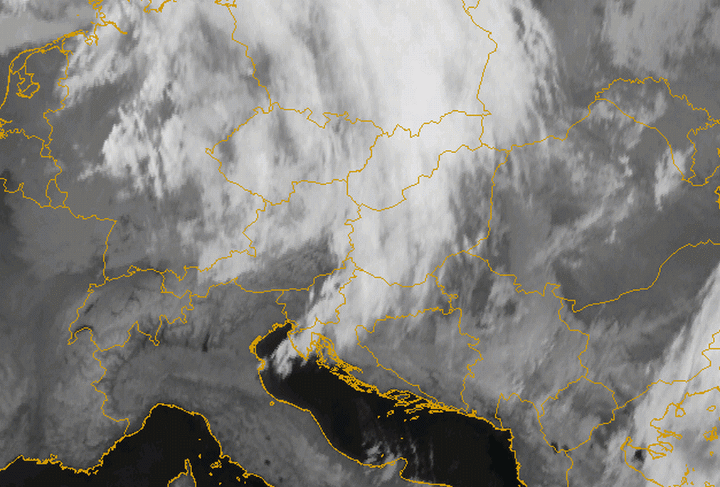
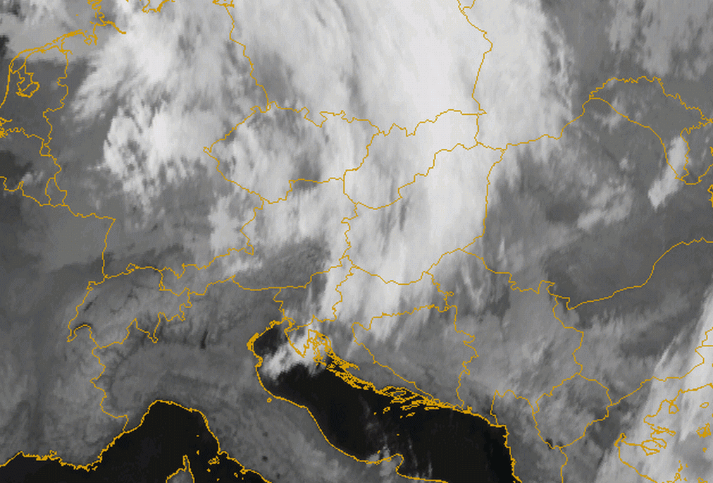
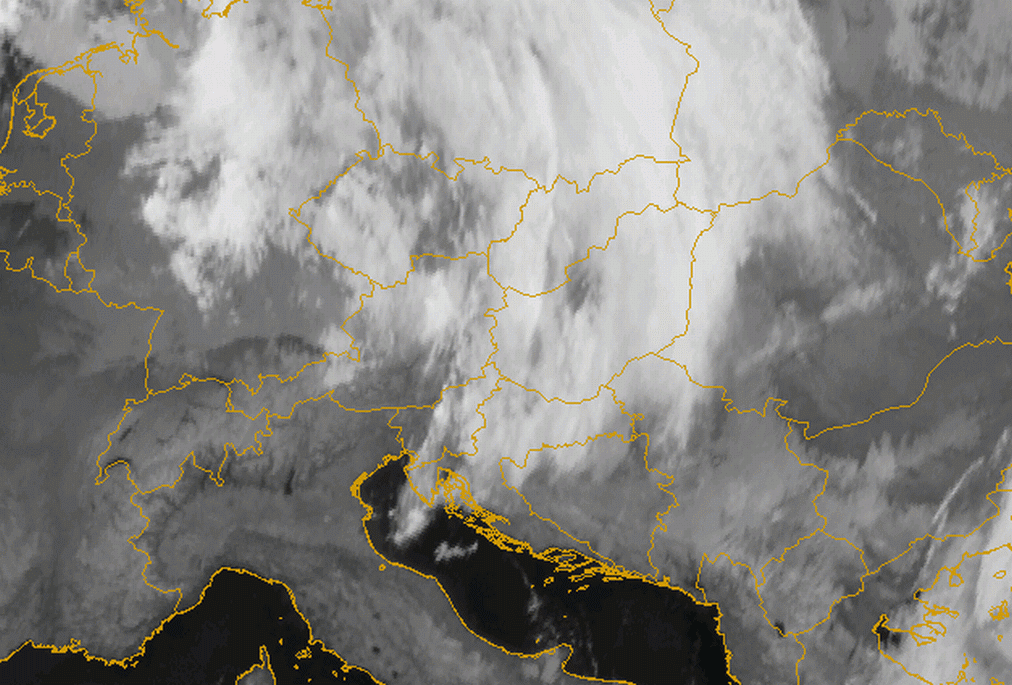
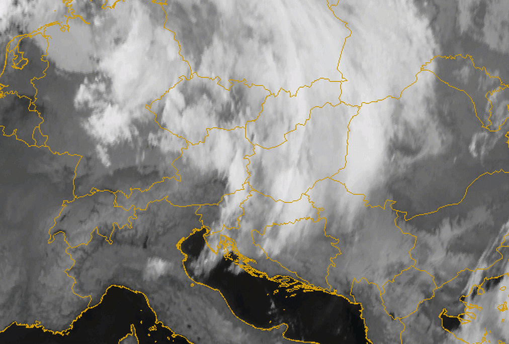
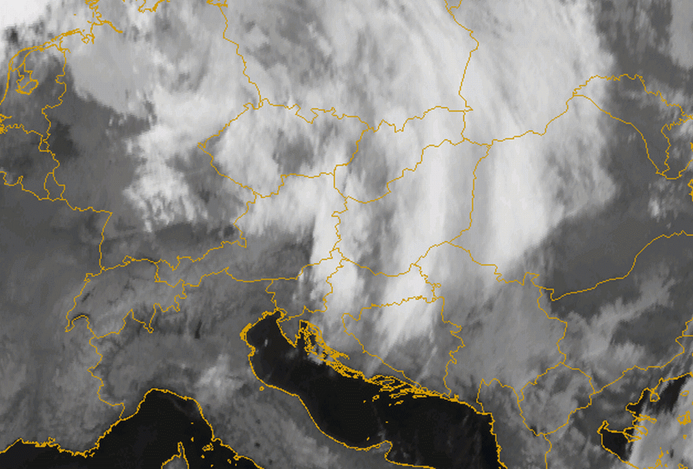
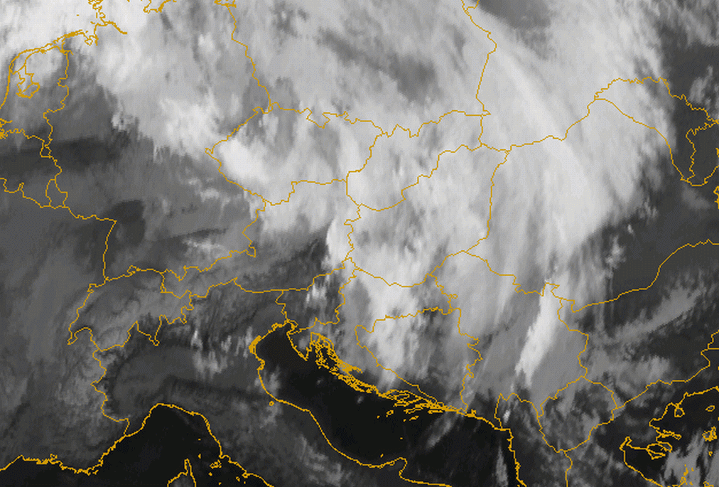
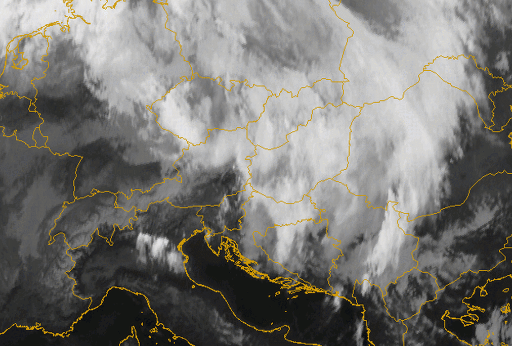
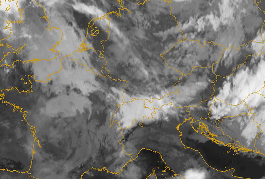
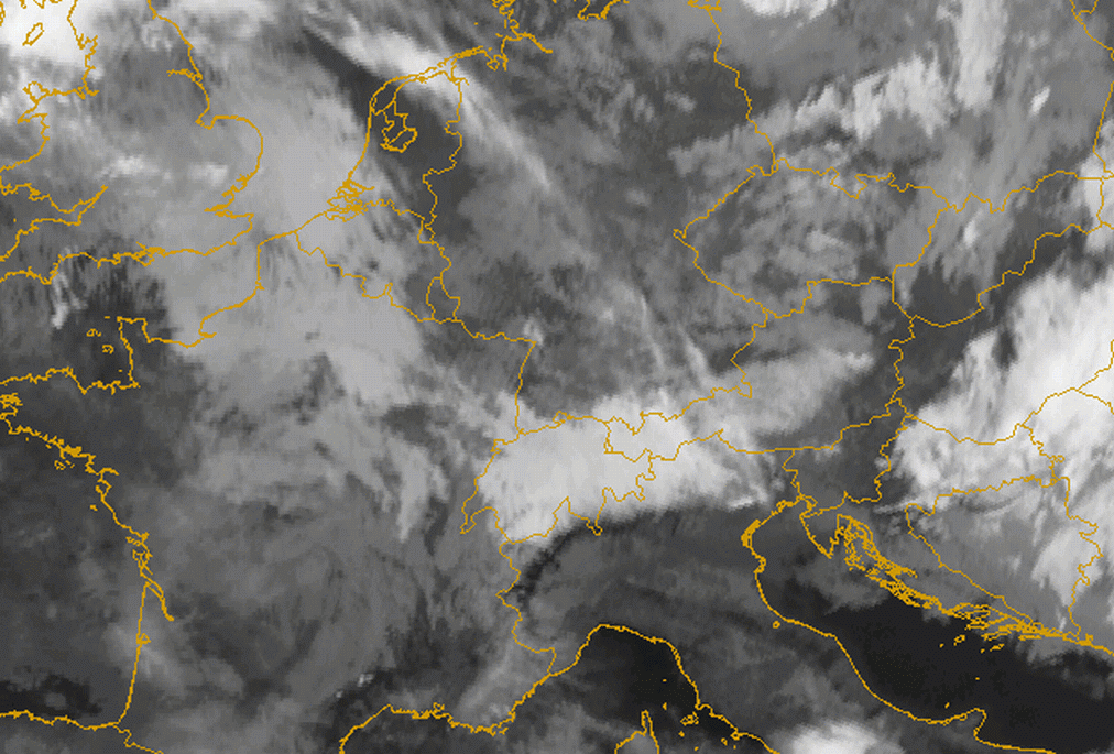
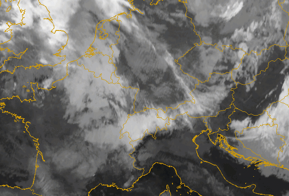
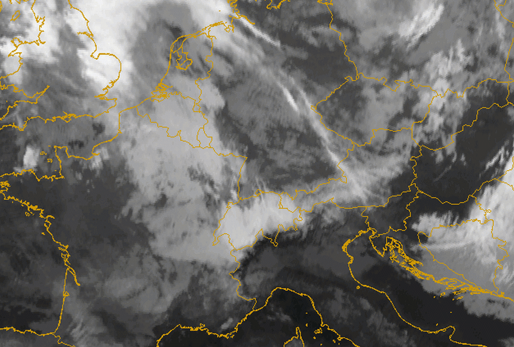
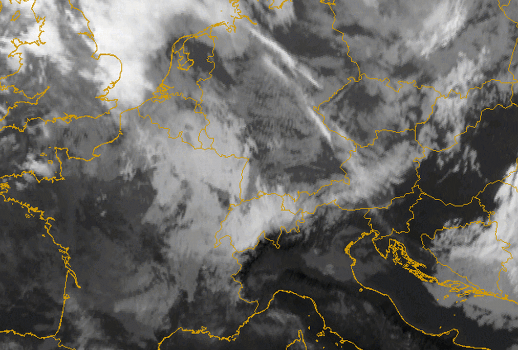
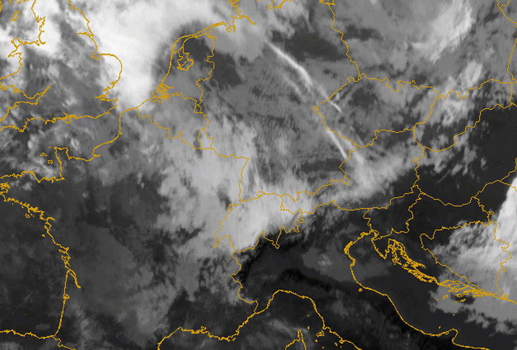
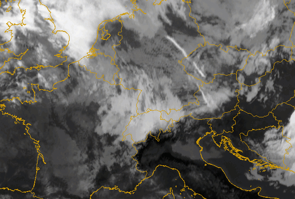
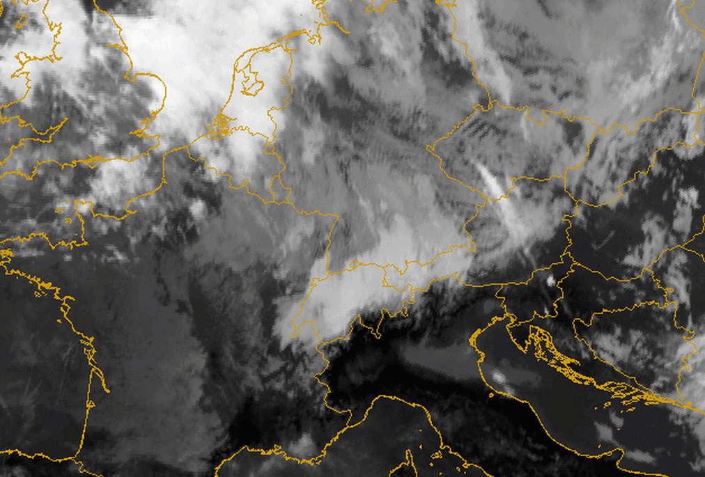
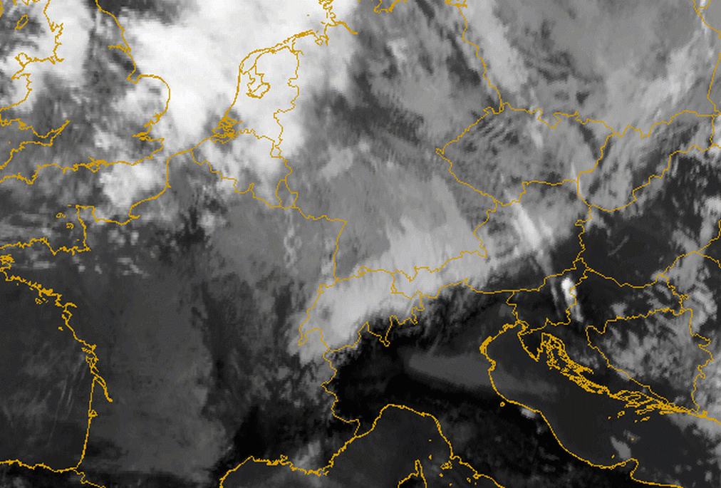
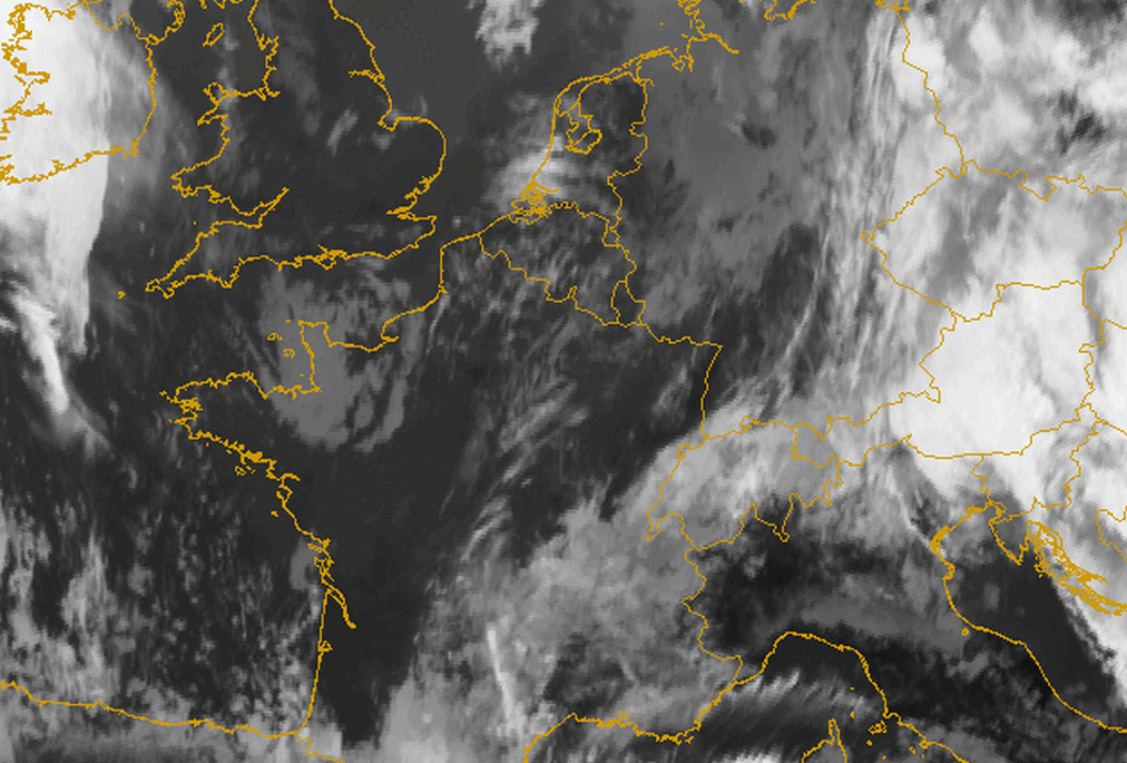
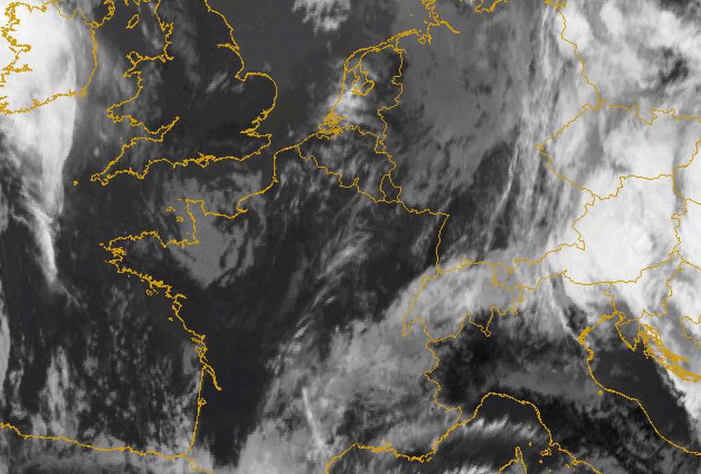
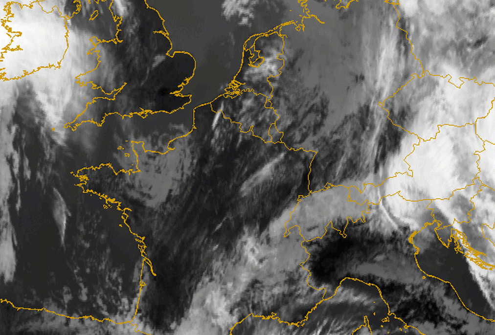
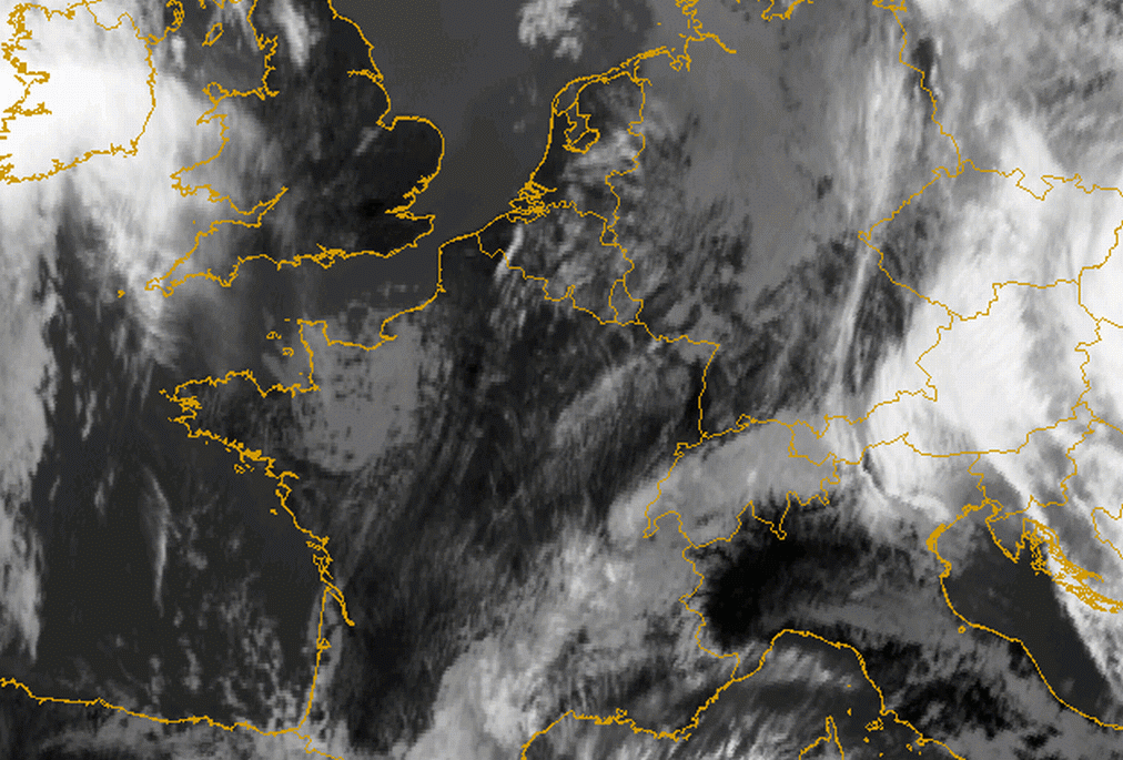
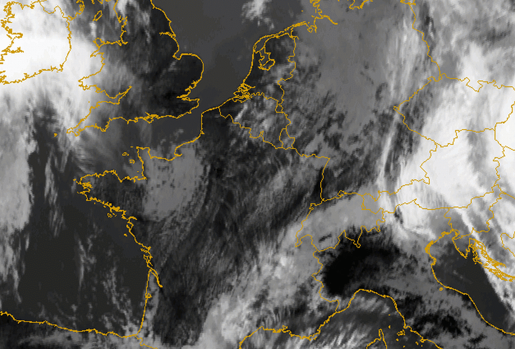
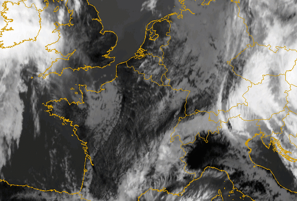
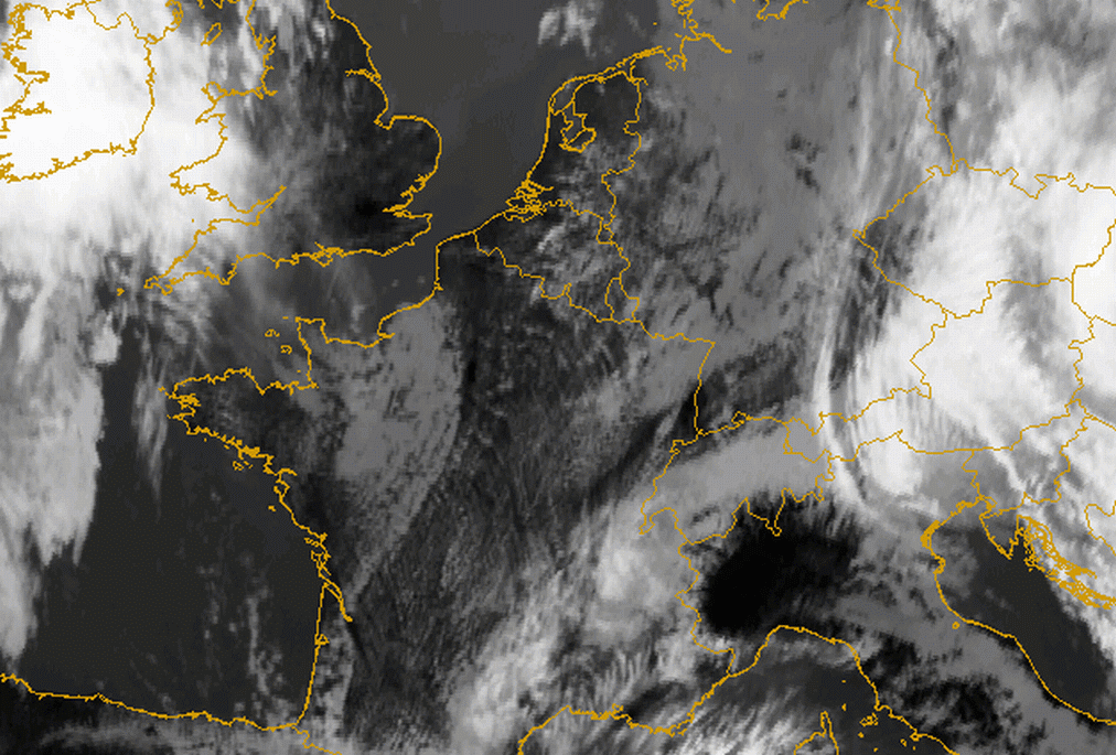
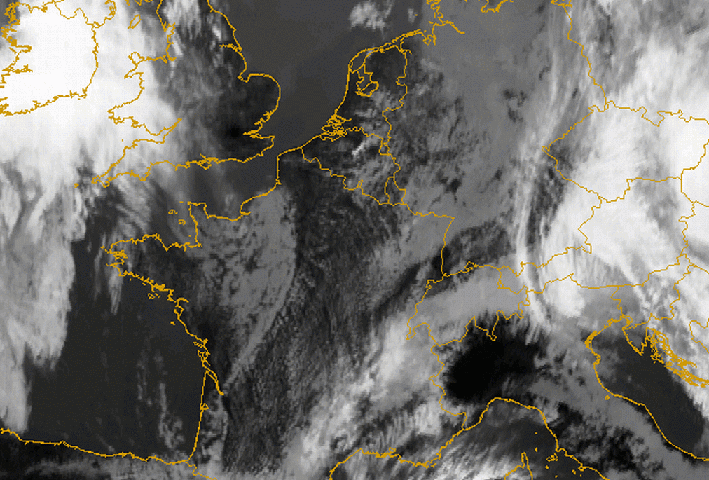
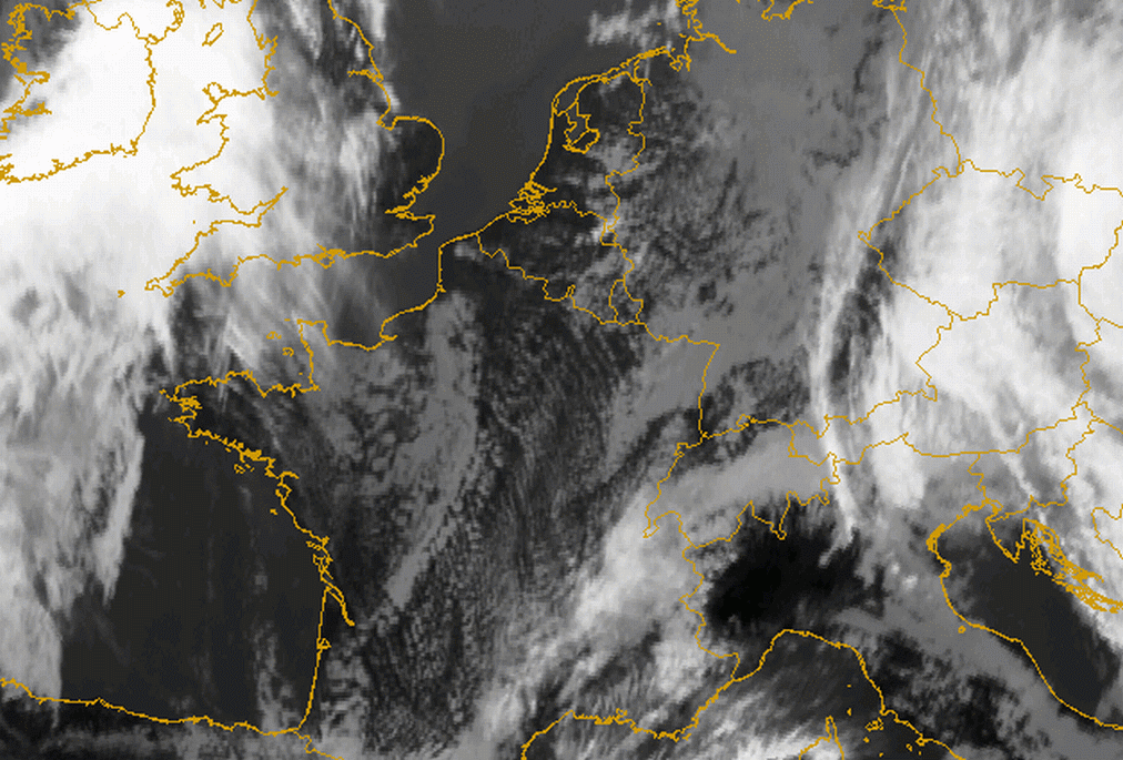
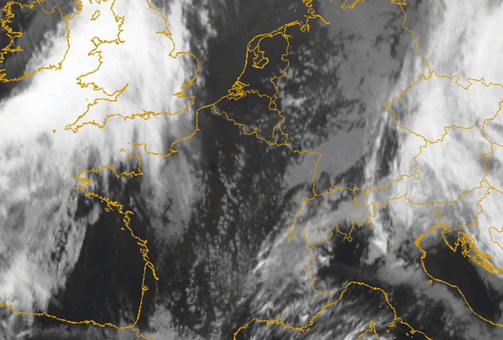
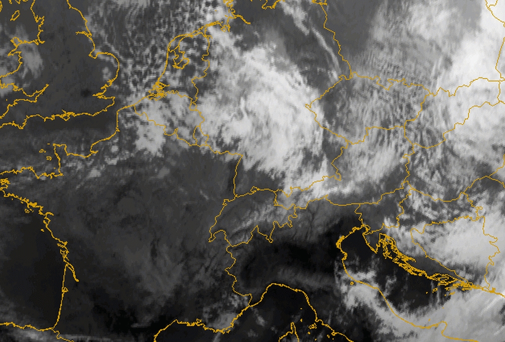
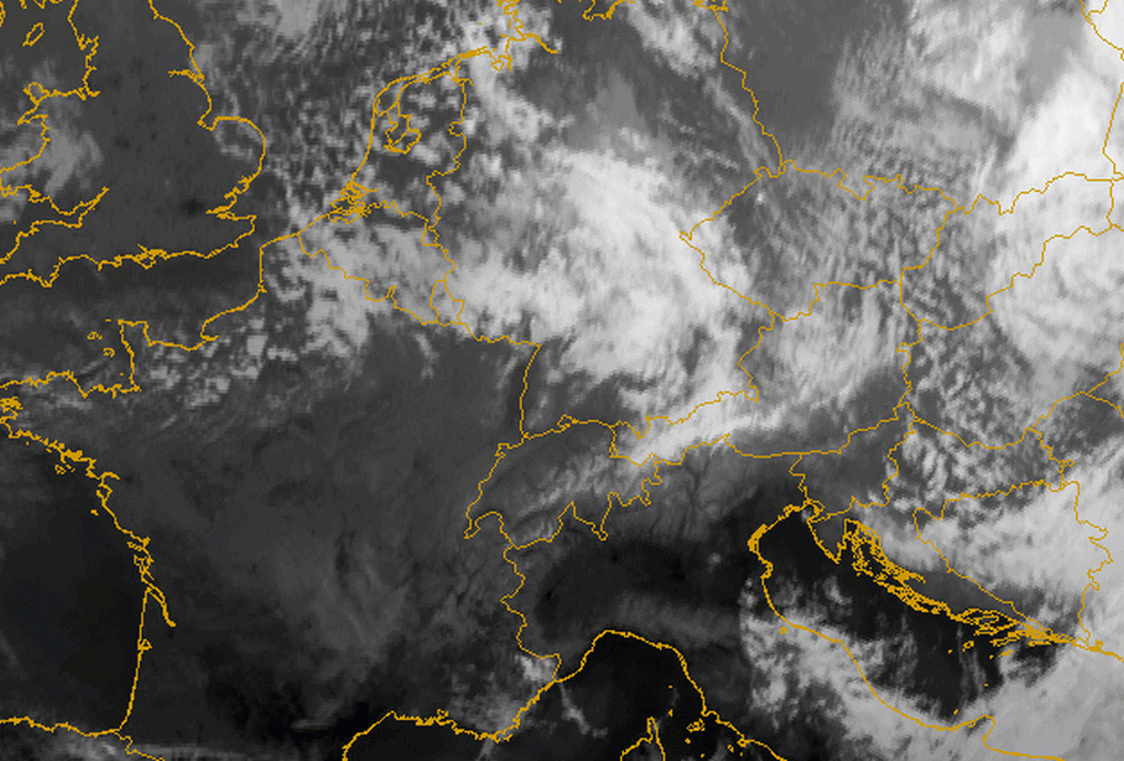
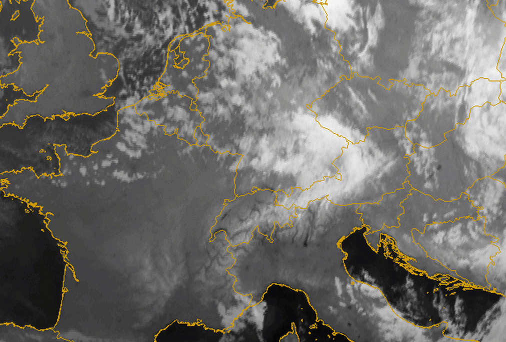
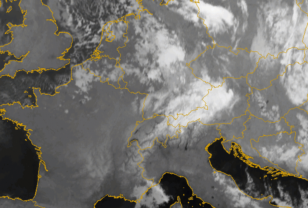
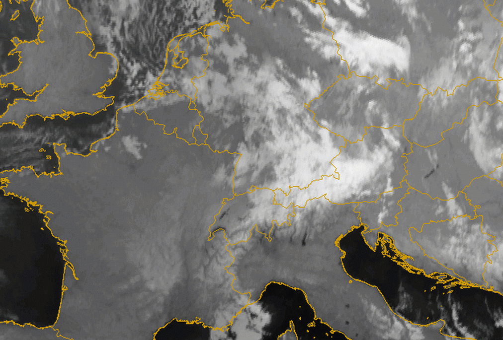
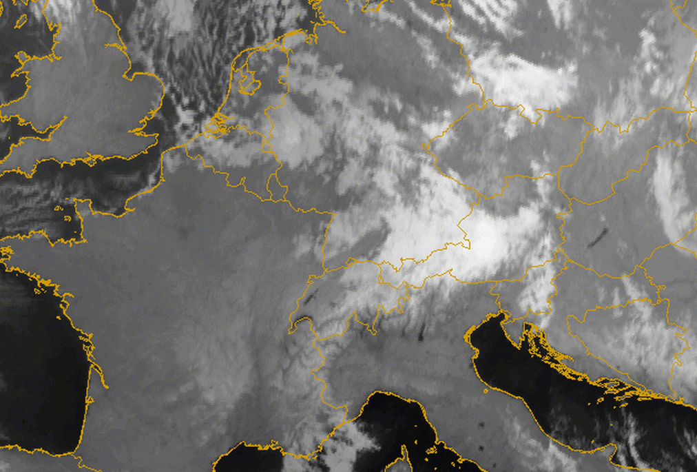
03 January 2005/12.00 UTC - Meteosat 8 IR10.8 image; 03/12.00 - 04/12.00 UTC hourly image loop
|
|
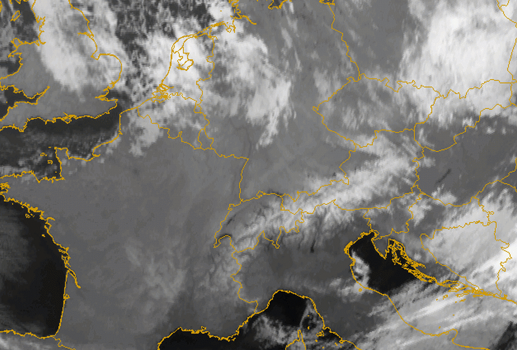
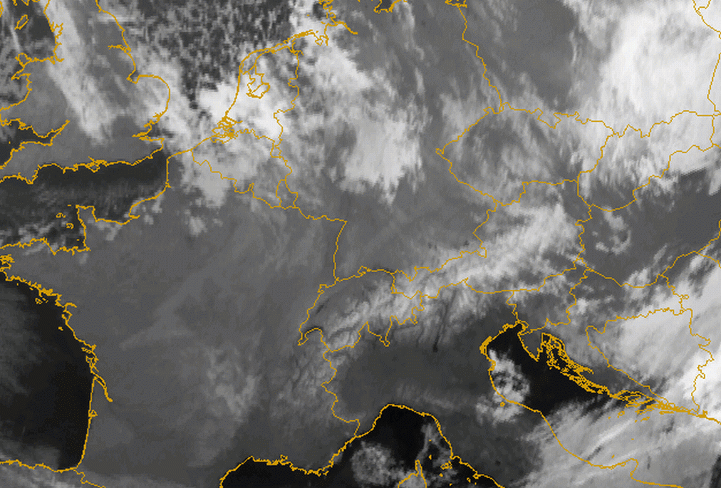
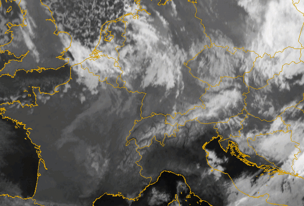
The IR10.8 image loop (above left) shows the passage of a front. It clearly shows the development of remaining cloudiness as Barrage on the north side of the Alps. To the south some lee waves are being formed just of the Alpine barrier. The behaviour of the Barrage cloudiness in the loop can be seen as a stationary cloud sheet directly above the windward slopes and main mountain ridge in Austria, extending upstream towards Germany and the Czech Republic.
Special case of orthogonal stream:
- In this case the remains of a frontal cloud band are "tied" to the mountain chain, forming a characteristic elongated cloud band
- During the crossing of the mountain barrier the frontal cloud band ascends within its baroclinic zone
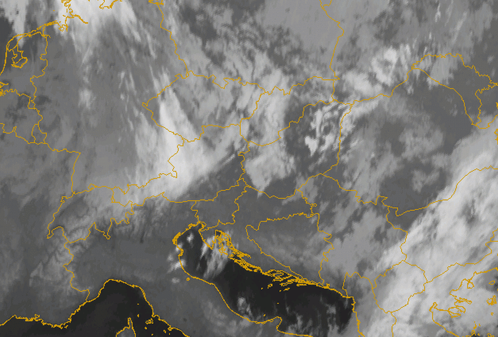
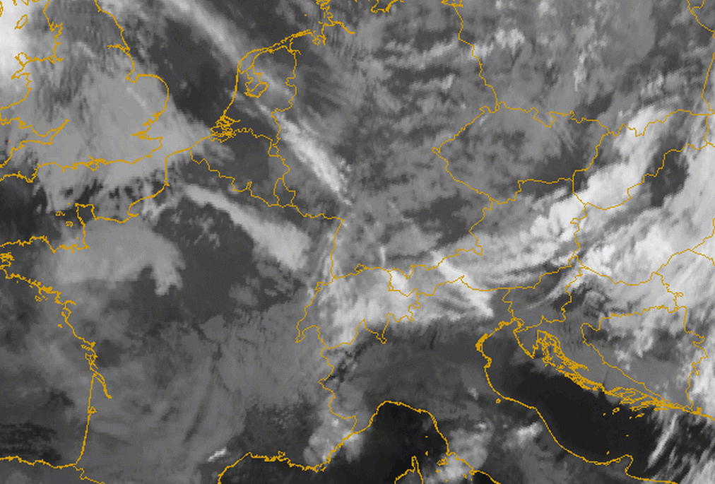
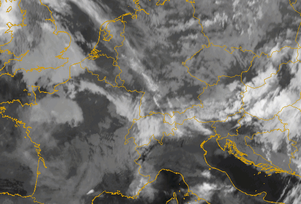
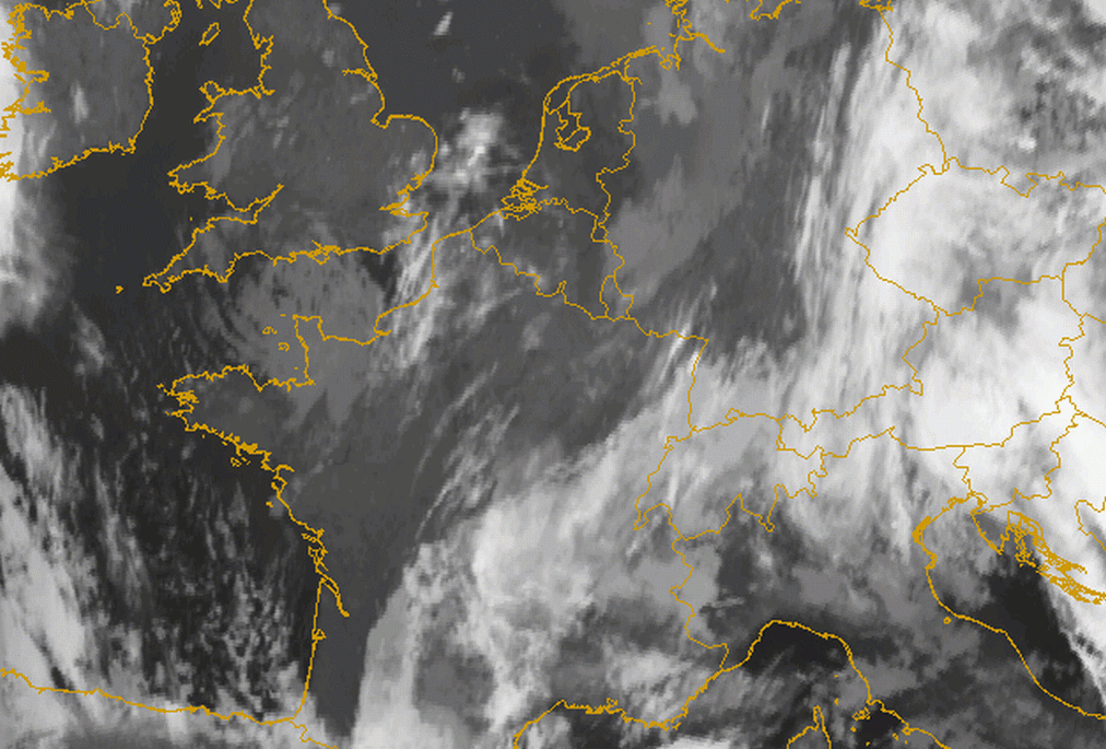
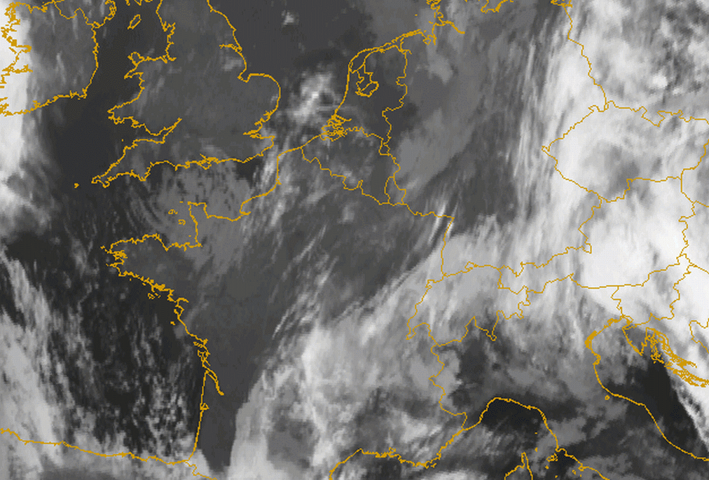
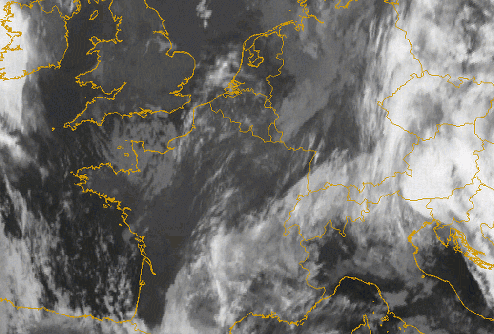
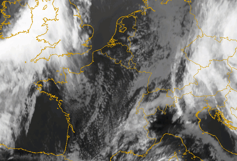
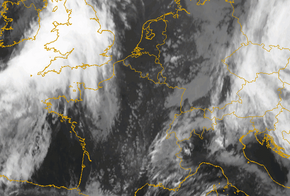
The IR10.8 image of the 12 January 2007 and the IR10.8 loop (below left) show a frontal cloud passage over Switzerland, orthogonal to the main Alpine chain. The remaining (and weakening) cloud intensifies again in the Barrage area (bright grey in the IR image). The Baroclinic Boundary of the system lies over France and Germany and consists of dark grey low clouds. In the high resolution visible image (below right) the sharp southern edge of the Barrage cloudiness can be observed. Also the enhancement during the Barrage process can be seen in the WV6.2 image (2nd row below left). Just south of the Alps the WV6.2 shows darker shades assuming the presence of some Foehn winds (see Foehn ).
|
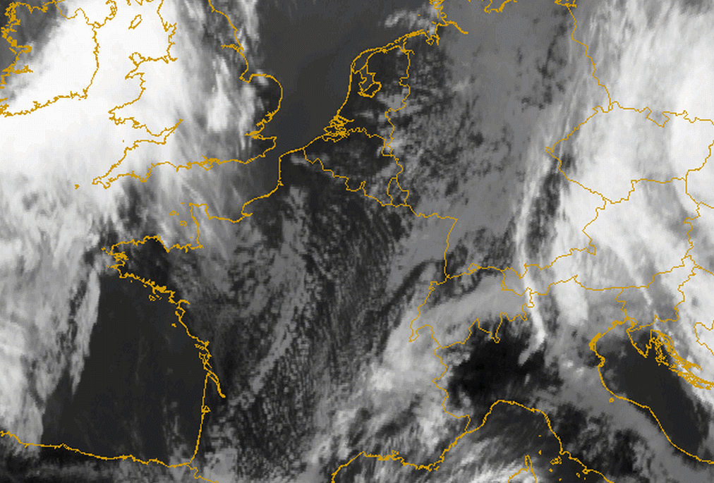
12 January 2007/12.00 UTC - Meteosat 8 IR10.8 image; SatRep overlay: names of conceptual models
|
12 January 2007/12.00 UTC - Meteosat 8 HRVIS image; SatRep overlay: names of conceptual models
|

|
|
|
|
|
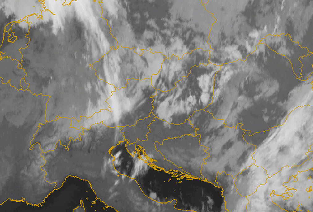
12 January 2005/03.00 UTC - Meteosat 8 IR10.8 image; 03.00 - 15.00 UTC half-hourly image loop
|
12 January 2007/12.00 UTC - Meteosat 8 WV6.2 image; SatRep overlay: names of conceptual models
|
2. Southern orthogonal stream
- The same mechanism takes place, only with the opposite direction of the flow, and with the Barrage cloud on the southern slopes
- Barrage over the southern Alps often causes heavy and persistent precipitation because of the high humidity content of the southerly flow arriving from the Mediterranean region is halted on the Alpine ridge. The resulting Barrage cloud to the south is part of the flow regime of a classical Foehn situation (see Foehn ).
The case of the 2 April 2007 is shown below. In an anticyclonic flow, remaining low cloudiness can be seen within the south western Alpine bow over northern Italy. A sharp edge to the cloud can be seen along the main Alpine crest in the IR10.8 image.
|
02 April 2007/12.00 UTC - Meteosat IR10.8 image; SatRep overlay: names of conceptual models
|
|
|
3. Westerly stream
- A distinct cloud bulge forms along the western Alpine bow associated with a strong westerly flow towards the western boundary of the Alps.
- A secondary tangential thin branch of Barrage cloudiness forms along the main north and north eastern alpine ridge.
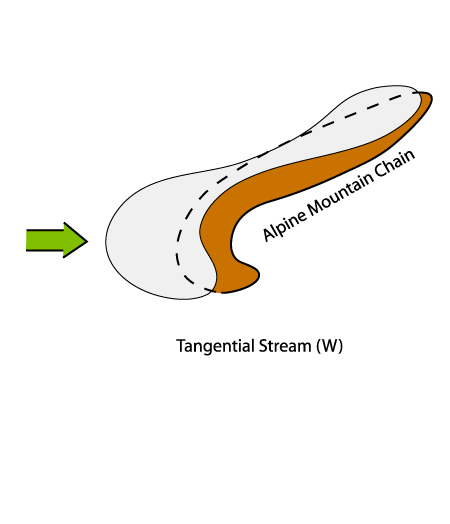
After the passage of a Cold Front, from Spain over E. France into Switzerland, Barrage cloudiness forms on the Western Alpine ridge. The
Barrage cloudiness extends tangentially to the main Alpine ridge with a pronounced cloud bulge over the western Alpine bow.
A distinct sharp edge on the lee side (below left) has formed which can also be well observed in the HRVIS image below right. The IR10.8 image
loop below left shows the frontal passage and the development of the Barrage cloudiness which remains long after frontal passage. The most
pronounced area of the Barrage cloudiness can be seen over the western Alpine bow, but the inner eastern Alps are also affected.
|
08 March 2007/12.00 UTC - Meteosat 8 IR10.8 image; SatRep overlay: names of conceptual models
|
08 March 2007/12.00 UTC - Meteosat 8 HRVIS image; SatRep overlay: names of conceptual models
|
|
|
|
08 March 2005/06.00 UTC - Meteosat 8 IR10.8 image; 06.00 - 18.00 UTC half-hourly image loop
|
|
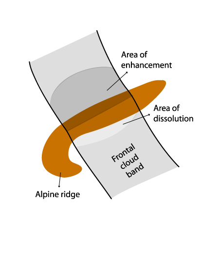
4. Barrage Cloud appearing within frontal cloud bands
- The only indication of Barrage within the front is the enhancement of the frontal cloud band over the Alpine ridge as a result of forced ascent along the windward side. The sinking motion along the lee side results in cloud dissipation (see schematic below).
- Only embedded Lee cloudiness can be observed with this type.
|
23 May 2006/06.00 UTC - Meteosat IR10.8 image; SatRep overlay: names of conceptual models
|
|
|
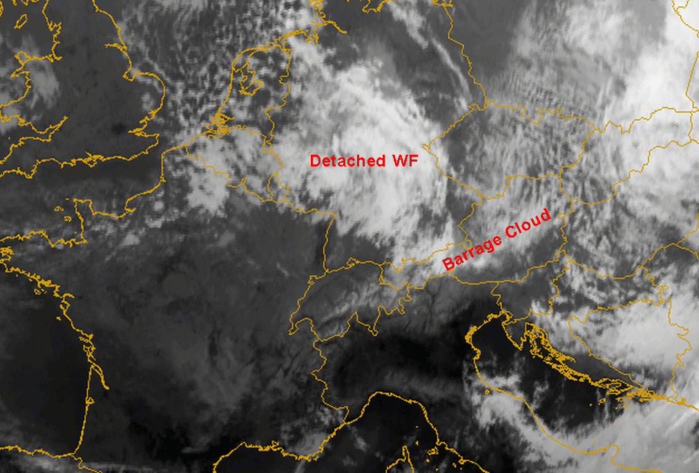
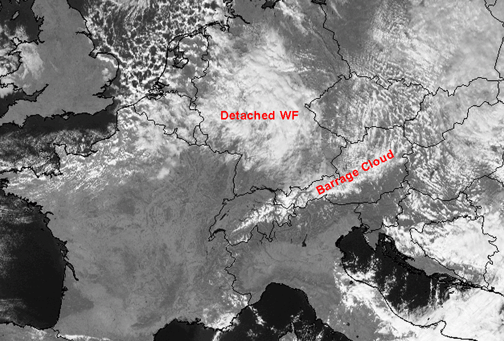
One common synoptic situation associated with the formation of long lasting Barrage cloudiness is the approach of a Detached Warm Front (see Detached Warm Front ). Here the downwind edge is not as sharply defined as usual. From experience, some cases of Barrage show a shift of the Barrage cloudiness somewhat to the lee side. This often seems to occur with Warm Fronts, with a marked southward displacement of high cloudiness.
In the IR10.8 and HRVIS image from the 2nd November 2006 the enhancement in the area of Barrage associated with the frontal zone of a Detached Warm Front over Germany and Northern Austria can be seen. In the W. Alps Barrage cloudiness develops from the residual low cloudiness after the frontal passage (below left and right). In the IR10.8 image loop it can be seen that the descent along the lee side becomes more pronounced. A slight shift of the Barrage cloudiness somewhat to the lee side is also recognizable.
|
02 November 2006/12.00 UTC - Meteosat 8 IR10.8 image; SatRep overlay: names of conceptual models
|
02 November 2006/12.00 UTC - Meteosat 8 HRVIS image; SatRep overlay: names of conceptual models
|
|
|
|
08 November 2006/06.00 UTC - Meteosat 8 IR10.8 image; 06.00 - 23.00 UTC hourly image loop
|
|
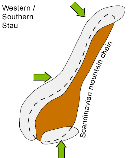
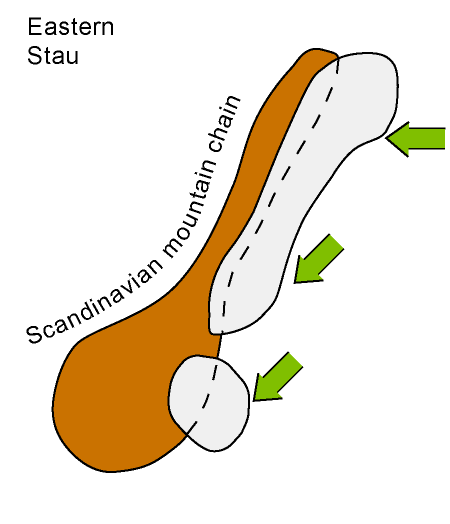
Scandinavian Barrage Clouds
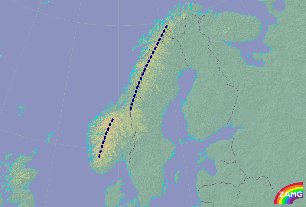
Scandinavian Barrage appears on both sides of the Scandinavian mountains. These areas are indicated in the schematics below. On the typical western or southern Barrage event (left schematic) the clouds are associated with a more humid air mass due to the underlying Norwegian or North Sea, while for the eastern Barrage (right schematic) the conditions are generally drier.
|
|
|
|
|
|
|
|
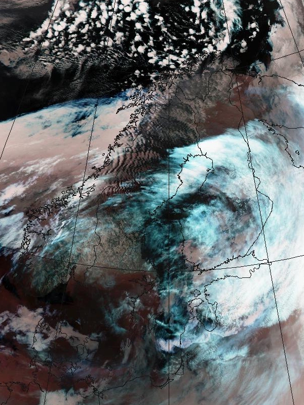
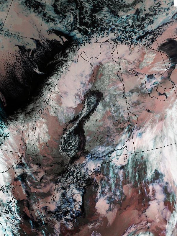
08 January 2002/01.28 UTC - NOAA image; Barrage Cloudiness pronounced on western coast of Norway
|
10 November 2002/19.00 UTC - NOAA image; Barrage Cloudiness is pronounced in Northern Sweden and Finland. Some barrage clouds seen even
in middle parts of Scandinavian mountains
|
The examples for both flow types are shown above. The AVHRR image on the left shows pronounced Barrage Cloudiness on the western coast of Norway. The AVHRR image on the right shows Barrage Cloudiness in Northern Sweden and Finland. Some Barrage cloud is also seen in middle parts of Scandinavian mountains.
Wind directions that are favourable in Scandinavia are S-W stream in southern Norway and the W-N stream over northern Scandinavia. Even NW-jets passing over the southern tip of Norway have caused Barrage Clouds. On the western side, the Barrage cases often appear together with Lee Clouds and Foehn on the eastern side of the mountains. Foehn is common even for the easterly cases. In southern Norway Barrage clouds sometimes grow larger covering a larger area than the coastal areas of south-western Norway.
In the easterly cases over the eastern side of the Scandinavian mountains, easterly low-level jets with wind speeds 30 knots or more are common. If the winds increase and back north, the Barrage Cloud usually stretches southwards along Sweden. Easterly cases may be quite dry and therefore only quite thin stratocumulus develops. With the easterly winds, there is often Foehn on the western Norwegian coast. Even in southern Norway northerly winds have caused Barrage Cloudiness that sometimes stretches down to the coastal region.
Barrage at other European mountain ridges
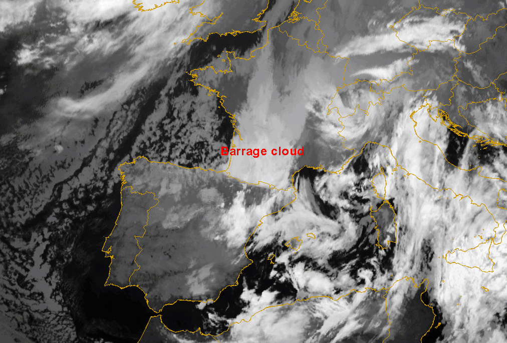
In the set of images below typical Barrage situations over the main central European mountain ridges can be seen (schematic below left). Below right (IR image) the Barrage case from 11 November 2004 along the Pyrenees is displayed. Low stratus is enhanced over central France towards the Barrage zone.
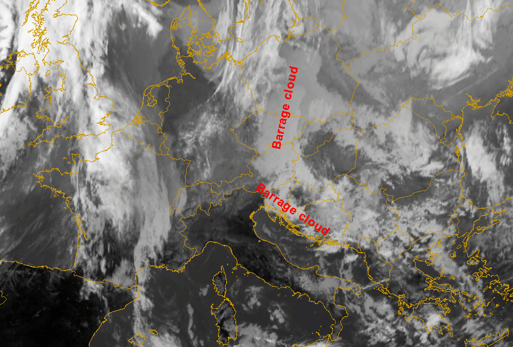
2nd row below left shows Barrage cloud over the Carpathian and Dinarian mountains on 13 February 2006. Low stratus sheets are situated over the whole area, only slightly enhanced in the Barrage zone.
In the case of 14 March 2006 (2nd row below right), Barrage cloudiness over the Dinarian, mountains is clearly visible.
|
|
11 November 2004/06.00 UTC - Meteosat 8 IR10.8 image; SatRep overlay: names of conceptual models
|
|
|
|
|
|
13 February 2006/12.00 UTC - Meteosat 8 IR10.8 image; SatRep overlay: names of conceptual models
|
14 March 2006/12.00 UTC - Meteosat 8 IR10.8 image; SatRep overlay: names of conceptual models
|
Appearance in the basic channels:
|
|
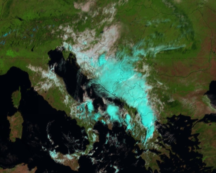
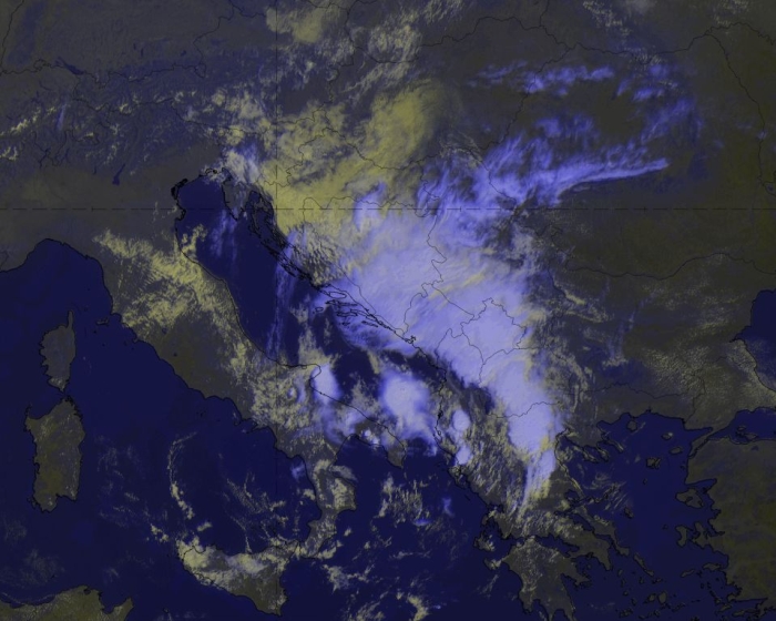
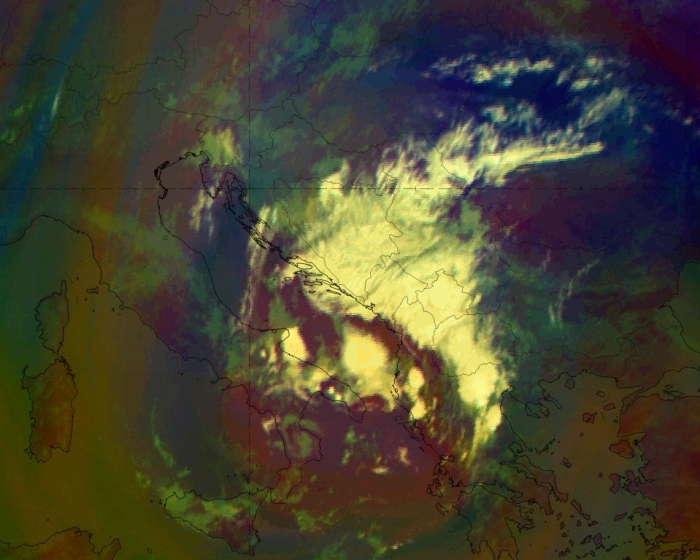
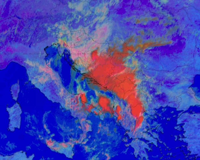
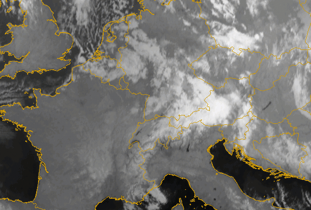
Day Natural Colours RGB (left) and HRV Cloud RGB (right) on 06 August 2020, 09 UTC. The flow is from the northeast and pushes the air against the Dinaric mountains.
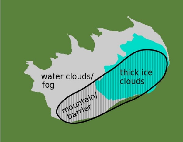
RGBs that include VIS channels are very useful for observing barrage cloud, but are limited to daytime use. The Day Natural Colour RGB, for instance, depicts the presence of dense cloud formations above the mountain ridge and a sharp edge along the downwind side of the mountain barrier, which directly follows the topographic shape of the mountain. It separates mid-level clouds (whitish) from high ice louds (cyan, turquoise) and additionally provides a good colour contrast with the (cloud-free) earth surface.
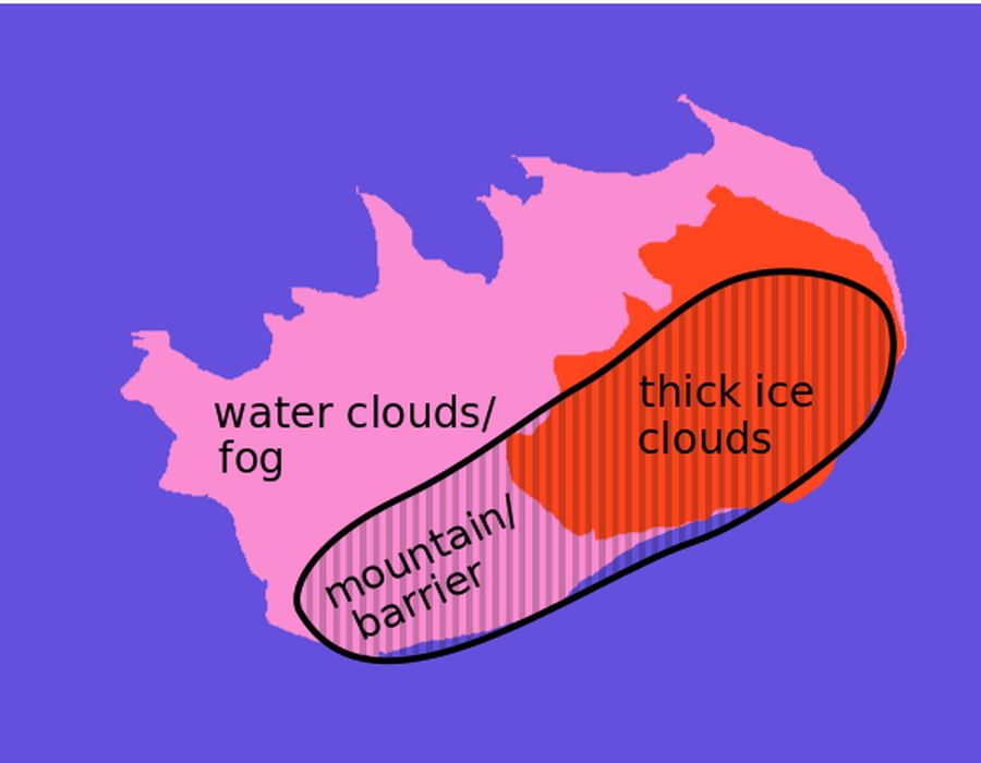
For smaller scale barrage clouds, or if higher resolution is needed to observe cloud features, the HRV Cloud RGB can also be useful. Often, barrage clouds are present at low or mid-level altitudes, and the HRV Cloud RGB can provide a good contrast between high-level clouds (blueish: thick ice clouds), lower-level clouds (yellowish: thick water clouds with small droplets; pinkish: larger droplets) and cloud-free regions.
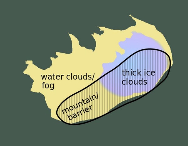
Schematic Day Natural Colours RGB (left); Schematic HRV Cloud RGB (right)
The Day Microphysics RGB also provides useful information on cloud top particle size, temperature and cloud optical thickness. Different cloud types and physical properties can be distinguished quite easily; in particular, the separation between low to mid-level thick water clouds (or fog) and thick ice clouds above is very clear. Additionally, the contrast with cloud-free land is emphasized by a sharp line downstream of the barrage cloud.
The Airmass RGB gives a very good overview of high-level thick clouds but is not well suited to low-level barrage cloud. It is also unable to discriminate between clouds and cloud-free land.
|
|
Day Microphysics RGB (left) and Airmass RGB (right) on 06 August 2020, 09 UTC.
Schematic Day Microphysics RGB
Meteorological Physical Background
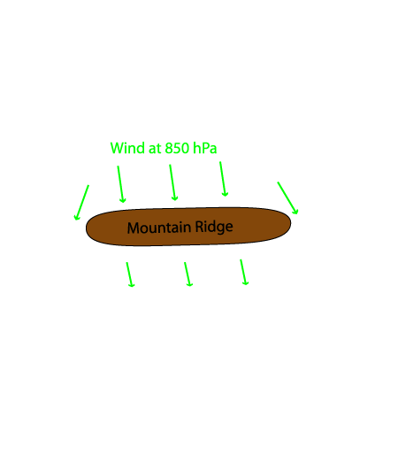
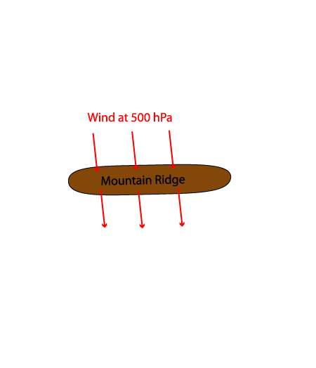
Barrage cloudiness is an orographically influenced conceptual model. If there is a stream field orthogonal to a mountain range it is blocked by the barrier, forced to rise over or forced to flow around the barrier according to the extent and height of the mountain ridge. This forced rising of the stream leads to adiabatic cooling and, if there is sufficient humidity, to condensation. Consequently, cloudiness with a high probability for precipitation forms at the windward side of the mountain range (see schematic below). On the other side, the so called Foehn process takes place: after passing the mountain chain the air parcel descends adiabatically, leading to a significant warming of the air (see Foehn ).
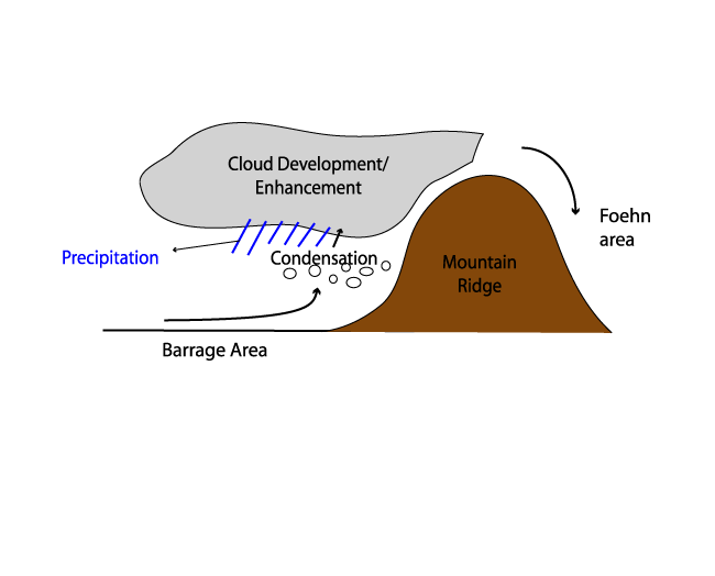
The intensity of the precipitation can be very strong and depends upon the distribution of the wind field with height or the type of Barrage.
Different types of Barrage events can be distinguished from the direction of the flow and whether there are separate Barrage Clouds or Barrage
within frontal zones. Although the latter is usually accompanied by heavy precipitation (e.g. Cold Front or Detached Warm Front), in general, a
dominating orthogonal component in the wind fields from 1000 hPa to 500 hPa generates more intensive precipitation. An acute angle between the
stream and the mountain barrier still causes distinct cloudiness but inhibits intensive precipitation. Furthermore, more intensive
precipitation is generated in frontal Barrage. From 32 cases with less shear, there are only 25 with strong precipitation, whereas out of 17
cases with vertical shear, 9 appear with strong precipitation.
These two effects, Barrage and Foehn, are the reason for relatively cold air on the windward side and relatively warm air on the lee side of
the mountains (at surface levels).
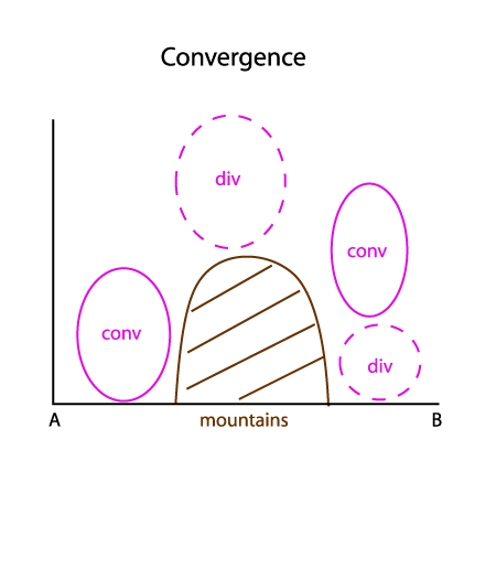
Convergence at low levels leads to a high pressure area within shallow cold air on the windward side, causing a characteristic ("nose
like") horizontal pressure gradient across the mountain chain. This convergence is compensated by divergence above. A similar mechanism
under opposite sign, leading to an area of low pressure, occurs on the lee side of the mountain chain.
Ascent of moist air is responsible for the enhancement or formation of Barrage cloudiness along the mountain slope. The appearance, form and the extension of such a cloud pattern depends on the flow crossing the mountain chain. The direction of the flow to the mountain chain, e.g. if it is orthogonal, tangential, causes different cloud formations (see Cloud structure in satellite images). As mentioned above, the change in wind direction and velocity with height will be responsible for the intensity of the Barrage event, either in the enhancement of the cloudiness or in the amount of precipitation. For example: if there is a northerly flow at low levels, and a strong westerly stream above, there will only be shallow cloudiness with weak precipitation on the windward side of the mountain chain.
The physical processes behind Barrage cloudiness also show the concurrence between two main situations:
- A blocking situation with an increasing mid level flow (at the level of the mountain crest) around the ridge
- A non-blocking situation with a geostrophic flow over the ridge line (see schematic below)
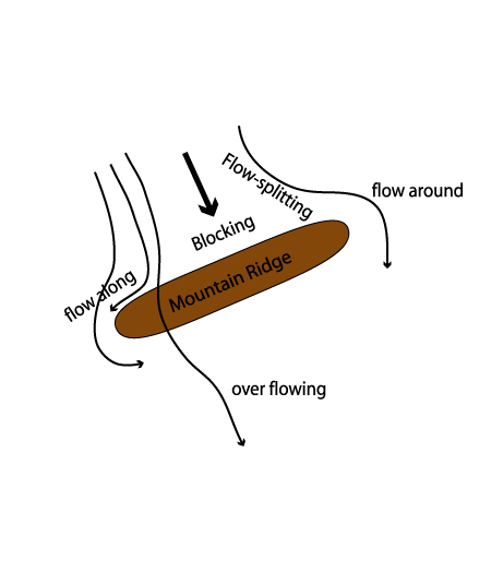
In both situations the low level flow is blocked by high mountain slopes (like in the Alps).
The Chen - parameter is an indicator for the tendency of blocking and deflection (flow around):

where
| N | Stability |
| h | Height |
| U | Stream |
Values of the Chen - Parameter around 1 provide a non - blocking and complete over flow of air with a stable layer above the mountain ridge and
geostrophic flow. Values >1 cause a blocking case with strong deflection of the flow at low levels. There is a split in the flow, with some
flowing around the mountain chain.
Consequently the splitting/blocking has an effect on the intensity of the cloudiness and the precipitation of a Barrage event: The flow
splitting causes a more diffluent stream at middle and lower levels, leading to a decrease of convergence and lifting on the windward side.
A second parameter that is also often referred to in literature in respect to Barrage cloudiness is the Froude number. The Froude number combines the influences of stability, wind speed and terrain height. The Froude number is dimensionless and indicates whether or not the flow has enough kinetic energy to rise over the barrier (Durran, 1990 and Houze, 1993. It therefore suggests whether or not the orographic lifting will occur directly over the terrain or upstream. High Froude number flow rises easily over a mountain barrier and robust upslope flow occurs, which can enhance precipitation over the windward side of a mountain barrier. When low Froude number flow is blocked by the terrain, lifting and enhancement of rainfall can occur upstream of the barrier (e.g. Grossman and Durran 1984).
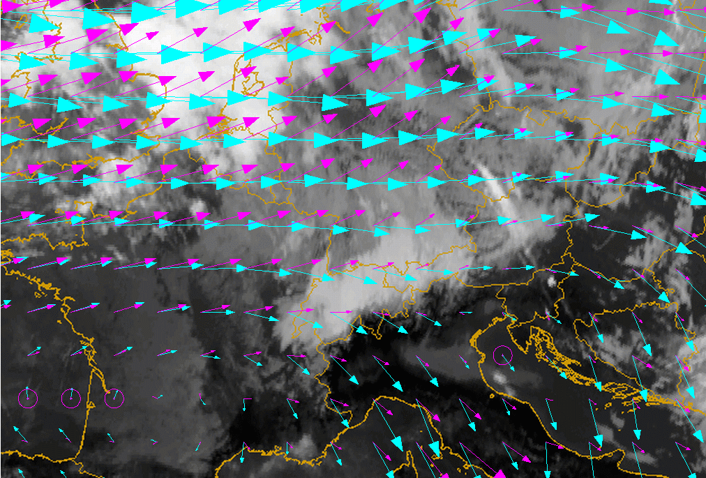
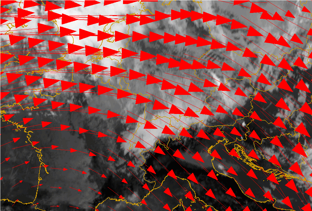
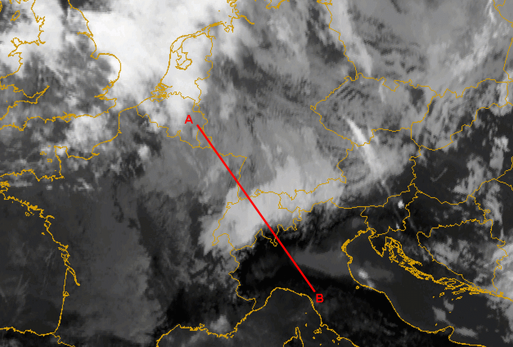
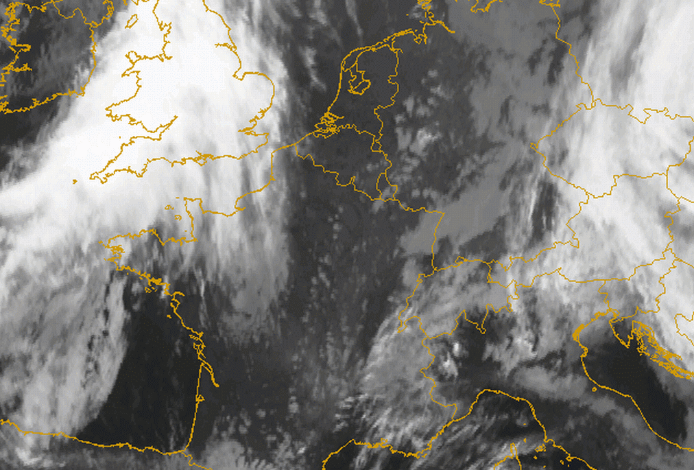
The example below shows the case of 12 January 2007. Driven by the westerly flow a narrow Barrage cloud forms along the western edge of the
Alpine mountain ridge. In the wind field at 850 hPa (below left) a slight splitting of the flow around the mountain barrier of the Alps is
seen. The half hourly IR10.8 image loop from 06.00 UTC to 15.00 UTC shows the growth of the Barrage cloud at the western Alpine ridge over
eastern France. During the day the northern part of the flow is deformed and forced to propagate along the northern slopes of the Alps, also
forming a narrow Barrage cloud. The cloud texture of the Barrage over southern Germany reflects the deformation and diffluence of the stream.
At the southern flank of the Alps marked cloud dissipation can be observed. The upper flow is indicated by the appearance of Lee Cloud fibres
over northern Italy.
|
12 January 2007/12.00 UTC - Meteosat 8 IR10.8 image; magenta: wind vectors 1000 hPa, green: wind vectors 850 hPa
|
12 January 2007/12.00 UTC - Meteosat 8 IR10.8 image
|
|

|
|
12 January 2005/03.00 UTC - Meteosat 8 IR10.8 image; 03.00 - 15.00 UTC half-hourly image loop
|
|
Key Parameters
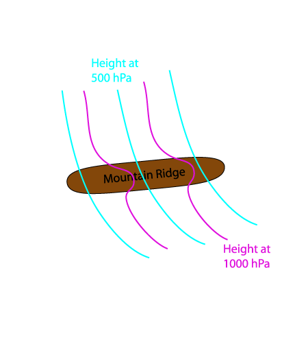
- Height contours at 1000 and 500 hPa:
- Shows a characteristic flat short wave feature across the mountain ridge. This feature is developed according to the pressure gradient and the confluence/convergence at surface levels on the windward side of the mountain chain.
- Strong flow across the mountain chain at upper levels
- Wind fields at 500 hPa:
- Winds at upper levels not influenced by the mountain barrier with an undisturbed flow across over the mountain chain
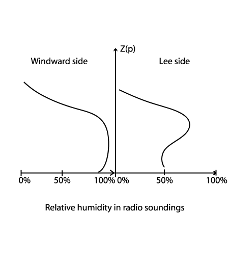
- Radio Soundings - Humidity:
- Radio Soundings on the windward side show a thick wet layer at low levels nearly up to the height of mountain crest.
- On the lee side of the mountain ridge they show a dry layer from the surface up to middle levels and a wet layer in middle layers.
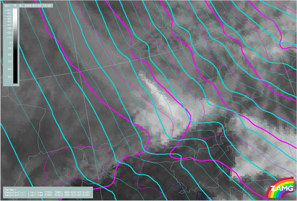
Height contours at 1000 and 500 hPa
|
|
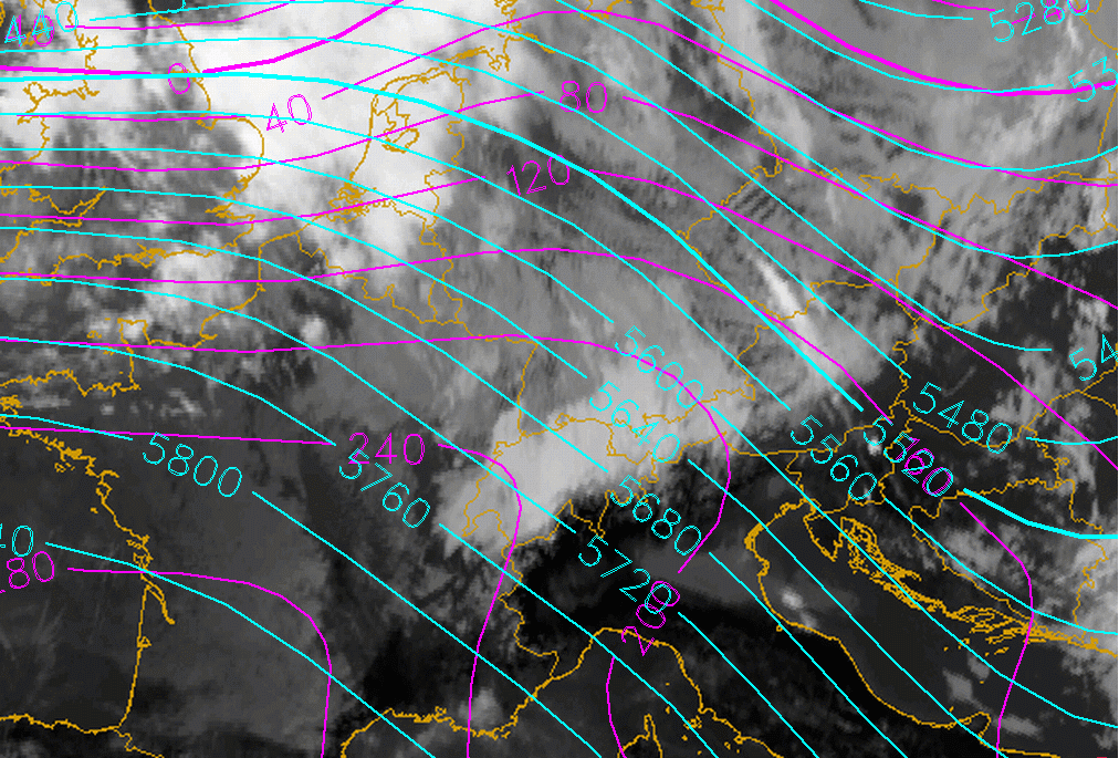
12 January 2007/12.00 UTC - Meteosat 8 IR10.8 image; cyan: height contours 500 hPa, magenta: height contours 1000 hPa
|
|
|
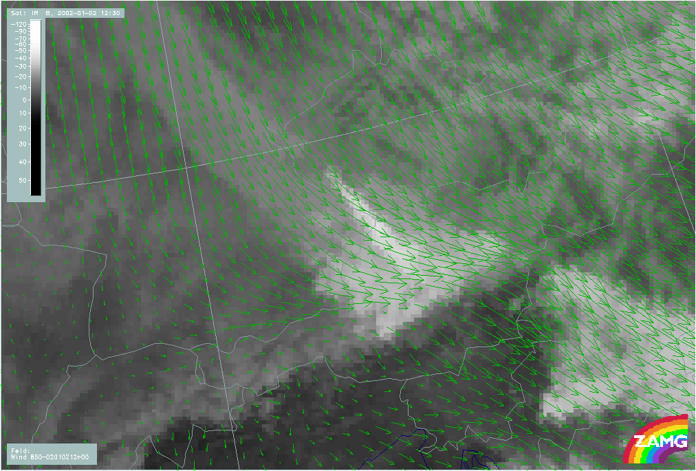
Wind fields at 850 hPa
|
|
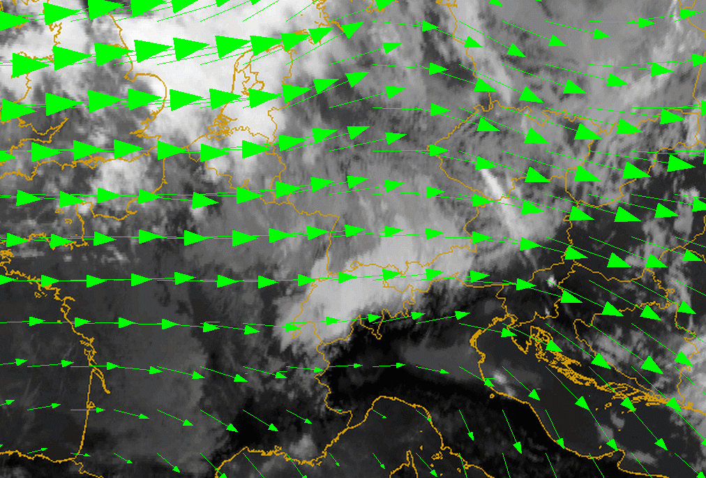
12 January 2007/12.00 UTC - Meteosat 8 IR10.8 image; green: wind vectors 850 hPa
|
|
|
The area of the flow splitting over France and the W. Alps is well indicated.
Wind fields at 500 hPa
|
|
12 January 2007/12.00 UTC - Meteosat 8 IR10.8 image; red: wind vectors 500 hPa
|
|
|
Radio Soundings - Humidity
|
|
|
|
|
|
|
|
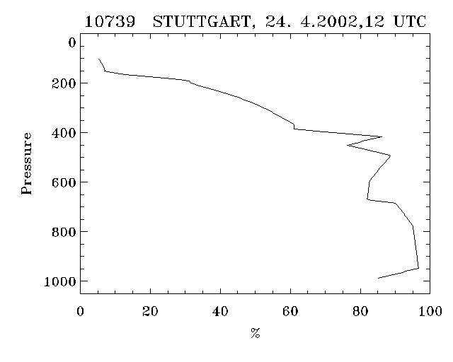
24 April 2002/12.00 UTC - Radio Sounding Stuttgart 10739; black solid: relative humidity; Windward side
|
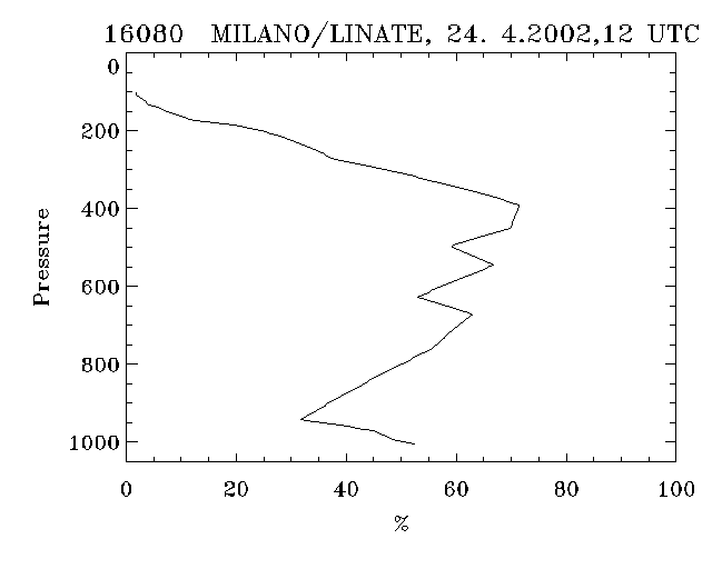
24 April 2002/12.00 UTC - Radio Sounding Milano 16080; black solid: relative humidity; Lee side
|
Meso-scale key parameters
Since LAM model fields are computed with a higher spatial resolution (about 15 km horizontal Grid for the ALADIN model) than ECMWF model fields (average distance between grid points is about 39km), the mesoscale dynamics of the Barrage Cloud are much better modelled. This is especially true for divergence and vertical motion. Other relevant parameters also show more detail and are more representative of the CM when taken at higher spatial resolution.
- Height contours at 1000 and 500 hPa:
- The 1000 hPa contours show a significant deformation across the mountains, and even at 500 hPa, there is a pressure gradient more to the lee side.
- Wind field at 850 hPa:
- The wind vectors at low levels show a strong convergence at the windward slopes of the mountain ridge.
- The flow around the mountain barrier is also much better indicated in the LAM model.
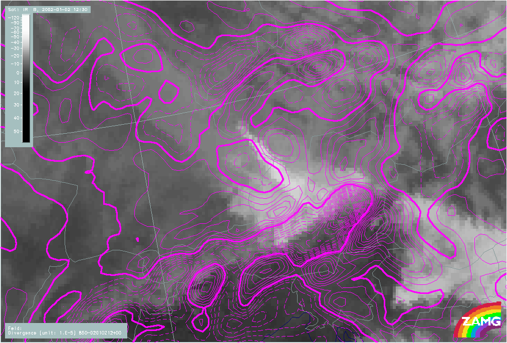
- Convergence at 850 hPa:
- Distinct maxima of convergence at low levels within the Barrage Cloud area. The flow splitting is caused by confluence to the left and right sides of the Barrage Cloud area.
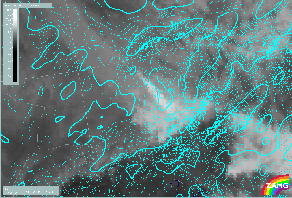
- Vertical motion at 850 hPa:
- Strong indications of forced uplift within the Barrage Cloud area and down ward motion on the lee side of the ridge.
Height contours at 1000 and 500 hPa
|
|
02 January 2002/12.00 UTC - Meteosat IR image; ALADIN LACE: cyan: height contours 500 hPa, magenta: height contours 1000 hPa
|
|
Wind field at 850 hPa
|
|
02 January 2002/12.00 UTC - Meteosat IR image; ALADIN LACE: green: wind vectors 850 hPa
|
|
Convergence at 850 hPa
|
|
02 January 2002/12.00 UTC - Meteosat IR image; ALADIN LACE: magenta solid: convergence 850 hPa, magenta dashed: divergence 850 hPa
|
|
Vertical motion at 850 hPa
|
|
02 January 2002/12.00 UTC - Meteosat IR image; ALADIN LACE: cyan solid: upward motion 850 hPa, cyan dashed: downward motion 850 hPa
|
|
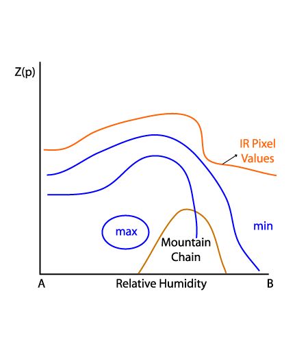
Typical Appearance In Vertical Cross Sections
Although the spatial resolution of the global ECMWF model is not very high, an indication of a Barrage process can be seen in vertical cross sections. The edge of the Barrage Cloud towards the lee side is displayed in a satellite image as a sharp decrease of IR values, indicating the position of the main mountain chain.
- Isentropes:
- Flat minimum of equivalent potential temperature on the windward side of the mountain ridge
- Relative humidity:
- A maximum of relative humidity on the windward side indicates the position of the Barrage cloud and the area of confluence
- A maximum towards higher levels indicates the ascent of humid air during the flow over the barrier
- Divergence:
- A distinct maximum of convergence at low levels confirms confluence in the windward Barrage area
- At higher levels on the windward side a minimum can be seen which is in accordance with the concept of compensation of convergence at upper levels.
- The opposite process takes place on the lee side with a maximum of convergence at upper levels and a minimum below.
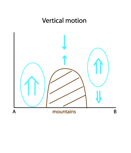
- Vertical motion:
- A maximum of upward motion can be seen directly over the wind ward mountain slopes
- On the lee side the maximum of upward vertical motion is positioned at higher levels with sinking air below.
|
|
12 January 2007/12.00 UTC - Meteosat 8 IR10.8 image; position of vertical cross section indicated
|
|
|
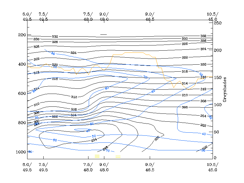
Relative humidity
|
|
12 January 2007/12.00 UTC - Vertical cross section; black: isentropes (ThetaE); blue: relative humidity; orange thin: IR pixel values;
|
|
|
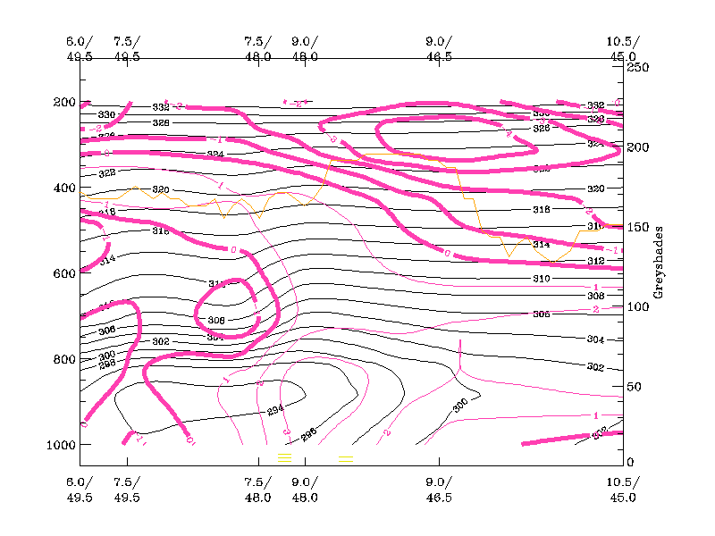
Divergence
|
|
12 January 2007/12.00 UTC - Vertical cross section; black: isentropes (ThetaE); magenta: divergence, thick: convergence; orange thin:
IR pixel values;
|
|
|
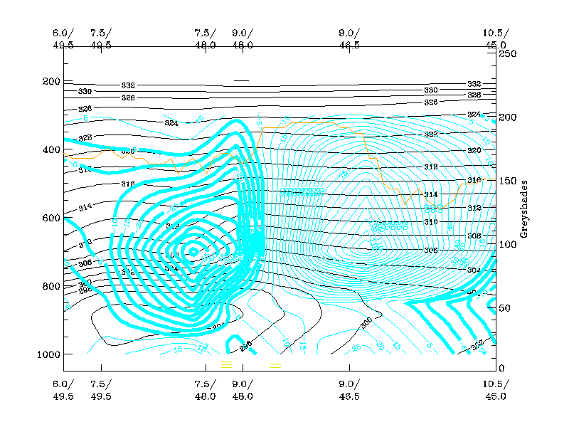
Vertical motion
|
|
12 January 2007/12.00 UTC - Vertical cross section; black: isentropes (ThetaE); cyan thick: vertical motion (omega) - upward motion,
cyan thin: vertical motion (omega) - downward motion; orange thin: IR pixel values;
|
|
|
Weather Events
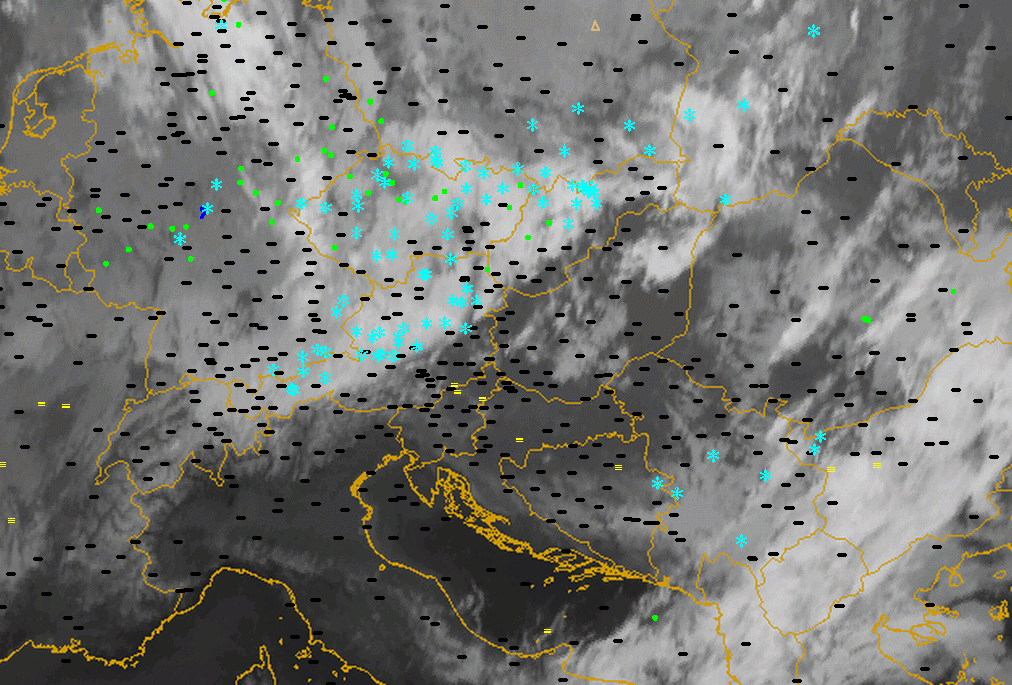
Barrage cloudiness forms if a flow of sufficiently moist air is forced to rise over a mountain barrier. This process generally results in prolonged precipitation.
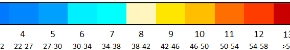
| Parameter | Description |
| Precipitation |
|
| Temperature | Cold stable shallow air mass on the windward side of the mountains, warm dry on the lee side. |
| Wind (incl. gusts) | Weakening within the Barrage region, strong winds on the lee side |
| Other relevant information |
|
|
|
03 January 2005/12.00 UTC - Meteosat 8 IR10.8 image; weather events (green: rain and showers, blue: drizzle, cyan: snow, red:
thunderstorm, black: no precipitation)
|
|
|
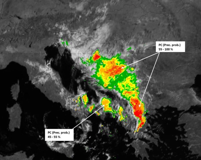
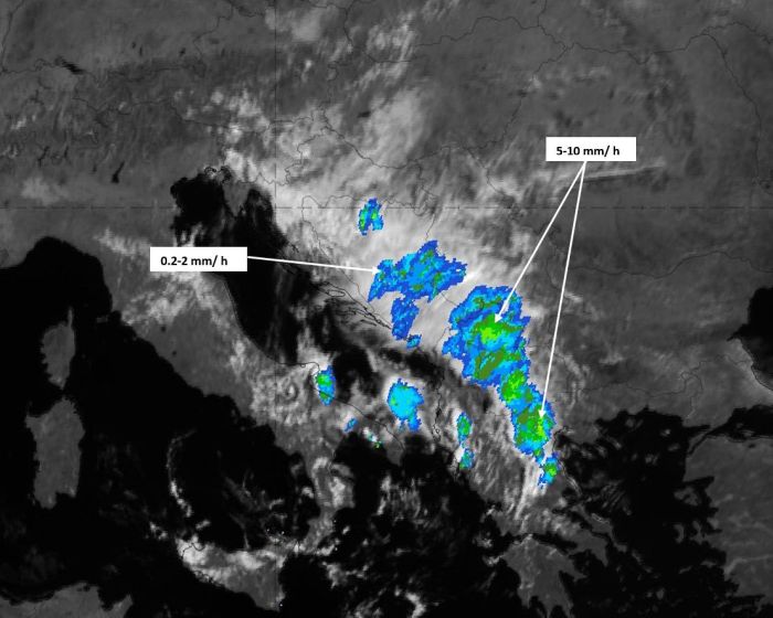
The Convective Rainfall Rate product and the Precipitating Clouds product clearly show strong signals of convective activity and thick precipitating clouds within the cloudy area that forms on/behind the barrier. The lee side descent of air, and the associated dissipation of clouds on the downwind side, creates a distinct edge in the images from both SAFsproducts.
|
|
Precipitating Clouds product (left) and Convective Rainfall Rate product (right) on 06 August 2020, 09 UTC.
A similar picture is obtained with the Opera radar image. In the image below, at 09 UTC on 06 August 2020, it detects rainfall in the area of dense, opaque clouds, on the windward side of the barrier:
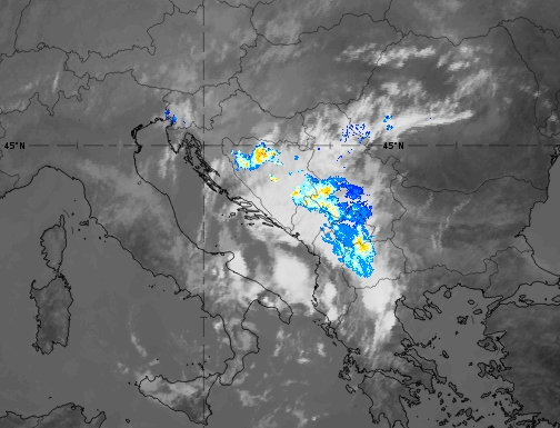
Opera Radar (colour) with IR 10.8 (grey background) on 06 August 2020, 09 UTC.
The Cloud Type analysis provides details of the height, transparency, thickness and type of the clouds. This can be very helpful information, for example during the night when VIS channels cannot be used, or to highlight specific features.
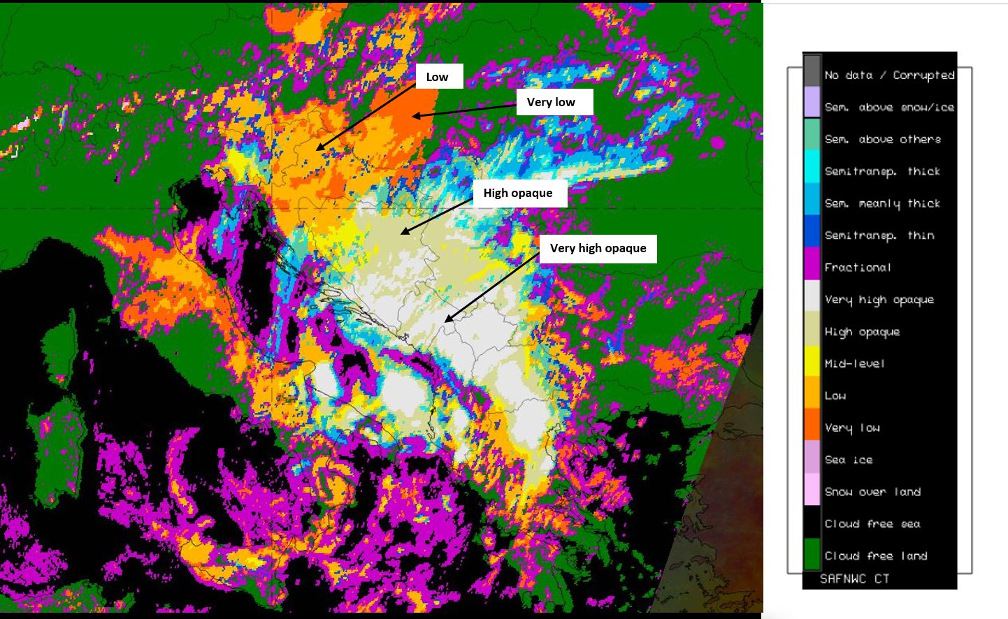
Cloud Type product on 06 August 2020, 09 UTC.
References
General Meteorology and Basics
- BLUESTEIN, H.B., 1993: Synoptic Dynamic Meteorology in Midlatitudes, Volume I, Oxford Univ. Press
- CHEN, W., SMITH, R.B., 1986: Blocking and deflection of Airflow by the Alps, Mon. Wea. Rev, 115, pp2578
- DURRAN, D. R., 1990 : Mountain waves and downslope winds. Atmospheric Processes over Complex Terrain (W. Blumen, Ed.), American Meteorological Society, Boston, 59-81
- GROSSMAN, R. L., and D. R. DURRAN, 1984: Interaction of low-level flow with the western Ghat Mountains and offshore convection in the summer monsoon. MonthlyWeather Review, 112, 652-672.
- HOUZE, R. A., Jr., 1993: Cloud Dynamics. International Geophysics Series, Vol. 53, Academic Press, San Diego, California, 573 pp.
- KURZ M. (1998): Synoptic Meteorology - 2nd complete revised edition, DWD
- LOTT, TEITELBAUM (1993): Topographic waves generated by a transient wind, J. Atmosph. Sci., 50, 1993, 2607 - 2624
- MYERS, V.A., 1962: Airflow on the Windward side of a Large Ridge, J. Geoph. Res., 67, pp4267
- PITTS, LYONS (1990): Airflows over two dimensional escarpment, Quart. J. Roy. Meteor. Soc., 116, 1990, 363-378
- WESLEY, D.A., PIELKE, R.A., 1990: Observations of Blocking-Induced Convergence Zones and Effects on Precipitation in Complex Terrain, Atmos. Res., 25, pp235
General Satellite Meteorology
- BADER M. J., FORBES G. S., GRANT J. R., LILLEY R. B. E. and WATERS A. J. (1995): Images in weather forecasting - A practical guide for interpreting satellite and radar imagery; Cambridge University Press, chapter 3.3
Specific Satellite Meteorology
- CRUETTE (1976): Experimental study of mountain lee - waves by means of satellite photographs and aircraft measurements, Tellus, 28, 1976, 9-523