Table of Contents
Cloud Structure In Satellite Images
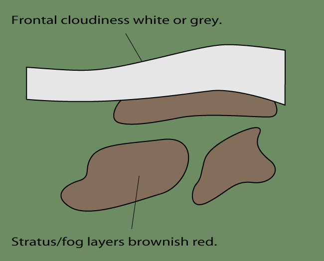
Fog and Stratus are seen in satellite images as low-level cloud sheets with a variable horizontal extent. Small local patches of fog are difficult to distinguish in satellite images (size in the order of a few kilometres). However, large areas of fog and stratus can cover areas over hundreds or thousands of square kilometres, and they are easily observed in Meteosat Second Generation.
Specific pattern features related to different St/fog types:
- The edges of radiation St/fog over land sharp but irregular, frequently bounded by terrain features.
- Over the oceans the edges are smoother.
- Valley fog is very easy to distinguish, since its dendritic edges follow the height contours of the valleys.
- Advection St/fog has a more regular edge pattern than radiation fog, which is restricted by the terrain features.
Appearance in METEOSAT 8 imagery
IR 10.8 imagery:
- The grey shades of cloud sheets usually grey or dark grey indicating relatively low (warm) cloud tops.
- The detection of cloud sheets using the IR image sometimes proves to be difficult, when the temperature difference between cloud tops and land surface small.
- The temperature difference can be reversed, that is, St/fog top can show warmer temperature than surrounding cloud-free land surface areas causing a black St/fog. This is especially the case in high latitudes during the winter when, in situations of intensive low-level temperature inversion, Fog tops can be much warmer than adjacent land areas. This is often called as "Black Fog".
- Animated loops greatly help in detecting low clouds and their movement.
WV 6.2 imagery:
- WV images cannot be used directly for the detection of St/fog, as low-level cloudiness does not contribute to the WV image.
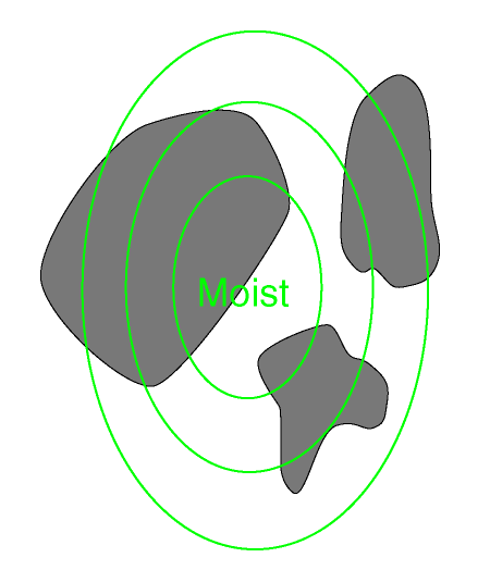
- However, WV images can sometimes be used indirectly in combination with VIS images; the advection of moist air (even without any cloudiness in IR or VIS images) above a St/fog-topped boundary layer can assist in the dispersion of low-level clouds.
VIS imagery:
- The grey shades of St/fog usually white or grey depending on the thickness of the cloud sheet and the elevation of the Sun.
- The overall flat appearance characteristic for St/fog in VIS 0.6 or 0.8 images, but in HRVIS images the top of Stratus can show more detailed patterns.
- VIS images show stratus clouds much better in daytime because of their strong reflectance.
|
|
|
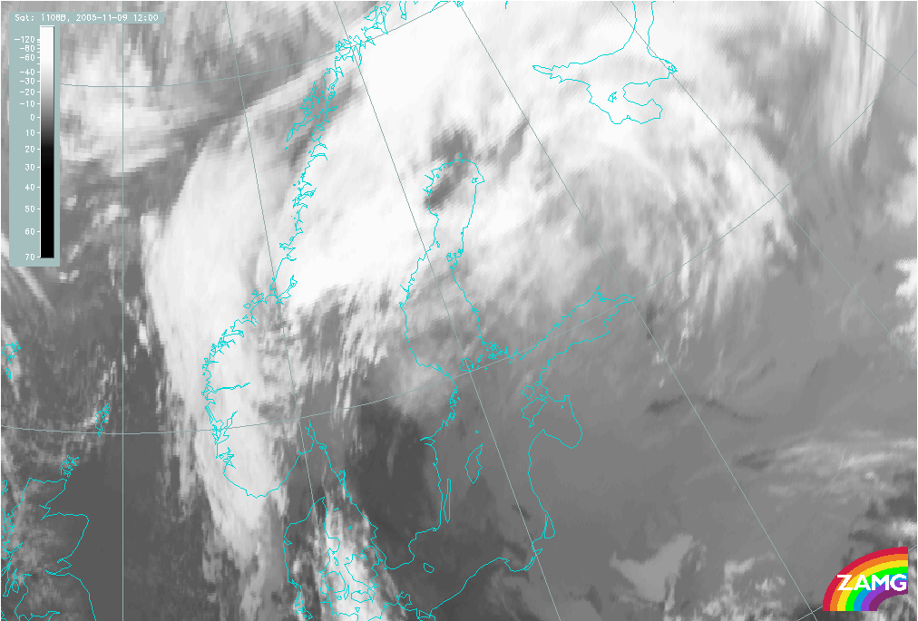
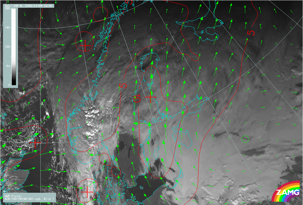
09 November 2005/12.00 UTC - Meteosat 8 IR 10.8 image
|
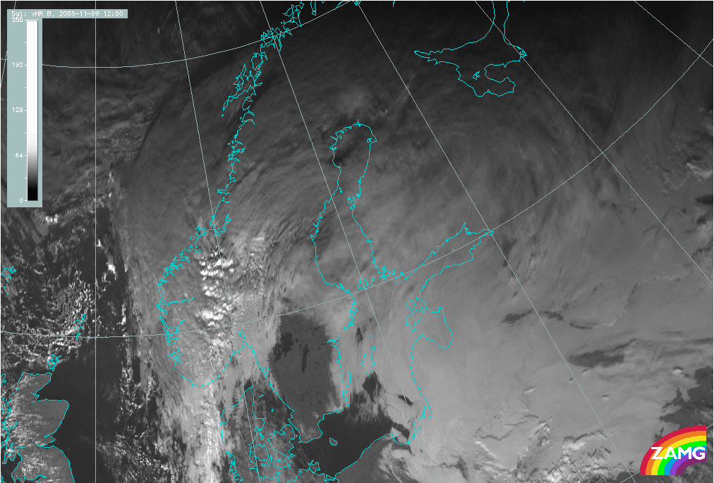
09 November 2005/12.00 UTC - Meteosat 8 HRVIS image
|
|
|
|
|
|
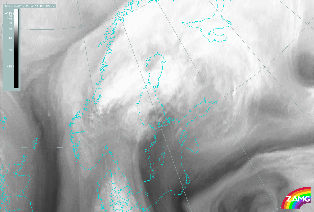
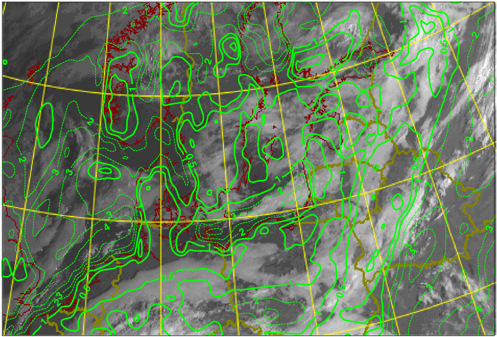
09 November 2005/12.00 UTC - Meteosat 8 WV 6.2 image
|
|
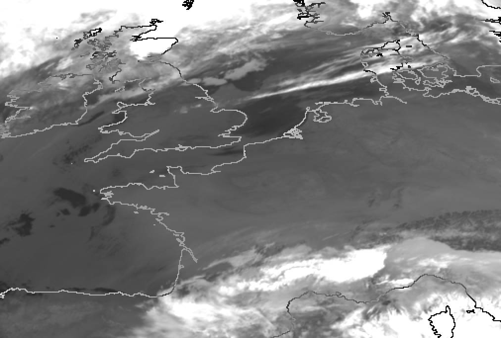
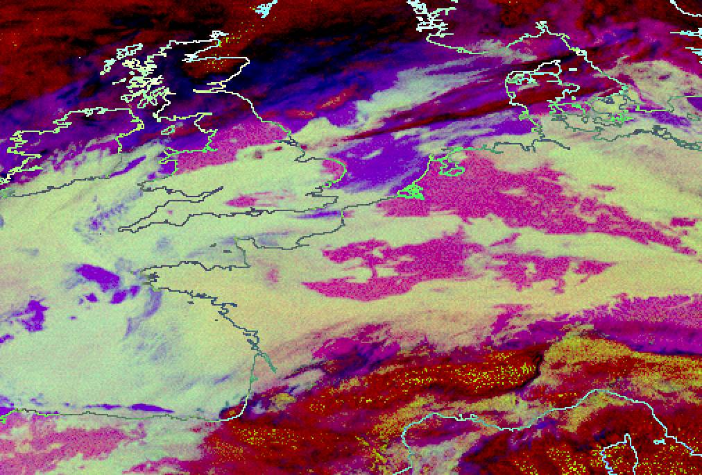
The images show radiation St/Fog over the Baltic States, Belarus, the western parts of Russia and advection St/Fog over the eastern part of Sweden and Finland. In the IR image the St/Fog is seen as a grey, flat, rather featureless cloud sheet, partly obscured by overlying frontal clouds.
By contrast, in the VIS image the St/Fog layer is clearly distinguishable as light grey, well-defined cloud sheets. Even in the VIS image the cloud top is rather flat and featureless, but the edges of the cloud sheet are clearly distinguishable in places where there are no overlying upper level clouds.
The Water vapour image shows only the water vapour content in the upper and middle troposphere and does not directly help the detection of St/Fog.
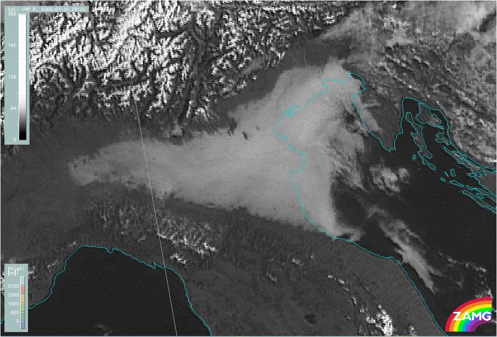
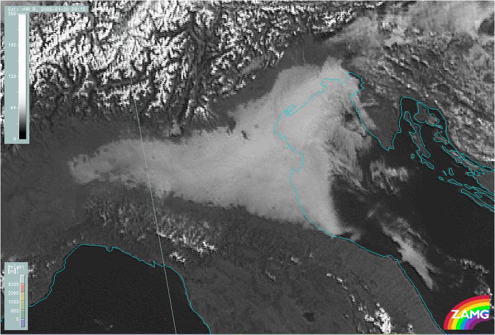
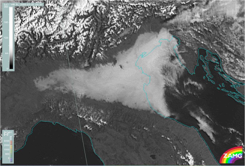
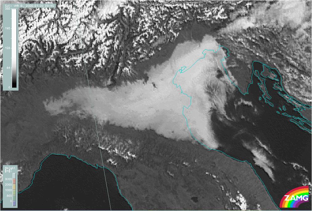
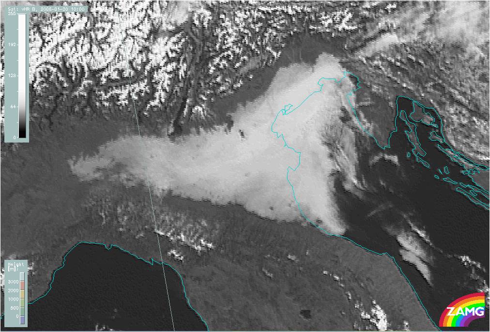
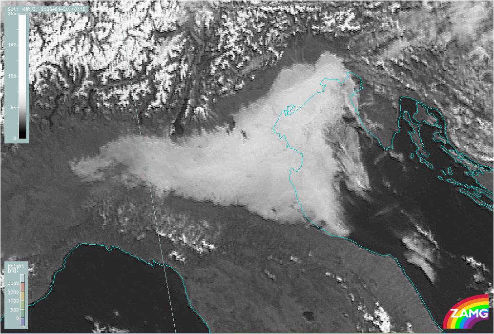
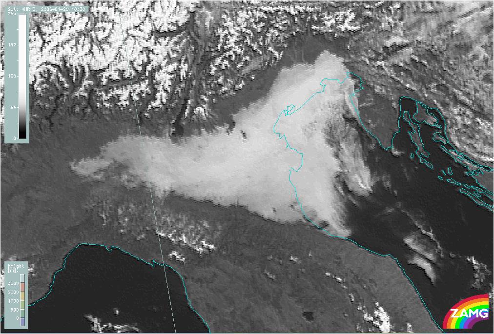
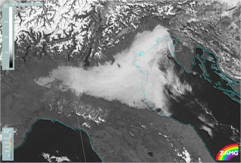
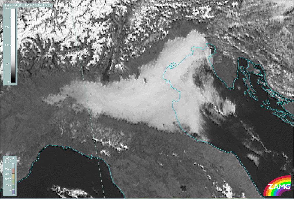
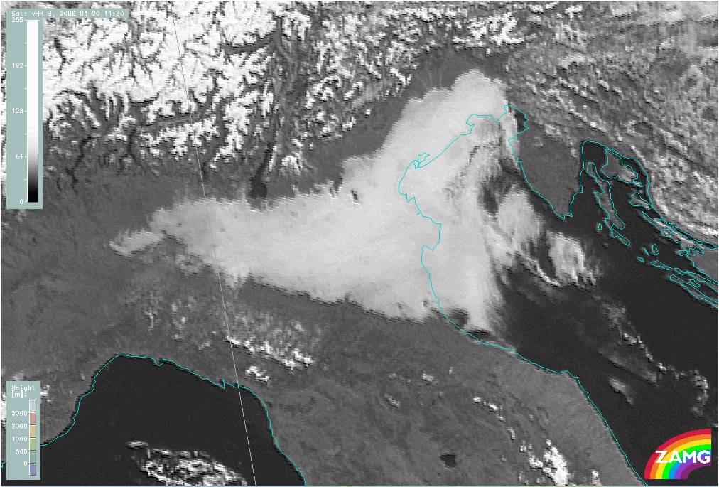
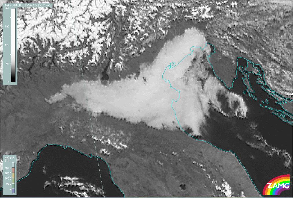
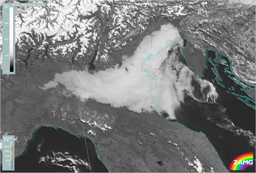
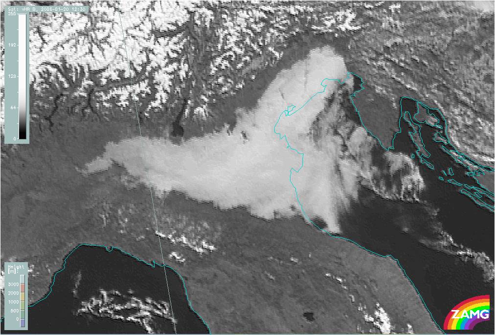
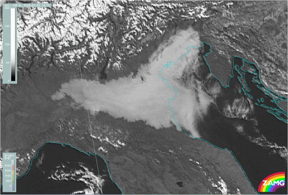
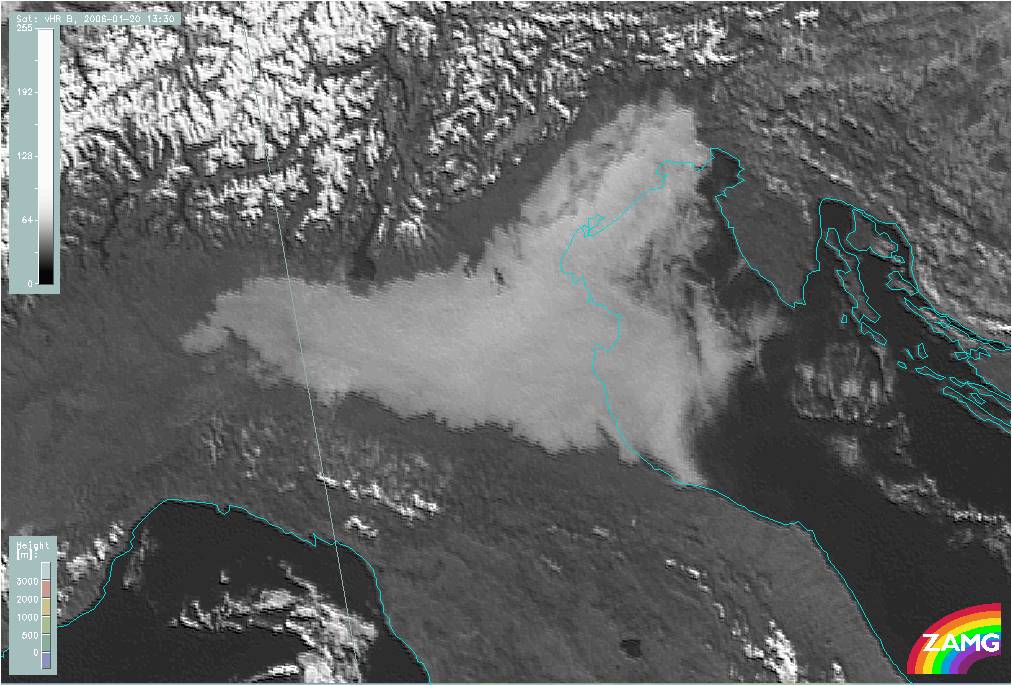
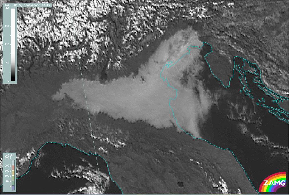
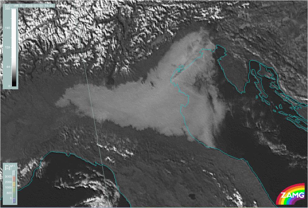
An example from southern Europe is shown below. A radiation fog area is located over Po Valley in Northern Italy. The loop of HRVIS images shows the fog layer being almost stationary throughout the day. The outer edges in the north and south are restricted by the slopes of higher terrain, while over the sea the cloud layer is slowly advected by the wind.
|
20 January 2006/09.00 UTC - Meteosat 8 HRVIS image; 09.00 UTC - 14.00 UTC 15-minutes image loop
|
|
MSG RGB composite images
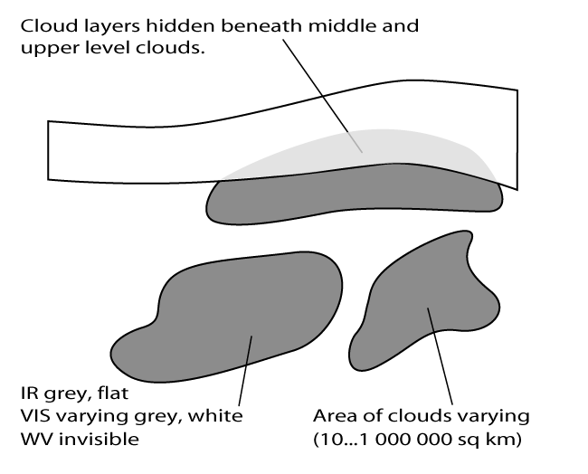
RGB combination images greatly help in identifying low level St/Fog. The great advantage of these combination channels is that the low-level cloud layers can be seen even when middle or upper level clouds may be present.
The most used combinations for identifying low-level clouds:
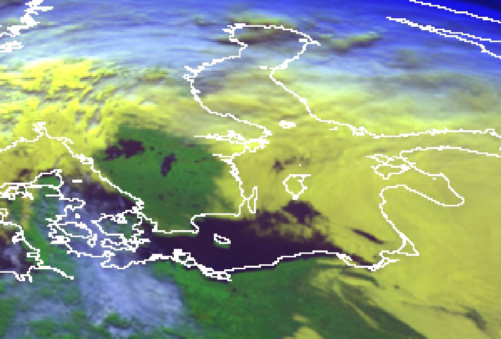
- "Day Natural colours" NIR1.6;VIS0.8;VIS0.6 (daytime): St/Fog whitish-pinkish
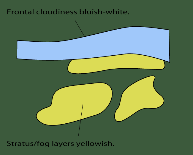
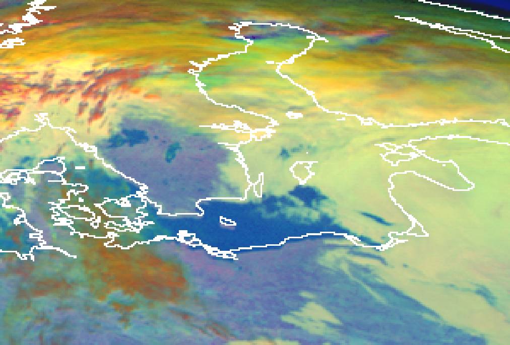
- "AVHRR inherited" VIS0.6;VIS0.8;IR10.8 (daytime): St/Fog yellowish
- "Day Microphysical" VIS0.8;IR3.9;IR10.8 (daytime): St/Fog whitish-light bluish
- "Day Solar" VIS0.8;NIR1.6;IR3.9 (daytime): St/Fog whitish
- "Night Microphysical" (IR12.0-IR10.8);(IR10.8-IR3.9);IR10.8 (night-time): St/Fog light greenish
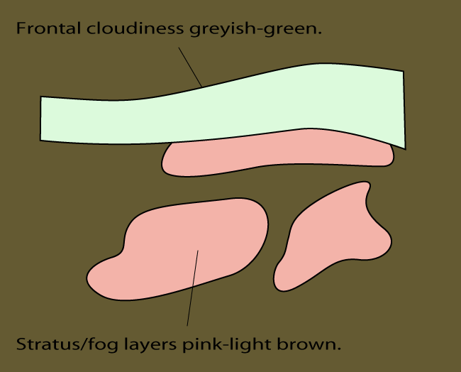
- "AVHRR inherited" IR3.9;IR10.8;IR12.0 Night-time and daytime) : St/Fog pinkish (night-time) or greyish-green (daytime)
As can be seen, many of the combinations exploit the NIR 1.6 and IR 3.9 wavelengths. These wavelengths are very useful for low-cloud detection since they effectively can differentiate low water (Stratus) clouds from ice clouds or snow.
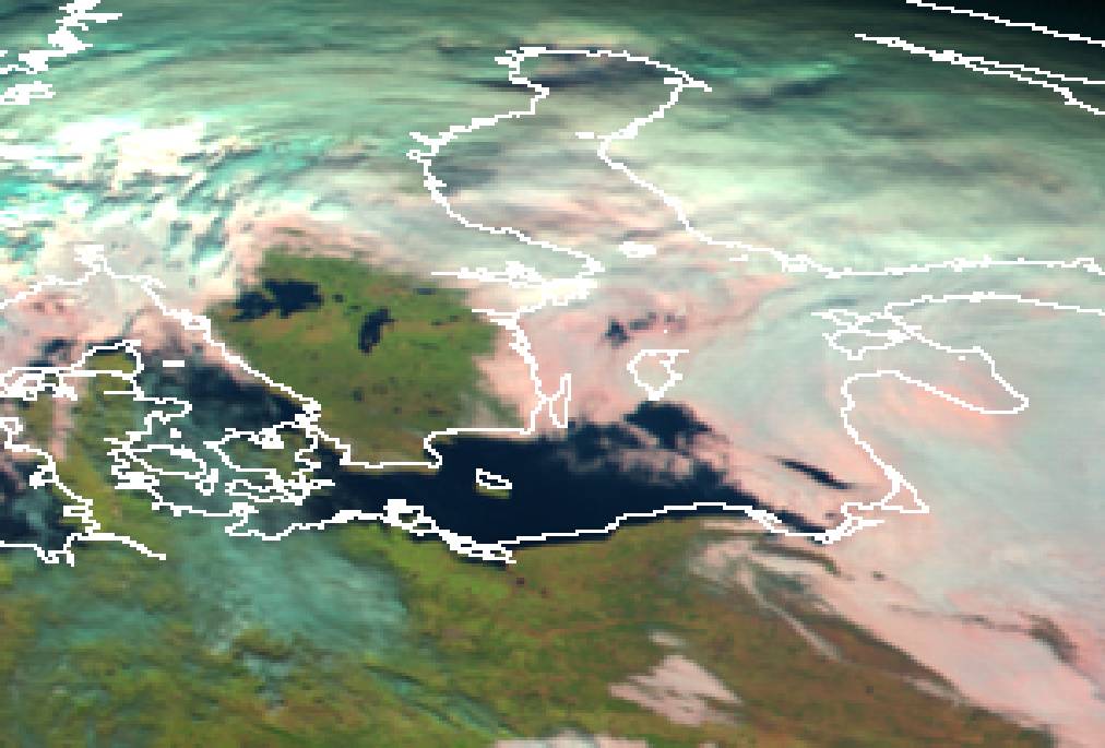
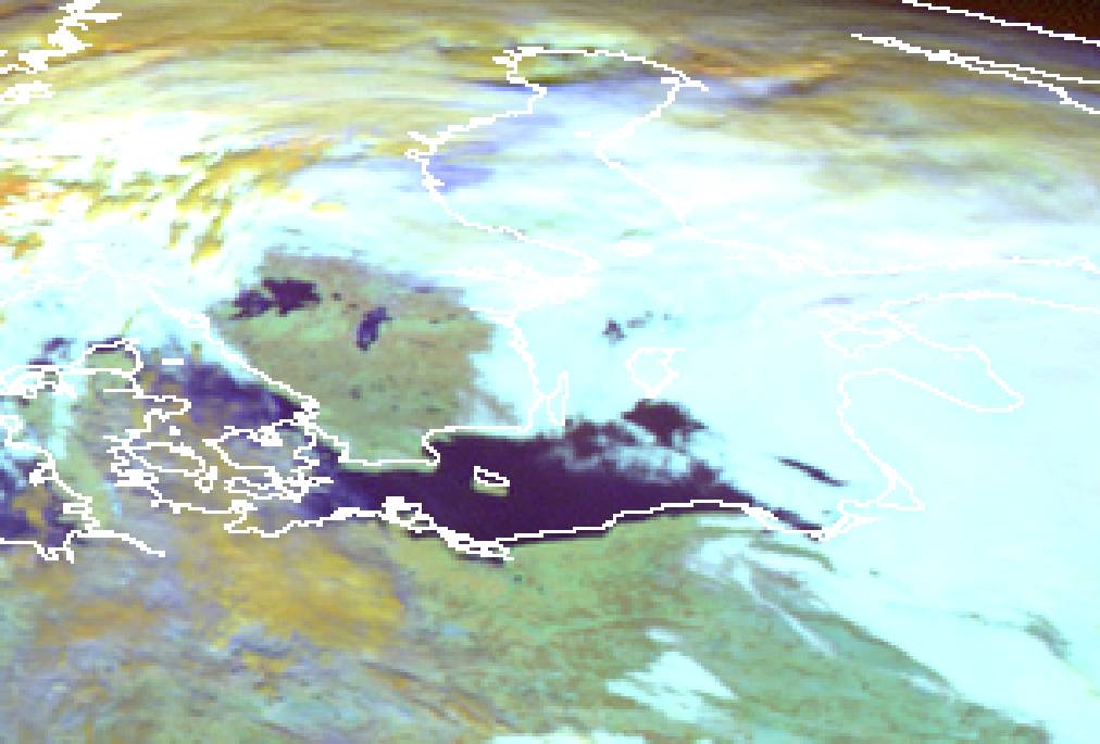
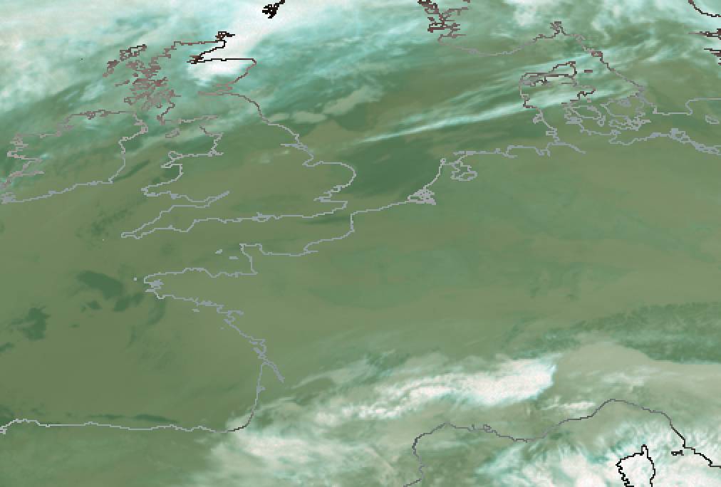
The MSG RGB daytime combination images below show a case of radiation and advection fog and Stratus over Finland, the Baltic Sea and the Baltic States. Different RGB combinations show St/Fog in different colours, but in all combinations the low cloud layers are well distinguishable from the ground or from the thicker frontal clouds. Especially useful these combinations become when the ground is snow- or ice-covered: all combinations exploiting 1.6 µm and 3.9 µm wavelength discriminate the low clouds from snow clearly.
|
|
09 November 2005/12.00 UTC - Meteosat 8 RGB image (NIR1.6, VIS0.8 and VIS0.6)
|
|
|
|
|
09 November 2005/12.00 UTC - Meteosat 8 RGB image (VIS0.6, VIS0.8 and IR10.8)
|
|
|
|
|
09 November 2005/12.00 UTC - Meteosat 8 RGB image (VIS0.8, IR3.9 and IR10.8)
|
|
|
|
|
09 November 2005/12.00 UTC - Meteosat 8 RGB image (VIS0.8, NIR1.6 and IR3.9; winter settings)
|
|
|
The night-time detection of St/Fog using the traditional individual images can be very difficult. The traditional AVHRR inherited combinations help a little, but the best result is achieved by using difference channels as a part of RGB composite.
The example below illustrates a night-time situation over Central Europe. Radiation fog extends throughout the continent, but with large gaps in the cloud sheet. Detecting these gaps (for example over western parts of Germany and eastern parts of France) is very difficult with the IR 10.8 image alone.
|
09 December 2004/00.00 UTC - Meteosat 8 IR 10.8 image
|
|
|
The detection is a little easier with a traditional RGB combination IR3.9;IR10.8;IR12.0, but still the contrast is not very good.
|
|
09 November 2005/12.00 UTC - Meteosat 8 RGB image (IR3.9, IR10.8 and IR12.0)
|
|
|
With the help of the night-time microphysical RGB combination, which uses thermal IR channels in appropriate way, the detection of low cloud layers is very easy.
|
|
09 November 2005/12.00 UTC - Meteosat 8 RGB image (IR12.0-IR10.8, IR10.8-IR3.9 and IR10.8)
|
|
|
Discriminating Stratus from Fog
Stratus and Fog are phenomena that are easy to differentiate for a human observer at ground level. The definition of each has been formulated as follows:
Stratus is used to describe flat, featureless clouds of low altitude, typically less than 300 metres. On the other hand, fog is a stratus cloud in contact with the ground. Horizontal visibility in fog is less than 1 km.
The reason why these two phenomena are discussed together is the fact that for satellite sensors viewing them from above the differentiation is not at all simple. The only real difference between Fog and Stratus is the different altitude of the cloud base, which for Stratus lies a few hundred meters above ground, whereas in Fog the cloud base descends to ground level.
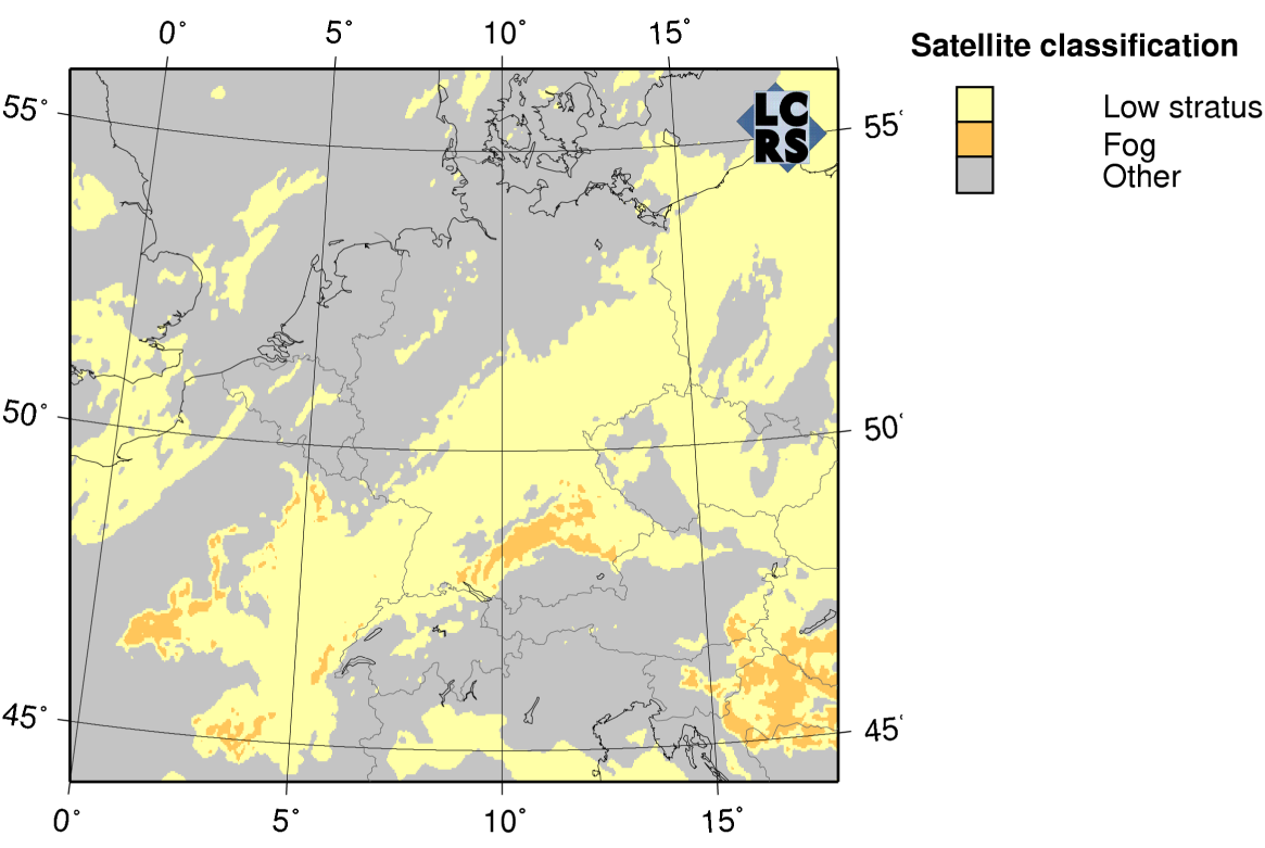
However, in quantitative satellite image interpretation requiring calculation of several cloud properties (such as cloud water distribution and cloud optical thickness), a discrimination between low stratus and fog areas is possible at daytime. Given that fog is a cloud in touch with the ground, a comparison of cloud base height with surface elevation can be used to discern fog presence. Cloud base height is computed as a difference between cloud top height and cloud thickness. The former is retrieved by interpolation of cloud margin heights (from relief or temperature lapse). The latter is determined by fitting a model of vertical cloud water distribution to the satellite-retrieved liquid water path.
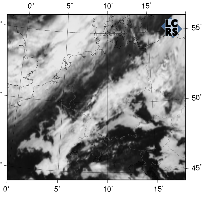
This approach can be illustrated with the following example. A traditional MSG visible channel image shows an area of low cloud over Central Europe. After the inclusion of quantitative satellite image interpretation algorithms the computed fog areas can be discriminated from stratus areas.
|
10 October 2005/12.00 UTC - Meteosat 8 VIS 0.8 image
|
10 October 2005/12.00 UTC - Fog/Stratus discrimination product
|
|
|
Meteorological Physical Background
Stratus and Fog are phenomena that are easy to differentiate for a human observer at ground level. The definition of each has been formulated as follows:
The reason why these two phenomena are discussed together is the fact that for satellite sensors viewing them from above the differentiation is not at all simple. The only real difference between Fog and Stratus is the different altitude of the cloud base, which for Stratus lies a few hundred meters above ground, whereas in Fog the cloud base descends to ground level. A recent solution for automatic diagnosis of whether the cloud is at the ground (fog) or lifted off the ground (stratus) was presented in previous chapter (see Cloud Structure In Satellite Images ).
This chapter mainly focuses on advection Stratus/fog and Radiation Fog.
Favoured synoptic environment for St/Fog
Fog (or low Stratus) is formed, when moist air near ground level starts to condensate. This condensation can be produced in the atmosphere by three mechanisms:
- By ascent and resultant cooling of an air parcel.
- By radiative heat loss.
- By the mixing of two parcels of slightly unsaturated air initially having different temperatures.
Radiation Fog formation typically calls for clear skies, ample moisture in the surface layer and light winds. Preferred locations to fulfil these conditions can be found adjacent to high pressures over land (mostly during the winter season) with associated weak pressure gradient. Wetness of soil significantly increases the chances of Radiation Fog, for which reason a very favoured situation for Fog formation is the sky clearing and wind decreasing in the evening after a rainy day. Too strong wind will most likely create Stratocumulus than Stratus.
For the Advection Fog the important factors are the advection of moisture and temperature by the wind. Depending on the wind speed and fetch over water the interaction between the cooler surface layer and the overlying air results in low-level Stratus cloudiness and even Fog. As an average moderate (4-7 m/s) surface winds are typical for Advection Fog occurrences. Moist and warm southwesterly or southerly air streams over cool waters such as over cold ocean currents can create very extensive Fog sheets. Advection Fog is also frequently observed in wintertime low pressure warm sector areas over the continents.
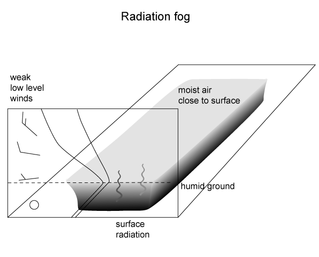
Radiation Fog
|
Diagram showing the synoptic conditions for night-time Radiation Fog with front and side view panels. The typical vertical
distribution of temperature, dew point temperature and wind are presented in the front panel.
|
|
|
Radiation Fog forms, when the ground cools rapidly after sunset by long-wave radiation to space. The cooling of the air near the ground makes it increasingly thermally stable, which weakens and eventually stops turbulence above ground. As radiative cooling continues, excess water vapour begins to condense into Fog droplets. As soon as the deepening Fog layer becomes optically thick (some tens of metres), the upper part of it becomes the effective interface to space.
As the Fog gets thicker, it becomes more uniform in the vertical, with a well-defined top. Depending on the season and synoptic conditions the Radiation Fog may or may not develop into a mature Fog. For example in summer, Fog layers are most often thin due to short nights. In the winter, however, under stationary synoptic situations Radiation Fog or lifted Fog (Stratus) can last for days.
The dissipation of Radiation Fog can take place through the following mechanisms:
- The spreading of a cloud sheet over the Fog, which reduces the radiative cooling at the Fog top layer.
- Atmospheric layers with high amounts of water vapour can help to dissipate fog by long wave radiation.
- Heat from the ground can lift the Fog into low cloud.
- Increasing shear at Fog top caused by increasing wind above the Fog increases the entrainment of dry air into the cloud and accelerates the rate of dissipation.
- In mature Fog the settling of droplets to the ground or onto vegetation contributes significantly to the dissipation.
- Solar radiation (excluding mid-winter) can penetrate to the ground in places where Fog is thinner (such as elevated places) and heat the ground and evaporate the Fog. Consequently, heat will be convected into the cloud. During summertime due to short nights the Fog has no time to thicken long enough, before the morning sun already starts heating the ground and breaks the Fogs into patches and later maybe into fair-weather cumulus.
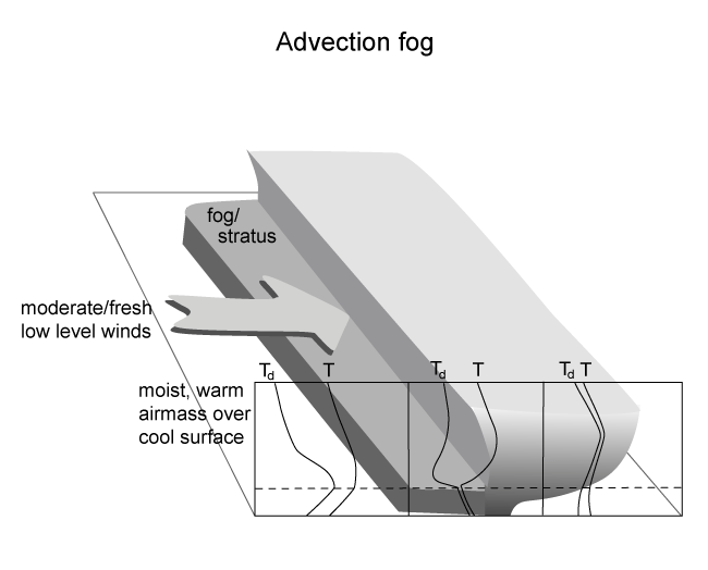
Advection Fog/St
|
Diagram showing the synoptic conditions for Advection Fog with front and side view panels. The typical vertical distribution of
temperature, dew point temperature and wind are presented in the front panel.
|
|
|
When moist and warm air is advected by the wind, turbulent mixing in the boundary layer moistens the air from below. This results in advection stratus clouds. When Stratus encounters cooler waters (with sea surface temperatures lower than air dewpoint temperature) or cold (possibly snow-covered) land, turbulence and thermal convection decrease significantly, but the water vapour-driven convection from the surface continues to mix the overlying air. This leads to cooling of the unsaturated air and lowering of the cloud base, eventually even to the formation of Advection Fog.
Important factors for the formation of Advection Fog are the fetch over the sea (or over land with wet snow) and wind speed. A long fetch together with not too high a wind speed allows the cloud to sink lower and eventually form Fog. Over land areas the snow temperature is an important factor: snow having below-zero temperatures can easily absorb moisture from overlying air. This is due to the smaller water vapour pressure for ice surfaces compared to liquid water surfaces. Fog formation over wet snow is therefore much more common than over dry snow, as wet snow is a source of moisture.
Advection Fog can be expected to be persistent, since the synoptic situation does not change rapidly. In wintertime warm sectors the middle and upper troposphere normally remain relatively dry, which favours extensive low level cloud decks to persist. Either a frontal passage and change of air-mass, increasing wind/turbulence or the advection of mid-level or low-level cloud over the St/fog top are needed for dissipation of the Fog to take place. The advection of sea Fog over warmer water can also lead to lifted stratus and possibly dispersal of cloud.
Advection Fog has the same tendency to shrink from the outer edges as Radiation Fog, but the advection of the clouds has to be taken into account. Brighter spots indicating thicker and more persistent cloud may be carried downwind, while the upwind edges of clouds will clear more rapidly.
Key Parameters
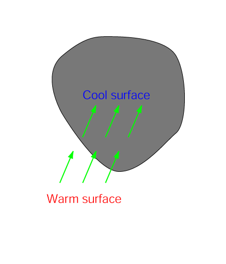
- Height contours at 1000 hPa:
High pressure or high pressure ridge with weak surface winds typical environment especially for radiation fog. - Wind vectors at 1000 hPa:
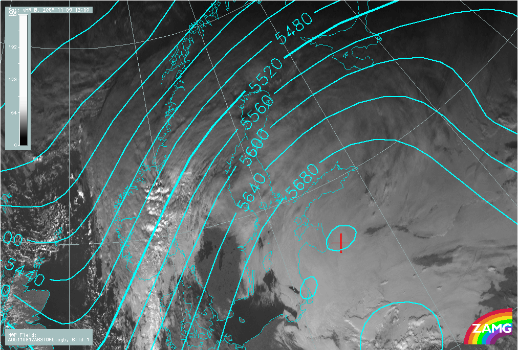
Moderate wind from relatively warm surface onto cold surface typical for advection St/Fog. - Height contours at 500 hPa:
Anticyclonic upper level ridge at warm sector supports the absence of middle- and upper level clouds and support favourable conditions for St/Fog at lower troposphere. - Surface dewpoint depression:
Very small difference between the surface temperature and dewpoint indicates fog or mist at the surface.
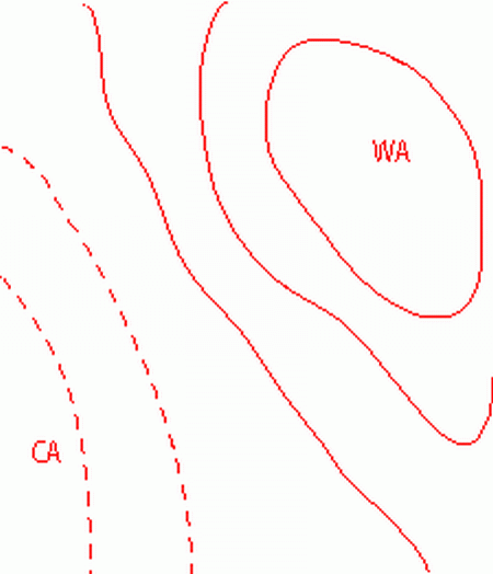
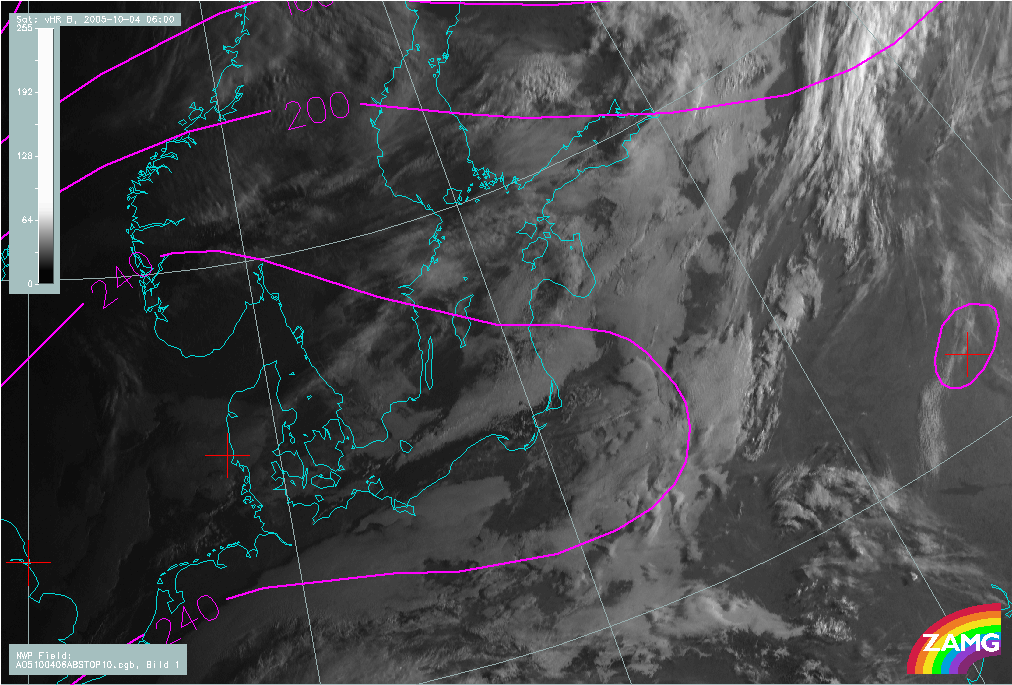
Height contours at 1000 hPa
|
|
04 October 2005/06.00 UTC - Meteosat 8 HRV image, magenta: height contours 1000 hPa
|
|
|
Wind vectors at 1000 hPa
|
|
09 November 2005/12.00 UTC - Meteosat 8 HRV image, green: wind vectors 1000 hPa; red: wind isotachs (m/s) 1000 hPa
|
|
|
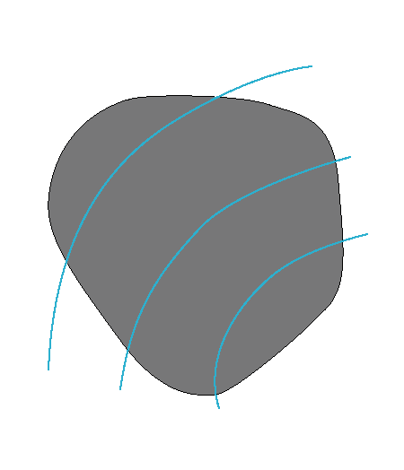
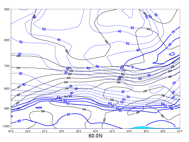
Height contours at 500 hPa
|
|
09 November 2005/12.00 UTC - Meteosat 8 HRV image, cyan: height contours 500 hPa
|
|
|
Surface dewpoint depression
|
|
04 October 2005/06.00 UTC - Meteosat 8 HRV image, green: dew point depression
|
|
|
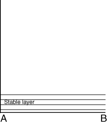
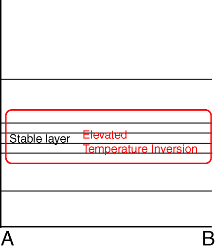
Typical Appearance In Vertical Cross Sections
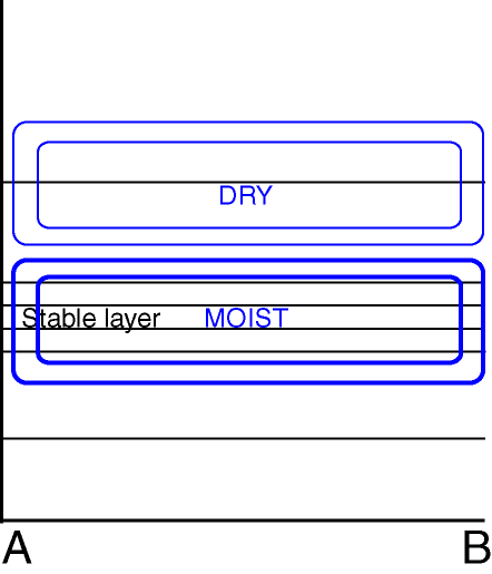
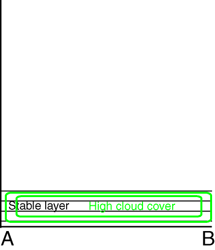
Fog and stratus are boundary layer phenomena, and vertical cross sections should preferable be zoomed into the lowest 300 or 500 hPa or the atmosphere to see the features most conveniently.
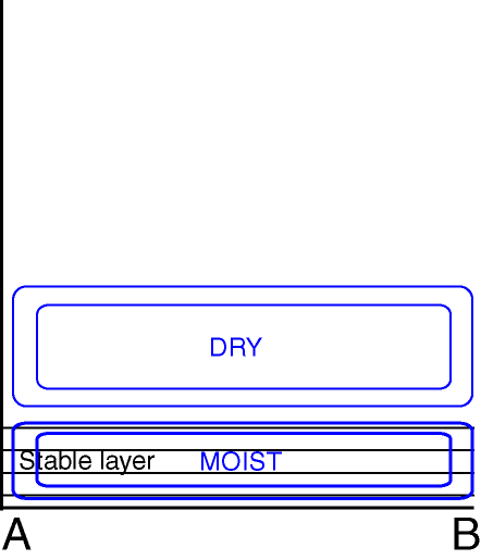
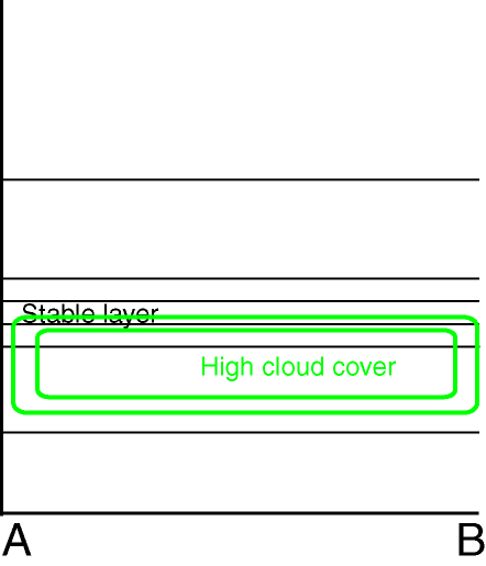
- Relative humidity:
A moist lower troposphere and relatively dry layers above typical for both radiation and advection St/Fog. - Total Cloud cover:
High (over 80%) cloud cover either very near or at the surface (both fog types ) or slightly lifted off the surface (advection St/Fog). - Isentropes:
Potentially stable situation at the lowest part of the troposphere. - Temperature:
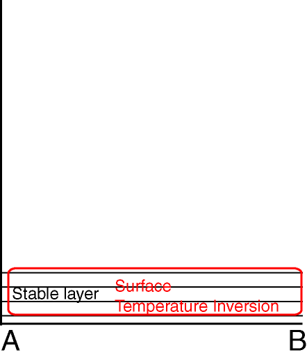
Surface (for both fog types) or elevated (for advection Stratus) temperature inversion.
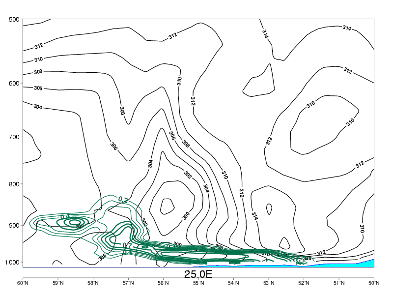
Advection Fog/St
|
|
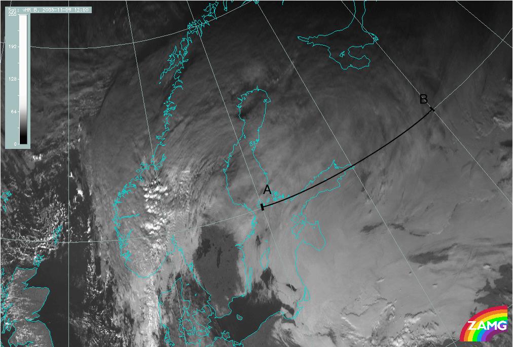
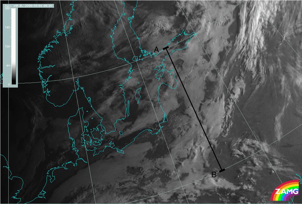
09 November 2005/12.00 UTC - Meteosat 8 HRV image; position of the Vertical Cross Section indicated
|
|
|
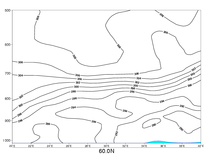
Radiation Fog
|
|
04 October 2005/06.00 UTC - Meteosat 8 HRV image; position of the Vertical Cross Section indicated
|
|
|
Relative Humidity
Advection Fog/St
|
|
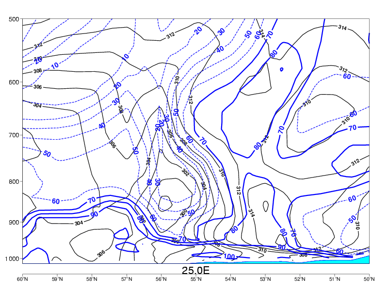
09 November 2005/12.00 UTC - Vertical cross section; blue: relative humidity
|
|
|
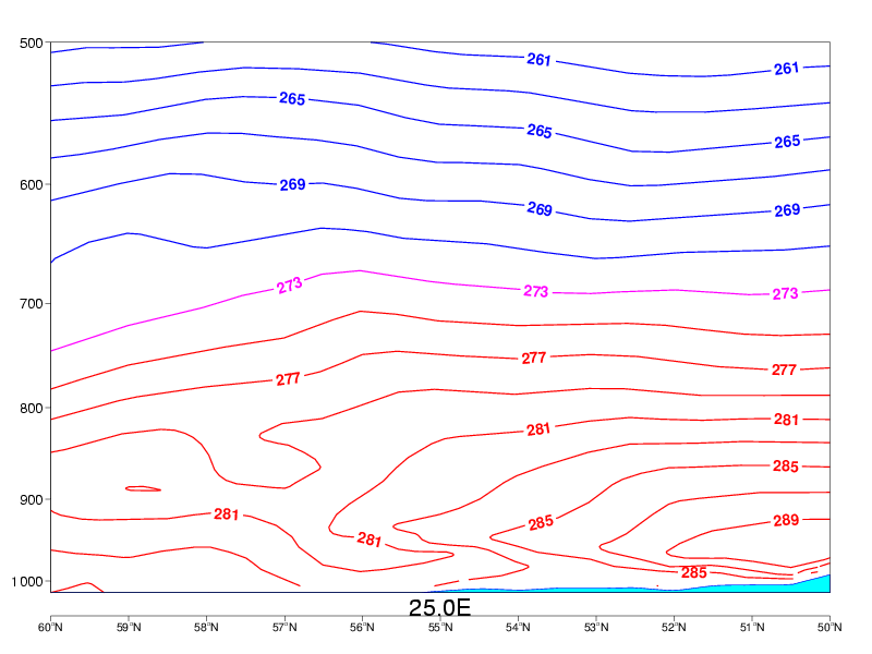
Radiation Fog
|
|
04 October 2005/06.00 UTC - Vertical cross section; blue: relative humidity
|
|
|
Total Cloud Cover
Advection Fog/St
|
|
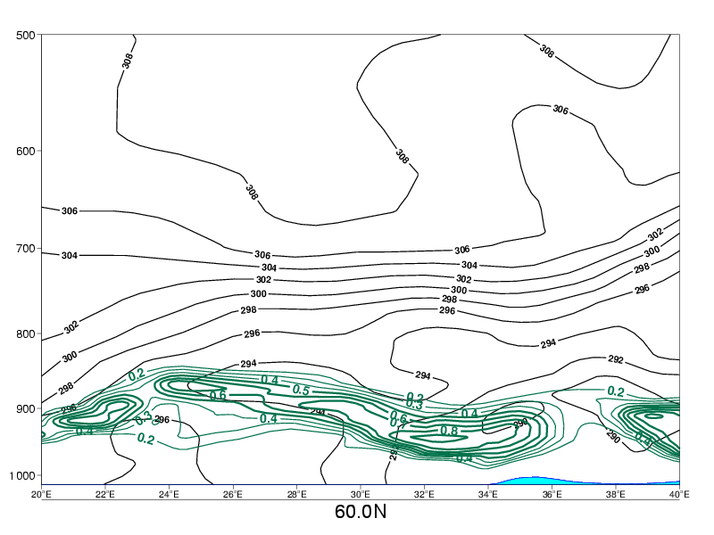
09 November 2005/12.00 UTC - Vertical cross section; green: total cloud cover
|
|
|
Radiation Fog
|
|
04 October 2005/06.00 UTC - Vertical cross section; green: total cloud cover
|
|
|
Isentropes
Advection Fog/St
|
|
09 November 2005/12.00 UTC - Vertical cross section; black: isentropes
|
|
|
Radiation Fog
|
|
04 October 2005/06.00 UTC - Vertical cross section; black: isentropes
|
|
|
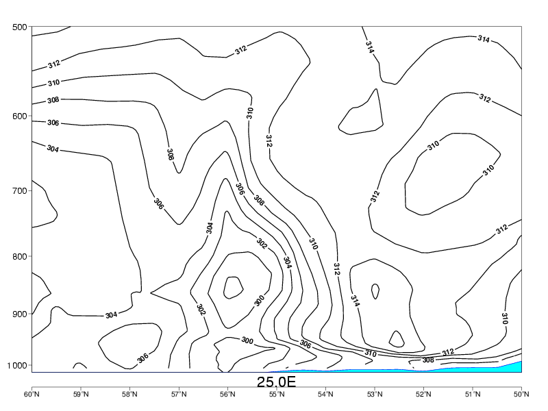
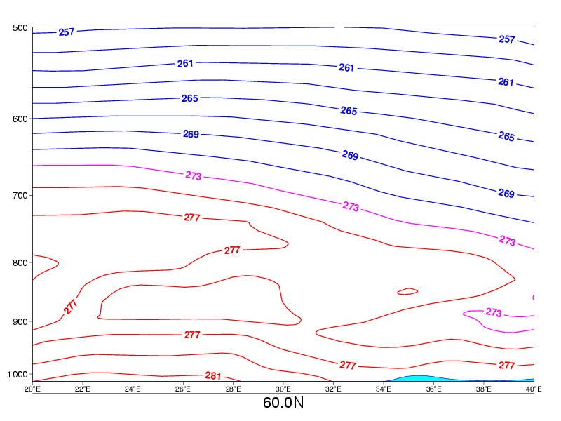
Temperature
Advection Fog/St
|
|
09 November 2005/12.00 UTC - Vertical cross section; red, magenta, blue: temperature
|
|
|
Radiation Fog
|
|
04 October 2005/06.00 UTC - Vertical cross section; red, magenta, blue: temperature
|
|
|
Weather Events
| Parameter | Description |
| Precipitation |
|
| Temperature |
|
| Wind (incl. gusts) |
|
| Other relevant information |
|
|
|
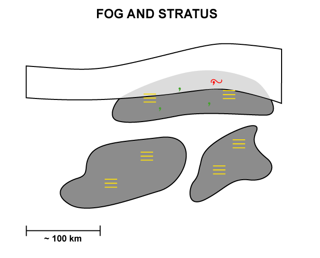
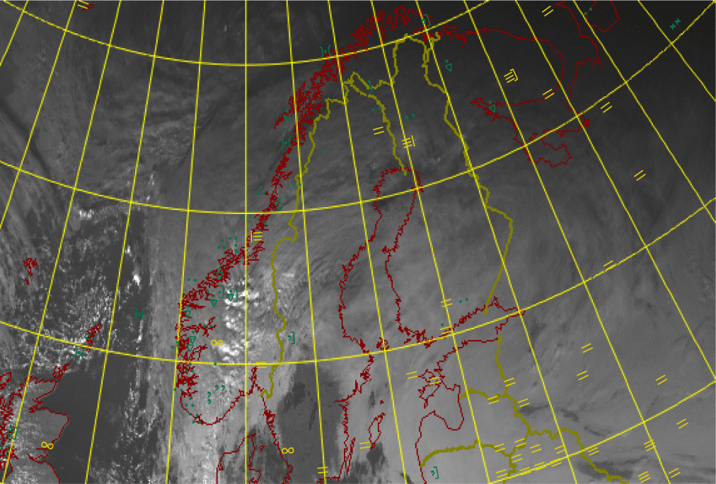
09 November 2005/12.00 UTC - Meteosat 8 IR 10.8 image; weather events (green: precipitation, yellow: fog/mist/haze)
|
|
|
References
General Satellite Meteorology
- BADER M. J., FORBES G. S., GRANT J. R., LILLEY R. B. E. and WATERS A. J. (1995): Images in weather forecasting - A practical guide for interpreting satellite and radar imagery; Cambridge University Press.
- KARLSSON, K.- G. (1997): Remote Sensing in Meteorology. Swedish Meteorological and Hydrological Institute.
Specific Satellite Meteorology
- ANTHIS, A. I. and CRACKNELL, A. P. (1999): Use of satellite images for fog detection (AVHRR) and forecast of fog dissipation (METEOSAT) over lowland Thessalia, Hellas. Int. Journal of Remote Sensing, Vol. 20, 1107-1124.
- BROWN, R: (1987): Observations of the structure of a deep fog. Meteorol. Mag., Vol. 116, p. 329-338.
- ELLROD, G.P. (1995): advances in the Detection and Analysis of Fog at Night Using GOES Multispectral Infrared Imagery. Weather and Forecasting, Vol. 10, p. 606-619.
- CERMAK, J. (2006): SOFOS - A New Satellite-based Operational Fog Observation Scheme. PhD thesis, Philipps-Universität Marburg.
- EYRE J .R., BROWNSCOMBE J. L., and ALLAM R. J. (1984): Detection of fog at night using Advanced Very High Resolution Radiometer (AVHRR) imagery; Met. Mag., Vol. 113, p. 266 - 271.
- GURKA, J. J. (1978): The use of enhanced visible imagery for predicting the time of fog dissipation. Preprints, Conference on Weather Forecasting and Analysis and Aviation Meteorology, pp. 343-346.
- GURKA, J. J. (1978): the Role of Inward Mixing in the Dissipation of Fog and Stratus. Monthly Weather Review, Vol. 106, pp. 1633-1635.
- JACOBS, W., NIETOSVAARA, V., MICHAELIDES, S. Chr., GMOSER, H. (ed.)(2005): Short-range forecasting methods of fog, visibility and low clouds. COST Action 722 Phase I report.
- KIDD, C. (1995): Images of widespread radiation fog over southern England on 23 December 1994. Weather, Vol. 50, p. 370-374.
- Lee, T. F. ,TURK, F. J., RICHARDSON, K. (1997): Stratus and fog products using GOES-8-9 3.9 μm data. Weather and Forecasting, Vol. 12, p. 664-677.
- LILJAS, E. (1986): Use of AVHRR 3.7 micrometer channel in multispectral cloud classification; Promis-Rapporter No. 2. (Norrköping, SMHI)
- MICHAELIDES, S. Chr. (ed.) (2005): Short-range forecasting methods of fog, visibility and low clouds. COST Action 722 Larnaca, Cyprus Workshop Proceedings.
- ROACH, W.T. (1994): Back to basics: Fog: Part 1- Definitions and basic physics. Weather, Vol. 49, p. 411 - 415.
- ROACH, W.T. (1995): Back to basics: Fog: Part 2 - The formation and dissipation of land fog. Weather, Vol. 50, p. 7-11.
- ROACH, W.T. (1995): Back to basics: Fog: Part 3: The formation and dissipation of sea fog. Weather, Vol. 50, p.80-84.
- TELFORD, J. W., CHAI, S. K. (1984): Inversions and fog, stratus, and cumulus formation in warm air over cooler water. Boundary-Layer Meteorology, Vol. 29, p. 109-137.
- TELFORD, J. W., CHAI, S. K. (1993): Marine Fog and Its Dissipation over Warm Water. J.of Atmos. Sci., Vol. 50, p. 3336 - 3349.
- WESSELS, H. R. A. (1980): Growth and disappearance of evaporation fog during the transformation of a cold air mass. Quart. Journal of Roy. Met. Soc., Vol.105, p. 963-977.