Cloud Structure In Satellite Images
A Comma is a very prominent cloud feature that develops and exists in cold air. Several similar phenomena occur within cold air, such as Enhanced Cumulus cloudiness (see Enhanced Cumulus). Also found in cold air are vortex rings, crescents, ovals, solid cloudiness, multiple deep or shallow bands, single deep or shallow bands and swirls in cumulus streets.
In order to distinguish the Comma from other cold air features, the Comma cloudiness is defined as a small to meso-scale cloud spiral consisting of white (i.e., cold) cloud cells partly overlaid by cirrus shields. In most cases the strongest convection can be found in the Comma tail, but sometimes enhanced convection can also be found in the Comma head. In a few cases the Comma head and tail are separated by a narrow cloud-free area or only connected by low clouds (although this may not be apparent throughout the whole lifetime of the system). Commas occur on scales between 200 and 1000 km, i.e., much smaller than a fully developed depression or a cyclone.
|
Larger Commas can be a sign of a development process called Cold Air Development (see Cold Air Development), where a Comma increases in size and finally gains some frontal characteristics.
Appearance in the basic channels
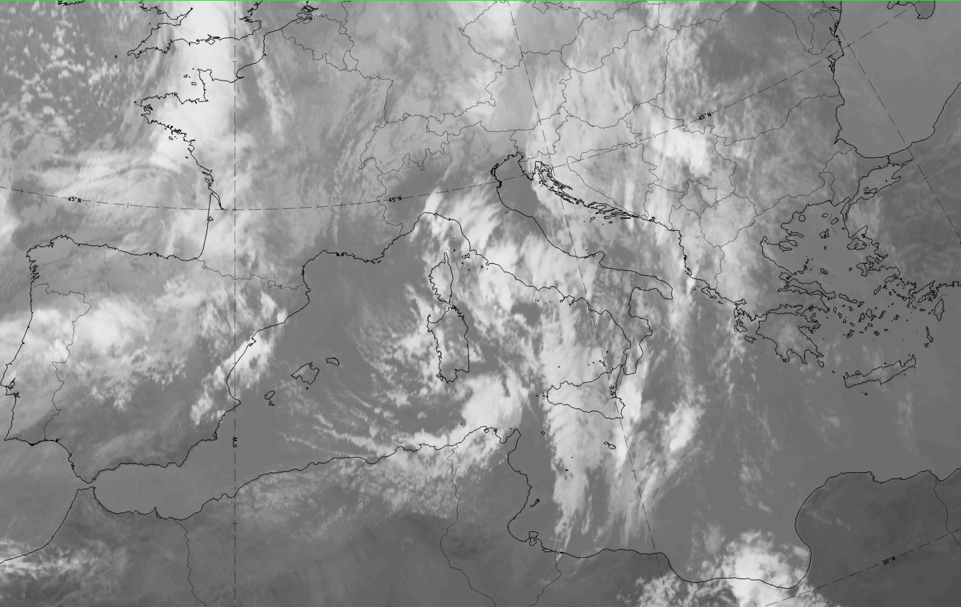
Comma head:
IR, VIS, WV: white, especially in the areas of embedded convection, representing rather thick cloud.
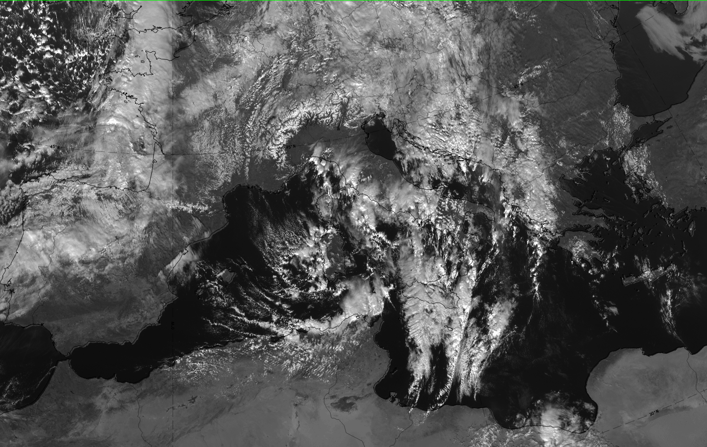
Comma tail:
IR, VIS and WV: light grey changing to white in the areas of convection. This represents lower cloud tops than on the head, where convection reaches higher of it exists.
 |
 |
Appearance in the basic RGBs:
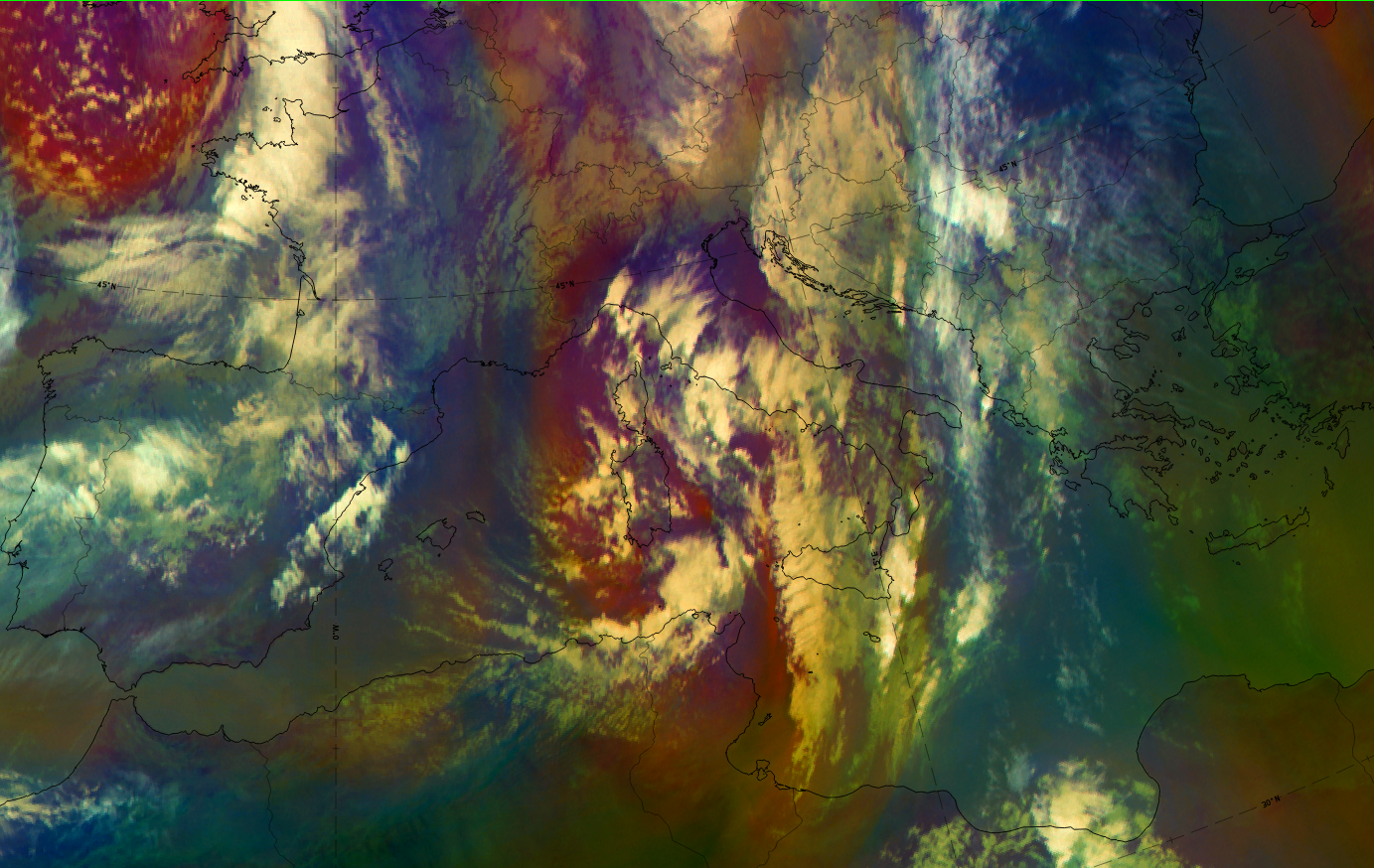
Airmass RGB:
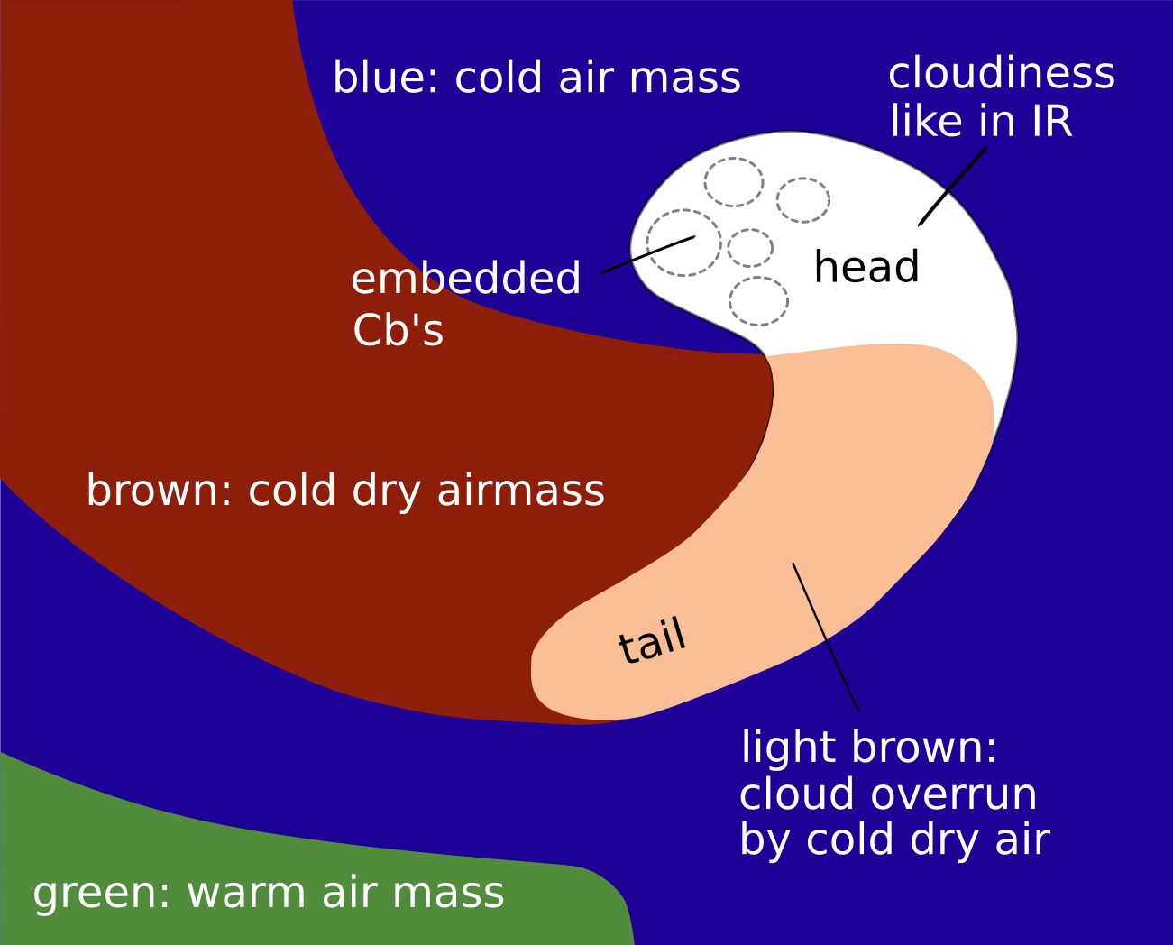
A comma is a mesoscale cloud feature in the cold air outbreak behind a front; consequently, and unlike for other cloud configuration types, shows the Airmass RGB shows dark blue and brown colours, representing the cold and dry air mass within the comma is located. Very often the brownish colours appear behind the comma and penetrating the comma tail. The area between the comma and the previous frontal cloud band is either blue or brown, depending on the specific case.
The Comma cloud itself looks very similar to that in the IR image but, mostly overlaid by the brownish colour representing the dry air, adding a brownish shade to the bright white colours. This is especially true for the comma tail, which consists of lower cloud.
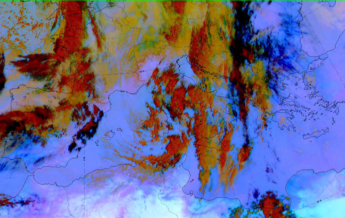
Dust RGB:
Unlike for other cloud configuration types, the Dust RGB shows blue or pinkish blue colours, representing cloud-free areas. Very often there is low cloud, which shows up as ochre colours.
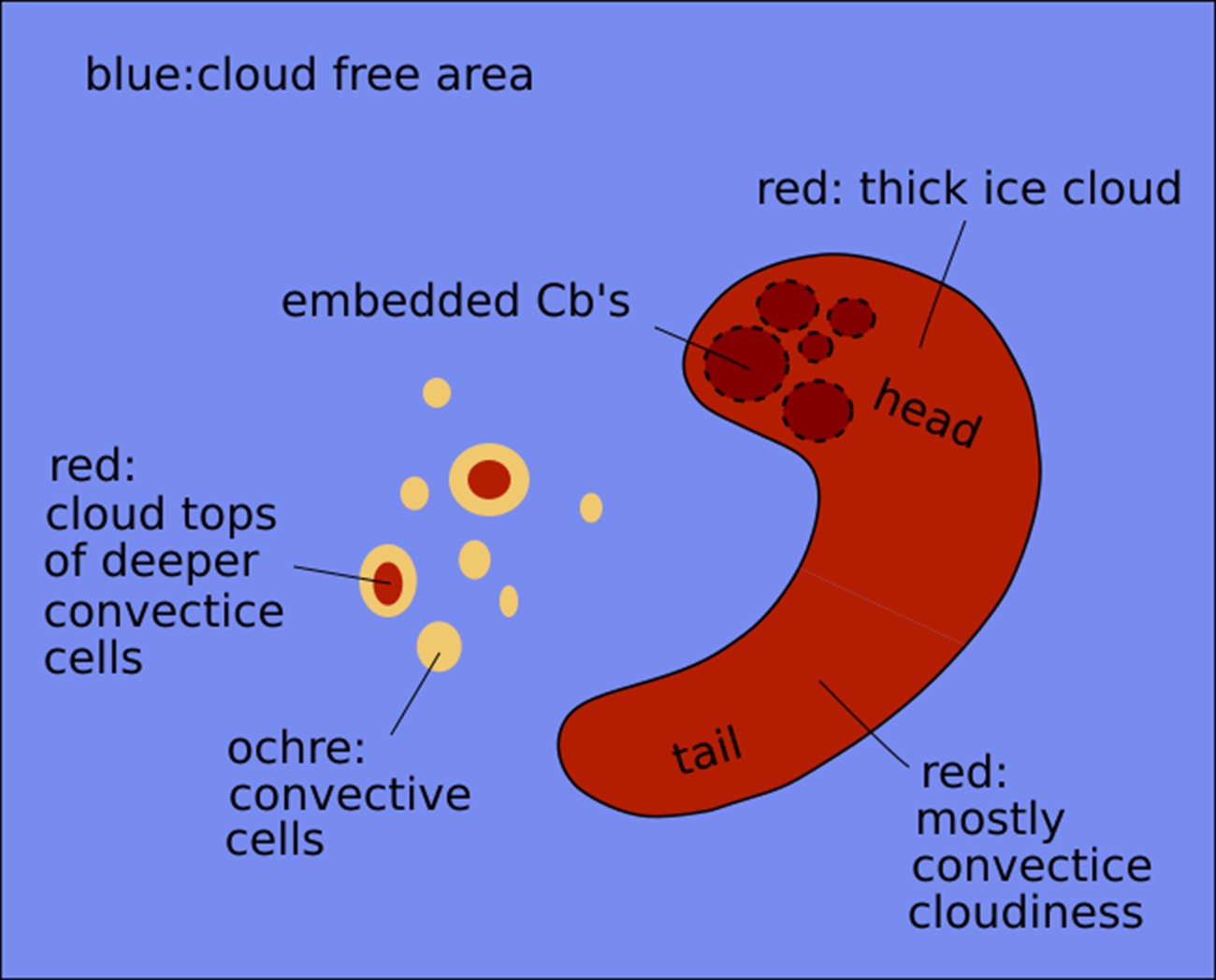
The comma cloud consists of the dark red areas, representing the thicker and convective cloud parts; this very often includes the comma tail but there are also cases with lower cloud in the comma tail represented by ochre colours.
 |
|
 |
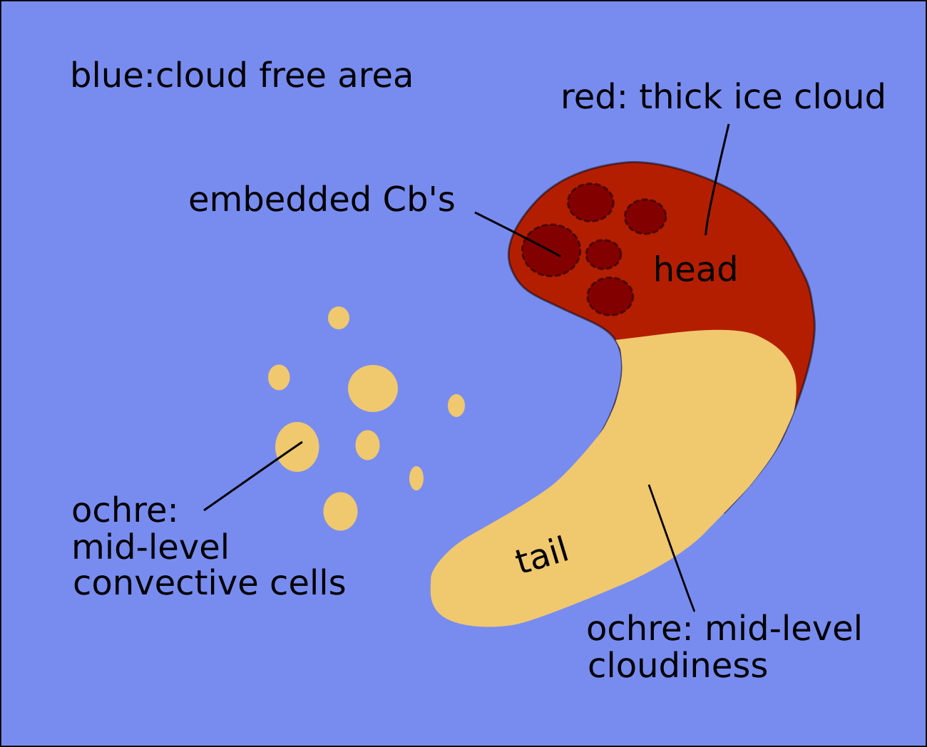 |
Basic RGBs schematics. U. row: Airmass RGB
l.l.: Dust RGB for comma with thick cloud in head and tail; l.r.: Dust RGB for comma with lower cloud in the tail.
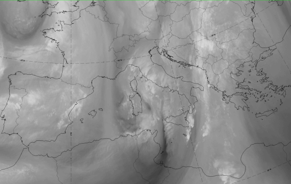
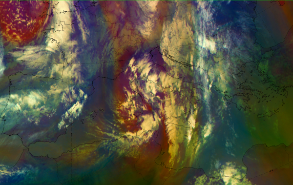
Data from 9 November 2019 at 12 show a mesoscale cloud spiral over northern Tunisia and the adjacent Mediterranean Sea.
|
|
|
|
|


| IR | White with embedded Cbs in head and tail; grey areas at the leading part of the comma tail. |
| HRV | White with embedded Cbs; in comma tail only the Cbs are visible. |
| WV | Light grey with a dark stripe on the rear side approaching from the north. |
| Airmass RGB | Dark brown representing dry air to the front and rear of the comma; comma cloudiness is similar to IR but with a brownish "shade" indicating overflowing dry air. |
| Dust RGB | Dark red in the biggest part of the comma representing thick ice cloud; rather ochre colours in some parts of the comma tail representing mid-level water cloud. |
 |
 |
 |
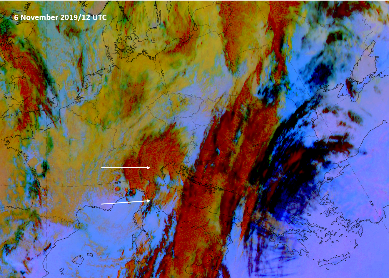 |
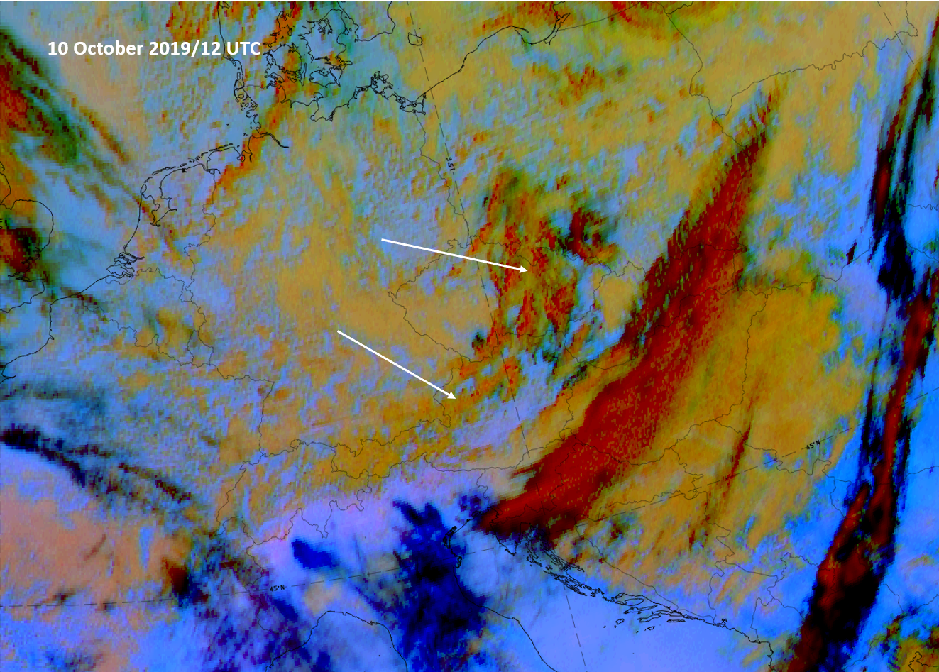
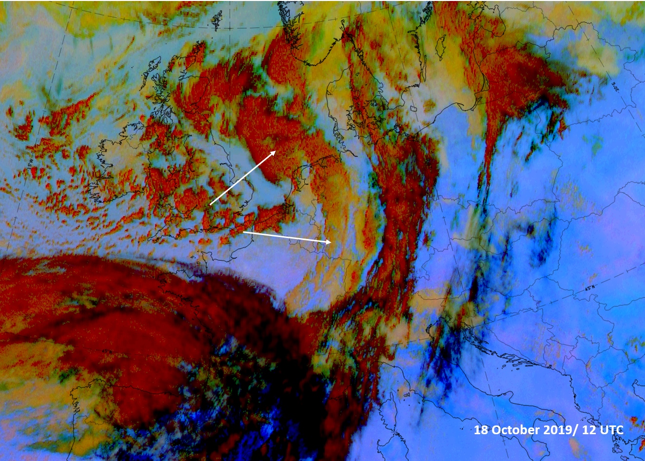
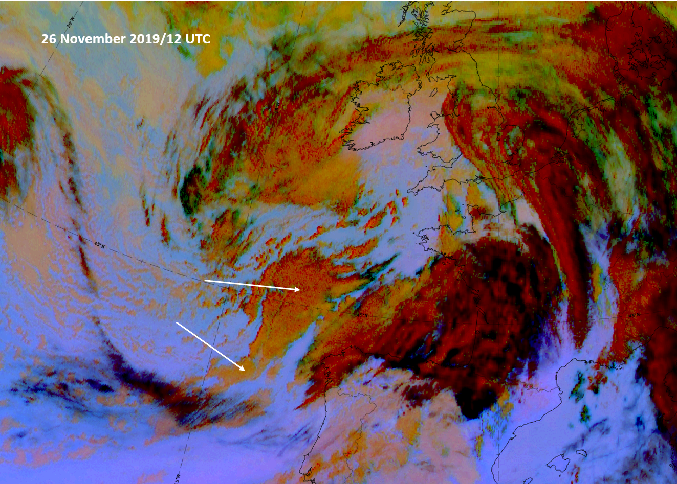
Examples of 4 different comma types; Dust RGB.
*Note: click on the image to access the image gallery (navigate using arrows on keyboard)
As mentioned in the introduction of this chapter, commas show a large variety of different configurations and structures; above are some examples which illustrate this. The case on 10th October (u.l.) forms a cyclonic spiral but consists of rather weak cloud with some small cells in the comma head and mid-level cloud in the comma tail. The case of 18 October (u.r.) is the opposite of this, showing a comma head with extended thick ice cloud on a scale already close to that of a fully developed stage of a "cold air development". The well-defined cloud spiral from 26 November (l.l.) on the cyclonic side of the jet axis (black cloud stripe) also shows the differentiation between a comma head under thick cloud and a cloud comma tail consisting of mid-level cloud while, in contrast to this, the case on 6 November (l.r.) shows developing and thick cells also in the comma tail, over Italy.