Table of Contents
Cloud Structure In Satellite Images
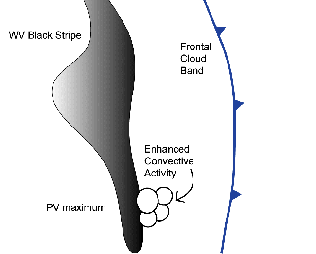
Potential Vorticity (PV) often plays an important role in the enhancement of convection either within or outside frontal zones.
Due to the fact that potential vorticity maxima at a certain level in the atmosphere represent the intrusion of dry air from the upper tropospheric or stratospheric levels into the lower troposphere, the best images to follow the processes connected to the PV are the WV images.
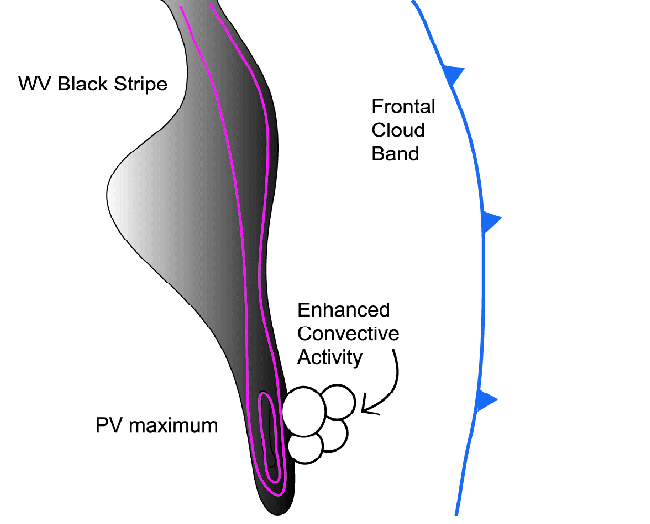
In WV imagery, convection is sometimes considerably enhanced just ahead of narrow elongated black stripes, and appears as developing white spots or marks.
|
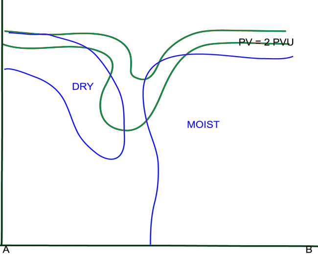
Schematic of a black area in the WV image and the triggering of convectivity at the front side
|
|
|
|
|
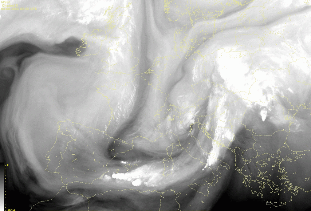
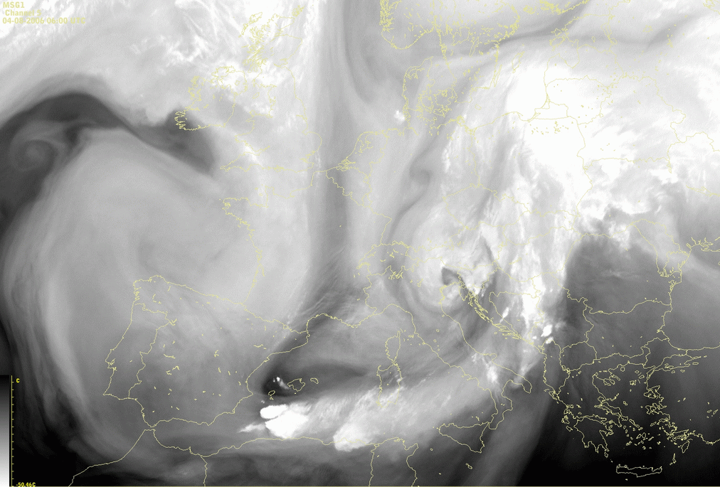
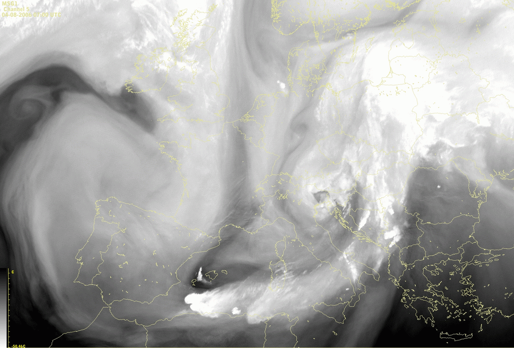
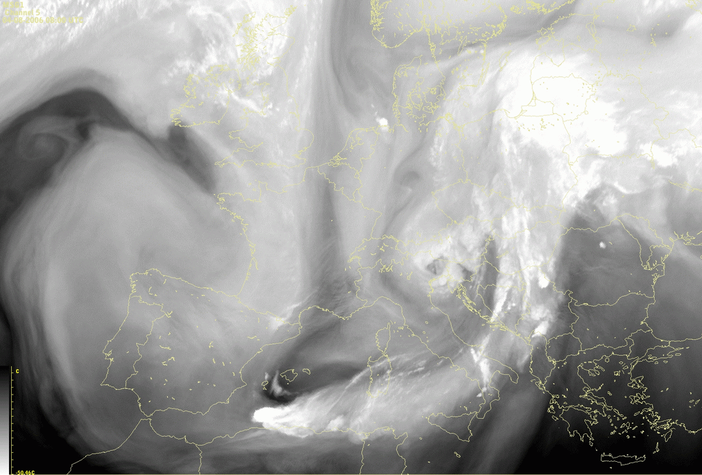
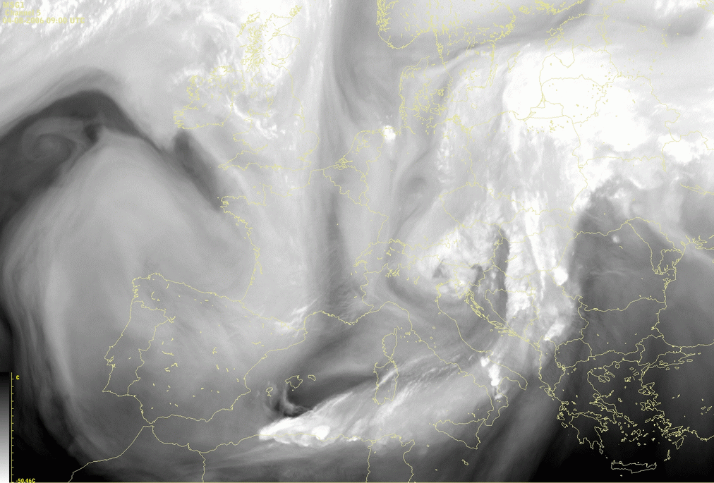
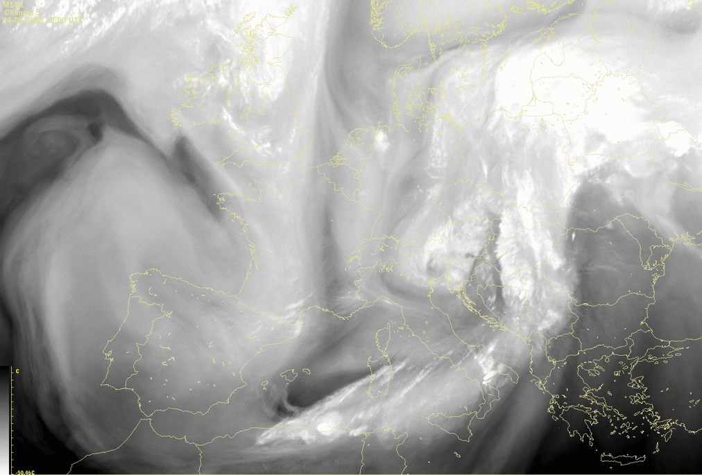
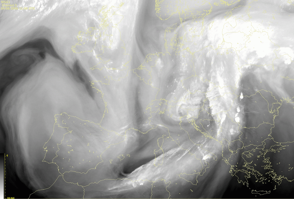
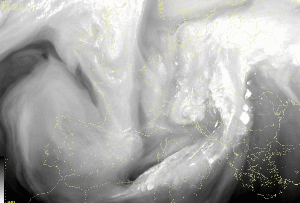
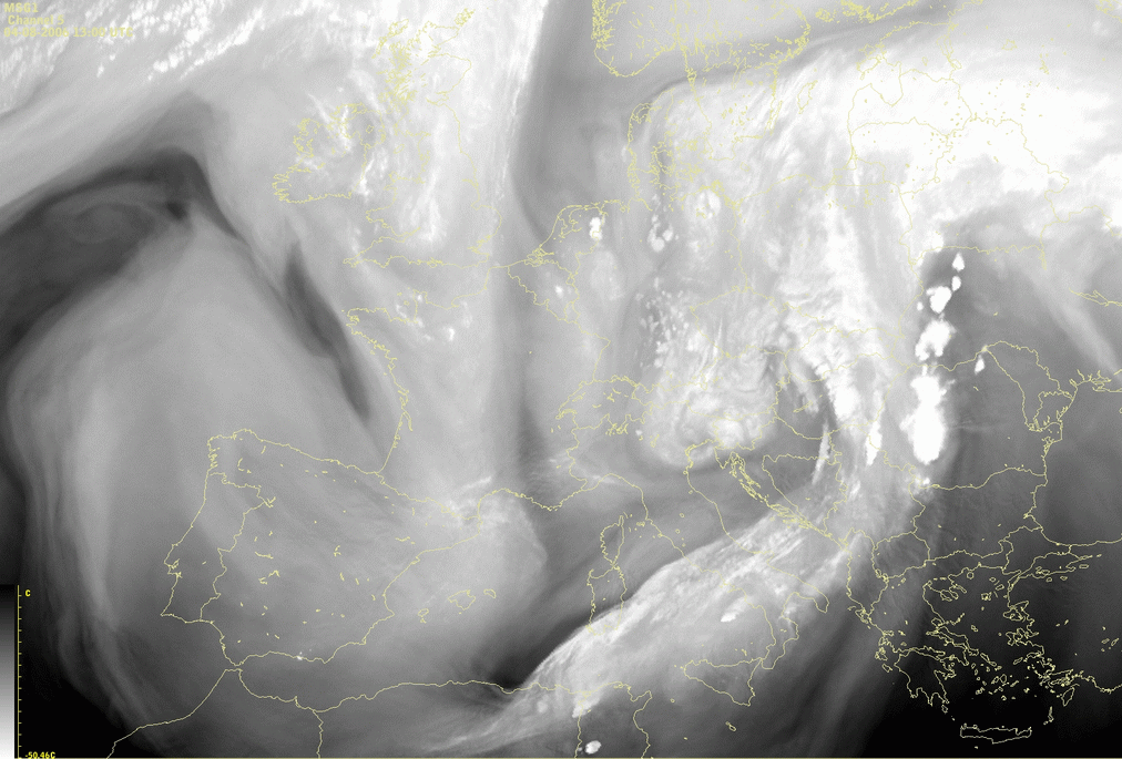
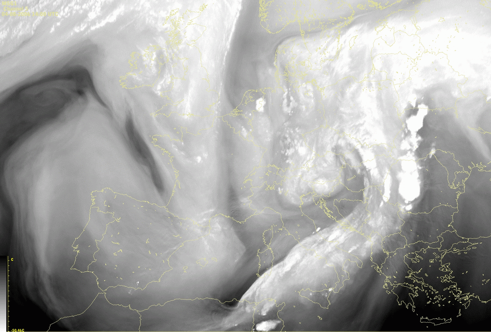
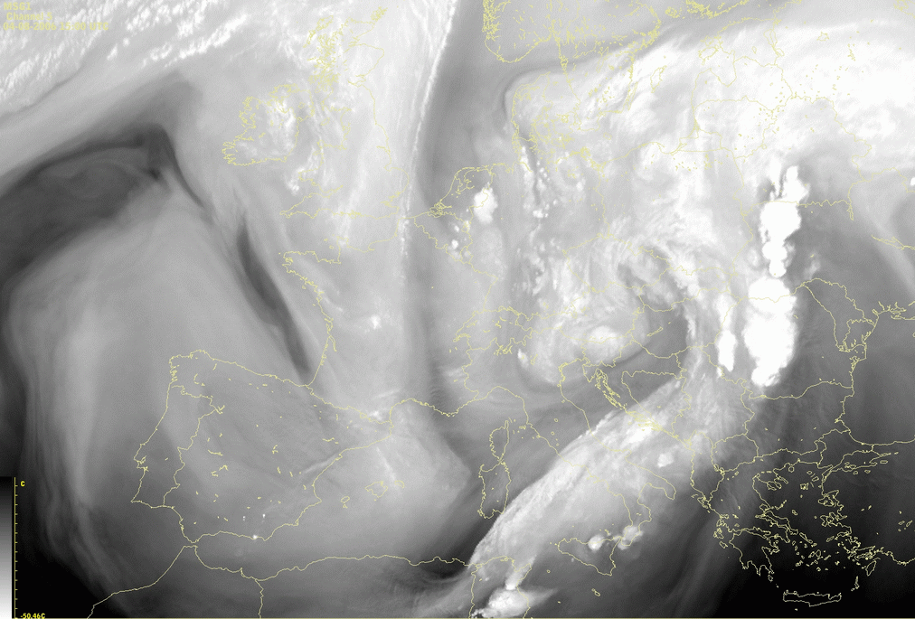
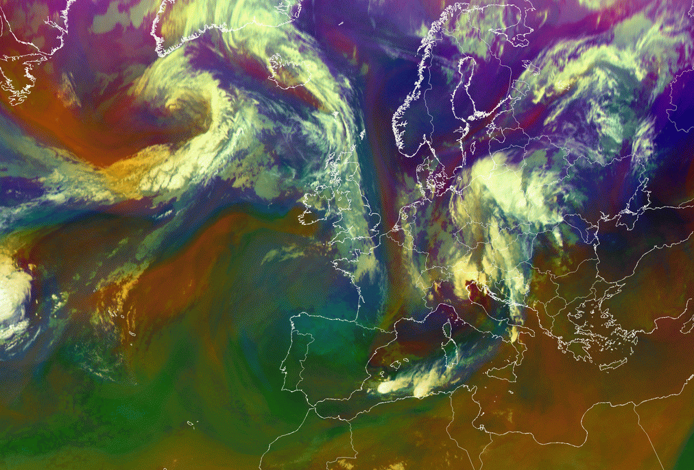
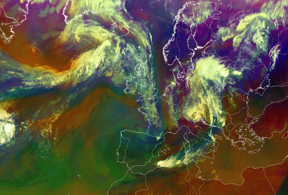
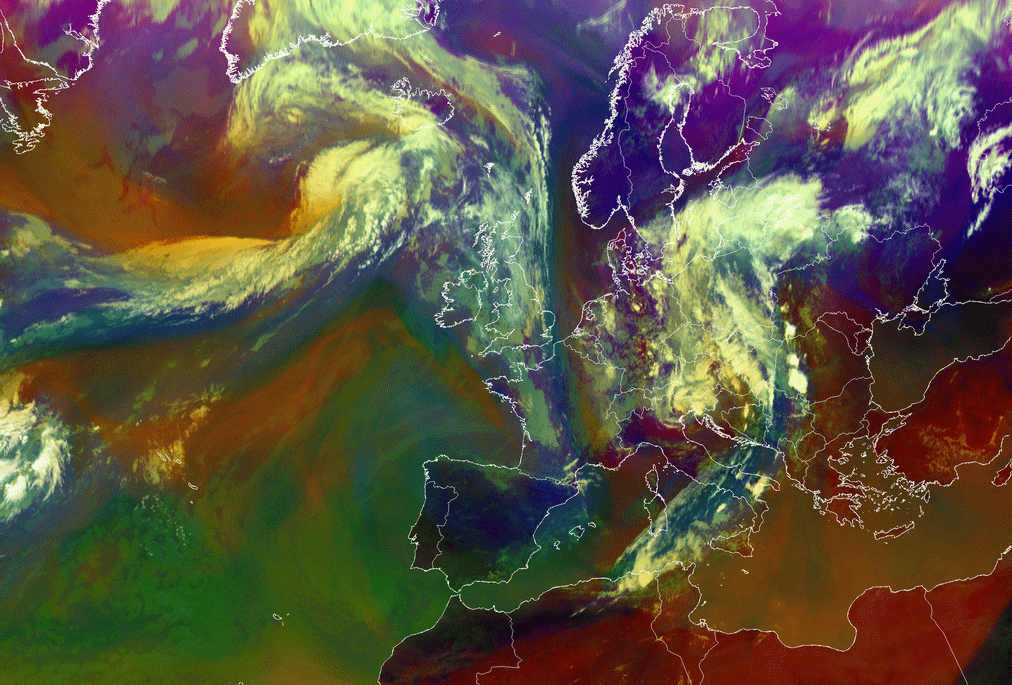
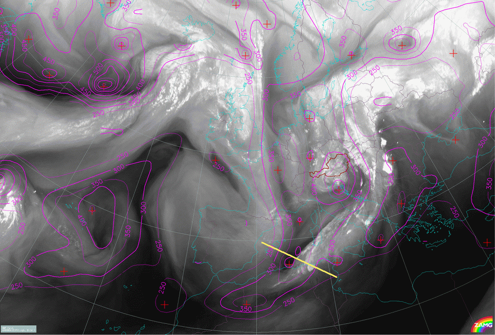
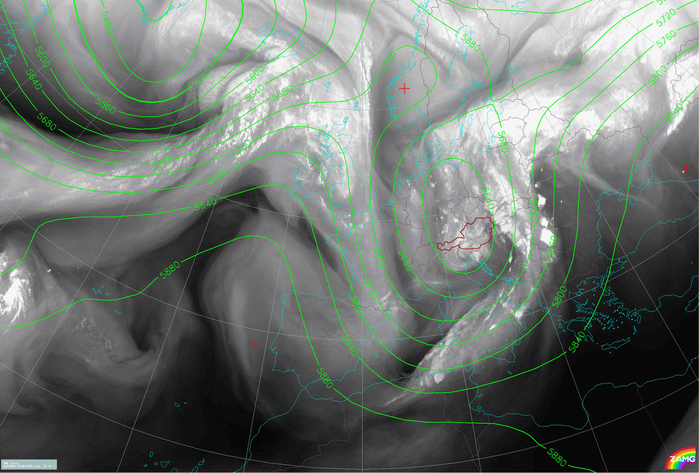
04 August 2006/00.00 UTC - Meteosat 8 WV6.2 image; 00.00 - 15.00 UTC hourly image loop
|
|
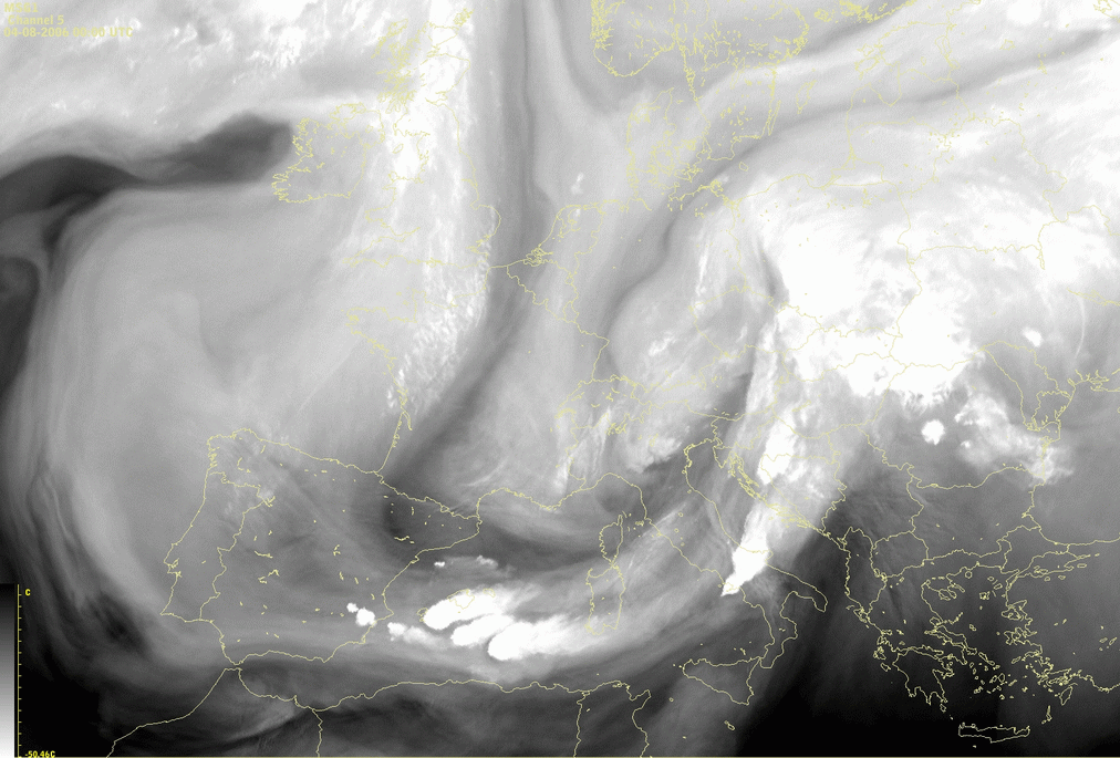
The Meteosat 8 WV channel 6.2 µm images show convective development southeast of Spain, associated with the WV dark stripe stretching from N. France towards the northern Spain. Convection occurs just next to the darkest area in the WV image, at the rear side of the frontal zone.
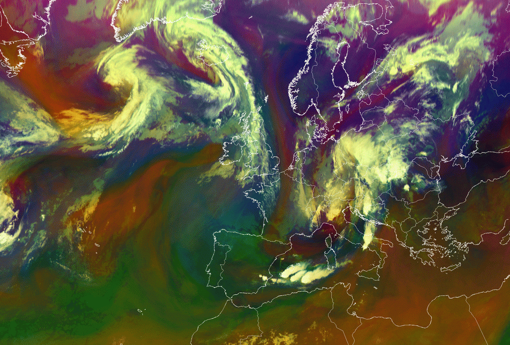
Appearance in the AIRMASS RGB composite images
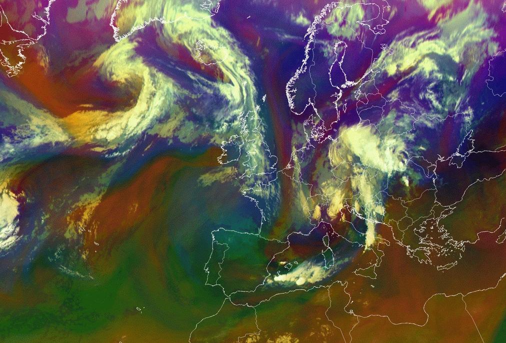
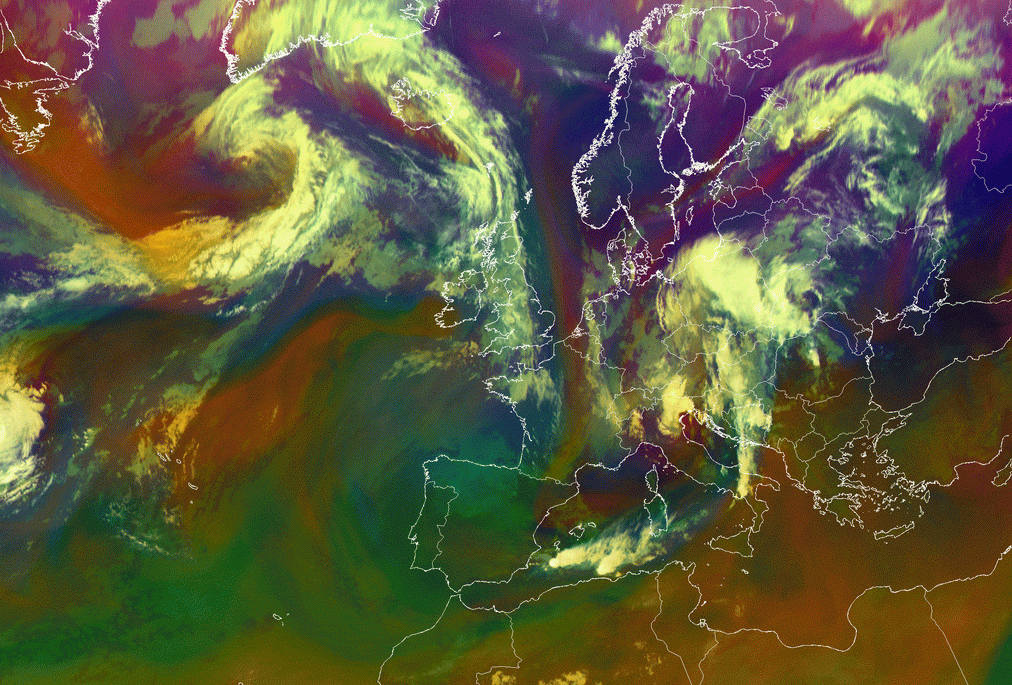
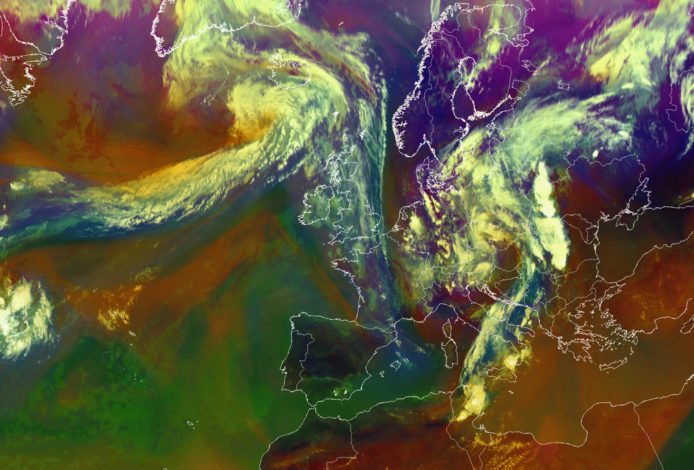
Apart from the single WV channel, the effects of the potential vorticity are even clearer in the Airmass RGB image, due to the fact that the combination of channels in the Airmass RGB clearly points out the regions where the intrusion of dry air from the upper levels takes place.
|
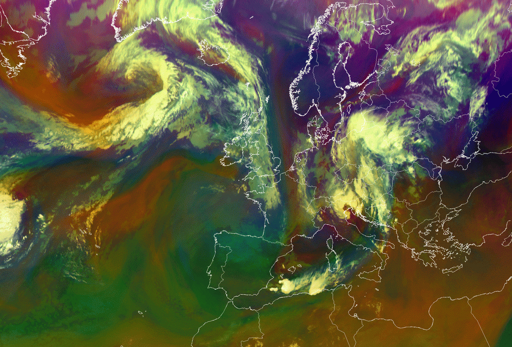
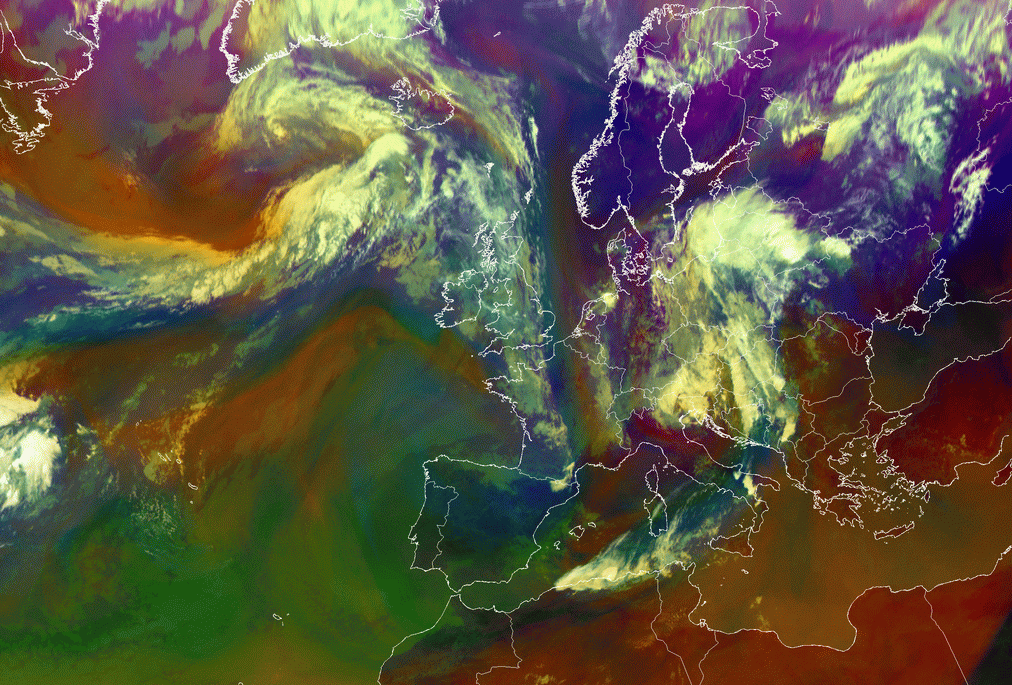
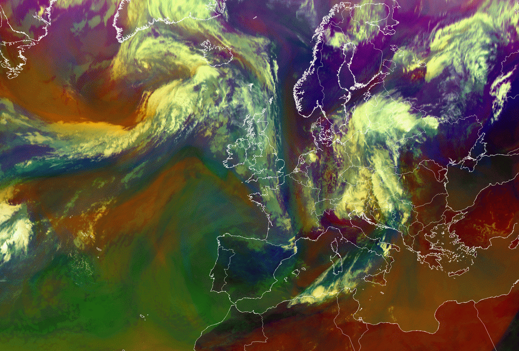
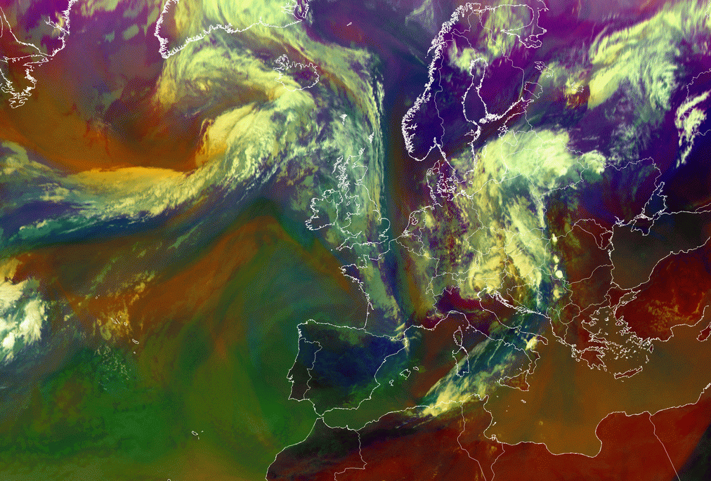
04 August 2006/00.00 UTC - Meteosat 8 Airmass RGB image; 00.00 - 15.00 UTC hourly image loop
|
|
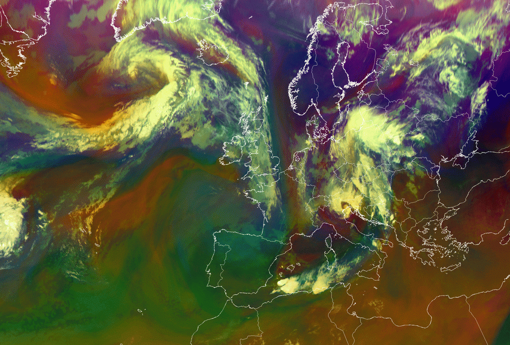
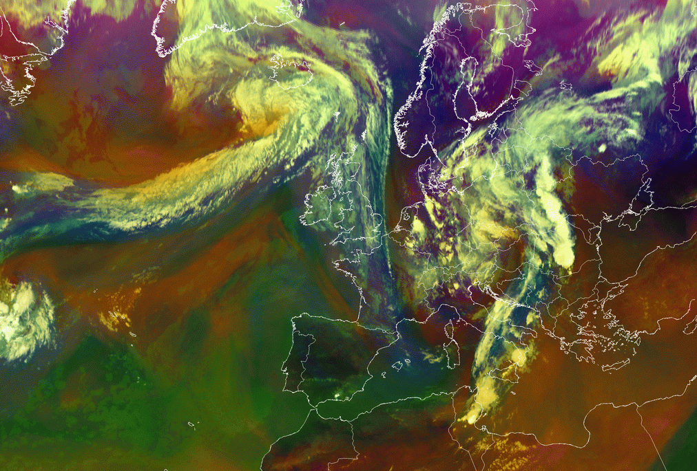
Reddish stripe from the north over France entering Mediterranean near the Baleares is connected to the dry air subsiding from the upper levels and therefore with high PV values. Convective clouds develop on the edge at the frontage of the reddish stripe.
Meteorological Physical Background
Potential vorticity (PV) represents a product of absolute vorticity and thermodynamic stability. It is defined by PV=(ξθ+f)(-g ∂θ/∂p), where ξ is relative vorticity on an isentropic surface, f the Coriolis parameter, g acceleration of gravity, θ potential temperature and p pressure. PV is greater in the stratosphere than in the troposphere, and is usually measured in PVU units (1 PVU=10-6 m-2Kkg-1s-1). Typically, value of 2 PVU is used as the dynamical definition of the tropopause. PV is conserved under adiabatic flow. Non-conservation of PV is caused by diabatic heating or cooling and turbulent mixing.
If stratospheric air is penetrating into the troposphere, a PV anomaly associated with a vorticity maximum will be observed. The reason for this is that the static stability in the troposphere is significantly lower than in the stratosphere. PV maximum is associated with cyclonic flow and high static stability. The relative vorticity and static stability anomaly on isentropic surfaces are therefore positively correlated. Distortions in the tropopause characterised by tongues of anomalously high PV are formed through the action of the large-scale deformation field, extending towards the equator. Some parts of these tongues may be stretched into long filaments, or roll up to form the isolated structures called the "cut-off" cyclones. Filamentary structures are mostly associated with stratosphere-troposphere exchange processes. In the troposphere, the distance between isentropic surfaces is much larger than in the stratosphere. As a result, relative vorticity will increase. (see Additional Parameters Indicative Of The Diagnosis Of Cloudiness: Potential Vorticity ). In the case of a propagation of the PV anomaly, there will be advection of positive vorticity ahead of the anomaly and advection of negative vorticity behind it. The propagation of PV anomaly is often associated with westerly current transport. The advection of positive vorticity, if increasing with height, causes divergence in the upper troposphere and, as a consequence, upward motion. On the other hand, convergence behind the anomaly causes sinking motion.
Although potential vorticity (PV) and vorticity advection (VA) are strongly connected, the use of PV as a key parameter, together with the WV
image, is often more illustrative than using PVA patterns alone.
When a PV anomaly approaches an area of moist and potentially unstable air, strong convection is initiated and convection systems such as EC,
Comma, Cb Clusters or MCS can develop. Additionally decaying systems can make intensify through this process. Locations favourable for these
phenomena are in cold air to the rear of frontal cloud bands.
|
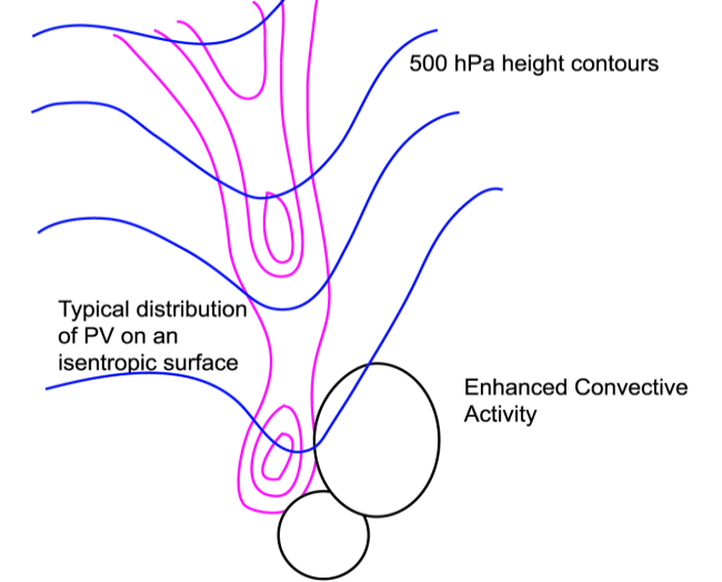
Schematic of the typical distribution of PV and the related WV image
|
01 November 2001/06.00 UTC - Meteosat WV image; red: potential vorticity 318K; position of vertical cross section indicated
|
|
|
|
|
|
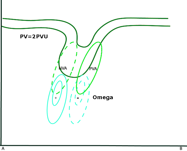
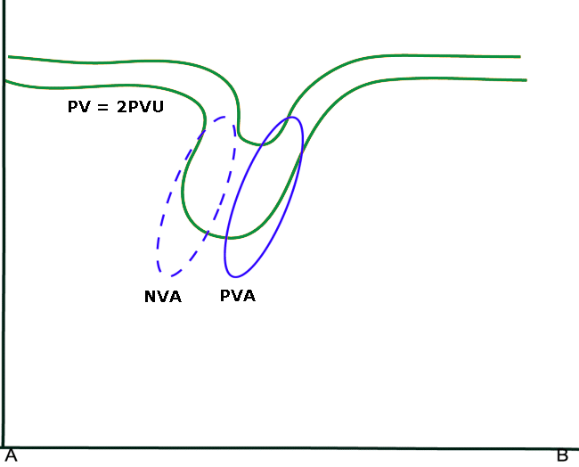
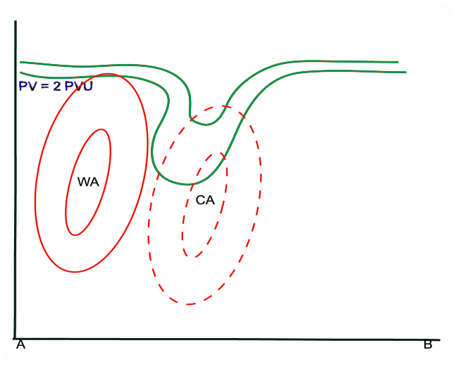
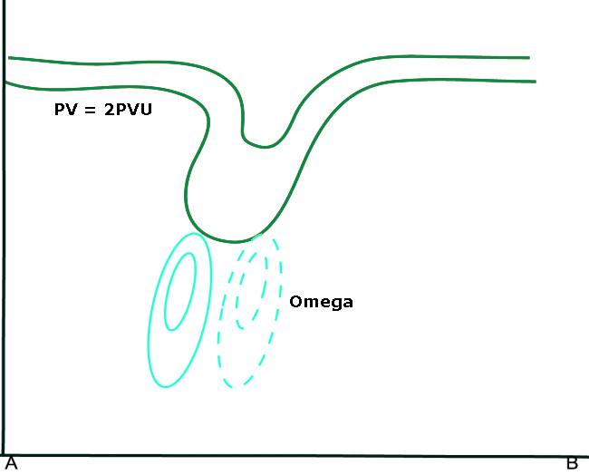
Schematic of PV anomalies in the upper troposphere and the connected vorticity advection and omega patterns
|
01 November 2001/06.00 UTC - Vertical cross section; black: potential vorticity, green: vorticity advection.
|
In the WV imagery, strong convective development can be seen southeast of Spain, near Sardinia, at 38N/06E. The PV maximum coincides with the
dark stripe in the WV image. A Cb Cluster has developed on the forward edge of the Dark Stripe.
The cross section shows a distinct PV anomaly, with the PV-2 unit protruding to 400 hPa. A distinct maximum of PVA can be found along the
forward edge of the PV anomaly, causing upward motion and development of the Cb Clusters.
Key Parameters
- Height of PV=1 PVU:
In the field of the pressure height of PV=1 PVU a long narrow elongated zone of heights of about 400 hPa is visible, associated with a dark stripe in the WV imagery. - 500 hPa geopotential height:
The distribution of geopotential height often shows a large trough, the trough axis coincident with the highest values of PV. However, the PV field gives a better overview of smaller scale features (see Additional Parameters Indicative Of The Diagnosis Of Cloudiness: Potential Vorticity
Height of PV=1 PVU
|
|
01 November 2001/06.00 UTC - Meteosat WV image; red: potential vorticity 318K; position of vertical cross section indicated
|
|

|
500 hPa geopotential height
|
|
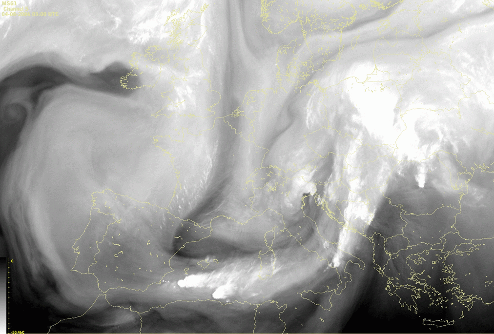
04 August 2006/12.00 UTC - Meteosat 8 WV6.2 image; green: height contours 500 hPa
|
|
Typical Appearance In Vertical Cross Sections
One of the most distinct features is a pronounced lowering of the PV-2 unit to heights of 400-500 hPa. This lowering of the dynamical tropopause
is regarded to as the upper level PV anomaly (see also
Additional Parameters Indicative Of The Diagnosis Of Cloudiness: Potential Vorticity
).
If this anomaly propagates over time, then ahead of the anomaly, positive vorticity advection occurs and to the rear, there is negative
vorticity advection.
A large area of cold advection can very often be found near the PV anomaly. There is a forward tilt of the advection pattern, resulting in increasing cold advection with height (and therefore destabilisation). To the rear of the PV anomaly, an area of warm advection can often be found which may indicate an approaching new frontal system.
Just below the PV anomaly, at mid-tropospheric levels, the strongest upward and downward motion can be found.
Although cold advection and the vorticity advection tend to counteract each other, a maximum of upward motion can be detected, indicating that
the contribution of vorticity advection must be larger than that of temperature advection. (see also
Numerical Parameters Indicative Of The Production Of Cloudiness: Omega Equation
).
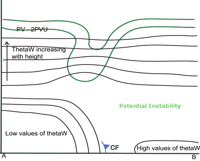
A sharp gradient of isentropes near the surface indicates the surface cold front (CF). To the rear of this CF, high values of ThetaW occur. The
ThetaW inversion at levels between 700 and 800 hPa characterises an air mass which is potentially unstable. This causes, together with dynamical
forcing, upward motion and subsequent convection.
In the higher troposphere, behind the PV anomaly, there is a marked inflow of dry air with stratospheric origin, caused by strong downward
motion. In WV imagery this can be seen as a narrow dark zone. To the rear of the CF, the relative humidity is high, especially at lower levels.
This provides a supply of moisture for the development of convection.
PV and ThetaW
|
|
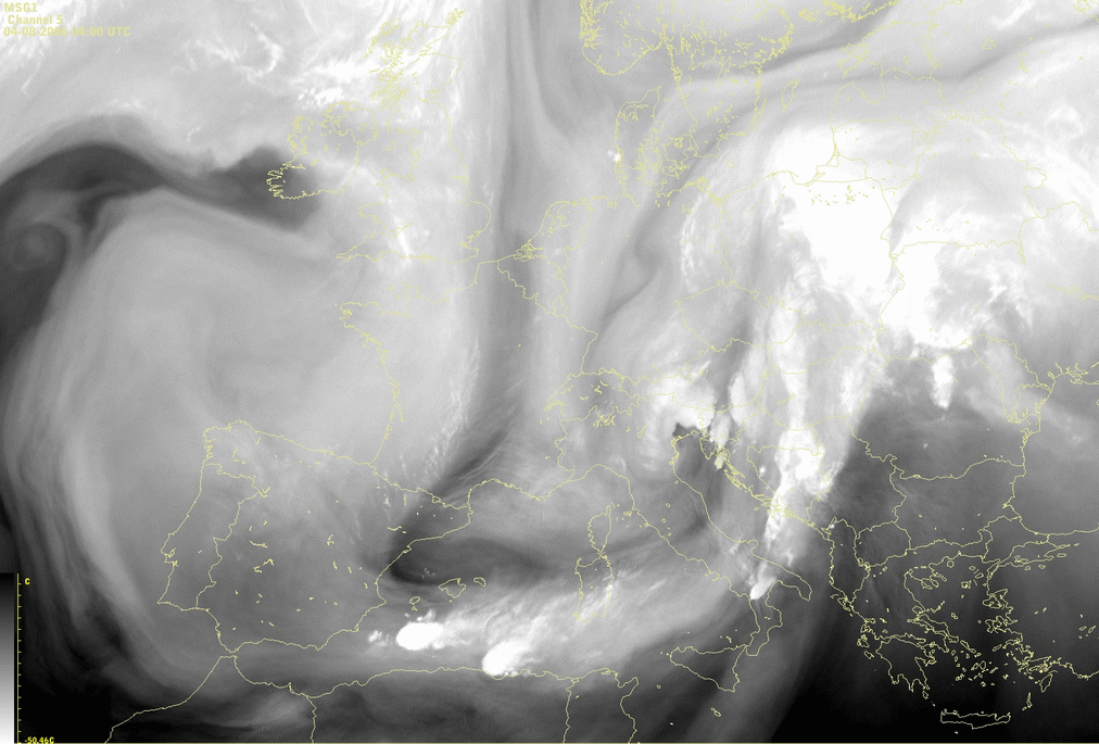
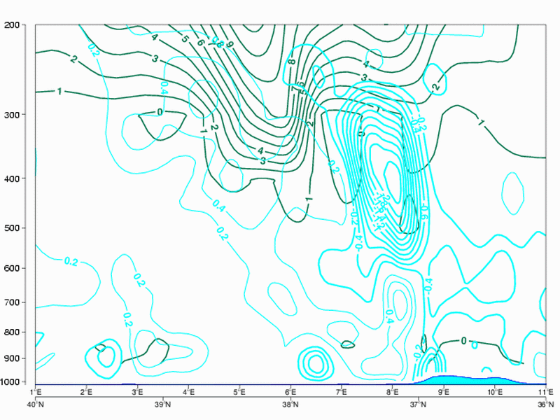
04 August 2006/12.00 UTC - Vertical cross section; dark green: potential vorticity, black solid: isentropes
|
|
|
The surface cold front is located at approximately 38N/06E. The isentropes show a distinct gradient at lower levels.
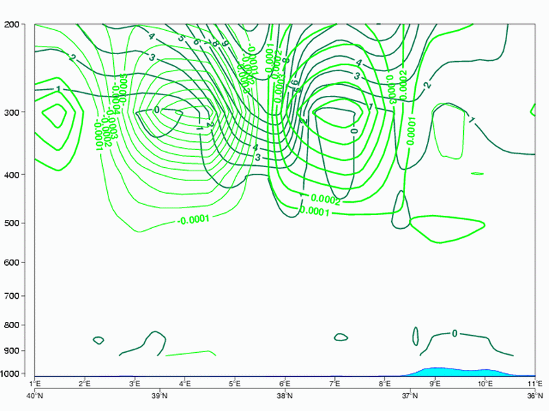
PV and PVA
|
|
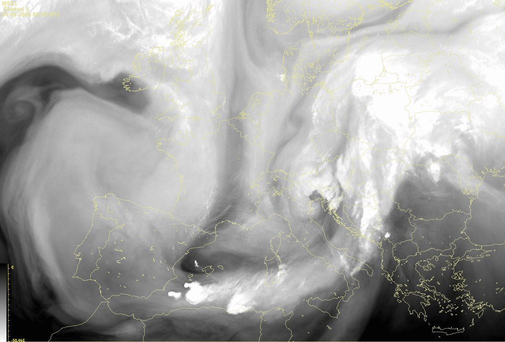
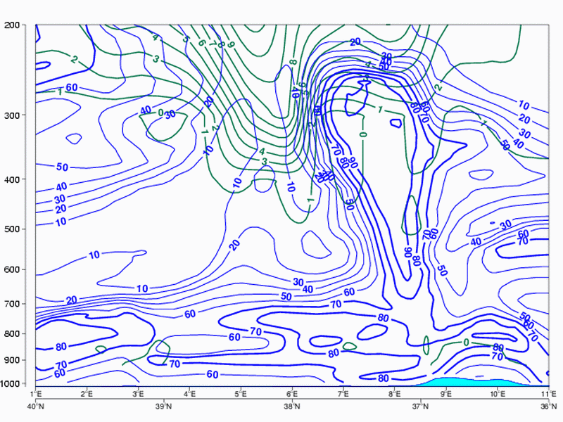
04 August 2006/12.00 UTC - Vertical cross section; dark green: potential vorticity, green thick: vorticity advection - PVA, green
thin: vorticity advection - NVA
|
|
|
At 38N/06E a distinct lowering of the 2 PVU isoline can be seen towards levels of approximately 400 hPa. To the east of the PV anomaly, where there is enhanced convection, a maximum of PVA can be seen at about 300 hPa. To the rear, where the dark stripe is found, there is a pronounced minimum of NVA.
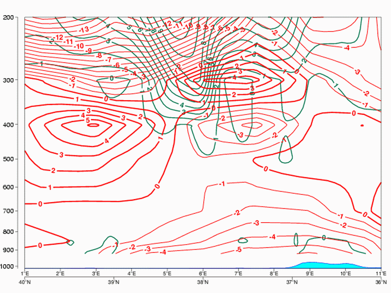
PV and TA
|
|
04 August 2006/12.00 UTC - Vertical cross section; dark green: potential vorticity, red thick: temperature advection - WA, red
thin: temperature advection - CA
|
|
|
At 38N/06E, around the PV anomaly, there is a distinct area cold advection that usually occurs behind the frontal zone. The forward tilt of the cold advection pattern can also be seen.
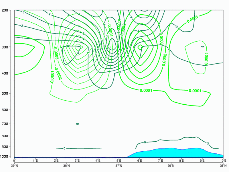
PV and Omega
|
|
04 August 2006/12.00 UTC - Vertical cross section; dark green: potential vorticity, cyan: vertical motion (omega)
|
|
|
The strongest vertical motion can be found at levels where the vertical gradient of vorticity advection shows a maximum.
PV and Relative Humidity
|
|
04 August 2006/12.00 UTC - Vertical cross section; dark green: potential vorticity, blue: relative humidity
|
|
|
Just east of the distinct gradient of isentropes, the values of relative humidity in the lower levels are high, highly increasing the change to the unstable stratification.
Weather Events
The nature of the clouds in this conceptual model is convective, therefore the weather events that occur in connection to them are the same as in other conceptual models describing the convective development, such as Cumulonimbus and Mesoscale convective systems.
For weather events see Cumulonimbus (Cb) And Mesoscale Convective System (MCS) - Weather Events
References
- BLUESTEIN, H. B. (1993): Observations and Theory of Weather Systems, Oxford University Press, New York, 594 pp.
- DAVIS C.A., EMANUEL K.A. (1991): Potential Vorticity Diagnostics of Cyclogenesis; Monthly weather review, Vol 115, p1929-1953.
- HOLTON, J. R., HAYNES, P. H., McINTYRE, M. E., DOUGLAS, A. R., HOOD, R.-B. and PFISTER, L. (1995): Stratosphere-troposphere exchange. Rev. Geophys. 33, 403-439.
- HOLTON, J. R. (2004): An introduction to Dynamic Meteorology. Academic Press, Fourth Edition, London, 535 pp.
- HOSKINS B. J., MCINTYRE M. E. and ROBERTSON A. L. W. (1985): On the use and significance of isentropic potential vorticity maps; Quart. J. R. Meteor. Soc., Vol. 111, p. 877 - 946
- VERKLEY W. (1995): Een scherpere kijk op de atmosfeer. Potentiele vorticiteit; Meteorologica 3-95