4. Differentiate between frontal and non-frontal ARs
ARs originate from tropical marine air masses and are initially not connected to mid-latitude fronts. However, when moving to higher latitudes, they become attracted to the low-pressure systems of the polar front and often end up merging with a cold front.
So, how can we recognize an AR once it has merged with a cold front?
- The cold front shows high values of moisture in lower levels.
- A low-level jet can be identified.
- Winds run parallel to the surface front at lower levels below 700 hPa.
- The cold front is stationary or slowly advancing.
When ARs merge with a cold front, they usually find advantageous conditions such as pre-frontal convergence at lower levels, which increases the water vapour concentration, and stronger temperature and pressure gradients, which increase the low-level jet and the humidity transport.
The difficulty in discerning an AR merged with a cold front comes from the fact that cold fronts typically show high humidity values and stronger winds anyway. However, the characteristics of the AR should be preserved within the lower frontal zone. In such a case we can discern:
- high water vapor content below 700 hPa
- a wind speed maximum or at least an area with higher wind speed below 700 hPa
- a wind direction parallel to the front.
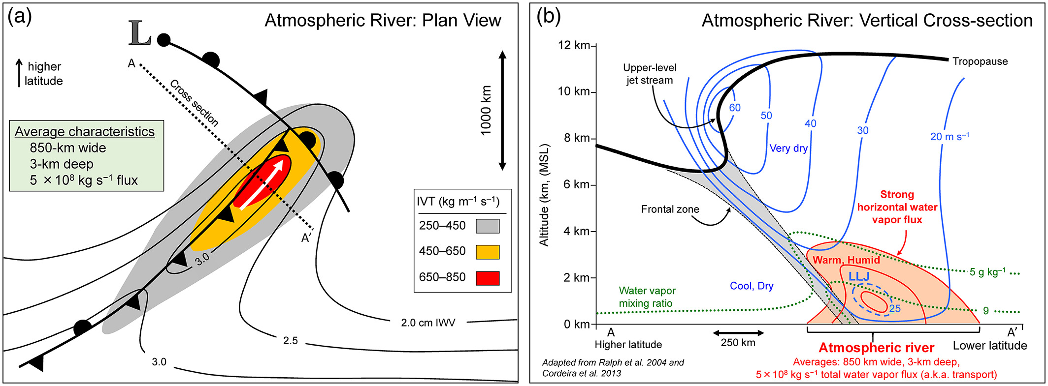
Figure 9: Left: Schematic of Integrated water Vapor Transport (IVT)
Right: Schematic of vertical moisture distribution and the low-level jet (LLJ), © Ralph et al., 2020.
Rapidly progressing cold fronts usually do not preserve the characteristics of an AR as in such a case surface winds tend to be perpendicular to the front, even at lower levels. These types of cold fronts can bring intense winds and heavy showers, but the duration is rather short so that the total amount of precipitation is not very high.
In the next chapter, we will see the impact of an AR when it makes landfall.
Exercise 4:
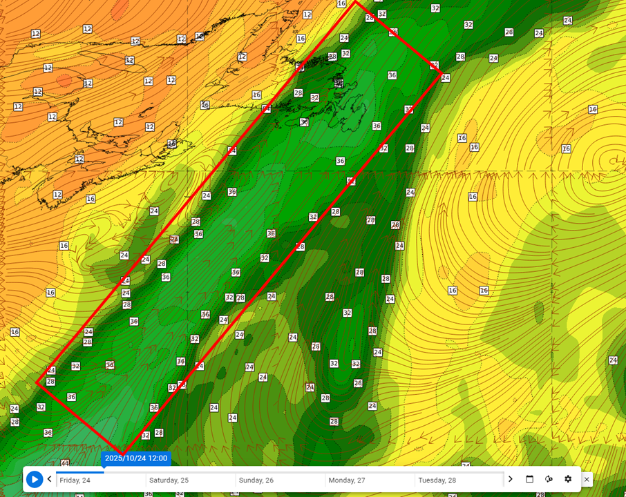
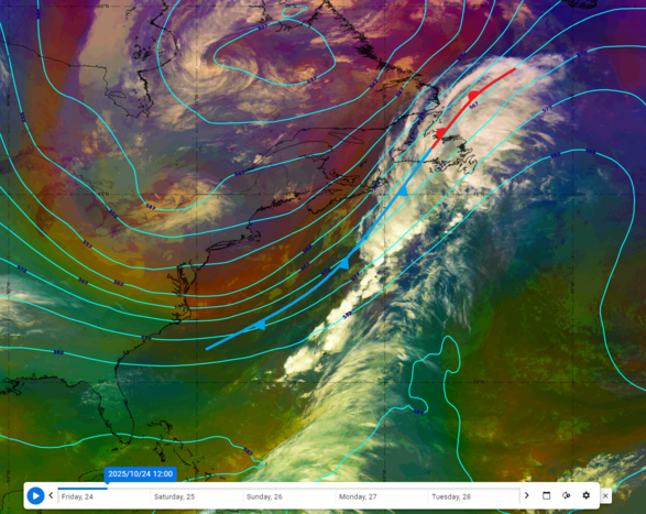
Look at the synoptic situation shown in the Airmass RGB below. You will see a cold front over the Atlantic and high Total Column Water values ahead of it.
Is there an AR merged with the cold front?
|
|
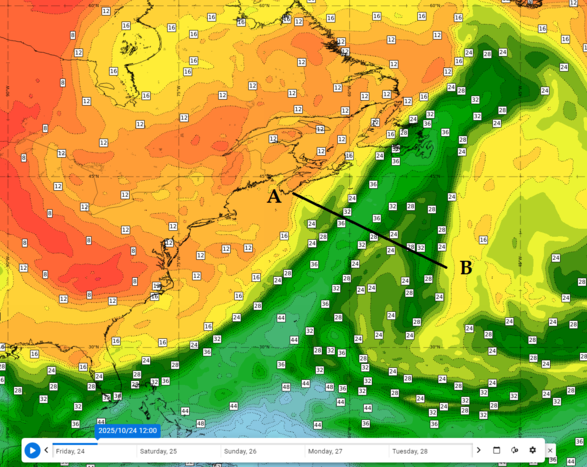
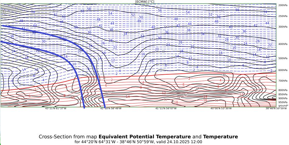
Let's start by identifying the cold front in the cross section. Draw the cold front:
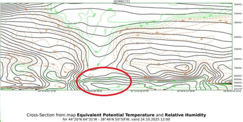
The next step consists of finding the high water vapor amounts ahead of the cold front at lower levels. Circle the AR:
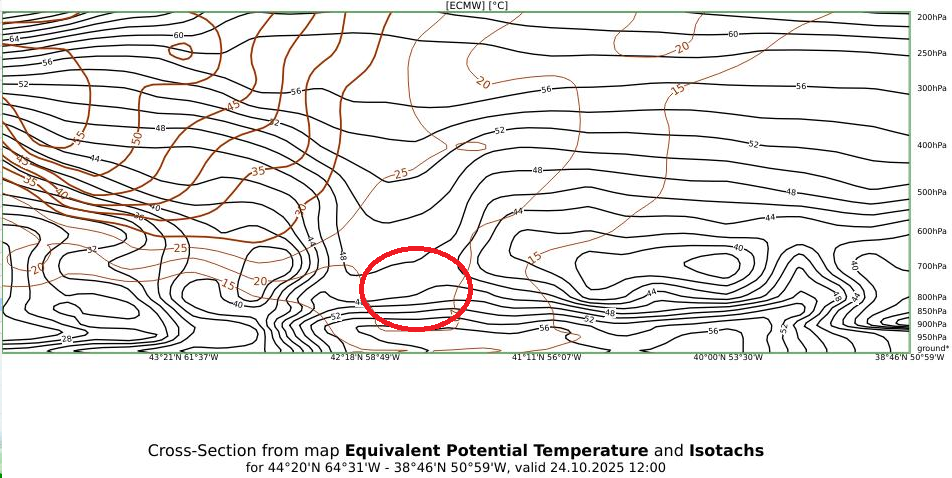
Now let's check the presence of a low-level jet. Circle the low-level jet.
Now you have seen the most important features of a merged AR in the vertical cross section. However, we still have to confirm that the low-level jet runs parallel to the cold front.
As you can see in the image below, the streamlines at 925 hPa do indeed run parallel to the cold front (red box):