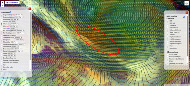
3. Identify the moisture transport
The third step consists of diagnosing the moisture transport. ARs are characterized by high moisture transport along the filament with:
- wind speeds at low levels (a.k.a. low-level jet) of more than 12.5 m/s.
A combination of high water vapor concentration (TCW > 20 mm) and wind speeds of more than 12.5 m/s within the AR results in a moisture transport of more than 250 kg m−1 s−1.
N.B.: 20 mm water = 20 kg m−2 ⟹ 20 kg m−2 * 12.5 m s−1 = 250 kg m−1 s−1
Low-level jets associated with these moisture bands are the result of pressure and/or temperature gradients along the AR. These pressure and temperature gradients are usually weak inside the tropical air mass from where they originate, but they usually become stronger as the AR moves north. However, many of these moisture outbreaks from tropical air masses do not meet favourable conditions to become an AR and dissolve.
When moisture filaments approach the cold front of a mid-latitude cyclone, temperature and pressure gradients usually increase in their vicinity and so does the low-level jet.
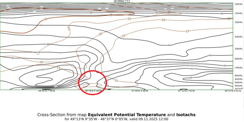
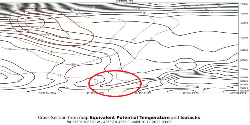
The wind profile in the cross section below shows a low-level jet accompanying the AR indicated by red cross (Figure 8).
Use the slider to compare the two images.
|
|
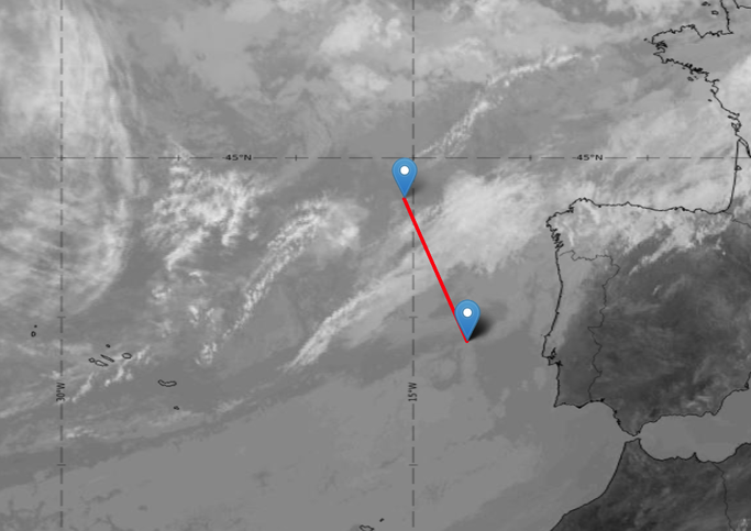
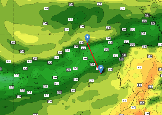
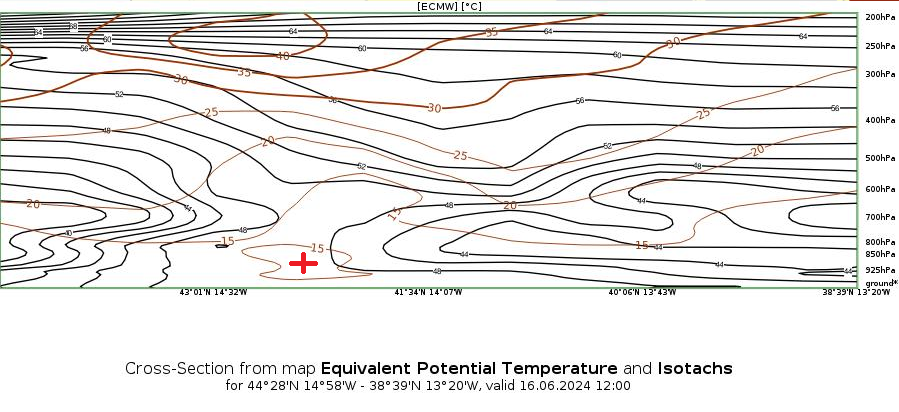
Figure 8: 16 June 2024 at 12:00 UTC.
Top: SEVIRI IR10.8 and TCW from ECMWF. The red line indicates the position of the cross section.
Bottom: Equivalent potential temperature (black) and isotachs (brown) in the cross section through the AR.
After finishing step 3, ARs are detected. However, some ARs merge with cold fronts and then their characteristics are mixed with the features of the cold front.
In the next chapter, you will learn how to recognize ARs that have merged with a cold front.
Exercise 3:
Hover over the image to see the details.
Identify the low-level jet in the data sources provided: