The origin of Atmospheric Rivers
Before we start the identification process, let's have a look at the geographic origins of ARs. Atmospheric Rivers get their initial moisture supply from tropical marine air masses. The boundary layer in tropical regions, especially over oceans, contains huge amounts of water vapor. A warm ocean with warm air above it is the perfect situation for high water vapor concentrations in the lower layers of the atmosphere to occur (Figure 2).
Driven by local winds, water vapor is peeled off the tropical moisture belt at about 15º − 20º latitude and often exists in filamentary form for several days before becoming associated directly with a low-pressure system.
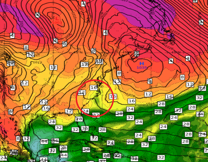
Figure 2: Total Column Water [mm] and Mean Sea Level Pressure [hPa] loop (3 March, 00:00 UTC to 5 March 2025, 00:00 UTC) illustrating the genesis of a moisture band from a tropical air mass. The red circle indicates the starting point of the AR.
This process can be best observed when using the total column water (TCW) products provided by numerical models or from direct measurement by active microwave sensors on board polar orbiting satellites. Figure 3 shows a satellite-derived total precipitable water (TPW) product that combines sounding data from various polar orbiting satellites carrying microwave sensors. The merged data sources are displayed on a global map.
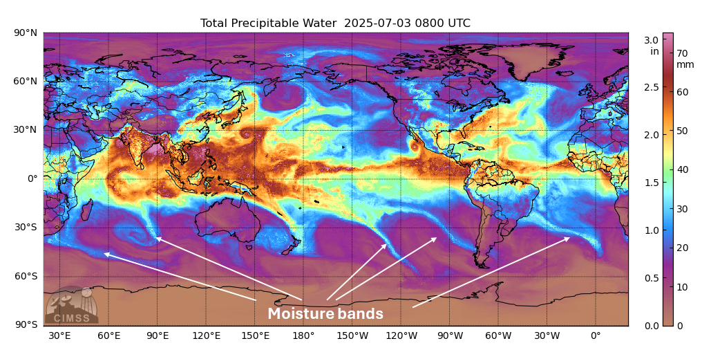
Figure 2: Global view of the Morphed Integrated Microwave Imagery SSMI/SSMIS/AMSR2-derived Total Precipitable Water. © CIMSS
After this short introduction, let's go through the five steps that lead to the classification of an AR.