Areas of application
Detecting very thin cirrus clouds
- Detecting thin cirrus clouds is useful for forecasters; for example, if the satellite images show more cirrus clouds that the numerical model forecast, then the weather forecaster should consider decreasing the daily maximum temperature forecast from the numerical model.
- It can be useful in aviation forecasting; for example, transverse cirrus bands along the jet stream (marked by arrows) indicate possible strong turbulence (Fig. 7.1).
- Detection of very thin cirrus clouds is important for cloud mask retrieval: surface parameters should be retrieved only in cloud-free areas.
- The Cloud Type RGB is useful for visual verification of retrieved cloud masks.
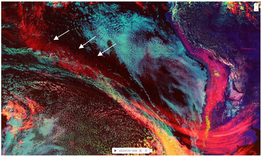
Fig. 7.1: GOES East ABI Cloud Type RGB taken on 01 July 2023 at 18:00 UTC. Transverse cirrus bands along the jet stream are indicated by arrows. (Credit to NOAA)
Detecting dry airmasses
If water clouds appear pinkish/whitish instead of cyan then this is an indicator that the vertically integrated water vapour amount above the cloud top is small. Fig. 7.2 shows examples of this
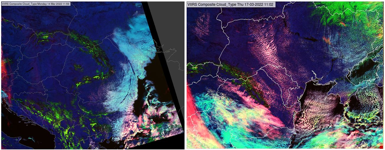
Fig. 7.2: VIIRS Cloud Type RGBs taken on 17 March 2022 at 11:02 UTC (left) and 17 March 2022 at 11:02 UTC (right). (Credit to NOAA)
Detecting supercooled clouds
Supercooled water clouds are a major hazard for aeronautical meteorology, and their detection is very important. Vast stratiform supercooled clouds may endanger airplanes due to icing. Cloud Type RGB (together with other information) may help to detect them. Water clouds appear whitish, pinkish or cyan in Cloud Type RGBs. Relatively high mid-level supercooled clouds typically appear whitish or pinkish. Fig. 4.12b shows an example.
Monitoring convection in developing phase
Looking at Cloud Type RGB animations, lifting processes can be followed, and which towering cumulus clouds have already reached the freezing level (where green colours turn to yellow) can be determined.
Monitoring convection in mature phase
Both Cloud Phase and Cloud Type RGBs can be useful for monitoring mature convection. They provide different information and complement each other.
- The Cloud Phase RGB provides good cloud top microphysics information.
- The Cloud Type RGB is very sensitive to high-level very thin ice clouds
The sensitivity of Cloud Type RGB to thin ice clouds may help in monitoring mature convection, due to the excellent colour contrast between the storm core and the thin edge of the anvil. Convective clouds are really eye- catching in the Cloud Type RGB. In Fig. 7.3 one can see how more details of the anvil edge (indicated by white arrows) may be seen in the Cloud Type RGB. On the other hand, the Cloud Phase RGB provides more information about the thick part of the storm top: overshooting tops can be seen (red arrow), which are (almost) not seen in the Cloud Type RGB. The Cloud Phase RGB provides also cloud top particle size information (younger cells are covered by smaller ice crystals).
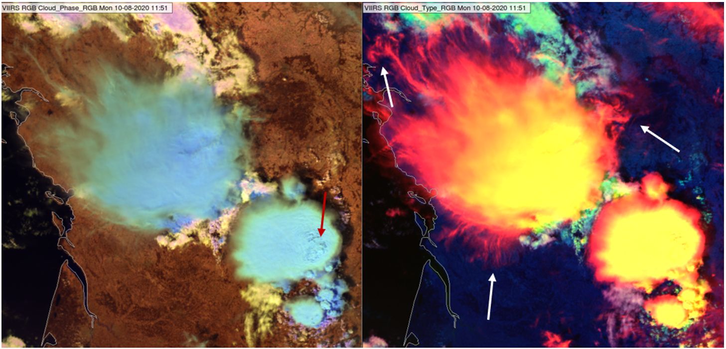
Fig. 7.3: VIIRS Cloud Phase RGB (left) and Cloud Type RGB (right) from 30 August 2020, 11:27 UTC. (Credit to NOAA)
The excellent colour contrast between the storm core and the more detailed thin edge of the anvil can help to determine the wind direction at the anvil level more easily. The anvil is elongated in the downwind direction.
Identifying fog or low clouds above snow
Fog/stratus often forms above snowy areas. It appears cyan, while snow appears green, in the Cloud Type RGB. The colour contrast between them can be rather good if the fog/stratus appears bluish cyan (smaller droplets) but is less good if it consists of larger droplets, which appear greenish cyan. Sometimes they can still be differentiated because of the different structure. Fig. 7.4 shows a situation that demonstrates this. The Cloud Phase RGB is also presented to help show the cloud top microphysics. For larger cloud top droplets, the cloud appears greenish cyan, but the clouds can still be differentiated from snowy areas.
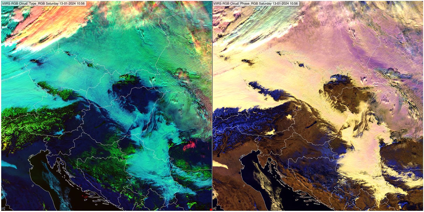
Fig. 7.4: VIIRS Cloud Type RGB (left) and Cloud Phase RGB (right) taken on 13 January 2024 at 10:56 UTC. (Credit to NOAA)
Cloud Type classification
The Cloud Type RGB helps in the visual differentiation of cloud types, see for example Figs. 4.23 and 8.1. It mostly works well for cloud type differentiation in moist atmospheres. The colours of the following features are (most often) different:
- (snow-free) surface,
- low/mid clouds and
- high clouds.
The cloud type differentiation is sometimes problematic. The relationship between cloud/surface classes and colours is ambiguous; different cloud types may appear the same colour and the same cloud type may appear in different colours.