Introduction
During 07-10 January 2021, a winter storm produced a significant 30-50 cm snow depth over large parts of Spain (Strelec Mahović et al., 2021). We studied this snow cover over the following ten days in VIIRS Cloud Phase RGB images. The Cloud Phase RGB is a composite image, which will also be available with data from the future Meteosat Third Generation (MTG) imager.
One of the new channels of the imager on MTG satellites will be the 2.25 μm near-infrared channel (NIR2.25). This channel was used to develop the Cloud Phase RGB. The primary aim of this RGB is to provide a more accurate representation of cloud microphysics (distinguishing water and ice clouds, characterizing the average particle size at the cloud top) (Kerkmann, 2018; Rosenfeld, 2016; Putsay, 2020). The present study demonstrates that this RGB is sensitive not only to the cloud top particle size, but also to the grain size of the snow on the surface.
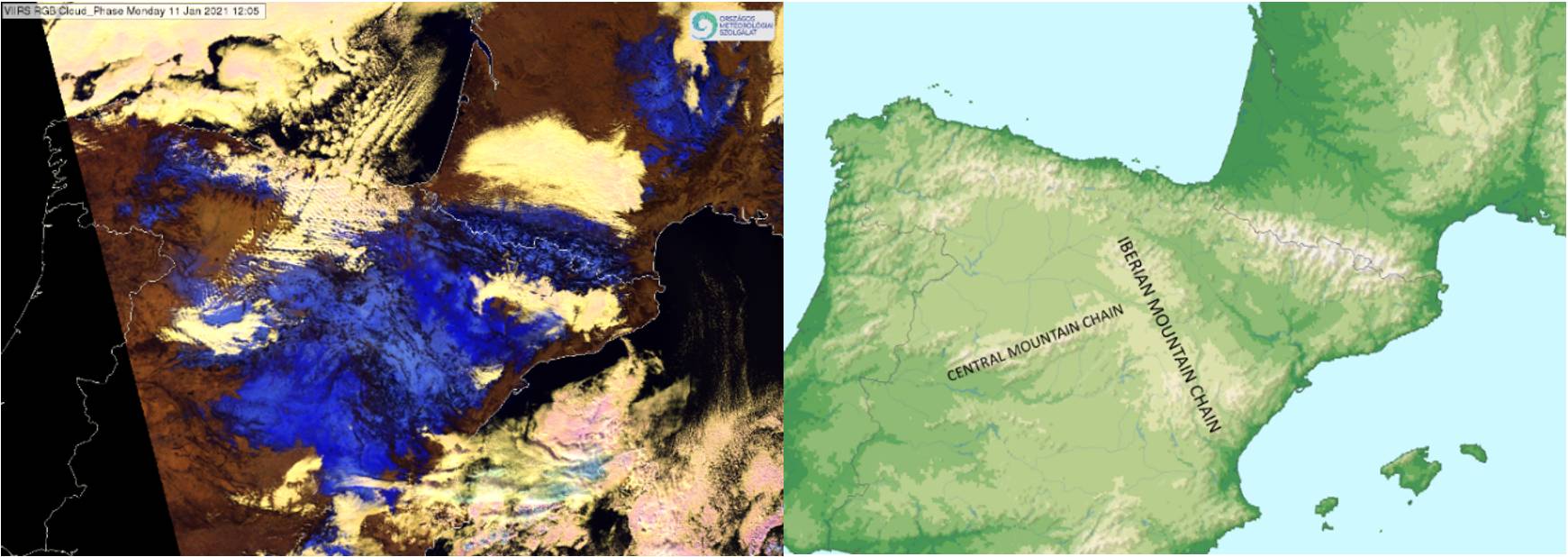
Figure 1 shows a VIIRS Cloud Phase RGB image and a relief map of Spain. The RGB image was taken on 11 January 2021, which was the first mostly cloud-free day after the winter storm. Due to the large amount of fresh snow, it is very likely that this day the snow cover was mainly continuous and fine (small grain size) first of all in the mountain region, where the temperature was low.
Figure 1: left: NOAA-20 VIIRS Cloud Phase RGB, 11 January 2021 12:05 UTC; right: relief map of Spain.
In Cloud Phase RGB images, snow usually appears medium to dark blue. In the case presented here, the snowy area appears in a rather wide range of blue shades: from dark blue (in the valleys) to almost light blue (in the Iberian Mountain Chain). The reason for this inhomogeneity is investigated in the present study.
