The question we try to answer here is: Why do we have lifting air masses at the leading edge of an approaching trough?
Let us first examine the forces that act on an air stream in the upper troposphere. Without frictional forces, pressure gradient and Coriolis force compensate each other; this is the so-called geostrophic balance. This geostrophic balance is usually accomplished at jet level. In case of a curved flow, centrifugal forces disturb the geostrophic balance.
Presumed that pressure gradient force remains constant along its way, in case of a cyclonic curvature, the speed of the air parcel in this flow has to decrease in order to balance with Coriolis and centrifugal forces. This is usually the case at the southern tip of an upper-level trough. Hence, wind speed convergence is strongest shortly before the trough axis. This upper-level convergence leads to low-level divergence (see figure 1). Vice versa, on the leading edge of the trough, curvature decreases and wind speed increases. This causes upper-level divergence followed by low-level convergence.
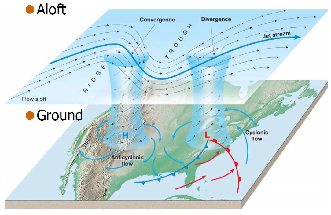
Figure 1: Typical positions of upper-level convergence and divergence in a trough. © Lutgens, F.K. and E.J. Tarbuck
The strength of upper-level divergence on the eastern flank of a short-wave trough is influence by:
- The amplitude of the short-wave trough (the shorter the wave, the stronger the divergence)
- The wind speed at 300 hPa (the higher the wind speed, the stronger the divergence)
- The wind shear (the higher the shear, the stronger the divergence)
- The wavelength of the trough (the shorter the wave length, the stronger the divergence)
We can also look at vertical motion induced by an approaching trough with help of the cyclonic vorticity advection (CVA). But, why do we use vorticity advection to describe vertical motion? Because the vertical variation of CVA is one component of the ω-equation that describes vertical motion in the atmosphere. If we consider a quasi-geostrophic flow (no friction nor diabatic heating), the omega-equation can be written as:
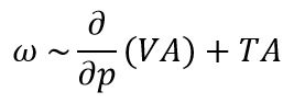
Where ω stands for the vertical motion, VA stands for the vorticity advection and TA for temperature advection.
The first term describes vertical motion induced by the variation of vorticity advection with height. Since the vorticity is proportional to the wind speed, we get higher vorticity values in upper levels as wind speed usually increases with height (jet stream). In practice, a vertical increase (decrease) of CVA results in rising (descending) air. Vice versa, a vertical increase (decrease) of negative vorticity advection results in descending (rising) air.
The second term describes vertical motion due to temperature advection. Warm air advection induces rising air, while cold air advection results in sinking air masses.
On a global scale (e.g., Rossby waves), troughs are associated with high cyclonic vorticity while ridges are associated with anticyclonic vorticity (see figure 2). An air parcel moving along a Rossby wave will advect cyclonic vorticity (Positive VA on the northern hemisphere) when moving northward along the eastern side of the trough and advect anticyclonic vorticity (Negative VA on the northern hemisphere) when moving south along the rear edge of the trough. The increase of PVA or NVA with height results from higher wind speeds at jet level compared to the ground.
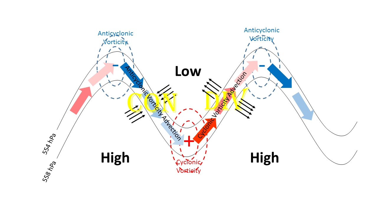
Figure 2: Vorticity and vorticity advection at jet level along a Rossby wave.
N.B.:
Positive/cyclonic vorticity advection (increasing with height) creates horizontal divergence near the tropopause and convergence near the ground. Vice versa, negative/anticyclonic vorticity advection at jet level produces convergence aloft and divergence near the ground.