The Role of Cyclonic Vorticity Advection
Upper-level divergence and convergence is closely connected to the vertical motion of the air column below. As it is difficult to determine upper-level divergence, meteorologists use the concept of vorticity advection to describe this phenomenon.
Vertical motion and vorticity advection (more precisely, the vertical increase of vorticity advection) are closely connected via the omega equation:
- Positive (cyclonic) vorticity advection that increases with height is an indicator of rising air masses
- Negative (anticyclonic) vorticity advection that increases with height is an indicator of descending air masses
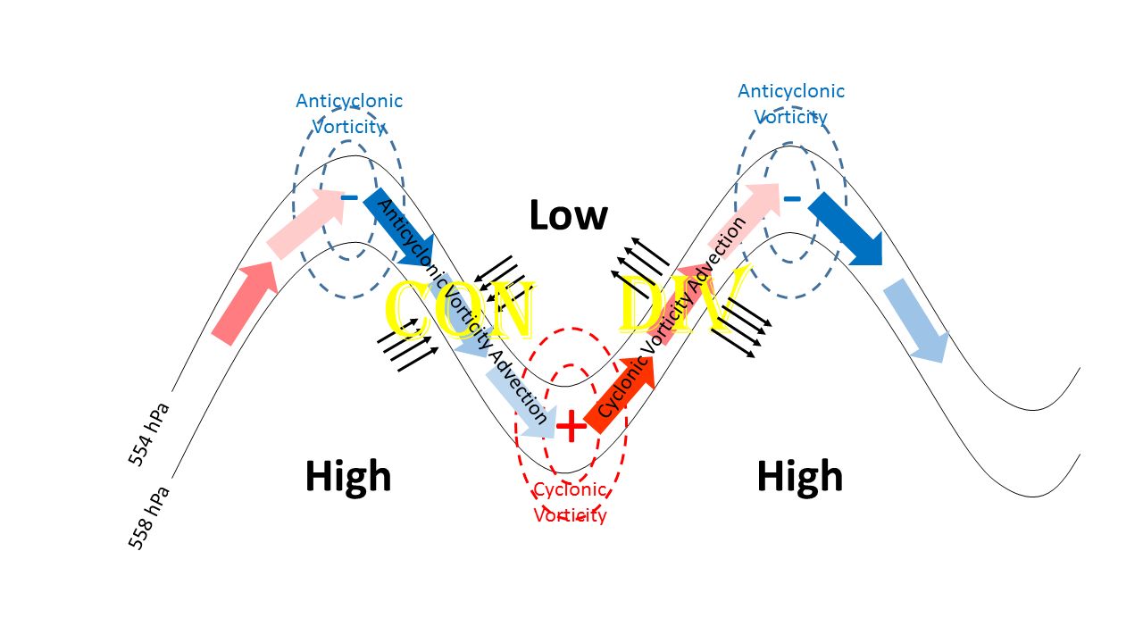
On a global scale (e.g. Rossby waves), troughs are associated with cyclonic vorticity at upper-levels, while ridges are associated with anticyclonic vorticity (see Figure 1 below). An air parcel moving along a Rossby wave will thus advect cyclonic vorticity (PVA in the northern hemisphere) when moving northward along the eastern side of the trough, and advect anticyclonic vorticity (NVA in the northern hemisphere) when moving southward along the rear side of the trough. The increase of PVA or NVA with height results from higher wind speeds at jet level compared to the ground.
Figure 1: Vorticity and vorticity advection at jet level along Rossby waves
Note:
Positive/cyclonic vorticity advection (increasing with height) creates horizontal divergence near the tropopause and convergence near the ground. Conversely, negative/anticyclonic vorticity advection at jet level produces convergence aloft and divergence near the ground.
