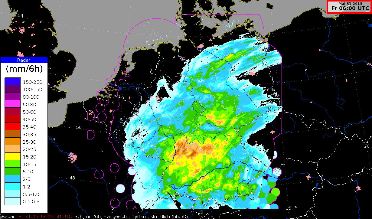
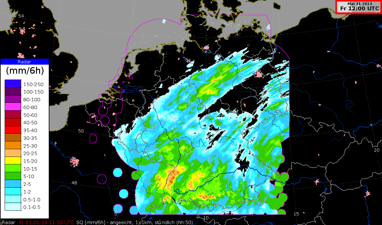
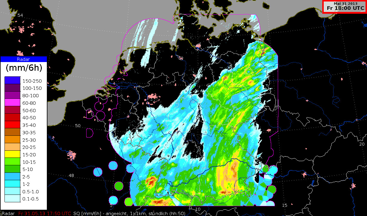
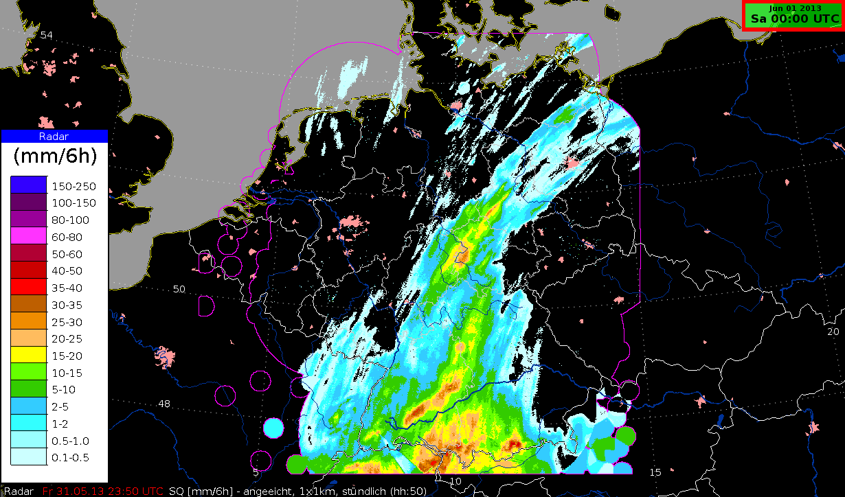
Composite image "SQ" with calibrated radar values in mm per 6 hours
Radar measurements can be improved by combining them with data from ca. 1000 ombrometer stations in Germany. Together they provide accurate results, measured in mm, every 6 hours. This data forms the basis of flood forecasts in Germany.
Shown here is a summary of the six hours before the image's timestamp. The movement of the cells is typical for these images and it serves to indicate wind direction.