Global maps of Land Surface Temperature composites from MODIS
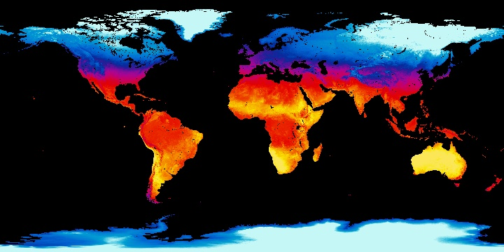
Fig. 31: Average monthly daytime land surface temperatures for December 2001 from MODIS. Source: http://neo.sci.gsfc.nasa.gov/view.php?datasetId=MOD_LSTD_CLIM_M
Instrument:Moderate Resolution Imaging Spectroradiometer (MODIS) on board the Terra satellite
Target accuracy: 1 K
Algorithm: Generalized split-window
Spatial coverage: global
Temporal frequency: Daytime and nighttime LSTs composites. 8 days and monthly daytime or nighttime LST composite products are also produced by averaging daily daytime or daily nighttime LST values, respectively.
Spatial resolution: 1 km
Projection: Stereographic
File format: JPEG, PNG, Google Earth, and GeoTIF
Archive data: 2001-2010
Data producers: MODIS team
Products available at http://neo.sci.gsfc.nasa.gov/view.php?datasetId=MOD_LSTD_CLIM_M