Lee Waves And Convection
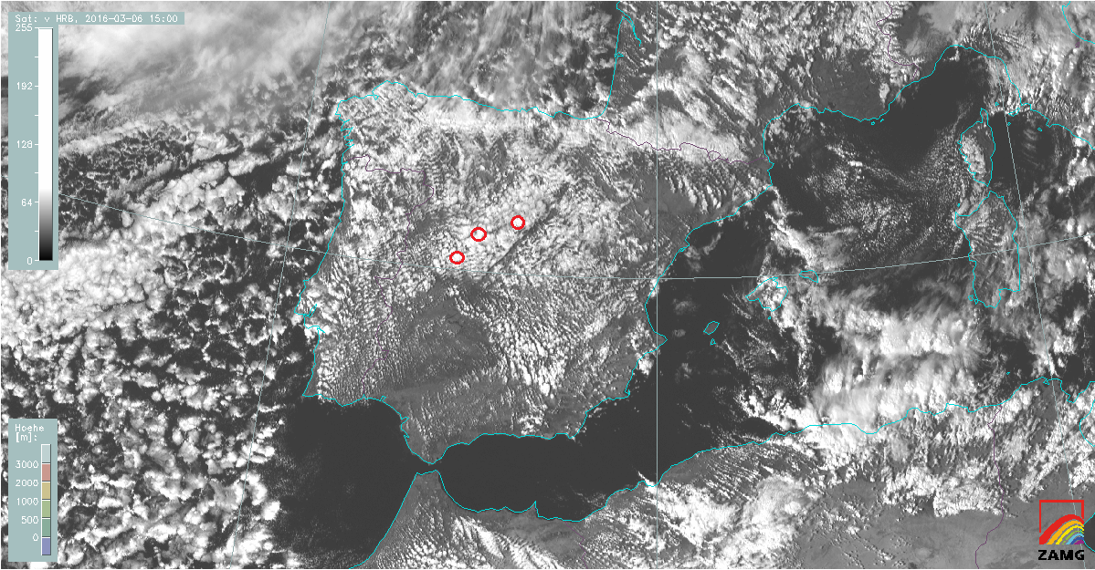
Atmospheric lee waves may also act as a trigger for convection. The vertically lifted air at the wave crest is cooled adiabatically, but at the same time, when cloud droplets form, latent heat is released. In a potentially unstable stratification of the surrounding air, this little extra heat can be crucial for initiating convection. Cloud lines mark the wave crests of the atmospheric gravity waves all over the Iberian Peninsula. At some locations further downstream, the HRV satellite image shows convective cells instead of thin cloud lines (red circles in figure 5). These are the regions where convective initiation takes place.
Figure 5: MSG SEVIRI image (HRV) from 6 March, 2016 at 15:00 UTC. The red circle points out some of the many convective cells initiated by atmospheric gravity waves. For the image loop click here.
It is sometimes difficult from the satellite perspective to discern whether the reason for convection is orography or gravity waves or both. In general, orographic convection is attached to a fixed place (windward side of the mountain) while convective initiation in lee waves moves downstream. In the image loop above (figure 5) both cloud types can be observed on the northwestern part of the Iberian Peninsula: stationary lee clouds and convective cloud cells moving southeast.
Severe convection usually acts as inhibitor to the propagation of gravity waves. While shallow convection (cumulus humilis) will not influence the wave propagation much, deep convection stops this process completely.
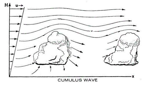
On the other hand, shallow convection is able to trigger so-called thermal waves. The vertical pulse of rising air acts similarly to a mountain barrier and obliges the air stream either to pass over the cumulus cloud or around it (figure 6).
Figure 6: Schematic illustrating how shallow convection initiates thermal waves (WMO, 1978).
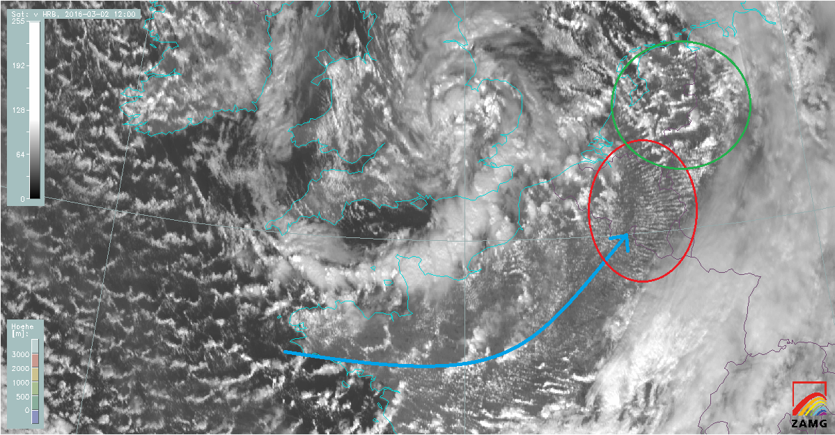
This effect is often visible when cold stable air arrives over flat warm land. Shallow cumulus convection starts to appear soon and takes on a wave like pattern. The HRV image below shows thermal waves (figure 7, red circle) above the Benelux in the cold Atlantic air behind a cold front. When convection gets stronger, the wave pattern disappears (figure 7, green circle).
Figure 7: MSG HR-VIS image from 2 March, 2016 at 12:00 UTC. The blue arrow shows the main wind direction.


