Burnt Area Gallery
Next
we will present you with some example cases form Europe on the detection of burnt
areas using the MODIS satellite. The cases are from NASA's Earth Observatory
website.
First, in the Côte d'Azur in France, there is a burnt area within the black rectangle.
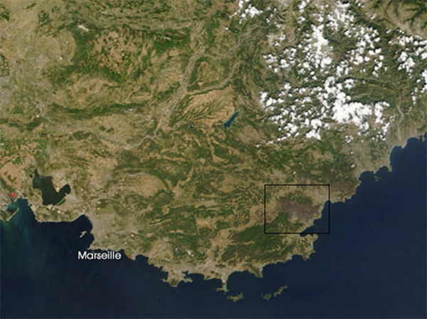
Fig 5.36 - MODIS image on 28 July 2003 from NASA´s TERRA satellite.
The brownish shade east of Marseille is due to the decreased albedo resulting from the fires.
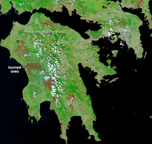
Fig 5.37 - MODIS image on 28 July 2003 from NASA´s AQUA satellite.
A
slightly older example shows the aftermath of the fires that raged over
Greece during the hot summer in 2003. Brownish areas depicting the burned
regions can be identified all over the Peloponnesian
Peninsula, as well as north of Athens. This MODIS RGB image with a 250 m spatial
resolution is composed of a combination of visible and infrared
bands (2.155 nm/876 nm/670 nm).
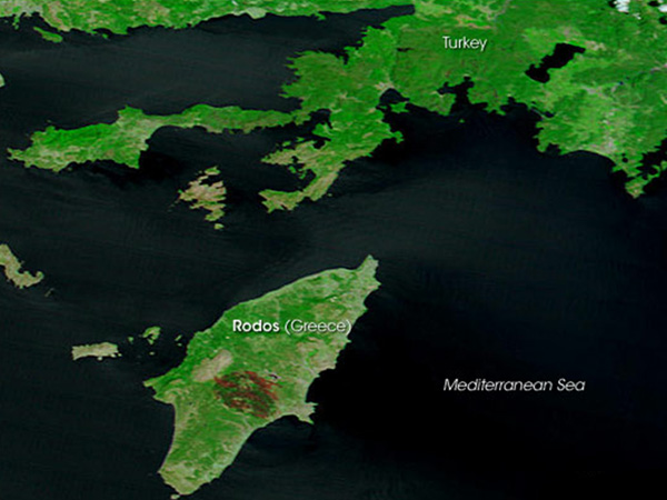
Fig 5.38 - MODIS image on 29 July 2008 from NASA´s TERRA satellite.
A shot of the island of Rhodes from the summer of 2008. The large burnt area in the middle of the island is easily recognizable.
The burnt areas show as brown in the colored image. This RGB image
with a 250 m spatial resolution is composed of a combination of visible
and infrared bands (2.155 nm/876 nm/670 nm).
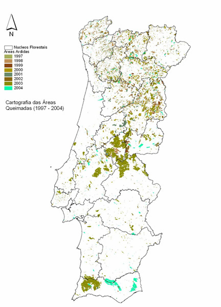
Fig 5.39 - A map of burnt areas over Portugal between 1997 and 2004.
This
map of Portugal was obtained with the AVHRR sensor onboard the NOAA
satellites between 1997 and 2004, and it shows the burnt areas. Each color
corresponds to a different year according to the color code in the top
left corner of the image.
The summer of 2003 with its deadly heat wave and the effect it
had on the wildfires in Portugal was already mentioned in the introduction of this training
module. The severity of
that summer's situation is clearly shown by all the
brown color.

Did you know that fires may originate an albedo seasonal change?
Yes,
scientists believe that fires in Africa may modify the natural
vegetation cycle, which is usually driven by the precipitation regime
related to the north-south migration of the Intertropical Convergence
Zone [ITCZ].
The explanation lies in the following:
The
albedo of open land is generally higher than forested land. Due to ITCZ
migration, maximum albedo values are usually reached at the end of the
dry season (April/May) and minimum albedo values are usually reached at
the end of the wet season (October). In other words, this means that
vegetation removal due to drought events originates an increase in the
albedo. It is also well know that a high albedo value causes a
radiative sink for the atmosphere near the surface, affecting the
surface energy balance and suppressing moisture and precipitation.
On
the other hand, fires originate surface darkening. In Africa, this
darkening has been proved to increase the radiation absorption at the
surface, excluding situations when smoke and aerosol are present in the
atmosphere. Scientists believe that this increase of absorption at the
surface is likely to strengthen convective activity. Therefore, it is
considered that processes of albedo change due to fires should even be
included in climate modelling for Africa.