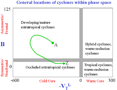
Understanding the Phase Diagram – Cyclone Phase
|
|
The vertical axis of the phase diagram is represented by the parameter "B".
The horizontal axis of the phase diagram is represented by the parameter "-VTL".
Four generic quadrants of cyclone type result:
Frontal/asymmetric warm-core [TR]
Nonfrontal/asymmetric warm-core [BR]
Nonfrontal/symmetric cold-core [BL]
Frontal/asymmetric cold-core [TL]
The conventional types of cyclones can be labeled within the phase space, although past and current research have shown there are no hard boundaries between each of the cyclone types. The full cyclone lifecycle (past, current, and/or forecast) can be plotted within the phase space (note schematic green arrow in example to the left).
The start of the cyclone in the online database is labeled by 'A' and the end of the cyclone in the online database (end of forecast time, or decay, whichever is reached first), is labeled by 'Z'.
Below is a sample of Phase diagrams for cyclones that occured during 2005.
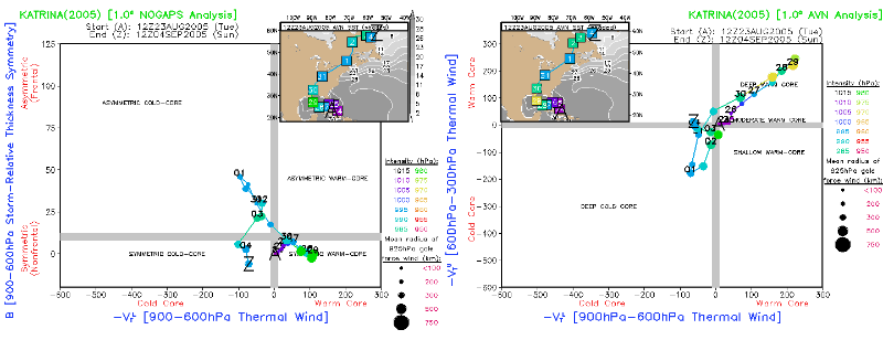
Hurricane Katrina:- Formed as a warm cored system about 175 miles southeast of Nassau in the Bahamas on 23 August. It became a tropical storm the following day. Katrina became a category 1 Hurricane during the evening of 25 August 2005 .
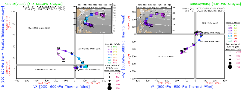
Extratropically transitioning typhoon that dissipates after transition.
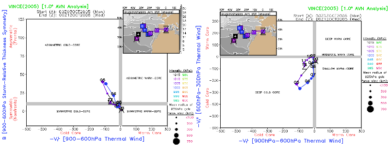
Vince the first known tropical cyclone to make landfall in Spain developed from a non-tropical area of low pressure in the Eastern Atlantic gradually acquiring tropical characteristics and becoming a tropical storm on 9 October about 515 miles East-southeast of the Azores.