Types of icing
There are two types of icing: rime formation and clear ice formation.
Rime ice (opaque, rough-skinned frozen particles) forms when droplets freeze rapidly upon striking the leading edge of wings and other exposed parts of the airframe. Rime occurs most often in temperatures between -1°C and -12°C, but rime icing also occurs with greater frequency than other ice types at temperatures colder than -15°C. Although rime is the most common type of icing, it is regarded as the least serious since it can be fought off (when foreseen) with deicing.
In a clear ice formation, only a small portion of the drop freezes immediately while the remaining unfrozen portion flows or smears over the aircraft surface, freezing gradually. Clear icing conditions exist more often in an environment with high liquid water contents and large droplets. It occurs mainly in temperatures between -0°C and -10°C. Clear icing is a more hazardous type of ice than rime.
Droplet size affects the collection of drops by the airframe. Small droplets tend to impact the airfoil near the plane's leading edge. Larger drops can impact farther back.
Because deicing and anti-icing devices are typically located near the forward edges of airfoils, ice that forms farther back on the airfoil is difficult to remove.
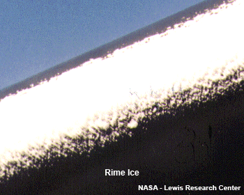
Fig. 2.2.a. Rime ice on a wing of an aeroplane (NASA - Lewis Research Center)
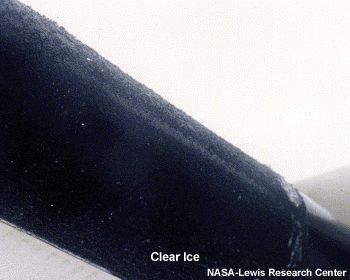
2.2.b. Clear ice on a wing of an aeroplane ((NASA - Lewis Research Center)
A type of clear icing that is particularly dangerous to flight operations is ice formed from supercooled large drops (SLD). This icing occurs in conditions of freezing rain or freezing drizzle.
SLD are water droplets persisting in subfreezing temperatures with a diameter greater than 40 microns. SLD include freezing drizzle (diameters 40…200 µm) and freezing rain (diameters greater than 200 µm).
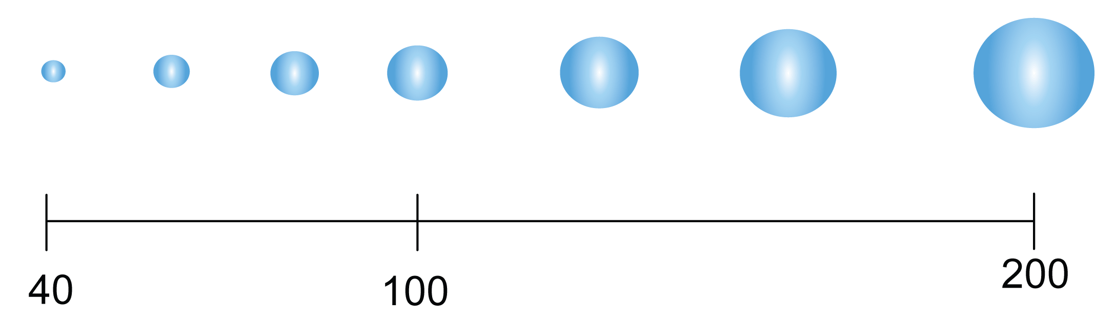
Fig. 2.3. Relative droplet sizes in microns
Icing can also consist of mixed rime and clear ice (the most uncommon type).
The icing process is also related to the concentration of aerosols acting as condensation nuclei within the prevailing air mass. In a maritime air mass the air contains few aerosols, which means that large supercooled drops can form. Continental air contains a lot of aerosols, which is favorable for the formation of a great number of small droplets. On the other hand, continental air can be relatively clean as well, if it has been "washed" by precipitation.
SLD can be formed in two ways:
- warm layer process: ice melts and the water drops fall through a layer with below-zero temperatures, becoming supercooled
- collision-coalescence: droplet growth
In either case the presence of freezing precipitation at the surface is a good indicator of SLD aloft.
SLD formation processes:
Fig. 2.4. Animated SLD formation by the warm layer process
Collision-coalescence:
Fig. 2.5. SLD formation by the collision-coalescence process
Typical synoptic situations for icing
Most supercooled large drops with a diameter of over 100 μm develop via the collision-coalescence process. The typical environment for that process is a strong inversion above a stratiform cloud.
SLD and freezing drizzle in particular tend to occur when a saturated, gradually rising air mass coincides with relatively warm cloud tops (around -12 °C). Likely regions include:
- Ahead of warm fronts
- Behind low pressure centers, connected with occluded fronts
- Post-frontal upslopes
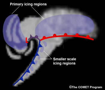
Fig.2.6. Typical locations of SLD in a mid-latitude cyclone
In mid-latitude areas the strongest icing occurs with drops larger than 200µm,
which usually occur in the wake of cold fronts.
In high latitudes drops between 100 and 200μm mostly occur ahead of warm fronts or warm occlusions, which dominate situations in high latitudes, where freezing rain is rarely observed elsewhere than ahead of warm fronts.