Models and forecasts
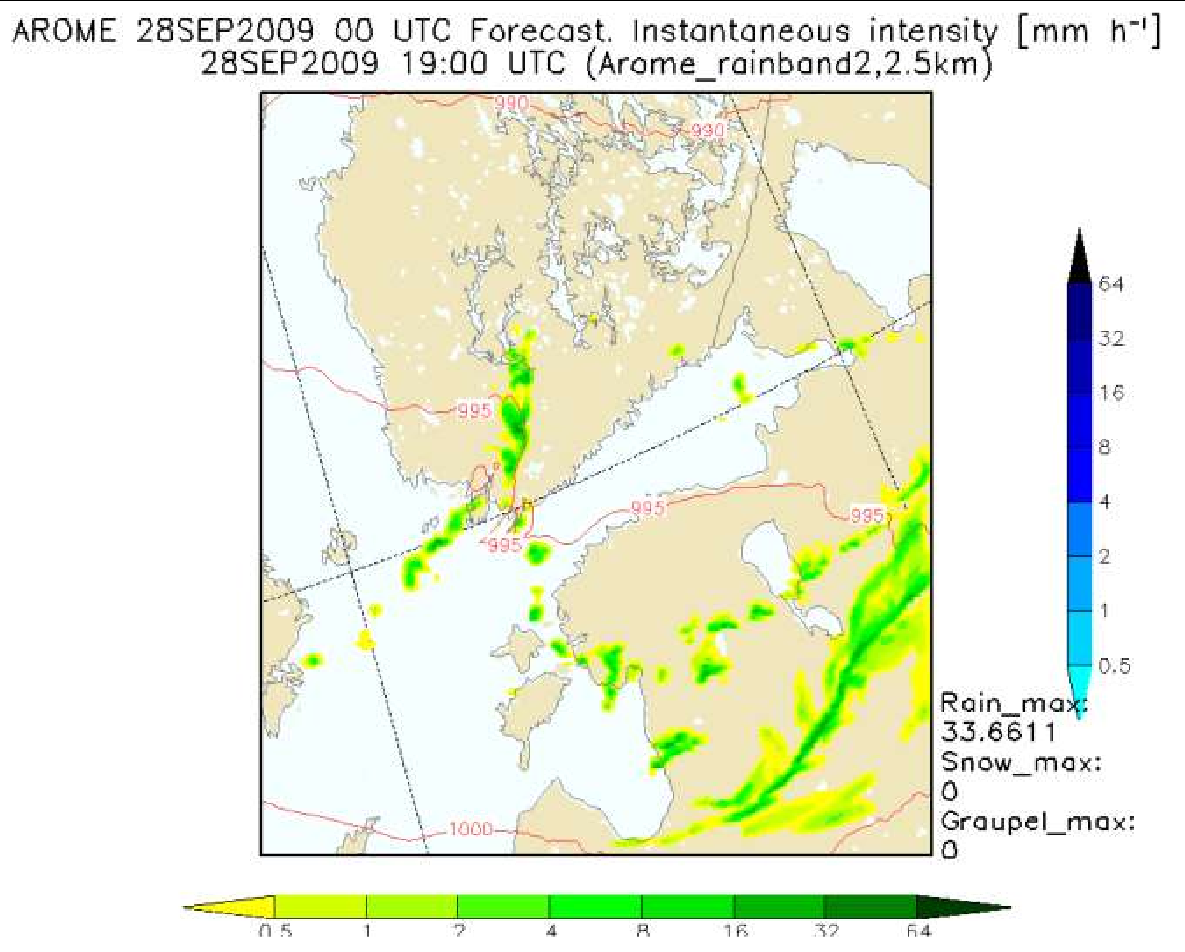
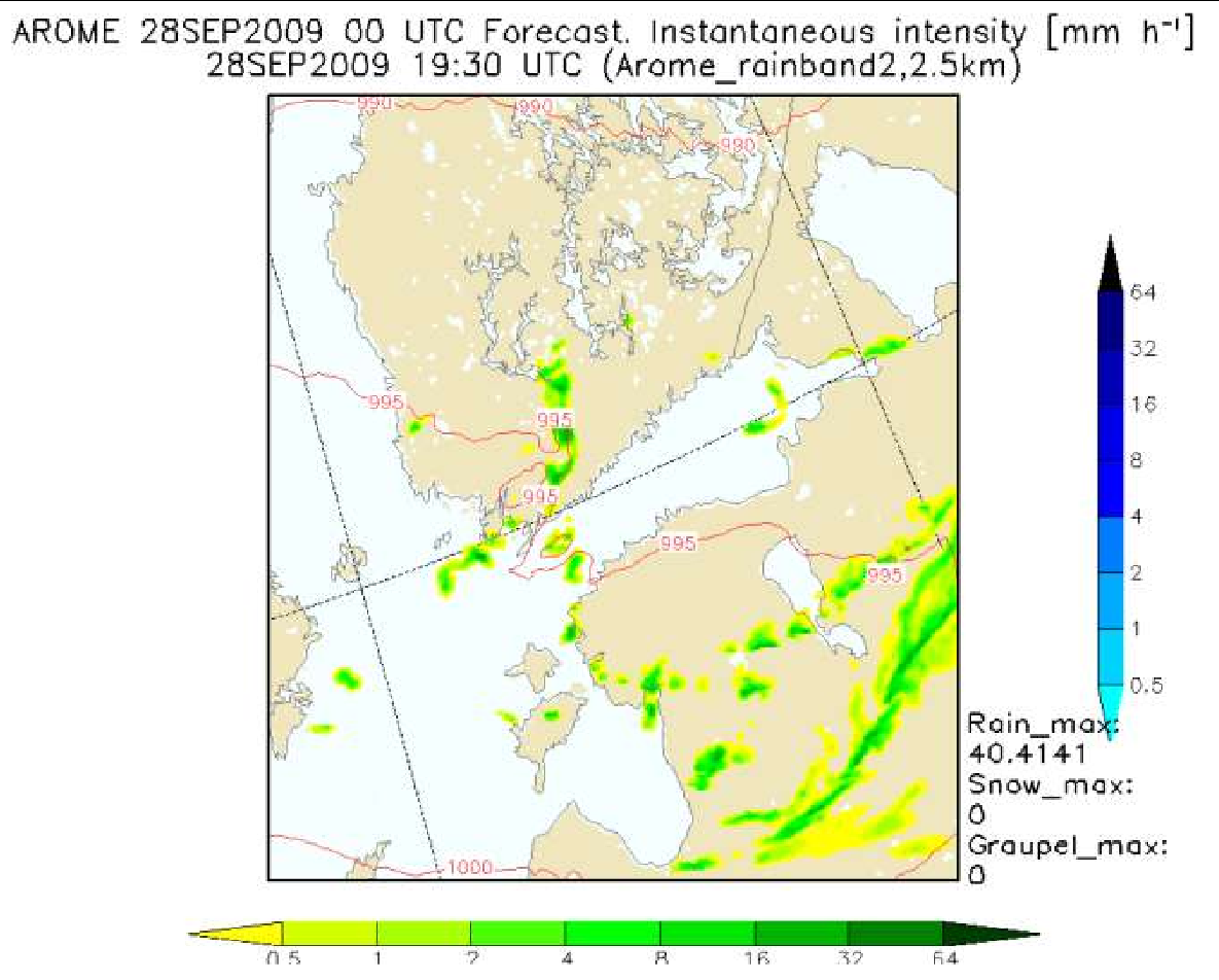
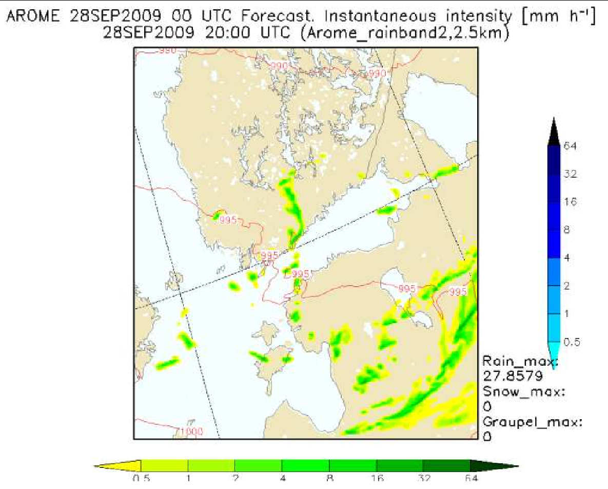
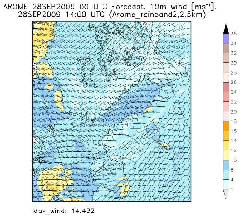
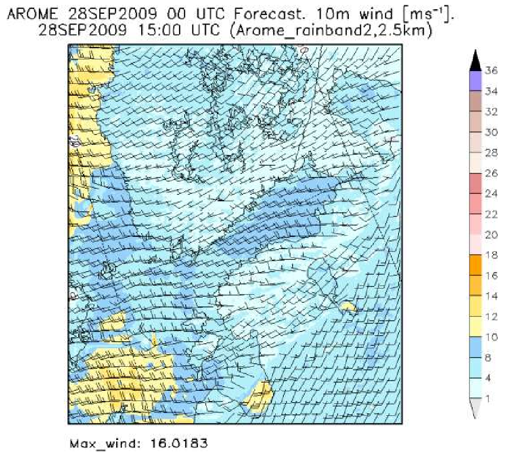
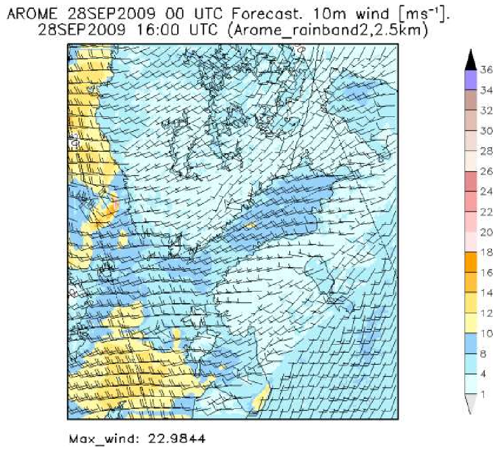
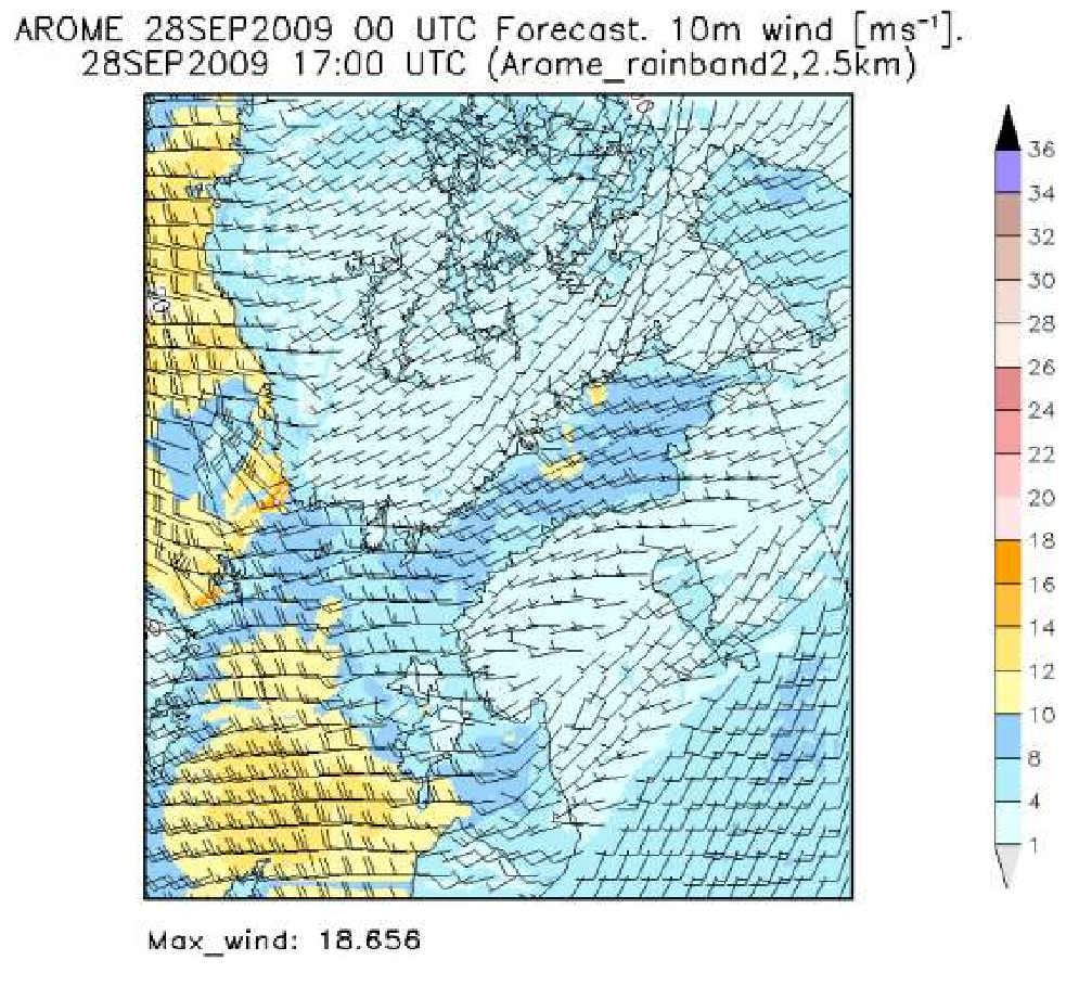
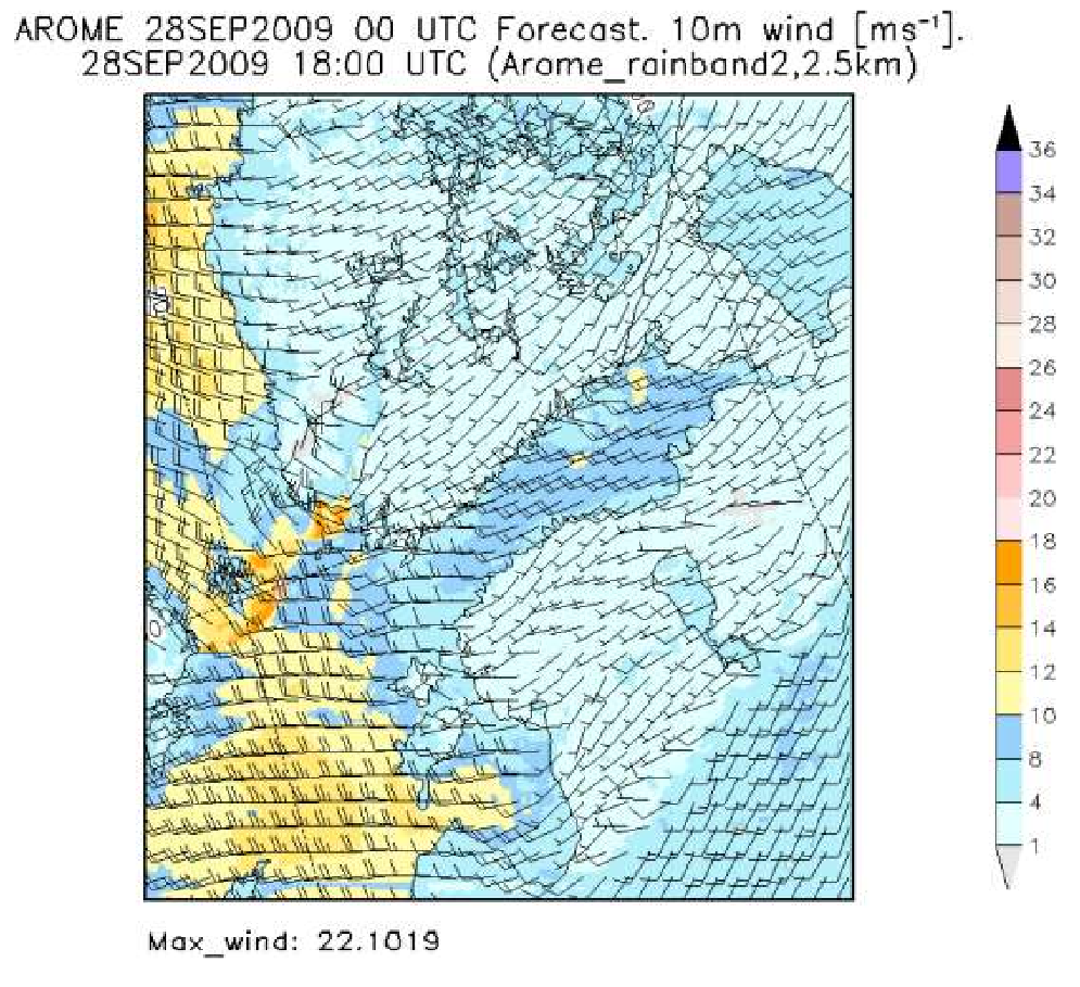
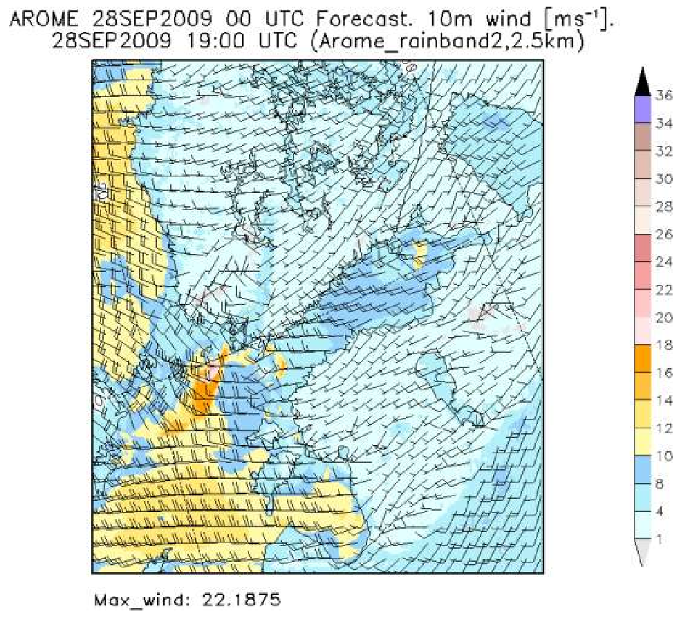
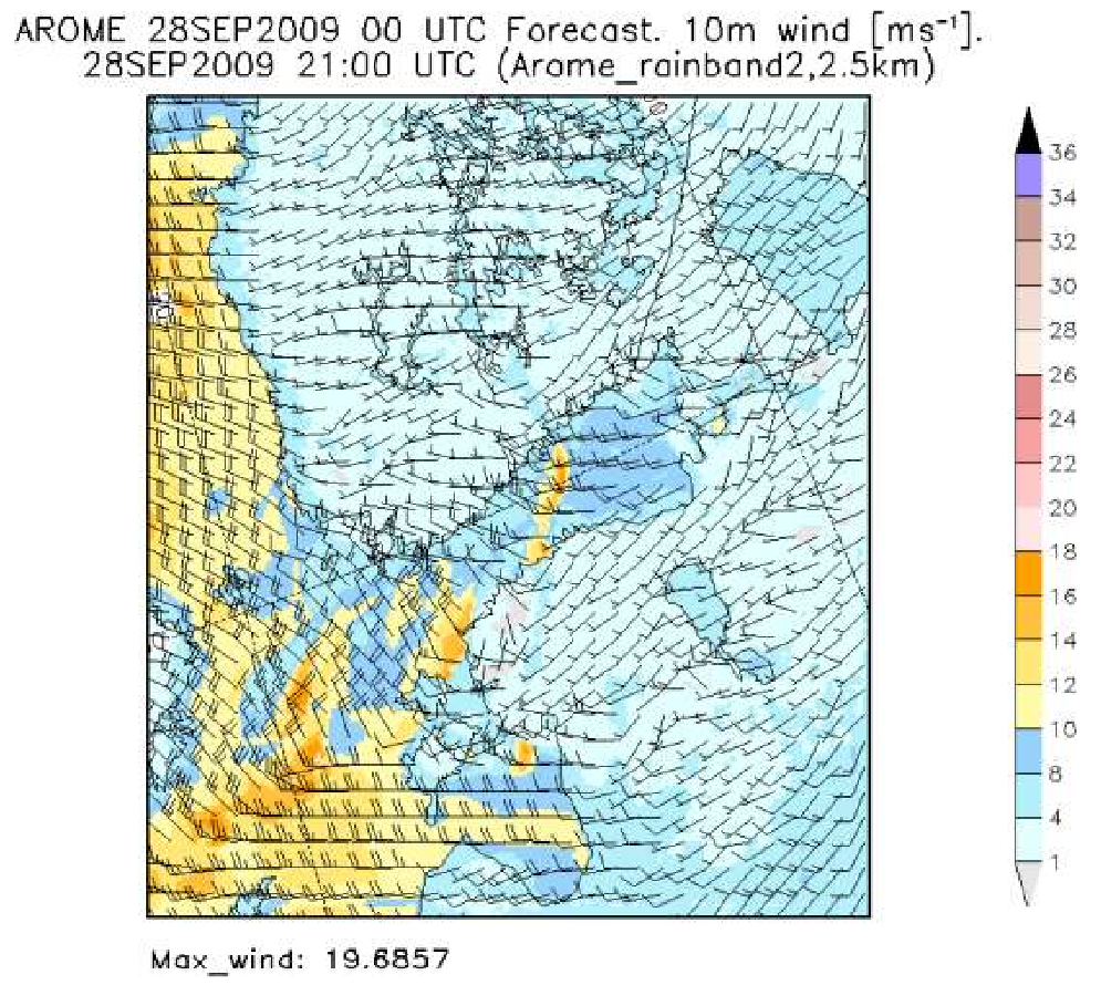
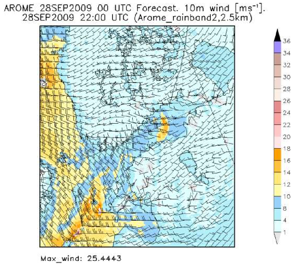
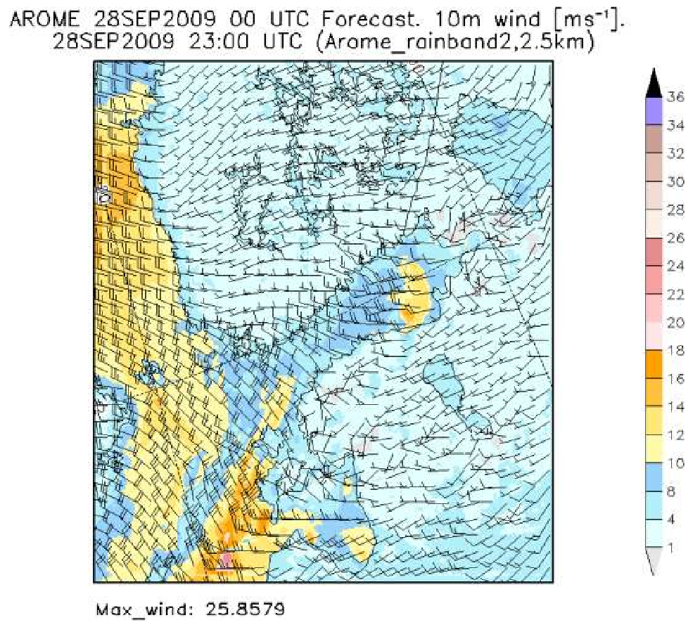
Hirlam, ECMWF and GFS forecasts were not successful in this case. There was no direct indication of a near storm wind speed. However, the situation was correctly forecasted as unstable and convectively active (not shown). This was somehow expected since those models are hydrostatic and have atoo sparse grid to explicitly depict small scale phenomena. In contrast, in this case FMI's operational high resolution non-hydrostatic AROME model forecasted relatively well the gusty winds attached to the cold front and the convective lines. This is seen in the next two animations.
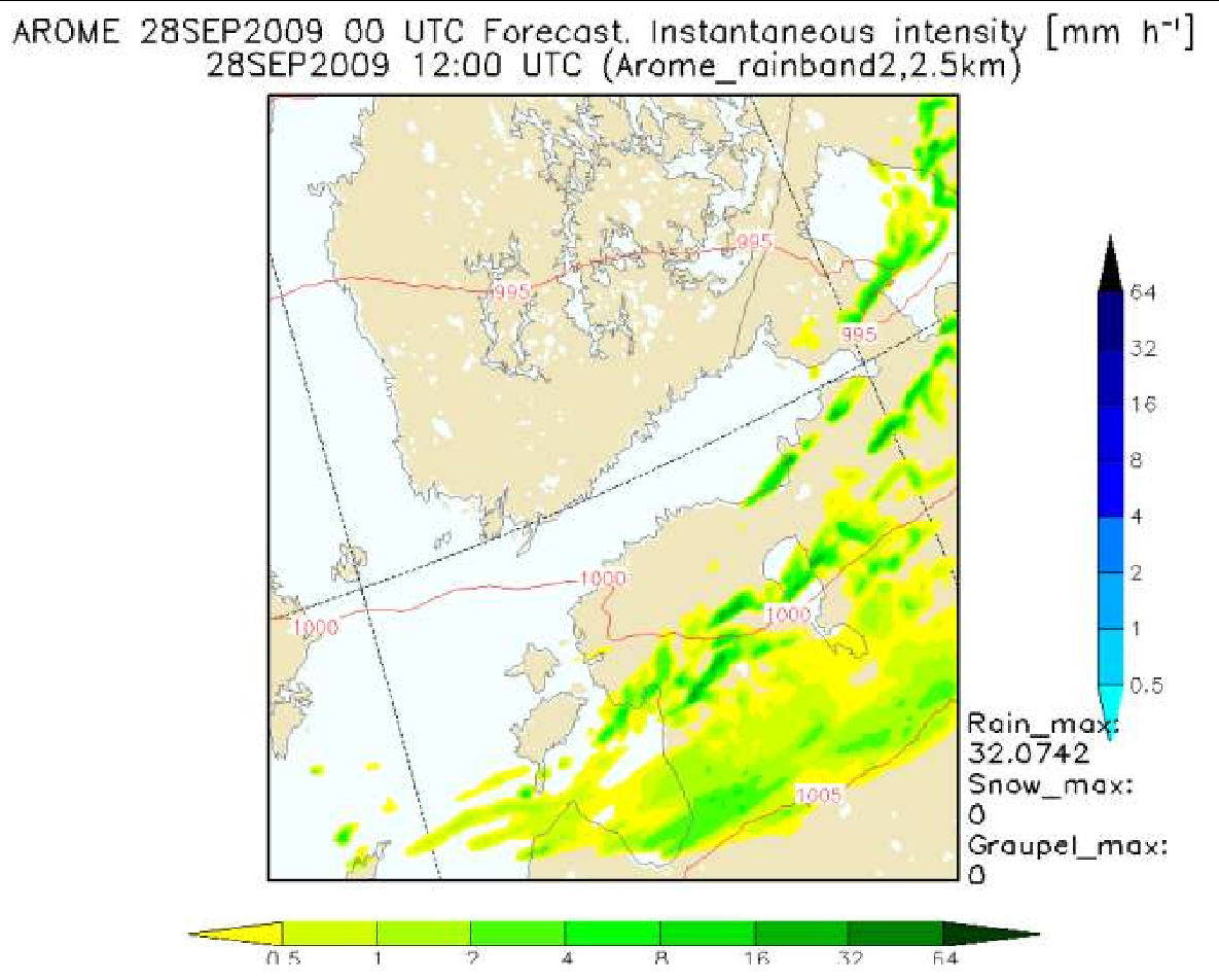
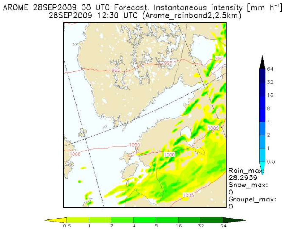
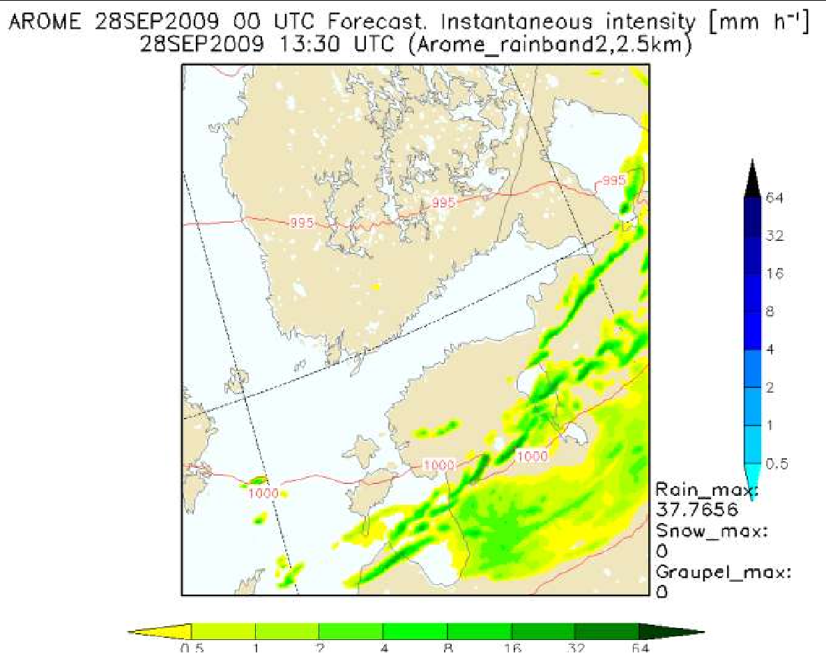
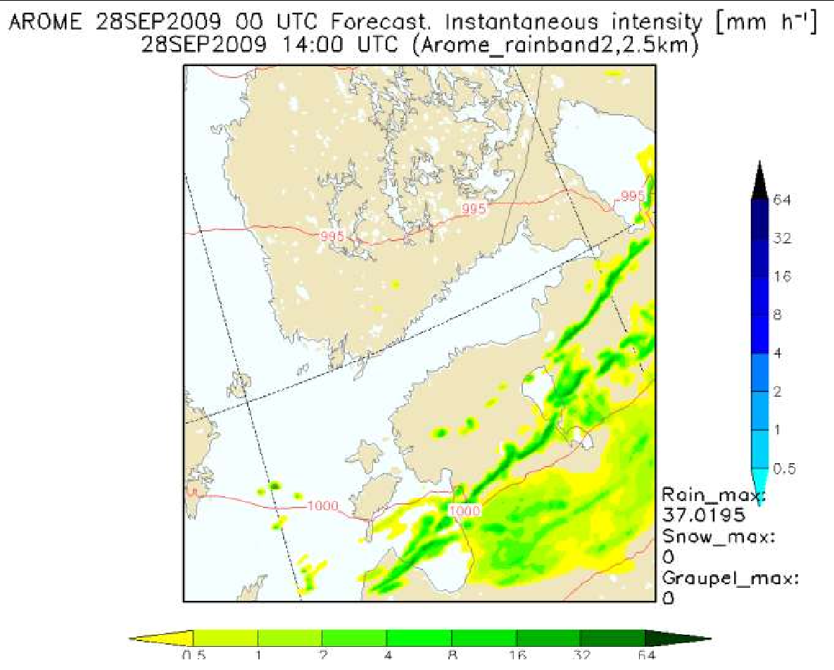
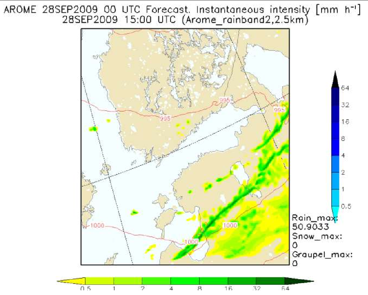
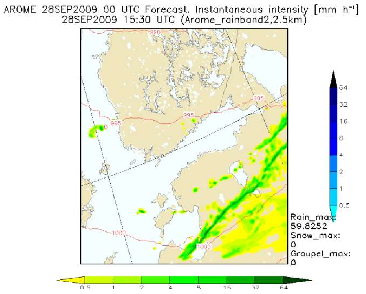
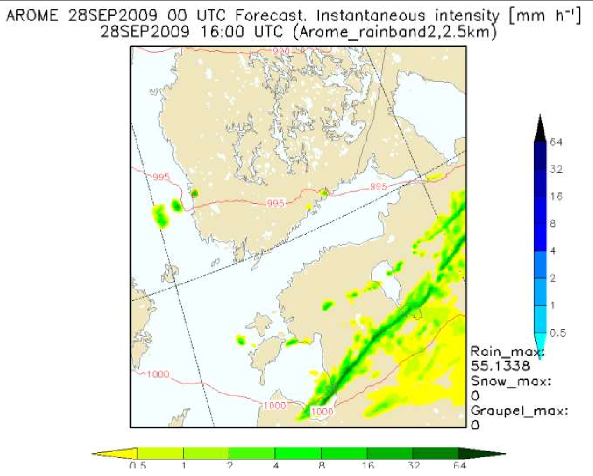
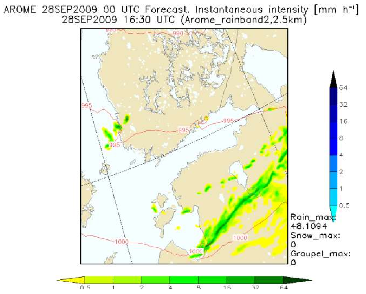
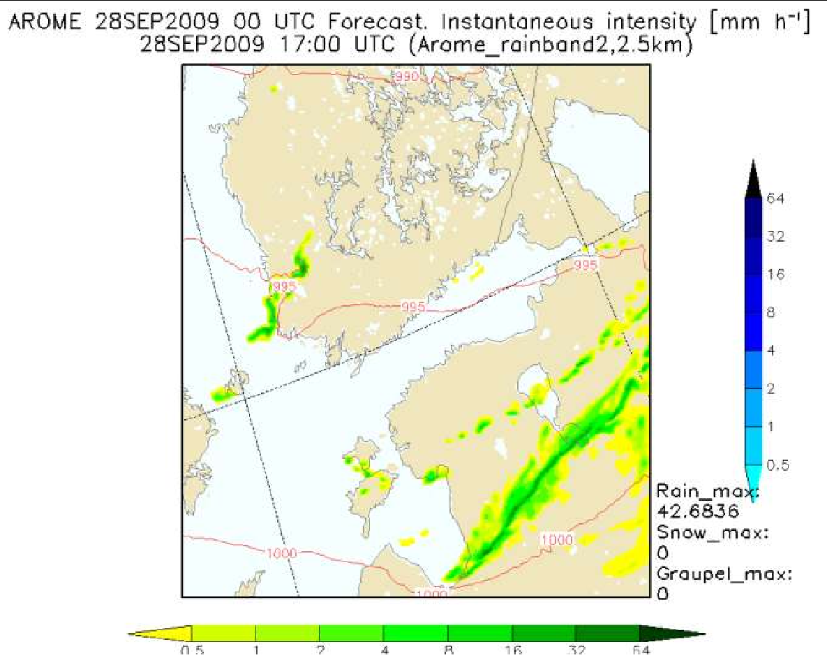
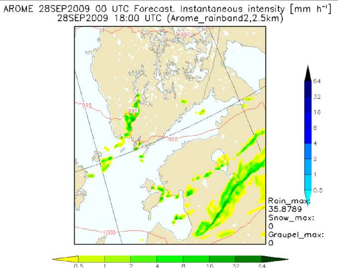
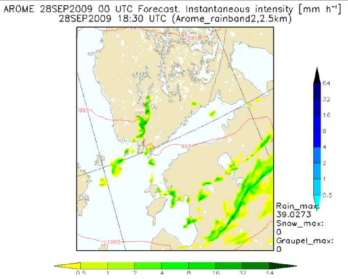
Figure 1: AROME precipitation intensity forecast. Convective line over southwestern Finland and archipelago is relatively well forecasted. Spatially forecasted system is somewhat smaller than observed and the timing is not exact.
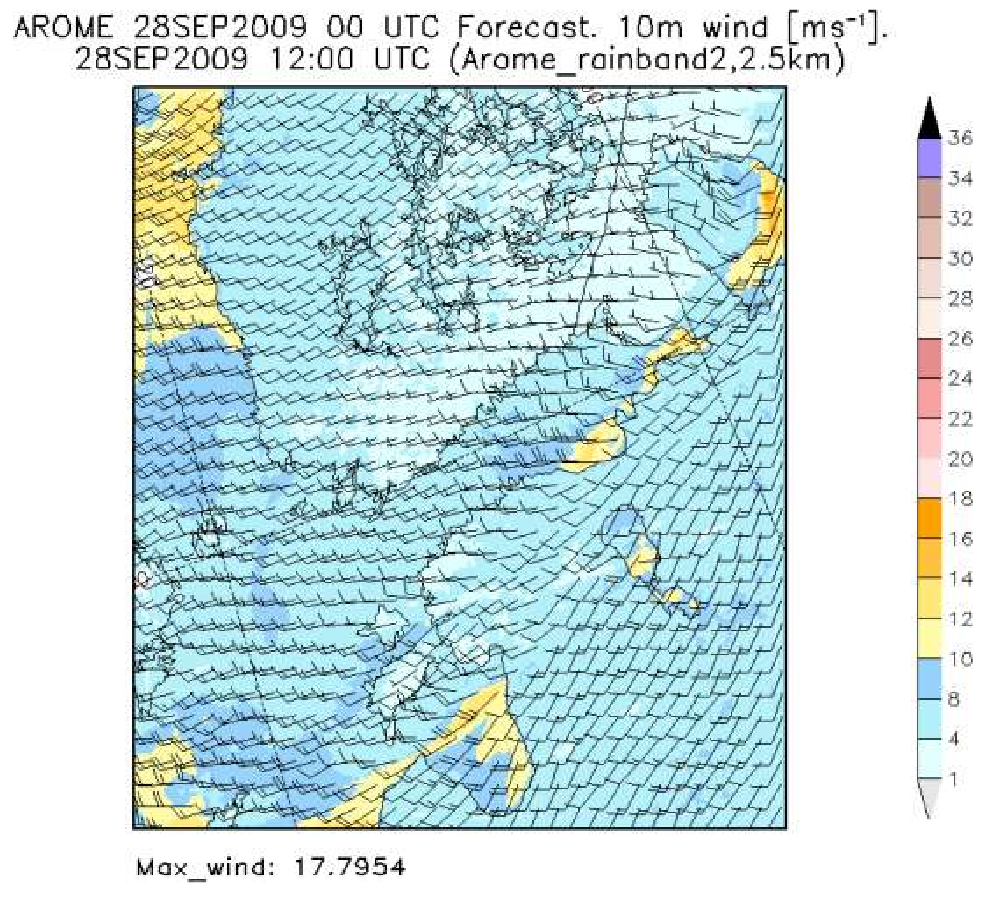
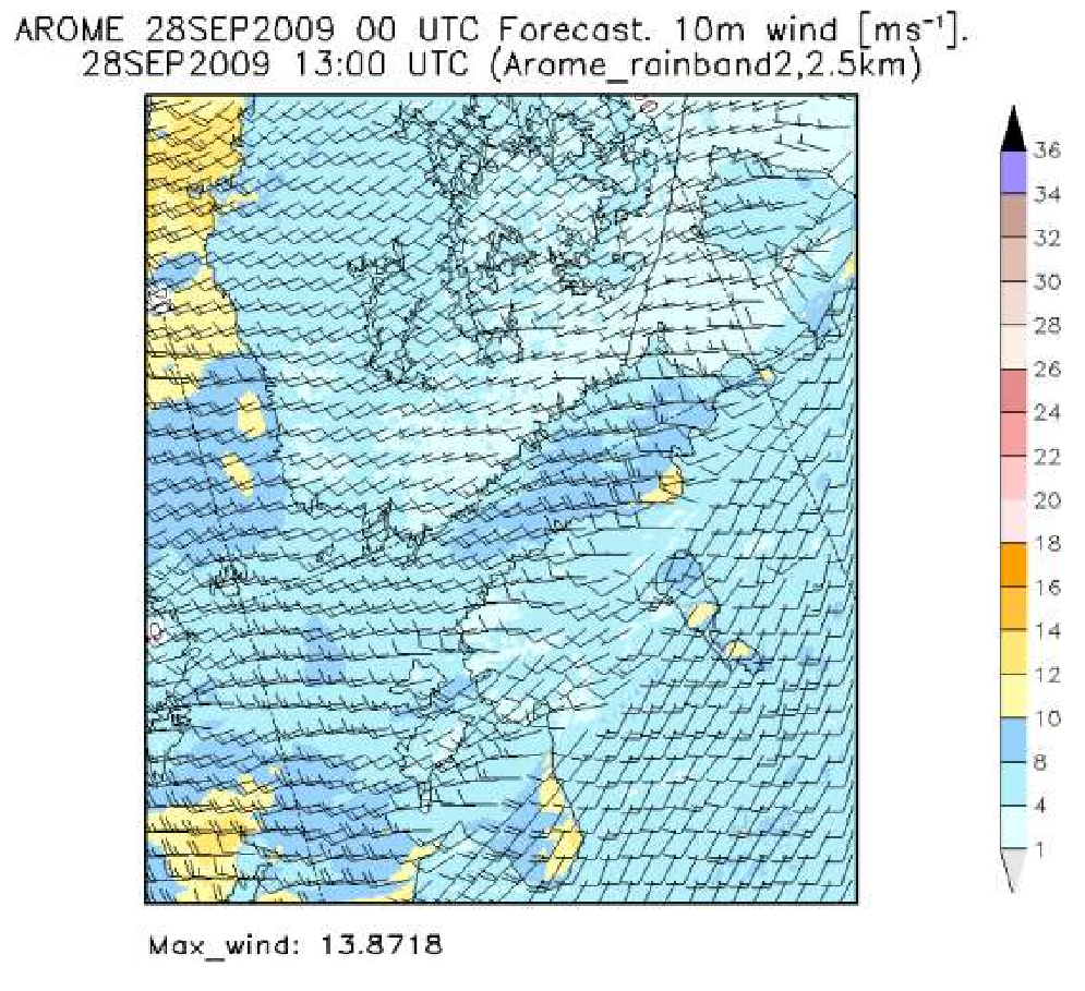
Figure 2: High wind speed associated with convective line is seen well in 10m wind speed forecast. 20 m/s wind speed was surprisingly well captured by this model run. However, there is about an hour delay in the forecasted gust front line compared with the observations