Isentropes
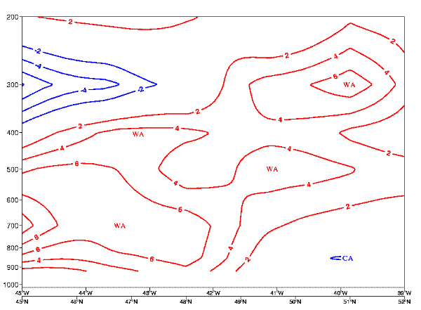
The isentropes θe show an inclined crowding zone to the northeast of Alex with an increasing stability from low levels throughout the atmosphere. The gradient of change within the isentropic surfaces shows that within the northeast quadrant of the hurricane that stabilisation is now occuring rapidly. Limited potential instablity is occuring under the cloud sheild, however the hurricane eye is no longer apparent.
Convergence/Divergence:
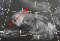
The field of divergence shows convergence from the surface to high altitudes with a maximum where the isentropic surfaces are inclided. An additional maximum is seen at low levels under the cloud sheild to the southwest, coinicident to where the central eye of the hurricane has eroded. the configuration of the convergence field suggests that the center of the storm is located at 47 °N 43.5°W. The divergence maximum is observed above this point , where the outflow of the hurricane is still evident.
Isotachs:
The isotach fields (m/s) show a maximum speed at between 500 and 200 hPa, at jet level. The westerly jet has now begun to engage Alex with a central core speed of 120 KT. The wind speeds at lower levels are still around 60 KT near the center of the system, but the location of the maximum winds is now focused to the southwest of the cyclone.
Vertical motion (omega):
Ascent is shown either side of the cyclone, this configuration still implies that surface heating and convergence at the surface is still a considerable forcing.
Vorticity:
A vorticity maximum is seen to the west of the cyclone this increase in vorticity seen throughout the atmosphere signifies the development of an upper trough to the west of the cyclone.
Vorticity advection:
A PVA maximum is seen to the west of the cyclone due to the development of an upper trough to the west of the cyclone.
Relative humidity:
Relative humidity is high throughout the atmosphere due to the tropical air associated with the hurricane and the vertical motion occurring around the system. Significant drying out is occuring to the northeast coinicident with the right exit of the jet stream.
Temperature advection:
Large scale warm advection is occuring throughout the entire atmosphere around the cyclone. We see the first signs of cold advection at high levels as the polar air begins to move to the rear of the cyclone.
Potential Vorticity:
We see high level PV associated with the jet stream to the northeast of the cyclone. At low levels the PV tower associated with the hurricane is apparent to the southwest of the center of the cyclone.