Isentropes
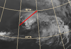
The isentropes of the equivalent potential temperature reveal a distinct trough structure indicating the warmer air which has been lifted and the baroclinic zone of a surface front. In this case the upper level trough is forward inclined with height. To the east the isentropes still reveal an unstable stratification. However this is less than 6 hours prior.
Convergence/Divergence:
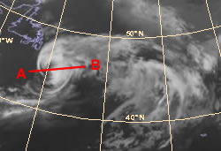
We still see convergence at the surface due to surface heating and ascent. At high levels we see large scale divergence indicated within the model fields, however this area is now more disorganised, although significant. This corresponds to the decay and disorganised large cirrus outflow observed on the satellite imagery.
Isotachs
The wind field has now expanded, with a core of strong winds remaining at low levels. At high levels we see the first indication of the westerly jet stream, this core of strong winds extends down to lower levels to near 600 hPa.
Vertical motion (omega):
Due to the decrease in surface heating and elimination of the energy available for hurricane development the amount of vertical motion has dramatically decreased.
Vorticity:
The maximum of vorticity remains at low levels and remains focused around the central core.
Vorticity advection:
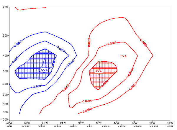
PVA remains to the east of the core and is coincident with large scale warm advection leading to continuing pressure falls ahead of the hurricane. To the west and rear of the development NVA is present. this is coinciding with the axis of a short wave trough.
Relative humidity:
Typically around the centre of the hurricane there is high humidity values extending throughout the troposphere.
Temperature advection:
The whole area of the forward inclined baroclinic zone and the leading part of the isentropic trough feature is under the influence of pronounced WA. The maximum of WA is found within the lower levels of the troposphere very close to the area where the forward inclined crowding zone reaches the surface. A secondary pronounced area of WA can be found within the upper levels of the troposphere on the rear side of the isentropic trough. This area is situated at approximately 300 hPa and indicates the tropopause. The lower and mid-levels of the troposphere are characterized by pronounced CA. The zero line of temperature advection is close to the minimum of the isentropic trough in the lower and mid-levels of the troposphere.
Potential Vorticity:
The PV tower associated with the hurricane central eye has begun to tilt westwards as Alex begins to become engaged in the westerly flow. The loss of the central eye is indicative of the engagement with a strong upper level flow as the cirrus sheilds is blown across the eye. The tilting effect is also a signal for the breaking down of the hurricanes lower level forcing.