Isentropes
The isentropes θe show a maximum of potential instability in the core of the hurricane at low levels with a minimum around 600 hPa, this area is coincident with a maximum of vorticity and ascent. A secondary area of very low level potential instability is focus to the northeast of the hurricane eye and is focused below 700 hPa. We see increasing stability at levels above 600 hPa above the core.
Convergence/Divergence:
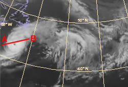
At this timeframe we see the classical internal structure of a hurricane. Surface driven convection leading to surface convergence around the hurricane core. At high levels we see large scale divergence indicated within the model fields this corresponds to the large cirrus outflow observed on the satellite imagery.
Isotachs
A maximum of wind speed is observed near the surface to the core of the hurricane. A second wind speed maximum can be found at the western edge of the hurricane at mid-troposphere. This coincides with the high amounts of cold polar air which is drawn into the hurricane.
Vertical motion (omega):
Vertical ascent is seen throughout the atmosphere with a maximum around the hurricane core.
Vorticity:
A maximum of vorticity is found within the hurricane, with a focus at lower levels, towards the surface.
Vorticity advection:
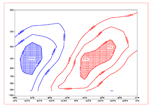
The PVA and NVA maxima observed are correlated to the high values of upward motion, and downward motion, resp. Previous we already discussed that the high NVA values in combination with the CA maxima can be explained because of the polar air being drawn into the Hurricane from the west.
Relative humidity:
Typically around the centre of the hurricane there is high humidity values which due to the rising motions extend throughout most of the troposphere.
Temperature advection:
Strong warm advection is taking places to the north east of the hurricane eye. We also see cold advection to the west of the hurricane eye as cooler polar air is drawn behind the hurricane. This area coincides with the cold advection area and rise of the surface pressure. The same result can also be seen in the fields of Vorticity advection where the sinking polar air is observed as NVA maxima.
Potential Vorticity:
The PV fields show clearly the PV tower associated with the hurricane central core which extends from the surface to 300 hPa.