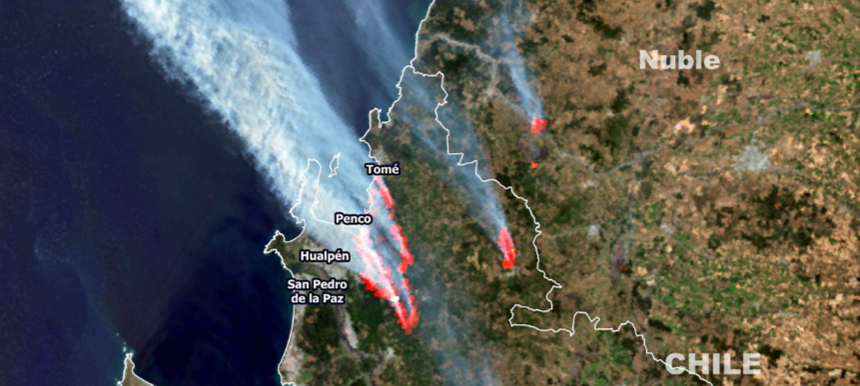
International Autumn School on Satellite Data Analysis
9 – 13 November 2026 / Athens, GreeceThe primary objective of this classroom workshop, jointly organised by Hellenic National Meteorological Service and EUMETSAT, is to enhance participants' understanding and utilisation of EUMETSAT's satellite data and products, in various fields of study or applications, with special focus on the MSG and MTG satellites.
Participants will gain comprehensive knowledge of EUMETSAT's data, products and services, together with skills to effectively incorporate them into their scientific projects and research. The course will offer informative lectures on remote-sensing principles and hands-on experience in navigating data platforms, accessing and processing satellite data using python scripts and Jupyter notebooks.
New scientists, post-graduate students, experts, and researchers from EUMETSAT member states, with knowledge or experience in remote sensing, satellite data and products interpretation, and some knowledge of Python coding, can apply to the course here.