Training Module

Operational use of RGBs: Part 1
Technological advances and the increasing sophistication of weather forecasting have created a demand for more frequent and more accurate and higher resolution observations from space. To meet this demand on 28th August 2002 the first of four satellites known as Meteosat Second Generation (MSG) was launched.
MSG transmits more than 20 times the information of its predecessor. The improved resolution of frequency of data significantly contributes to the accuracy of both short-term and medium range weather forecasts. Since 2004, the MSG satellites have been providing full Earth disc images every 15 minutes, in 12 spectral bands.
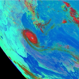
Twenty times more information is also a challenge for the user to cope with. To present all of this extra data in a understandable way to the user, so-called RGB (red, green and blue) images were developed that allow you to easily make a qualitative analysis. In RGB images the different properties of the twelve spectral bands of MSG are combined in one powerful coloured image.
Fog, snow, atmospheric dust, SO2 clouds from erupting volcanoes, severe updrafts in convective systems, Potential Vorticity (PV) anomalies are just a few keywords and applications that we will teach you to recognise in satellite imagery. On several occasions questions and exercises will help you to test your gained knowledge.
Filed under Keywords:
Fog, Stratus, Forest Fires, Convection, Cyclogenesis

