Webcast


Convergence lines over Sea and Lakes
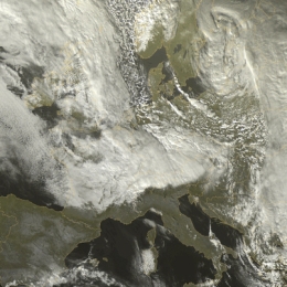
The intention of this case study lecture is to demonstrate the effect of an intensifying, marine cloud street (originated in continuing cold air advection over warm seawater) as a result of divergence and convergence at low levels over coastal regions and narrow straits. Frictional convergence and high instability appear to be the most important aspects for intense line convection. Although the divergence at low altitudes was not always very clear depicted in this case the large-scale divergence patterns at higher levels, the extreme low temperatures and the left exit of the Polar Jet streak overhead appeared to have a major impact. As a result the marine cloud streets changed into active lines of hail and snow showers over sea and especially over land with quite a number of thunderstorms at time of the maximum temperature. The use of satellite imagery, surface and upper air weather charts almost simultaneously is of great help in detection and very short term weather forecasting (nowcasting). In very cold air objective instability indices, like Boyden, appear to be very helpful in forecasting low topped winter storms.
Filed under Keywords:
Conceptual Models, Synoptic Scale Meteorology, Frontal Structures, Frontal Substructures, Convection, Cold Air Outbreak