Webcast

Evaluation of the two-moment-microphysical scheme using observations from radar and SEVIRI visible channels
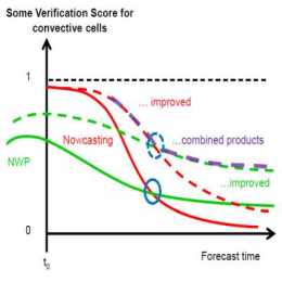
The goal of the SINFONY project of Deutscher Wetterdienst is to complement, refine and improve the methods of nowcasting (NWC) and numerical weather prediction (NWP) so that a continuous representation of atmospheric conditions and weather phenomena from the current time to the short-term forecast, i.e. in the period 0 to 12 hours, is possible. The pilot project focuses on summertime convective heavy-precipitation events, with the aim of providing more concise and accurate information for our warning service.
The representation of deep convection in km-scale NWP strongly depends on the parameterization of cloud processes at the microscopic scale: the cloud microphysics. Traditional NWP microphysical schemes describe each hydrometeor type (e.g. cloud water, rain, snow, graupel or ice) by one single prognostic variable. This one-moment description performs sufficiently well in many weather situations, but it is also known to produce a too coarse representation of the microphysics and dynamics of deep convective cells. Case studies have shown that a better representation can be obtained with the so-called twomoment schemes, in which each hydrometeor is represented by two prognostic variables, usually mass und number densities. Those schemes have thus the potential to produce more realistic convective dynamics, which can improve short-term forecasts of heavy-precipitation events
We employ different observational systems to evaluate how different models and microphysical parameterizations represent clouds and precipitation over Germany. We compare simulations with ICON and COSMO using different microphysical schemes (operational one-moment vs. Seifert and Beheng two-moment). All simulations are driven by the same boundary conditions from the ICON-EU analysis fields. The simulated period is spring/summer 2016, which is characterized by heavy convection over Germany. In the presentation we mainly focus on the observations from the radar network and on the observations in the visible channels from SEVIRI.

