Case Study
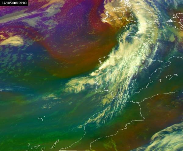
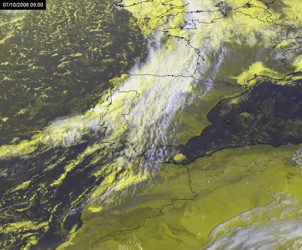
Figure 1: Air Mass RGB at 9 UTC on 7th October 2008.
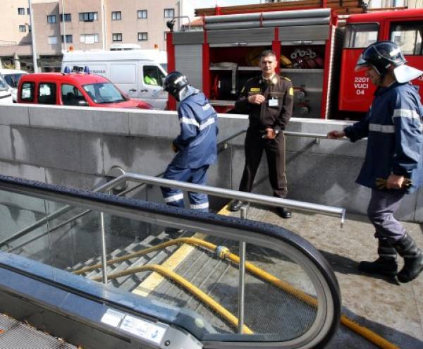
On 7th October 2008 (early morning and morning) a cold front crossed northwestern part of the Iberian Peninsula (Figure 1), producing large amounts of precipitation and causing disruption of same activities in the affected areas. For example, in Porto, the second largest city in Portugal, a flooding event occurred inside a subway station, which had to be closed for a full day (Figure 2).
Figure 2: Activities to remove water in a subway station in Porto after the heavy precipitation event (16 mm between 8 and 9 UTC, 25 mm between 7 and 10 UTC in the closest AWS).
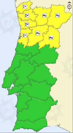
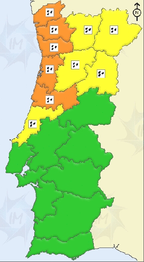
In northwestern Portugal, a maximum of 41 mm in 6 hours was obtained in an automatic weather station (AWS) in a mountain area and a maximum of 20 mm in 1 hour in a coastal area, both reaching the orange warning lower threshold for meteoalarm (40mm/6h and 20mm/1h, respectively). The Portuguese meteorological service (IM) has first issued a yellow warning with 24 hours advance, and the orange warning has been issued 7 hours before the beginning of the period of heaviest precipitation (Figure 3).
Figure 3: Meteoalarm Warnings issued by the Portuguese met. service.
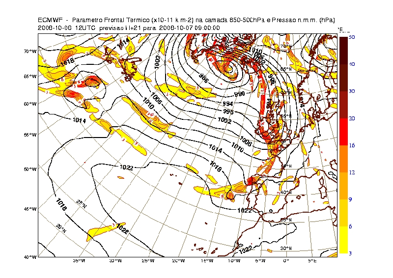
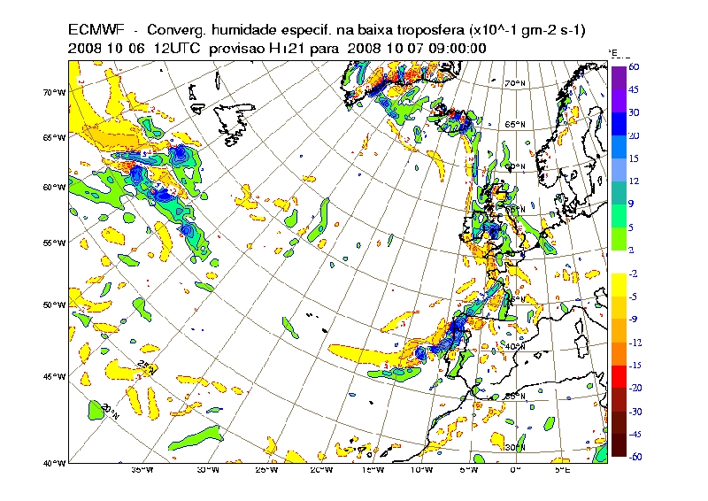
At 9 UTC, during the period of highest frontal activity over northwestern Portugal, the ECMWF thermal frontal parameter (TFP) forecast depicts the cold front a little behind of its actual position (Figure 4). At the same instant, a strong signal in the convergence of specific humidity in lower troposphere is also found over Portugal (Figure 5).
Figure 4: Thermal Frontal Parameter at 9UTC on 7th October 2008. H+21 from ECMWF run at 12 UTC on 6th October 2008.
Figure 5: Specific Humidity Convergence in low troposphere at 9UTC on 7th October 2008. H+21 from ECMWF run at 12 UTC on 6th October 2008.
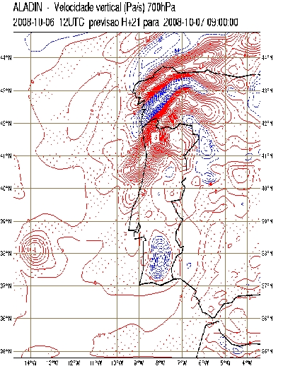
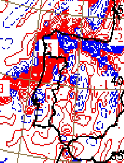
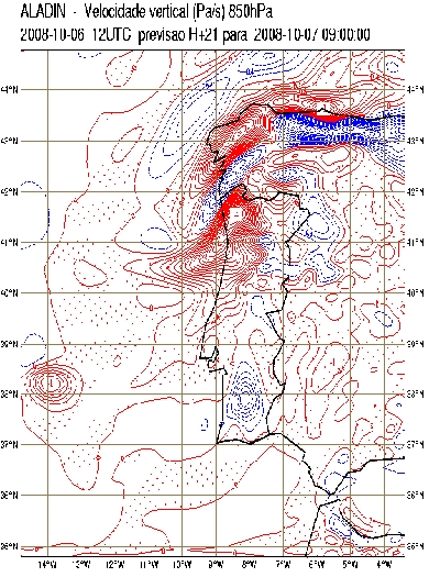
A clear distinction of high convective cells along the cold front and lower stratified cloudiness in the front vicinity is clearly depicted in the HRV RGB (Figure 6), which is reasonably reproduced by the 21 hour forecast of vertical wind at 850 and 700 hPa, for both ECMWF and Aladin models (Figure 7).
Figure 6: HRV RGB at 9 UTC on 7th October 2008.
Figure 7: Vertical Wind at 700 hPa (upper row) and 850 hPa (lower row) at 9UTC on 7th October 2008. H+21 from ECMWF (left column) and Aladin (right column) runs at 12 UTC on 6th October 2008.
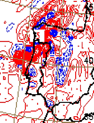
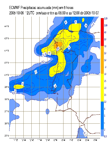
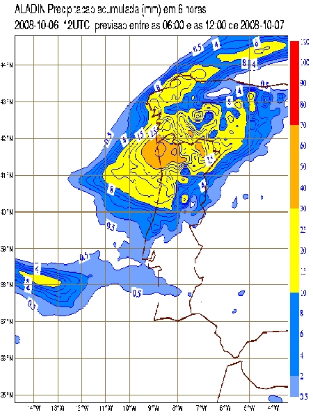
All the parameters above fit the configuration of a typical cold front and, in fact, the precipitation forecast was pretty much inline with the observed values with maximum 6-hour amounts of 30-40 mm in Galicia for ECMWF and 40-50 mm in Northwestern Portugal for Aladin (Figure 8), with a decreasing of precipitation as the cold front moved southeastward along the Peninsula.
Figure 8: 6 hour precipitation between 6 and 12 UTC on 7th October 2008 from ECMWF (left image) and Aladin (right image) runs at 12 UTC on 6th October 2008. Note that the color code is not the same as in meteoalarm criteria.
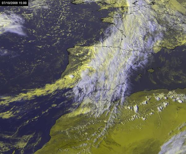
Besides being an "orange warning, well-behaved cold front" case, this episode gains particularly interest as, in the afternoon, an intensification developed along the front over southern Portugal. The HRV RGB shows the convective cell as a whitish rounded structure and the cold front in yellow tones in a southwest-northeast direction (passing over Lisbon and along the Tagus river), with embedded smaller scale cumulus (Figure 9).
Figure 9: HRV RGB at 15 UTC on 7th October 2008.
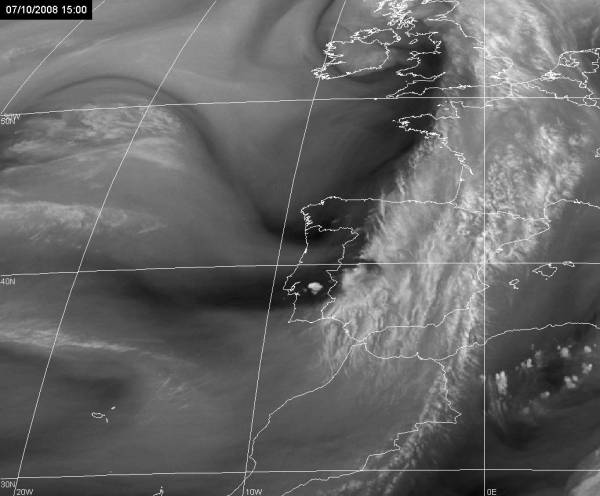
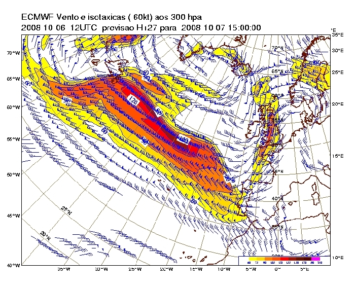
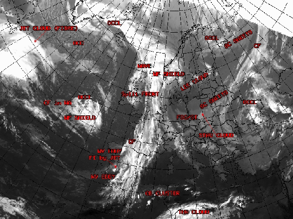
On the other hand, the WV image at 15 UTC (Figure 10) shows that the convective cell is embedded in a wide area of dry intrusion of stratospheric air, located to the north of a jet stream axis. In fact, the image indicates the existence of two branches of the jet stream, which are also suggested by the ECMWF forecast for that time (Figure 11). Later, at 18 UTC, the structure is still visible as it moved to Spanish territory, and the conceptual model of "front intensification by jet" was identified in SATREP analysis (Figure 12).
Figure 10: WV6.2 at 15 UTC on 7th October 2008.
Figure 11: Jet stream at 300 hPa at 15UTC on 7th October 2008. H+27 from ECMWF runs at 12 UTC on 6th October 2008. Wind barbs greater or equal 30 kt and isotachs greater or equal 60 kt.
Figure 12: SATREP at 18 UTC on 7th October 2008.
