Hirlam Precipitation
Below, the 00 UTC run of HIRLAM model: 6 hours acumulated precipitation forecast, from 12 to 18 UTC, (shaded).
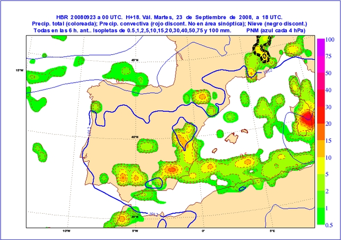
Questions:
- Can we figure out some possible causes for the tremendous precip underestimation in the target areas?
- Is it a typical feature of NWP models to understimate precip in Mediterranean spots?
- Which factors we think that should be better parametrized in order to catch these types of events? Apart from the physics, could it be also an impact of model resolution?