Introduction
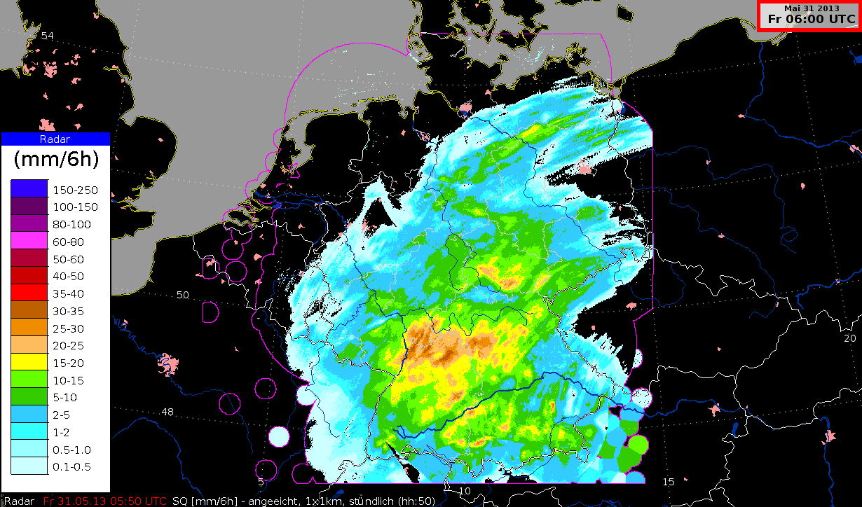
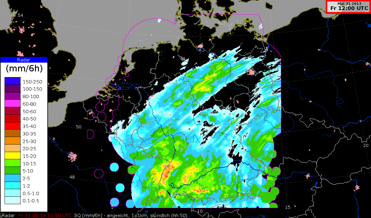
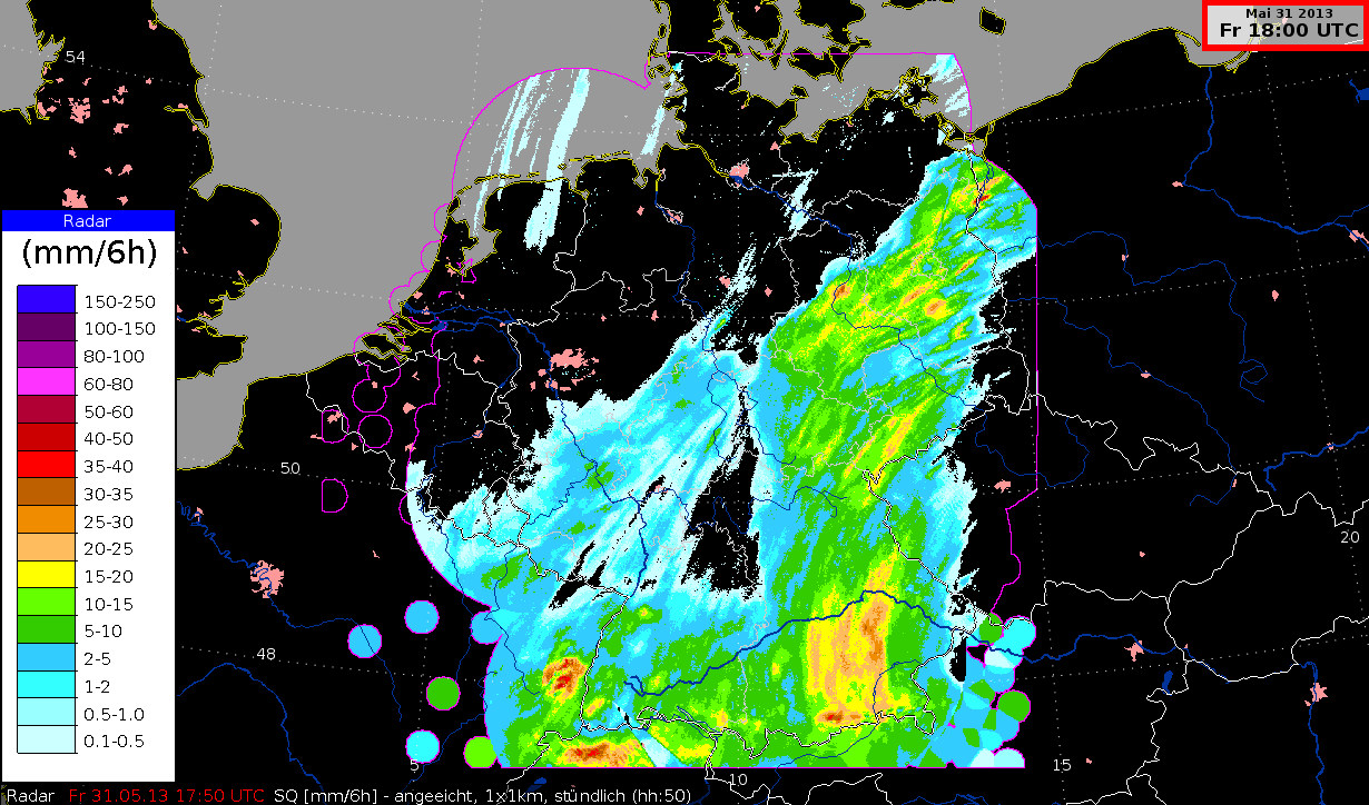
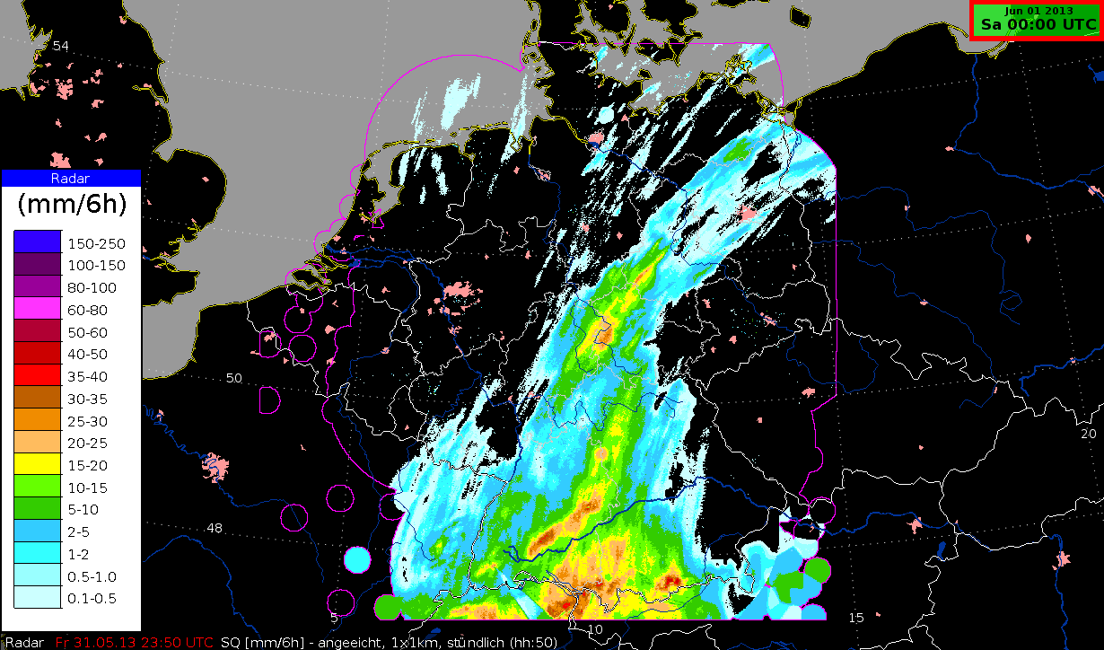
Germany's 17 radar stations are very important for the processes of nowcasting and managing the warnings for convective and long-lasting precipitation. Some of the images they produce are introduced here.
Radar composite image PM with Satellite image IR10.8, 31 May 2013, 00 UTC - 23 UTC (Source: DWD)