Nowcasting
The automatic cell detection (based mainly on IR imagery) identifies the relevant convective cells for the first time at 11.30: one over Vienna, a second south-west of it. Atmospheric motion vectors indicate a north-east displacement (in the whole area of the cells), so the more southerly cell can be regarded as the one approaching Vienna.
Figure 15: 13 May 2003/11.30 UTC - Meteosat IR image; automatic cell detection (blue crosses, >: growing MCS, red crosses: small growing cells, green crosses: large growing cells, green 0: large cell at climax, red -: small decaying cell); radar echoes superimposed
At that point in time the strongest radar echo is located directly above the cells, typical for young cells.

Figure 16: 13 May 2003/11.30 UTC - Meteosat IR image; automatic cell detection (blue crosses, >: growing MCS, red crosses: small growing cells, green crosses: large growing cells, green 0: large cell at climax, red -: small decaying cell), brown: AMVs; radar echoes superimposed
At 12.00 UTC the two convective cells are now analysed as MCS (blue symbols): The various nowcasting methods used show the displacement:
- Atmospheric motion vectors
- Radar motion vectors
- Tracking of cells
As the cells are now in a more advanced stage, the maximum radar echos are located in the south-east part of the cells, thus cell detection by satellite imagery and radar differs with regard to the exact location of the cells.
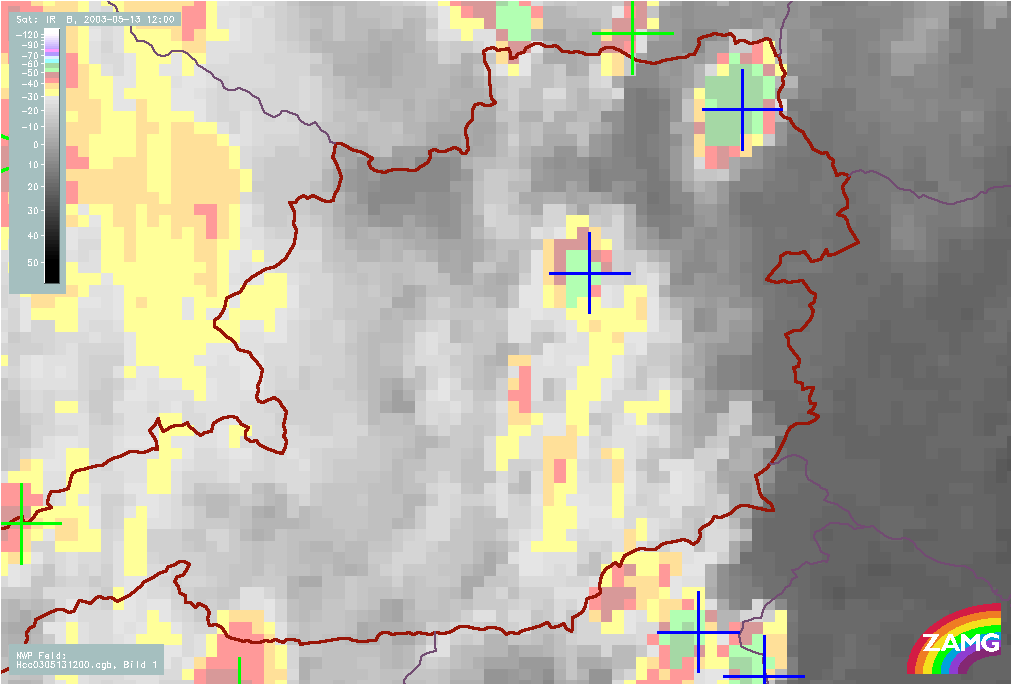
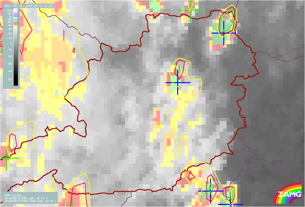
Figure 17: left: 13 May 2003/12.00 UTC - Meteosat IR enhanced image; automatic cell detection (blue crosses, >: growing MCS, red crosses: small growing cells, green crosses: large growing cells, green 0: large cell at climax, red -: small decaying cell)
right: 13 May 2003/12.00 UTC - Meteosat IR enhanced image; automatic cell detection (blue crosses, >: growing MCS, red crosses: small growing cells, green crosses: large growing cells, green 0: large cell at climax, red -: small decaying cell); 30min cloud top temperature forecast

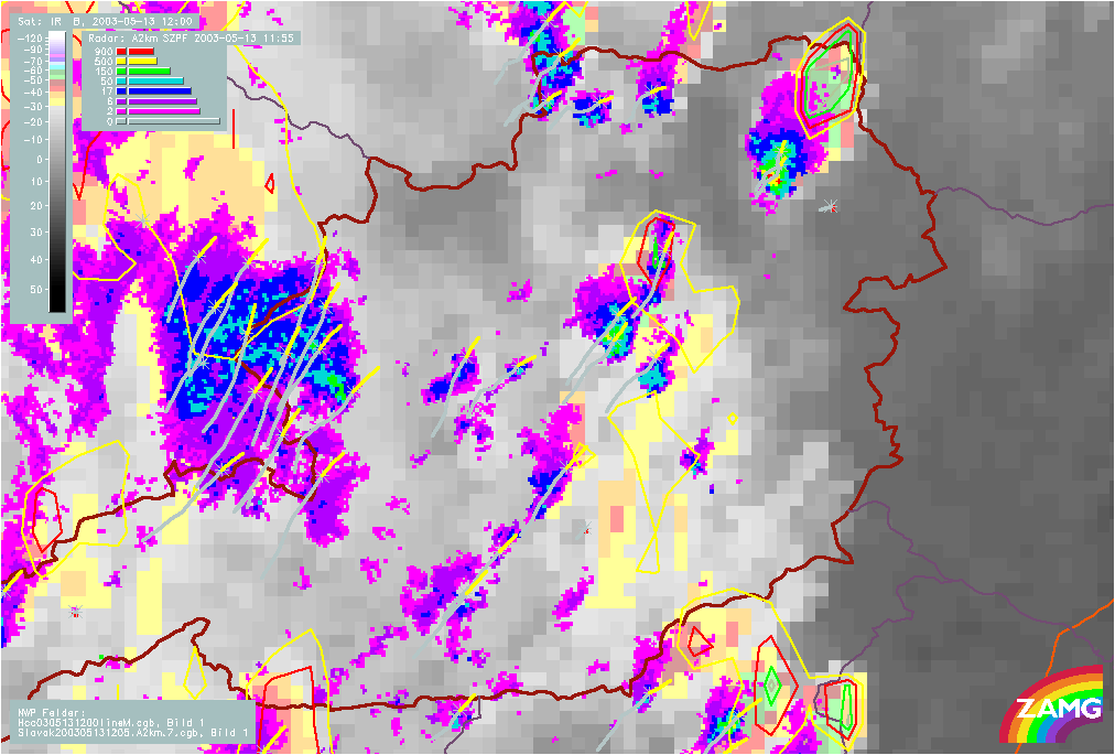
Figure 18: left: 13 May 2003/12.00 UTC - Meteosat IR enhanced image; automatic cell detection (blue crosses, >: growing MCS, red crosses: small growing cells, green crosses: large growing cells, green 0: large cell at climax, red -: small decaying cell); radar echoes superimposed
right: 13 May 2003/12.00 UTC - Meteosat IR enhanced image; automatic cell detection (blue crosses, >: growing MCS, red crosses: small growing cells, green crosses: large growing cells, green 0: large cell at climax, red -: small decaying cell), orange: tracking of cells found in radar echoes, yellow: forcast of radar cells, 30min cloud top temperature forecast; radar echoes superimposed
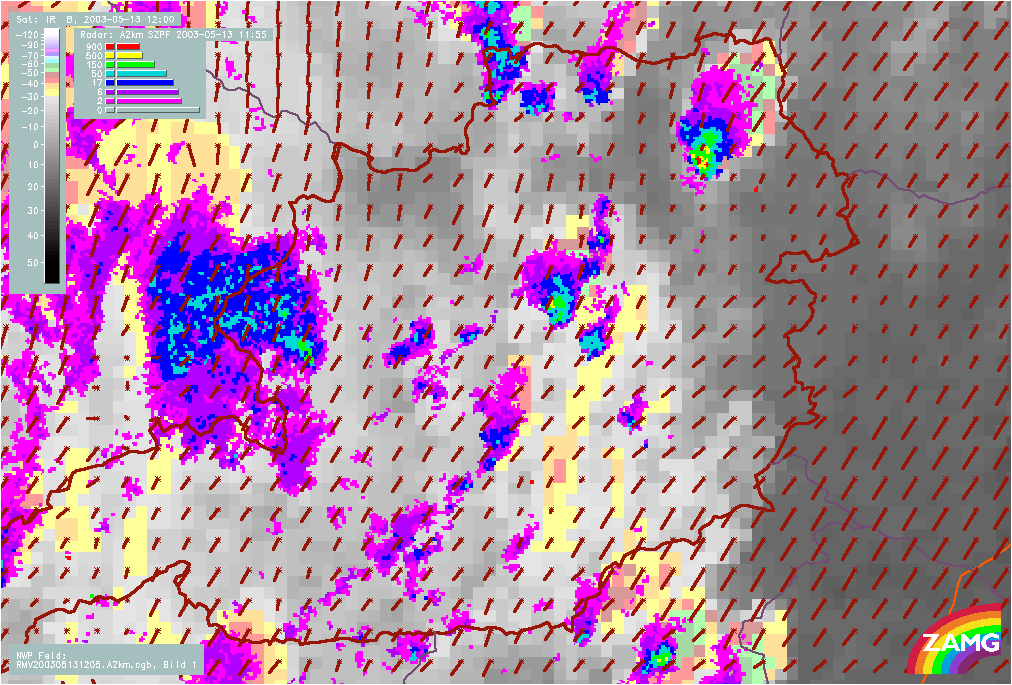
Figure 19: 13 May 2003/12.00 UTC - Meteosat IR enhanced image; automatic cell detection (blue crosses, >: growing MCS, red crosses: small growing cells, green crosses: large growing cells, green 0: large cell at climax, red -: small decaying cell), brown: radar motion vectors; radar echoes superimposed
At 12.00 UTC surface observations report a thunderstorm in Vienna for the first time that day. The displacement with AMV shows that this thunderstorm is stationary and will remain at this location. Reports of hail are rare due to the coarse grid of observation when compared to the scale of hail which covered only some parts of Vienna (north and west).
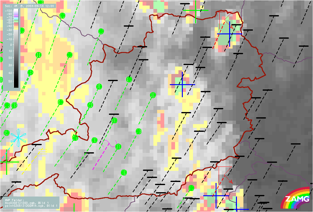
Figure 20: 13 May 2003/12.00 UTC - Meteosat IR enhanced image; automatic cell detection (blue crosses, >: growing MCS, red crosses: small growing cells, green crosses: large growing cells, green 0: large cell at climax, red -: small decaying cell), weather events (green: rain and showers, blue: drizzle, cyan: snow, red: thunderstorm, black: no precipitation), dashed lines: 30min weather event displacement; radar echoes superimposed
AMVs show displacement of the cell to the north-east. The cells approaching from the south-west therefore is of interest for the Viennese region.
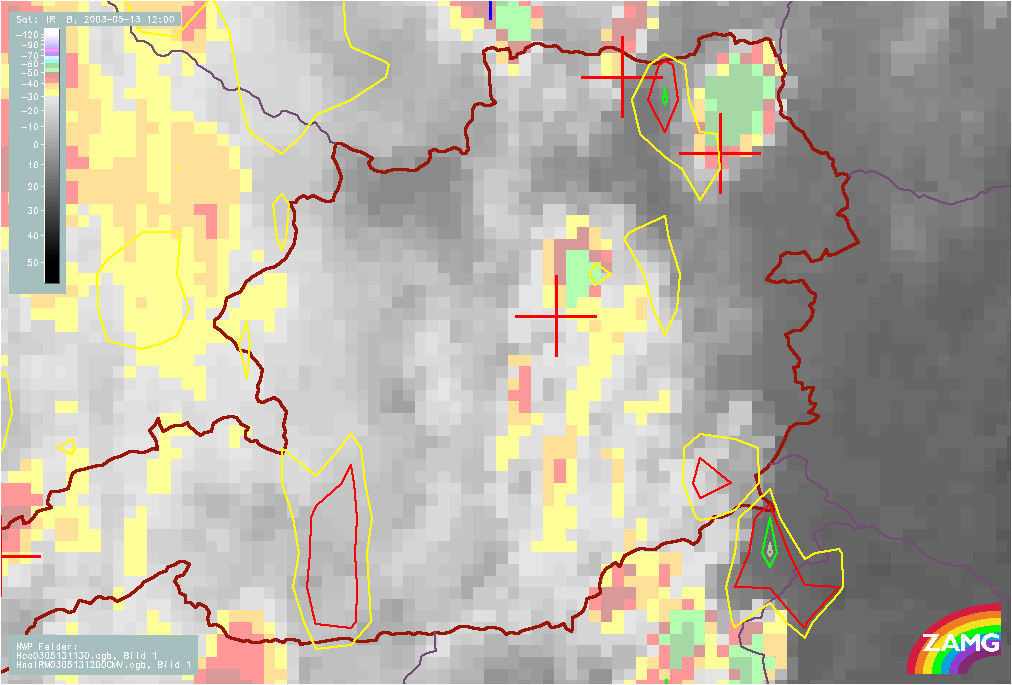
Figure 21: 13 May 2003/12.00 UTC - Meteosat IR enhanced image; automatic cell detection (blue crosses, >: growing MCS, red crosses: small growing cells, green crosses: large growing cells, green 0: large cell at climax, red -: small decaying cell), brown: radar motion vectors; 30min cloud top temperature forecast; radar echoes superimposed
Weather Activity
Vienna reports a thunderstorm at 12.00 UTC . It was (partly) accompanied by hail, where single hail stones had a diameter of about 5 cm. The track of the thunderstorm was to the west and north-west of Vienna with high local variability in time and intensity.
The analysis of precipitation area (based upon weather reports, radar and satellite imagery) is shown below. Both cells are within the precipitation area, but it is not as extensive as seen in the satellite image (high cloudiness whithout precipitation).
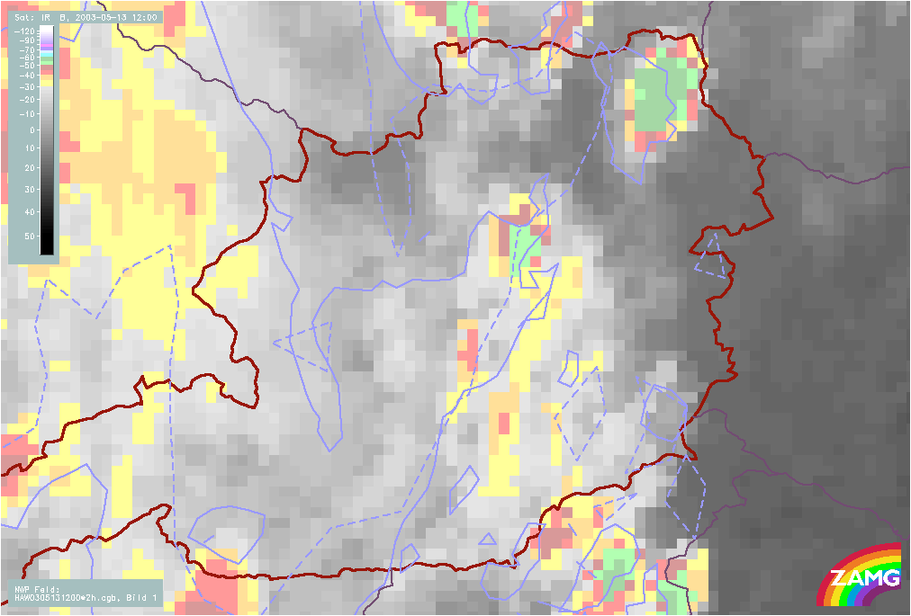
Figure 22: 13 May 2003/12.00 UTC - Meteosat IR enhanced image; blue solid: analysis of precipitation area, blue dashed: nowcast of precipitation area
At 12.30 UTC nowcasting modules still show a similar situation. The cell south-west of Vienna is expected to reach Vienna and merge with the cell already over it. This actually happened. The precipitation area has increased.
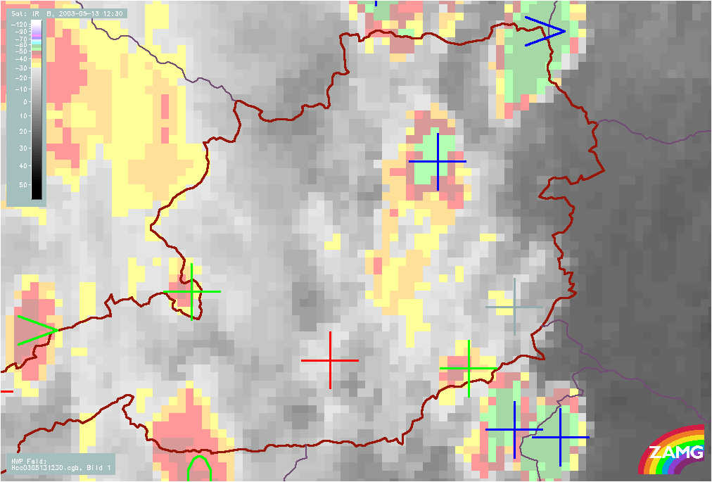
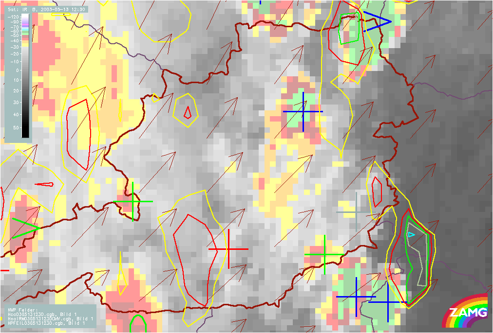
Figure 23: left: 13 May 2003/12.30 UTC - Meteosat IR enhanced image; automatic cell detection (blue crosses, >: growing MCS, red crosses: small growing cells, green crosses: large growing cells, green 0: large cell at climax, red -: small decaying cell)
right: 13 May 2003/12.30 UTC - Meteosat IR enhanced image; automatic cell detection (blue crosses, >: growing MCS, red crosses: small growing cells, green crosses: large growing cells, green 0: large cell at climax, red -: small decaying cell), 30min cloud top temperature forecast, brown: AMVs
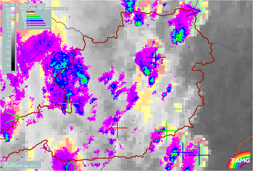
Figure 24: 13 May 2003/12.30 UTC - Meteosat IR enhanced image; automatic cell detection (blue crosses, >: growing MCS, red crosses: small growing cells, green crosses: large growing cells, green 0: large cell at climax, red -: small decaying cell); radar echoes superimposed
right: 13 May 2003/12.30 UTC - Meteosat IR enhanced image; blue solid: analysis of precipitation area, blue dashed: nowcast of precipitation area
13 May 2003 13.00 UTC: The two cells have now almost completely merged. Vienna is reporting hail.
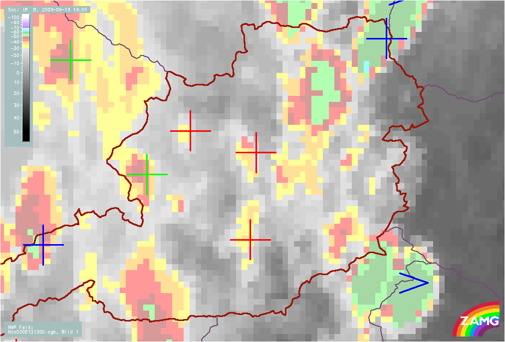
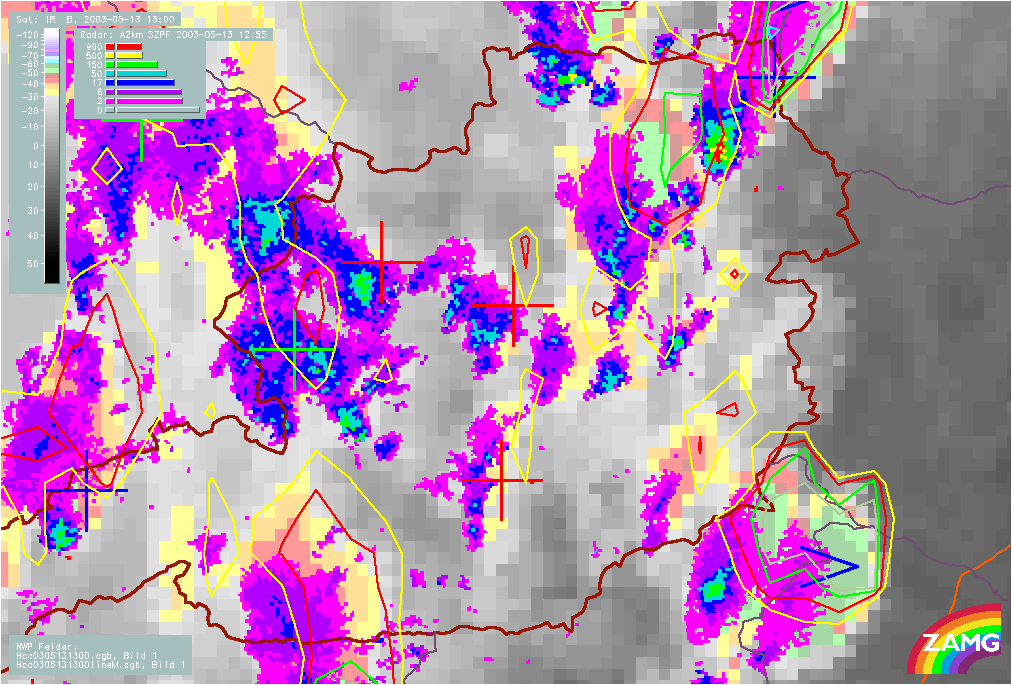
Figure 25: left: 13 May 2003/13.00 UTC - Meteosat IR enhanced image;automatic cell detection (blue crosses, >: growing MCS, red crosses: small growing cells, green crosses: large growing cells, green 0: large cell at climax, red -: small decaying cell)
right: 13 May 2003/13.00 UTC - Meteosat IR enhanced image;automatic cell detection (blue crosses, >: growing MCS, red crosses: small growing cells, green crosses: large growing cells, green 0: large cell at climax, red -: small decaying cell), 30min cloud top temperature forecast
Radar echoes now indicate the highest precipitation intensity (colour: red) which is an indication for hail.
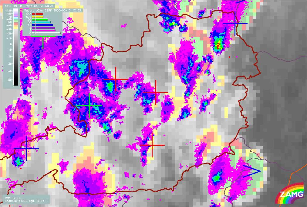
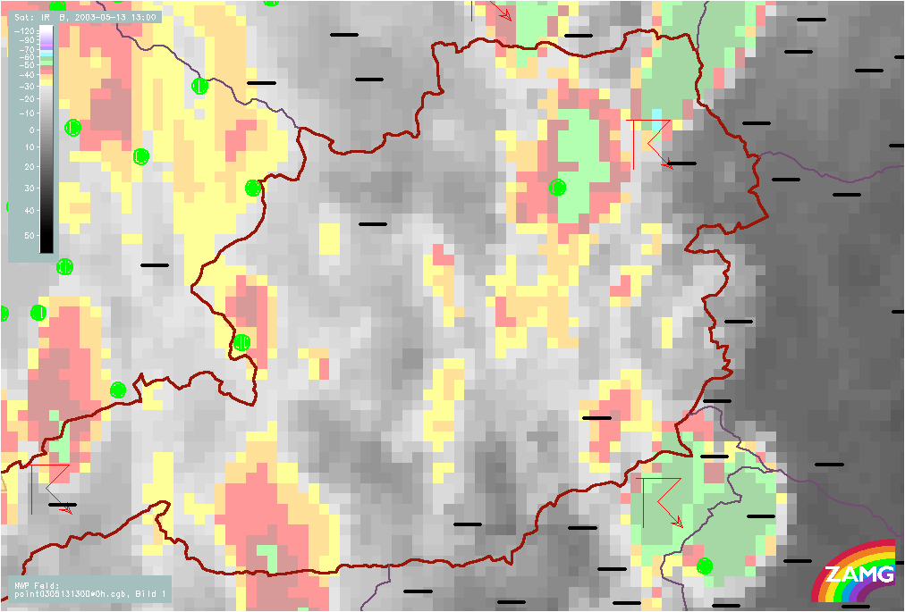
Figure 26: left: 13 May 2003/13.00 UTC - Meteosat IR enhanced image; automatic cell detection (blue crosses, >: growing MCS, red crosses: small growing cells, green crosses: large growing cells, green 0: large cell at climax, red -: small decaying cell); radar echoes superimposed
right: 13 May 2003/13.00 UTC - Meteosat IR enhanced image; surface observations
13 May 2003 13.30 UTC: The two cells have already merged. Several smaller cells develop west and south-west of Vienna which also show convergent displacement.
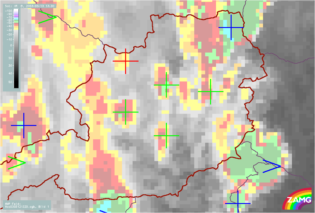
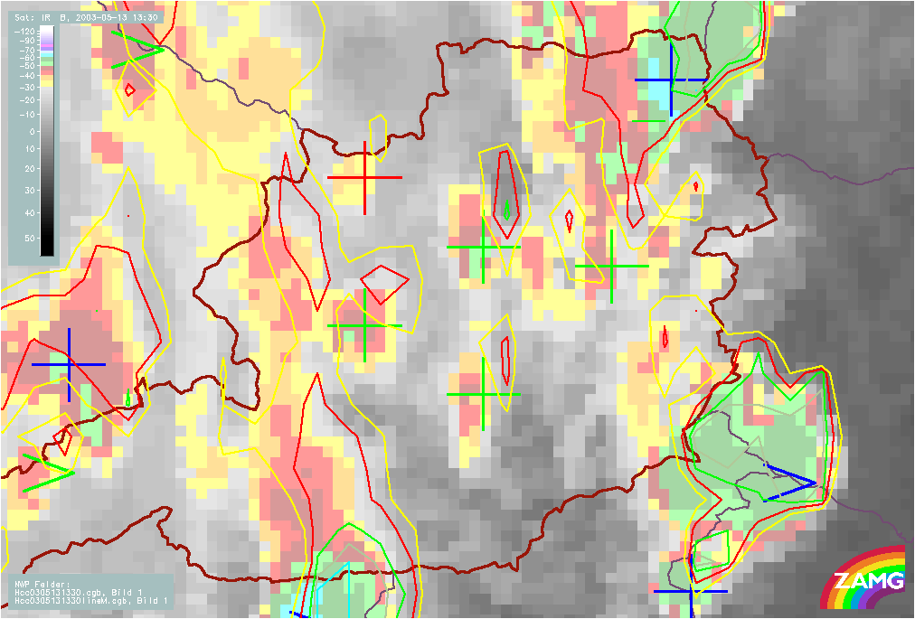
Figure 27: left: 13 May 2003/13.30 UTC - Meteosat IR enhanced image; automatic cell detection (blue crosses, >: growing MCS, red crosses: small growing cells, green crosses: large growing cells, green 0: large cell at climax, red -: small decaying cell)
right: 13 May 2003/13.30 UTC - Meteosat IR enhanced image; automatic cell detection (blue crosses, >: growing MCS, red crosses: small growing cells, green crosses: large growing cells, green 0: large cell at climax, red -: small decaying cell), 30min cloud top temperature forecast
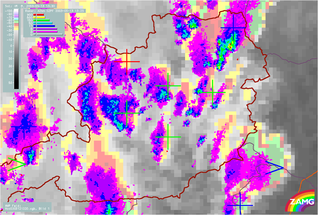
Figure 28: 13 May 2003/13.30 UTC - Meteosat IR enhanced image; automatic cell detection (blue crosses, >: growing MCS, red crosses: small growing cells, green crosses: large growing cells, green 0: large cell at climax, red -: small decaying cell); radar echoes superimposed
Tracking of the cells
A zoom of the Vienna region shows the track of the cells analysed by radar tracking and clearly shows the path taken by the thunderstorm with hail. The highest category of radar reflectivity shows indication of hail.
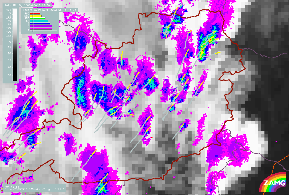
Figure 29: 13 May 2003/13.30 UTC - Meteosat IR enhanced image; orange: tracking of cells found in radar echoes, yellow: forcast of radar cells; radar echoes superimposed