Benefits and limitations
Benefits
- Good discrimination between snow and water clouds
- High spatial resolution
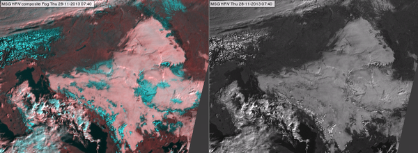
Fig. 9 shows the benefit of HRV Fog RGB compared to the HRV image. It is much easier to distinguish snow and water cloud in the HRV Fog RGB image, because of the excellent colour contrast.
|
Figure 9: HRV Fog RGB (left) and HRV (right) image for 28 November 2013 at 07:40 UTC
|

|
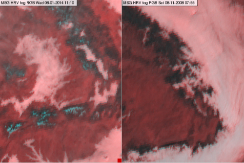
Due to the high resolution, this RGB is more useful for monitoring smaller features like valley fogs than the 3 km resolution single channels or the RGBs composed from 3 km resolution images. Examples of these are shown in Fig. 10.
|
Figure 10: Valley fog in HRV Fog RGB images for 08 January 2014 at 11:10 UTC (left) and 8 November 2008 at 07:55 UTC (right)
|

|
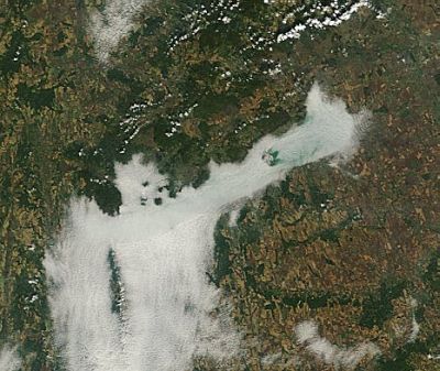
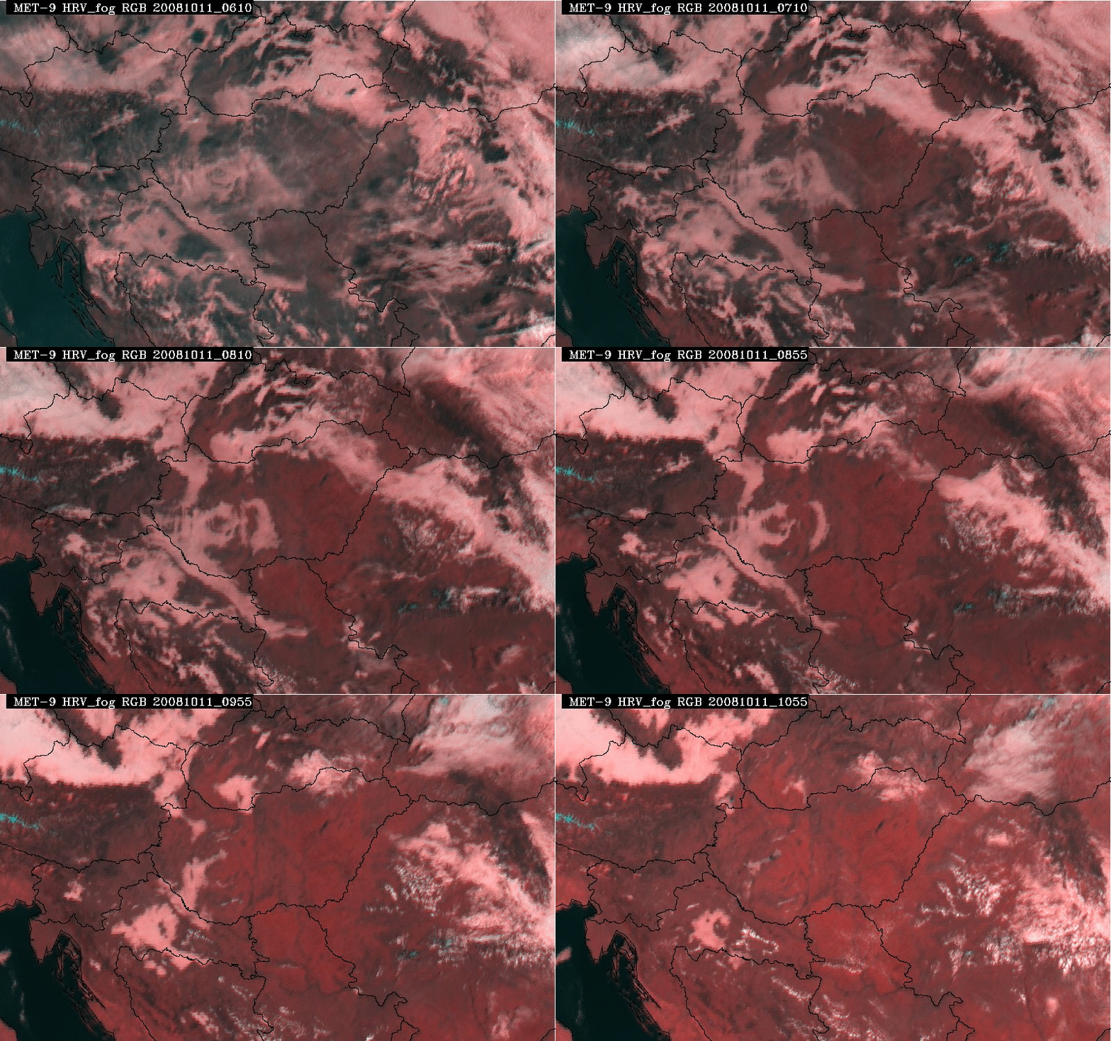
Combined high spatial and temporal resolution can be beneficial for forecasting fog dissipation. 5-minute data is particularly useful for monitoring rapid fog dissipation. Fig. 11a shows a MODIS true colour image on Lake Balaton covered with fog. Fig. 11b shows the fog dissipation from 06:10 to 10:55 UTC (animation created from 5-minute SEVIRI HRV Fog RGB images).
|
Figure 11a: MODIS true colour image for 11 October 2008 at 09:50 UTC
|

|
|
Figure 11b: METEOSAT HRV Fog RGB animation (11 October 2008, 06:10-10:55 UTC)
|

|
Limitations
- Only works in daytime.
- Ice clouds and snow have similar colours.
- Thin cirrus clouds are undetected, or barely so.
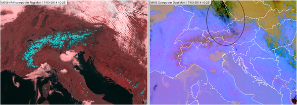
Fig. 12 demonstrates how thin cirrus clouds are difficult to detect in this type of RGB image. Here we can compare a HRV Fog RGB image with the corresponding Dust RGB image. The Dust RGB shows thin cirrus (indicated by black circle in the right panel), which is not seen in the HRV Fog RGB image (left panel). Thin cirrus clouds are usually much less visible in shortwave images than in infrared ones, while the Dust RGB is very sensitive to thin cirrus clouds.
|
Figure 12: HRV Fog RGB (left) and Dust RGB (right) for 17 March 2014 at 10:25 UTC. The encircled area is covered by thin cirrus clouds.
|

|
