Examples of interpretation
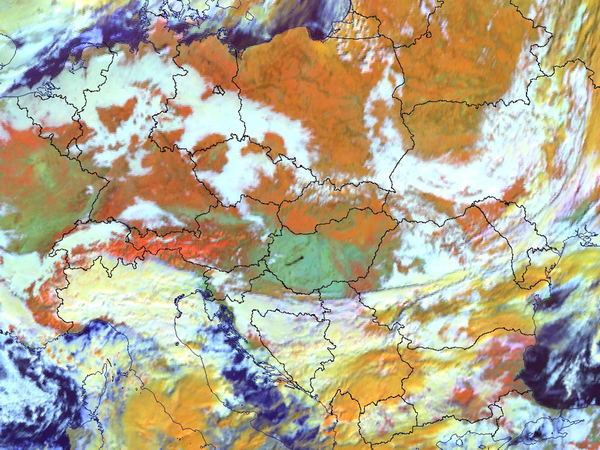
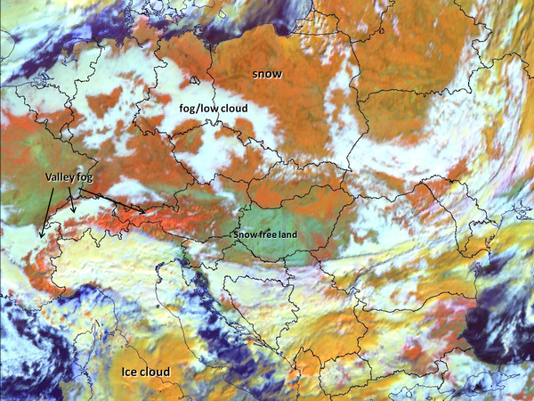
Two cases are shown with and without annotations to give examples on the proper interpretation of the different surface and cloud types in the Snow RGB images (Figs. 9 and 10). The valley fog in the Alps shows clearly in Fig. 9 because of the good colour contrast.
| Figure 9: Snow RGB with and without annotations for 08 January 2009 at 09:55 UTC |
 
|
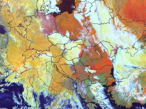
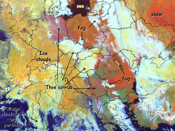
| Figure 10: Snow RGB with and without annotations for 05 February 2010 at 09:25 UTC |
 
|
The thin cirrus clouds across Germany, Hungary and Serbia are hard to see in Fig. 10.
Cloud-free snowy mountains and land can have different appearance in the satellite imagery. If the snow lies on a plain or low hill, one can often see patches, lines or spots in it. Patches might be due to forest with shadows and branches not covered by snow. Lines might be due to rivers, and spots (small patches) due to settlements. In mountainous terrain one can often see the structure of the valleys and ridges. Snow on high mountains is usually depicted in a brighter colour than on plains or hills, as there is less vegetation in the mountains to disrupt the snow cover.