Creating HRV Fog RGB images
The 'recipe' of the HRV Fog RGB type is summarized in the following table. Table 1 shows which channels are visualized in which colour. The measured values should be calibrated to calculate reflectivity, including solar zenith angle correction. The images should be then enhanced - linearly stretched - within the reflectivity ranges shown in the table.
Table 1: Recipe of the HRV Fog RGB
| Colour beam | Channel | Range [%] | |
|---|---|---|---|
| Red | NIR1.6 | 0 | 70 |
| Green | HRV | 0 | 100 |
| Blue | HRV | 0 | 100 |
The following example shows how the HRV Fog RGB is combined from the NIR1.6 and HRV images. It shows not only the resulting RGB image, but the components as well. First we show an example of a cloud-free area with water clouds, and then an example with ice clouds.
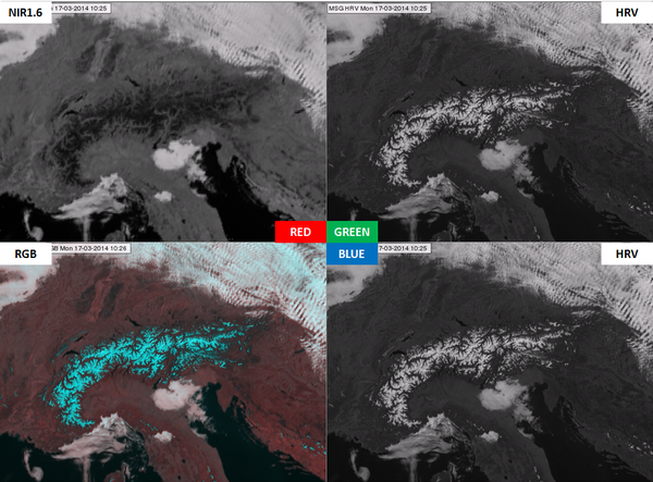
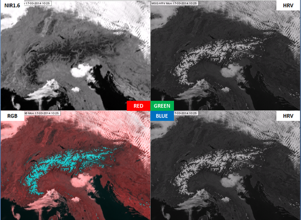
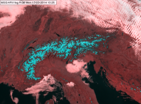
Fig. 3a shows the NIR1.6 (top left) and the HRV (top and bottom right) channels stretched in the 0-100 % reflectivity range. The RGB (bottom left) was created from these images with NIR1.6 as the red component and HRV as the blue and green components. Fig. 3b shows the same channels, but now NIR1.6 is stretched between 0-70 %, and the RGB is created from this more enhanced NIR1.6 channel. This is the so called HRV Fog RGB image. The range (of red colour) is smaller for the NIR1.6 than for the HRV channel (green and blue colours), causing a stronger enhancement of NIR1.6. It was tuned in this way to get better colour contrast between water clouds and snow-covered land. Comparing the RGB images in Figs. 3a and 3b we see that the stronger enhancement of NIR1.6 results in pinkish water clouds instead of whitish ones; more red than green and blue, with the latter two in equal measure. Snow appears cyan as it contains equal quantities of green and blue and much less red. The pinkish water clouds (Fig. 3b) have better colour contrast with the cyan snow than whitish water clouds (Fig. 3a) would have.
| Figure 3b: Same as Fig. 3a, but NIR1.6 is stretched between 0-70 %, and the RGB is created from this more enhanced NIR1.6 |
|
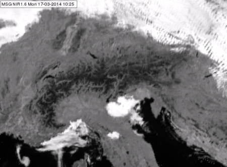
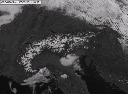
In Figs. 4a and 4b the HRV Fog RGB image can be compared with NIR1.6 and HRV images. One can see that the high resolution is coming from the HRV image, while the snow detection is enabled by the difference between the NIR1.6 and HRV channel data.
| Figure 4a: SEVIRI NIR1.6 channel (stretched in 0-70 % reflectivity range) and HRV Fog RGB for 17 March 2014 10:25 UTC. |
|
| Figure 4b: SEVIRI HRV broadband channel (stretched in 0-100 % reflectivity range) and HRV Fog RGB for 17 March 2014 10:25 UTC. |
|
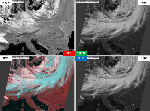
The appearance of ice and water clouds will be compared in the second example. Fig. 5 shows a cold front. Ice clouds are darker than water clouds in the NIR1.6 image (upper left panel of Fig. 5), while their reflectivity values are similar in HRV image (right panels of Fig 10.5). As a consequence, ice clouds are cyan in the HRV Fog RGB image (similar to snowy land, but with slight greyish tones), while water clouds are pinkish. There is a definite colour contrast between ice and water clouds.
