Moist and unstable environment without deep convection
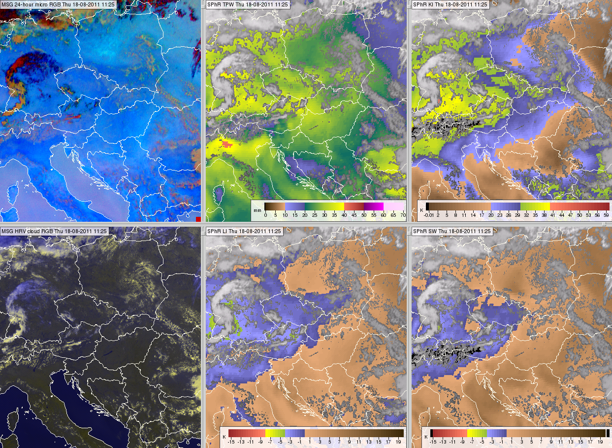
High moisture and instability does not necessarily mean that convection will form. For this we have already shown a case over the Adriatic Sea (Fig. 11 in Section Stability indices). The next example is from over land. On 18 August 2011 both the TPW and K-index were high over southern Germany, up to 36 mm and 38 °C (Fig 21), but no convection formed.
Figure 21: Meteosat SEVIRI images from 18 August 2011, 11:40 UTC: 24 hour Microphysics RGB (top left), SPhR TPW (top middle), SPhR K-Index (top right), HRV cloud RGB image (bottom left), SPhR Lifted Index (bottom middle) and SPhR Showalter Index (bottom right). Black color stands for no data.
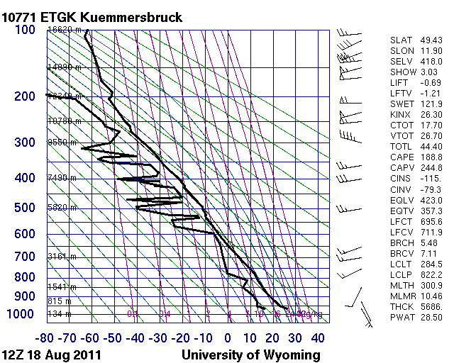
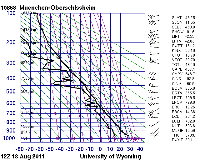
Fig. 22 shows corresponding radiosonde measurements from two south German stations. Both stations' data shows moderate negative Convective Inhibition (CIN) and high Level of Free Convection (LFC). The Kümmersbruck station shows weak to moderate wind shear, weak low-level wind and a slightly stable layer at 900-750 hPa. The magnitude of the CIN and LFC values might explain the lack of convective activity in south Germany that day.

|

|
Figure 22: Radiosonde data measured on 18 August 2011, 12 UTC in Kümmersbruck and in München-Oberschleissheim in southern Germany
