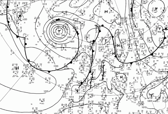

The surface weather chart from 12 UTC shows a cold front in the backfield of the convective development over central Europe. This cold front is associated with a large frontal cloud band as seen in IR-enhanced imagery. Small scale surface lows in connection with surface convergences (over France and western Germany) can be observed. Thunderstorm were already reported. These developments occurred in the forefield of an upper air trough (compare with the following chapter on geopotential height 300 hPa). Such structures are hints for thunderstorm developments that have to be monitored carefully.