19th June 2006: 00UTC
In this chapter the IR images are overlayed with the Showalter index. This index gives a good indication where the atmosphere is unstable and where convective development may be expected. A Showalter index between 1 and 4 gives the indication that thunderstorms are possible but that a trigger is still needed. From this treshold downward the chance on thunderstorms increase. Values under –3 are associated to very heavy thunderstorms. In this set of images the treshold of Showalter Index = 0 is pictured using the pink line. This allow an easy discrimination of the potential convective areas. Such an area can be seen here stretched over central Europe. Over the Alps (a region where convergence will be seen) the SI is even below –3.
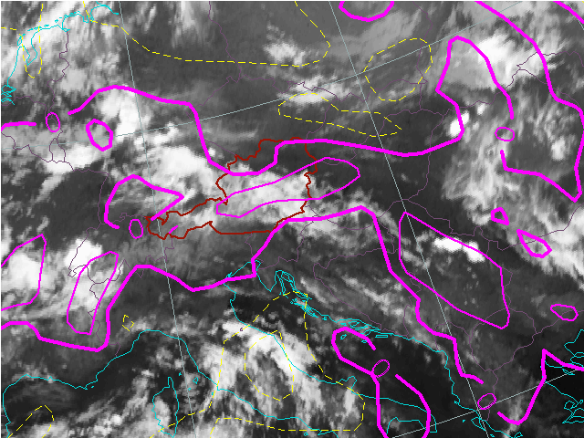
19th June 2006: 03UTC
It is a large region where we at a later stage will see our convection. In this image around 03UTC the most important areas where convection will happen are already marked by negative Showalter Index values.
19th June 2006: 06UTC
With a Showalter Index < 0 Some convection is already seen over the Elzas.
19th June 2006: 09UTC
20th June 2006: 12UTC
The convection has started in the unstable region with Showalter Index below 0. Just south of the Alps small scale convection is triggered in an area with SI below -3.
19th June 2006: 15UTC
Convection is now underway. All the cells are characterised by an unstable atmosphere and Showalter Index below 0. Over the Alps the situation is even more critical with SI under -3.
19th June 2006: 18UTC
Convection has reached its climax. All the cells are characterised by an unstable atmosphere and Showalter Index below 0. Over the Alps the situation is even more critical with SI under -3.
19th June 2006: 21UTC
All the cells are characterised by an unstable atmosphere and Showlater Index below 0. Over the Alps the situation is even more critical with SI under -3.