30th July 2005: 06UTC
A different part of the satellite image is studied because of the use of the LAM model. By using the model fields of Aladin the divergence/convergence at 925 hPa is pictured. The convergence is presented by the dashed lines. Within the cold front (over Switzerland and Baden Wurtemberg) a region with convergence is recognised. It is this region that will during the day further enhance and also show some convective development. Concentrating back on the case study, also ahead of the frontal system regions with convergence can be observed which at this stage already mark the orientation of the prefrontal convergence line.
30th July 2005: 12UTC
By this time the convection is about to start. In the model fields a wide line of converging movements is seen stretching from Northern Italy over Austria, the Czech Republic and further north in Poland.
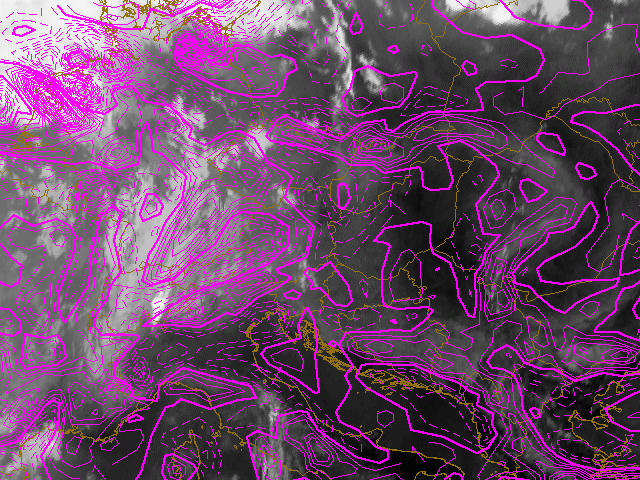
30th July 2005: 18UTC
A prefontal convergence line formed over the past 6 hours. Except for the two cells up north all of them are marked by convergence near the surface. Also within the cold front severe enhancement of cloudiness and convection is marked by a pronounced convergence maximum.
31st July 2005: 00UTC
The cells of the prefrontal convergence lines have merged with convection embedded to the cold front. The cells all show convergence near the surface because of the rising motions associated.
31st July 2005: 06UTC
The convection hast mostly died over night. Up North still an MCS is observed which is superimposed by convergence near the surface. The cold front which consists mainly of low clouds shows no disticnt features at the surface at this stage which would be an indication for development.