Introduction
During the night from 24 to 25 September 2010 heavy rain caused flash-flooding of the town of Pula and the surrounding area. In places Valbandon, Fažana and Veli vrh 200 mm of rain fell in less than 7 hours causing extreme communal difficulties. The rain-gauge precipitation in Pula amounted 176 mm, which is the highest daily precipitation ever measured in Pula.
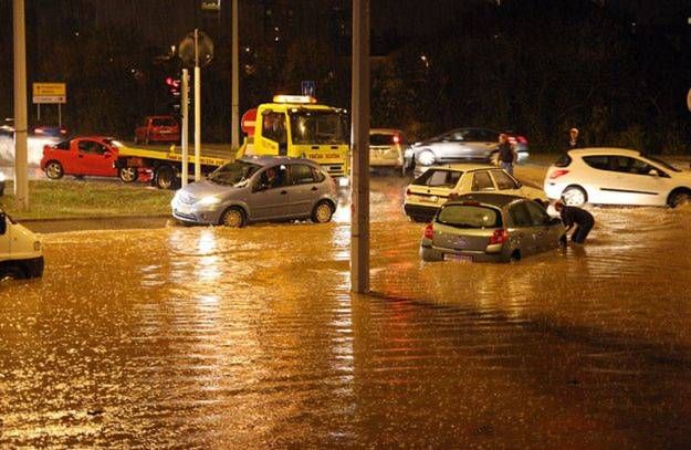
Figure 1.1: Flooded streets in Pula in the night from 24 to 25 September 2010
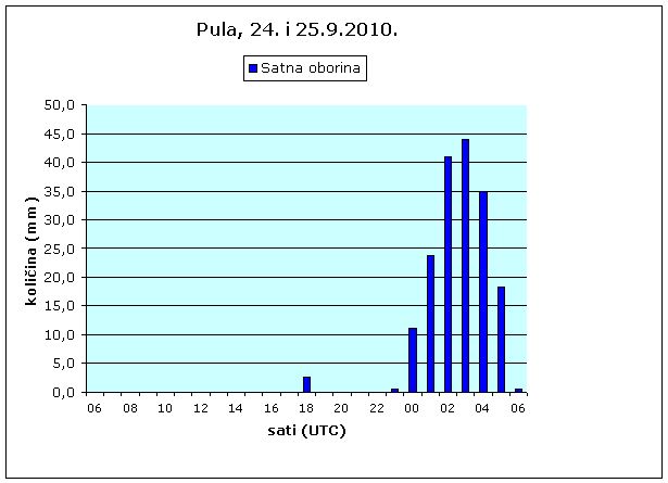
Figure 1.2: Hourly precipitation amounts measured in Pula since 24 Sep 06UTC to 25 Sep 06 UTC
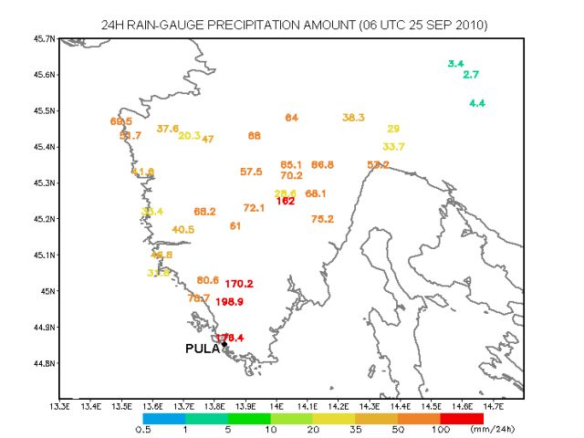
Figure 1.3: 24 hours rain-gauge precipitation measured on 25 Sep 2010
In this extreme event vineyards, olive groves and roads were flooded; transport and electricity supply was interrupted. Currents of muddy water damaged houses and streets and people had to be evacuated from their homes flooded by up to 1m of water.
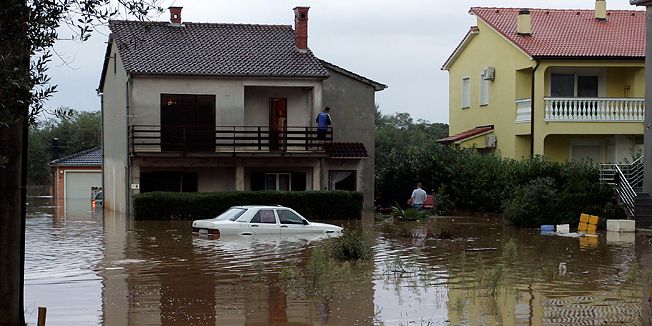
Figure 1.4: Flash flood in the area
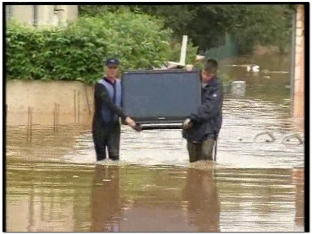
Figure 1.5: Flash flood in the area
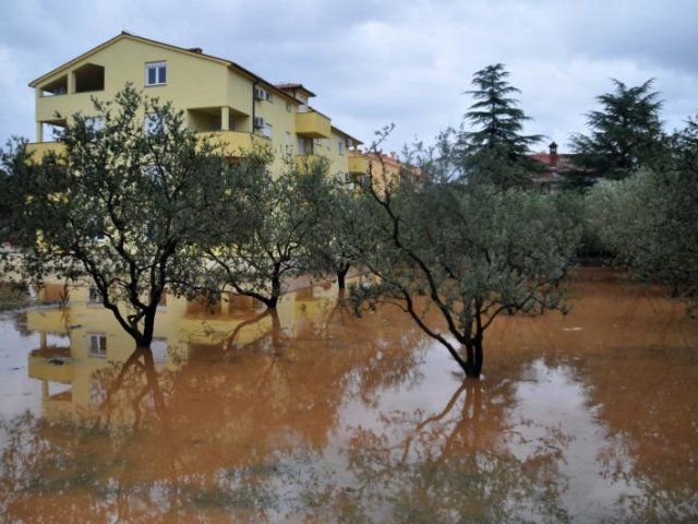
Figure 1.6: Flash flood in the area, flooded olive groves
Figure 1.7: Colour enhanced METEOSAT 9 IR image, loop from 24 Sept 2010 18:00 UTC to 25 Sept 2010 04:30 UTC
This study will show that the flooding was the result of a convective system which developed in the convergence zone caused by a specific placing of two Mediterranean cyclones.
Generally, the Mediterranean region is recognized as one of the most cyclogenetic regions in the world (Campinis et al., 2000; Alpert et al., 1990). According to Horvath et al., 2008, Mediterranean cyclones are classified in 3 major types: Genoa cyclones, Adriatic cyclones and non-Genoa cyclones. Although it is rather rare, the major-type cyclones can exist simultaneously belonging to the theoretical category of twin or eyeglass cyclones. The most common twins are the simultaneous Genoa and Adriatic cyclones (Brzović, 1999), therefore classified as the 4th type of Mediterranean cyclones.
Depending of the season and general synoptic conditions, the paths of the cyclones in the Mediterranean basin are diverse. On their way through this complex geography, they can produce a range of extreme weather phenomena such as heavy orographic precipitation, thunderstorms, supercells and mesoscale convective systems (Ivančan-Picek et al, 2003).
The local intensity of the precipitation is also very much dependent on the available moisture. The heaviest rain events take place when the cyclone path is in such position that it produces the convergence of moist air and a large quantity of precipitable water (Lionello et al., 2006).
In the case shown here the convergence line/area above the North Adriatic was the result of the collision on the leading sides of the two cyclones placed in Tyrrhenian and Ligurian Sea.