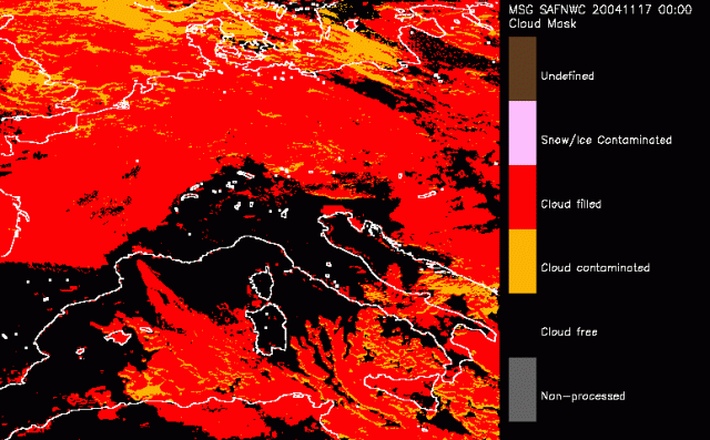
17 November 2004/00.00 UTC - Cloud Mask
The cloud mask (CMa) allows the identification of cloud free areas where other products (total or layer precipitable water, stability analysis imagery, snow/ice cover delineation) may be computed. It also allows identifying cloudy areas where other products (cloud types and cloud top temperature/height) may be derived.
The central aim of the CMa is therefore to delineate all cloud-free pixels in a satellite scene with a high confidence. In addition, the product provides information on the presence of snow/sea ice, dust clouds and volcanic plumes.
In the first image onse sees that most of Western Europe is covered by clouds, here indicated by a red colour. A sharp boundary is recognised just north of the Pyrenees. Towards northern Europe more broken or transparant clouds are found pictured here as orange. On 18 Novemeber at 18UTC lee clouds are seen. The Rapid Cyclogenesis is about to start. The thick cloudhead is found over the North Sea int his image. Another 6 hours later at 19 November 00UTC the RaCy moved over land. The dry intrusion is seen as the orange (transparant) area over Normandy and Central France. In the following tiomesteps the RaCy quickly moves further into Europe The influence of the Alps on the cloudcover is wel observed in these timesteps.