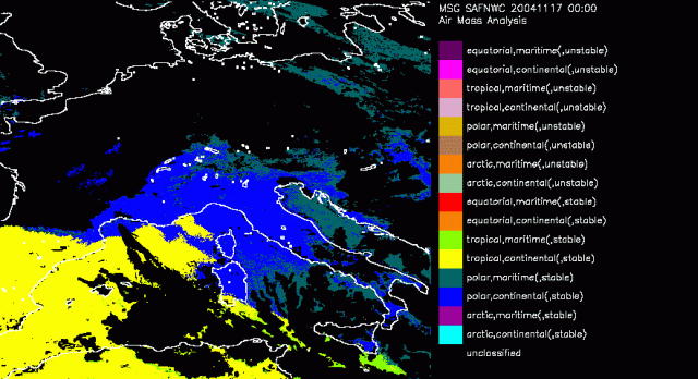
17 November 2004/00.00 UTC - Airmass Analysis
The Air Mass Analysis product of the SAFNWC aims to support the nowcasting applications through providing several products describing air mass characteristics. These characteristics are determined by the surface temperature, the moisture content of the airmass and the stability of the airmass derived from SAI (Stability Analysis Index). The criteria then allow a discrimination of about 16 different airmasses Because of the use of the surface temperature the AMA can only be calculated for cloudfree areas.
With the depression rapidly moving in form the Atlantic, only parts of Spain (tropical continental) and Italy (polar continental) are diagnosed as cloudfree and and a subsequent Airmass diagnoses is done. This does not change that much int he following timseteps. At 19 November around 09UTC the first sign of the RaCy in these set of Airmass Analysis is seen. The dry intrusion is found over Britain, Belgium and Northern France. It is diagnosed as polar maritim and continental. This accords well with the corresponding Airmass RGB image. The dry intrusion in the Airmass image is seen as purple. A mixture of blue (polar airmass) and red (protruding stratospheric air and low clouds).